Lost Lake

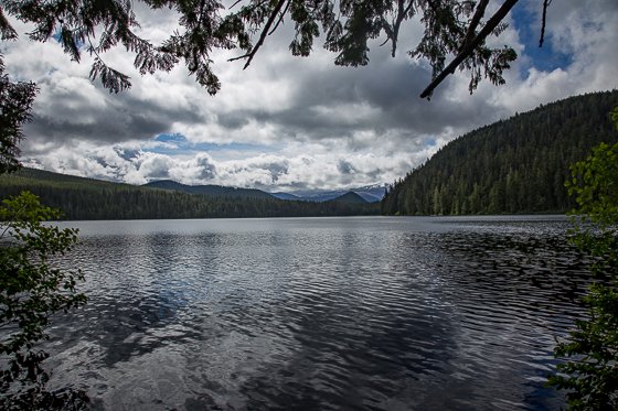
Mother Nature went the extra mile when it came to Lost Lake. The surrounding topography is rugged, mountainous and magical. The flora and fauna is abundant and easily accessible.
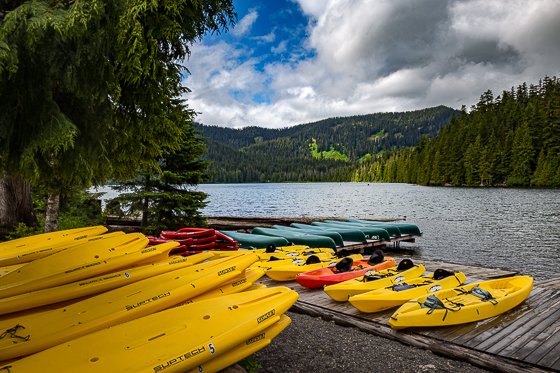
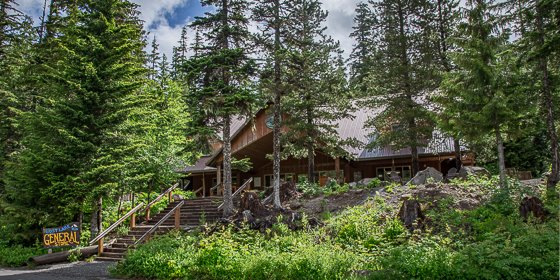
The lake is a popular recreational site, with 125 primitive campsites seven rustic cabins and a rustic general store. The resort’s normal season is May through October. Canoes, row boats, and kayaks are available for rental; motor craft are not allowed. A day use fee applies to all vehicles entering the area, payable to the concessionaire.
Hiking Trails
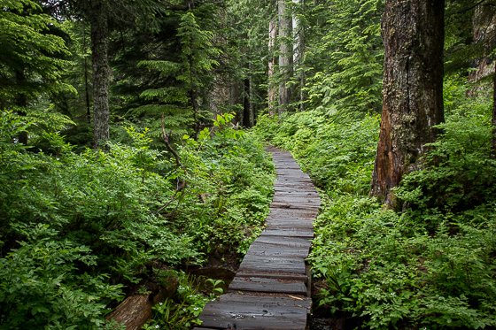
TRAIL DESCRIPTIONS LAKESHORE TRAIL This is an easy 3.2mile stroll around the perimeter of the lake. Starting at the viewpoint at the north end of the lake the first portion of the trail is a selfguided nature walk and from the store parking lot south to the bottom of the lake is barrierfree. Allow yourself an hour or more so you can stop along the way to enjoy the splendid views of the lake and Mt. Hood.
OLD GROWTH TRAIL This trail runs north and south between A Loop Campground and the Organization Camp for a distance of 1 mile. If offers the hiker an ideal opportunity to learn more about the ecology of the area through numerous interpretive signs set along the trail. The Old Growth trail is an easy walk and is barrierfree the entire length.
OLD SKYLINE TRAIL A slightly more difficult trail, 2.5miles long, it connects the Lake Branch Cascades Trail, north of the lake, with Jones Creek Road and is open to mountain bikes as well a hikers.
LAKESHORE EXPRESS This is a short, halfmile trail that connects the Old Growth Trail with the Lost Lake shoreline at the public boat launch. It is a little more strenuous but it is still barrierfree.
LOST LAKE BUTTE TRAIL This trail is a steep one, climbing 1400 feet in its 2mile length, but well worth the effort. It starts from the General Store parking area and takes you up east of the lake to where you an see pretty near everything that’s wort seeing… Mt. Adams, Mt. Hood, as well a occasional views of Mt. Jefferson. All you need is that extra bowl of Wheaties.
LAKE BRANCH CASCADES TRAIL just less than a mile long this trail meets up with Lake Branch Creek Road where you can either loop back around to Lost Lake Road to the east or head west and connect with the Pacific Crest Trail. This trail has some rough areas but is open to mountain bikes.
HUCKLEBERRY MOUNTAIN TRAIL This trail starts either at the south end of the lake on the Lakeshore Trail of from Sentinel Spur Road off of Jones Creek Road. It is a fairly steep 2.5mile climb and connects to the Pacific Crest Trail.
Admission & Hours
Hours and services vary seasonally
Entrance Fees
There are two day use areas – North day use and South day use. See Maps for details. The South day use area has a public boat launch. $8 entrance fee for day use.
Getting There:
Lost lake is 85 miles from Portland by way of Hood River. Take interstate 84 east up the Columbia River Gorge to Hood River, then drive southwest to Dee and follow the signs to Lost Lake.
Driving Directions
From I 84
- Take exit 62 for US-30 for Westcliff Dr./W Hood River-0.2 mi
- Turn right at Cascade Ave/US-30 – 154 ft
- Turn right at Country Club Rd – 2.9 mi
- Turn left at Barrett Dr – 1.2 mi
- Turn right at Tucker Rd – 2.0 mi
- Slight right at Dee Hwy – 6.3 mi
- Slight right at Lost Lake Rd – 1.5 mi
- Turn left/stay on Lost Lake Rd – 0.5 mi
- Turn right/stay on Lost Lake Rd – 6.1 mi
- Turn right/stay on Lost Lake Rd – 0.1 mi
- Turn left at Lost Lake Rd/NFD 13 Rd – 3.7 mi
- Turn right at NFD 13 Rd – 1.7 mi
- Slight right at N F Dev Rd 1340 – 0.2 mi
- Welcome to Lost Lake (kiosk)
- 9000 Lost Lake Road, Hood River, OR 97031
Maps:
Interactive Google Map
Use the map + – controls to zoom in and out, click and drag the to move the map, use the Map drop-down to change to “Map”, “Satellite”, “Hybrid”, or “Terrain” views. Drag the little man icon from the upper left corner to a map location for street level view.
Facilities
Lost Lake is adjacent to a full service resort with a variety of campsites to accommodate all types of visitors, including group, family and single campsites. In addition to the campsites, there are cabins, yurts, lodge rooms and an extensively stocked general store on site.
Location Contact Information:
16400 Champion Way
Sandy, Oregon 97055
Hours:
M – F 7:30am – 4:30pm
Closed 11:30 – 12:30
Telephone:
(503) 668 1700
Nearest City or Town:
Hood River County Chamber of Commerce
Lost Lake Gallery
Click here for full page gallery
More Photographic Destinations in Oregon:
Interactive Google Map
Use the map + – controls to zoom in and out, use the Map drop-down to change to “Map”, “Satellite”, “Hybrid”, or “Terrain” views. Drag the little man icon from the upper left corner to a map location for street level view. Click on a pushpin for more information about the Photographic Destination, then click on the title to go to the location page.
