Great Places for Great Photos
Let me help you to find a great location for your next photography adventure. I will list many lesser known destinations, as well as the famous “Icon Locations” for photography. I will provide photos (Lots of Photos), location information, consisting of what there is to photograph as well as other information about the destination. I will give costs, maps, directions, contact information, and other essential information for a successful photo trip. I will only post for locations that I have personally photographed to insure a quality guide to great locations for photography.
Wildlife Refuge Destinations
US National Wildlife Refuge System
National Wildlife Refuge System is a designation for certain protected areas of the United States managed by the United States Fish and Wildlife Service. The National Wildlife Refuge System is the system of public lands and waters set aside to conserve America’s fish, wildlife, and plants. Since President Theodore Roosevelt designated Florida’s Pelican Island National Wildlife Refuge as the first wildlife refuge in 1903, the system has grown to over 568 national wildlife refuges and 38 wetland management districts encompassing more than 150,000,000 acres.
National Wildlife Refuges manage a full range of habitat types, including wetlands, prairies, coastal and marine areas, and temperate, tundra, and boreal forests. The management of each habitat is a complex web of controlling or eradicating invasive species, using fire in a prescribed manner, assuring adequate water resources, and assessing external threats such as development or contamination.
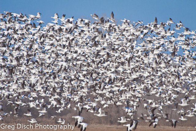
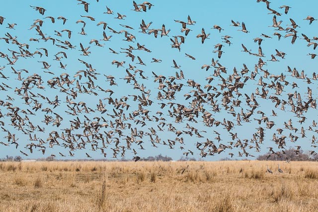
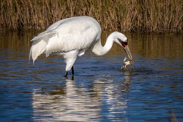
Among these, hundreds of national refuges are home to some 700 species of birds, 220 species of mammals, 250 reptile and amphibian species, and more than 1000 species of fish. Endangered species are a priority of National Wildlife Refuges in that nearly 60 refuges have been established with the primary purpose of conserving 280 threatened or endangered species.
National Wildlife Refuges are also places where visitors can participate in a wide variety of outdoor recreational activities. The National Wildlife Refuge System welcomes nearly 50 million visitors each year. The system manages six wildlife-dependent recreational uses in accordance with the National Wildlife Refuge System Improvement Act of 1997, including hunting, fishing, birding, photography, environmental education, and environmental interpretation. Hunters visit more than 350 hunting programs on refuges and on about 36,000 waterfowl production areas. Opportunities for fresh or saltwater fishing are available at more than 340 refuges. At least one wildlife refuge is in each of the 50 states.
Other Refuges
There are also many private, state and local wildlife refuges and wildlife management areas that are open to the public and can make for excellent locations for photography.
- Aransas National Wildlife Refuge
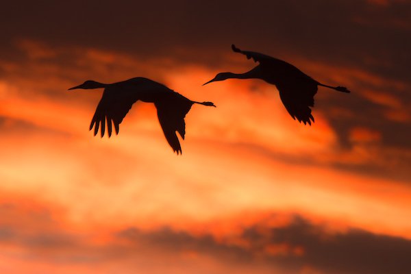
- Platte River Sandhill Cranes
- Bosque del Apache National Wildlife Refuge
- National Bison Range Montana
- Sequoyah National Wildlife Refuge
Interactive Google Map
Use the map + – controls to zoom in and out, use the Map drop-down to change to “Map”, “Satellite”, “Hybrid”, or “Terrain” views. Drag the little man icon from the upper left corner to a map location for street level view. Click on a pushpin for more information about the Photographic Destination, then click on the title to go to the location page.