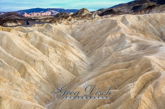
Zabriskie Point

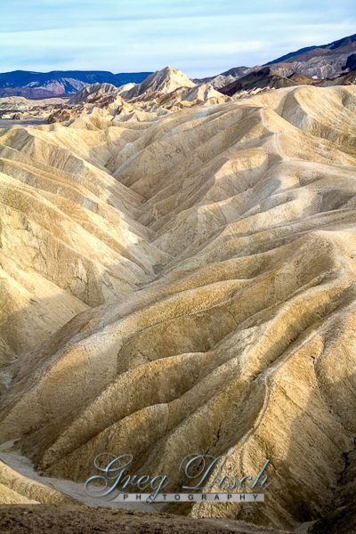
The most famous viewpoint in Death Valley National Park. Overlooking the golden colored badlands of the Furnace Creek formation, visitors can simply enjoy the view or elect to start the hike from the point around Badlands Loop. Connector trails lead to Golden Canyon, Gower Gulch, and Red Cathedral. The point is most popular at sunrise and sunset.
Zabriskie Point is a part of the Amargosa Range located east of Death Valley in Death Valley National Park in California, United States, noted for its erosional landscape. It is composed of sediments from Furnace Creek Lake, which dried up 5 million years ago—long before Death Valley came into existence.
The location was named after Christian Brevoort Zabriskie, vice-president and general manager of the Pacific Coast Borax Company in the early 20th century. The company’s twenty-mule teams were used to transport borax from its mining operations in Death Valley.

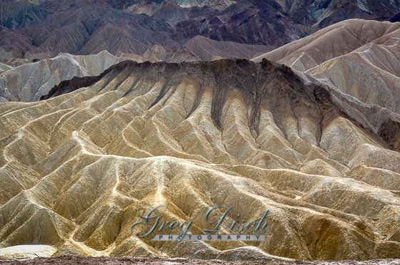
Zabriskie Point offers spectacular views of the colorful eroded badlands of Death Valley National Park.
What to Photograph:
Just one of the most incredible views in the country, or it may be from another planet, it has been used in films to represent other planets.
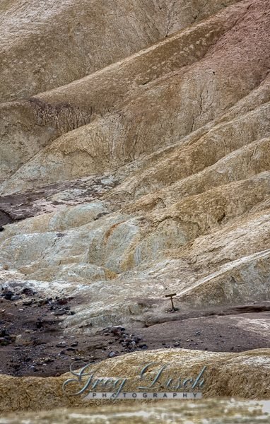
Looking out from Zabriskie Point, you are surrounded by one of Death Valley’s forbidding, almost unearthly, desert landscapes. These are badlands. Everywhere you look, you see bone-dry, finely-sculpted, golden brown rock. Only the sparsest vegetation can survive in this intricately carved terrain.
Best Time for Photographers:
Death Valley National Park is usually considered a winter park, but it is possible to visit here all year. When is the best time to visit? It all depends on what you’re looking for.
AUTUMN arrives in late October, with warm but pleasant temperatures and generally clear skies. The camping season begins in fall and so do the Ranger Programs, which continue through spring.
WINTER has cool days, chilly nights and rarely, rainstorms. With snow capping the high peaks and low angled winter light, this season is especially beautiful for exploring the valley. The period after Thanksgiving and before Christmas is the least crowded time of the entire year.
SPRINGTIME is the most popular time to visit Death Valley. Besides warm and sunny days, the possibility of spring wildflowers is a big attraction. If the previous winter brought rain, the desert can put on an impressive floral display, usually peaking in late March to early April.
SUMMER starts early in Death Valley. By May the valley is too hot for most visitors, yet throughout the hottest months, visitors from around the world still flock to the park. Lodging and camping are available, but only the most hardy will want to camp in the low elevations in the summer.
Where it is:
Traveling by Car
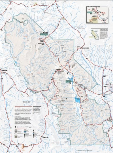
- The main road transecting Death Valley National Park from east to west is California Highway 190.
- On the east in Nevada, U.S. Route 95 parallels the park from north to south with connecting highways at Scotty’s Junction (State Route 267- Access closed until further notice), Beatty (State Route 374), and Lathrop Wells (State Route 373).
The most direct route from Las Vegas is via Pahrump, NV, and California Highway 190. - Coming from the west, State Route 14 and U.S. Route 395 lead to Ridgecrest, CA where State Route 178 heads east into the park. Further north on Hwy 395 at Olancha, CA you can join Hwy 190 to the park, or north of that at Lone Pine, CA, Hwy 136 will also join Hwy 190 heading east into the park.
- South of the park, Interstate 15 passes through Baker, California on its way from Los Angeles to Las Vegas. State Route 127 travels north from Baker to Shoshone and Death Valley Junction with connections to the park on State Route 178 from Shoshone and connection with California Highway 190 at Death Valley Junction.
Maps:
Interactive Google Map
Use the map + – controls to zoom in and out, click and drag the to move the map, use the Map drop-down to change to “Map”, “Satellite”, “Hybrid”, or “Terrain” views. Drag the little man icon from the upper left corner to a map location for street level view.
Cost:
Zabriskie Point is in Death Valley National Park.
Entrance Fees
Vehicle Entrance Fee
- $25 for 7 Days
- This permit allows all persons traveling with the permit holder in one single private, non-commercial vehicle (car/truck/van) to leave and re-enter the park as many times as they wish during the 7-day period from the date of purchase.
Motorcycle Entrance Fee
- $20 for 7 Days
Individual Entrance Fee
- $12 for 7 Days
- This permit allows a single individual traveling on foot or bicycle to leave and re-enter the park as many times as they wish during the 7-day period from the date of purchase.
Death Valley Annual Pass
- $50 for one year
- Annual pass providing free entrance to Death Valley for 12 months from the date of purchase
National Park Passes are also accepted.
Hours:
The park is open 24 hours a day.
Facilities:
There are primitive bathrooms at the Zabriskie Point viewpoint.
Lodging and restaurants may be found at four resorts located in the central part of Death Valley National Park: Furnace Creek Ranch and Inn, Stovepipe Wells and Panamint Springs. Additional lodging and dining opportunities can be found in communities outside the national park.
Links:
Death Valley National Park Website
Location Contact Information:
By Mail
Death Valley National Park
P.O. Box 579
Death Valley, CA 92328
By Phone
Visitor Information
(760) 786-3200
By Fax
(760) 786-3246
Zabriskie Point
Photo Gallery
Click Here for full page gallery
More Photographic Destinations in California:
Interactive Google Map
Use the map + – controls to zoom in and out, use the Map drop-down to change to “Map”, “Satellite”, “Hybrid”, or “Terrain” views. Drag the little man icon from the upper left corner to a map location for street level view. Click on a pushpin for more information about the Photographic Destination, then click on the title to go to the location page.
Click Here for Photographic Destinations by State

