Pensacola Lighthouse

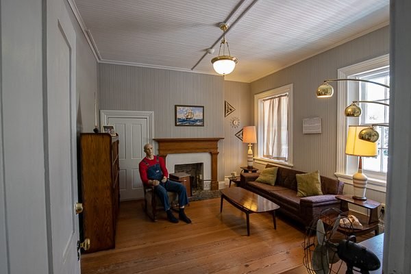
The Pensacola Light remains an active aid to navigation. As of 2009, the lighthouse opened on a limited basis for public tours, and since early 2011 it has been open 7 days a week. Maintenance and tour operations are currently conducted by the Pensacola Lighthouse Association. The 1869 keeper’s quarters, adjacent to the lighthouse tower, houses a museum and gift shop also administered by the Pensacola Lighthouse Association.
In 1858 a new tower was built on the north side of the bay entrance, and was lit on January 1, 1859. The new, and current, tower is 150 feet (46 m) tall, and also sits on a 40-foot (12 m) bluff located on the Pensacola Naval Air Station, placing the light 190 feet (58 m) above sea level.
At the start of the Civil War, Pensacola was controlled by Confederate forces, while Fort Pickens across the bay remained in Union hands. Confederate authorities removed the lens from the lighthouse, and most of the lighthouse supplies were requisitioned for the war effort. In November 1861 an artillery duel between the two forces damaged the lighthouse tower.
Confederate forces later evacuated Pensacola, and were replaced by Union forces. In 1863 the Pensacola Light was relit using a fourth-order Fresnel lens. A new first-order lens was placed in the tower in 1869. The tower was all white during the Civil War. Later, the upper two-thirds of the tower was painted black. Electricity was introduced to the lighthouse in 1939, eliminating the need to rewind the light rotation clockworks every 4½ hours. The light was automated in 1965. The lighthouse tower and associated buildings were placed on the National Register of Historic Places in 1974.
What to Photograph
The Pensacola Lighthouse and grounds along with great views of Pensacola Naval Air Station and Pensacola Bay from the 150 tall lighthouse tower.
The Lighthouse is located right across the street from the National Naval Aviation Museum, the world’s largest Naval Aviation museum and one of the most-visited museums in the state of Florida.
Security Gate Procedures
-
- From the U.S. Department of Defense: “Defense Department installations will no longer accept driver’s licenses from Illinois, Missouri and New Mexico as proof of identity for access control purposes, according to DoD officials. Non-enhanced licenses from Minnesota or Washington also are no longer accepted. Those attempting to gain physical access to DoD installations must show an alternate form of identification, such as a passport.”
- Other acceptable alterate forms of identification include:
– Social Security Card
– Voter’s Registration
– State or Federal Work ID
– Concealed Weapons ID
Driving Directions
From Perdido Key, FL and Orange Beach, Gulf Shores, AL:
From 292, cross Perdido Key Bridge and take the first right onto Gulf Beach Hwy. Then take a right onto Blue Angel Parkway and drive through the west gate of NAS Pensacola. Take Radford Boulevard. The Pensacola Lighthouse will be on the right.
From I-10 East or West:
Take Exit 7 (Pine Forest Road, 297). Head south about 1.5 miles to Blue Angel Parkway. Drive about 11 miles to west gate of NAS Pensacola. Keep straight on Radford Boulevard. Pensacola Lighthouse will be on the right.
From Gulf Breeze, Pensacola Beach, Ft. Walton and Destin:
From Highway 98 to Pensacola Bay Bridge, veer left onto Bayfront Parkway, which turns into Main Street. Take a left onto Barrancas Avenue. Continue on Gulf Beach Hwy and turn left onto Blue Angel Parkway and drive through the west gate of NAS Pensacola. Take Radford Boulevard. The Pensacola Lighthouse will be on the right.
Maps:
Interactive Google Map
Use the map + – controls to zoom in and out, click and drag the to move the map, use the Map drop-down to change to “Map”, “Satellite”, “Hybrid”, or “Terrain” views. Drag the little man icon from the upper left corner to a map location for street level view.
GPS:
30°20’45.185″ N 87°18’30.384″ W
Cost:
Daily Admission
Hours:
Hours of Operation
Facilities:
There are restrooms and a gift shop on site.
Location Contact Information:
Email: info@PensacolaLighthouse.org
Pensacola Lighthouse Photo Gallery
Click Here for full page gallery
More Photographic Destinations in Florida:
Interactive Google Map
Use the map + – controls to zoom in and out, use the Map drop-down to change to “Map”, “Satellite”, “Hybrid”, or “Terrain” views. Drag the little man icon from the upper left corner to a map location for street level view. Click on a pushpin for more information about the Photographic Destination, then click on the title to go to the location page.
Click Here for Photographic Destinations by State


