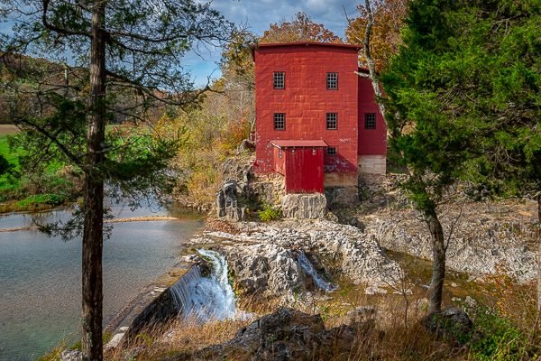
Dillard Mill

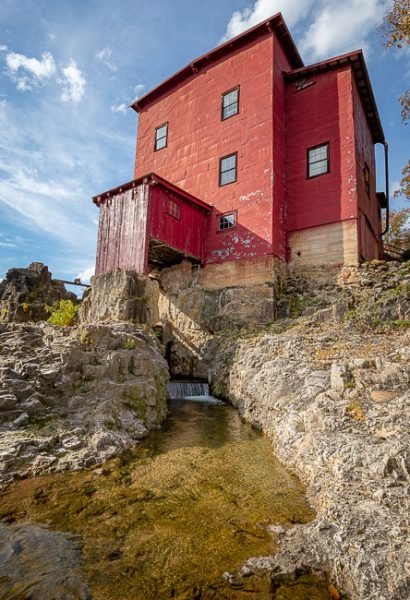
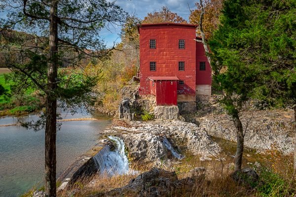
Dillard Mill is one of Missouri’s best-preserved examples of a water-powered gristmill. Sitting along the clear-flowing Ozark stream, Huzzah Creek, the red mill is nestled among trees and near water cascading over a rock dam, creating a picturesque setting.
Dillard Mill is the second mill structure at this site. Wisdom’s Mill, the first mill built here, was constructed in the 1850s. A rock wall along the Huzzah Creek was blasted open allowing the increased water flow to the mill needed for its operation. As a result, Huzzah Creek changed its channel.
Joseph Dillard Cottrell and his brother, James, later owned Wisdom’s Mill from 1881 to 1889 – years that brought many changes to the area. During the Cottrells’ ownership of the mill, the small community grew with the establishment of a post office in 1887. It was also during this time that the community was named Dillard after Joseph Dillard Cottrell.
Today, the restored mill contains most of its original machinery. Two of the three steel roller mills, however, were donated for scrap metal during World War II. Visitors can see the remaining machinery come to life during a tour of the mill. With the turn of a wheel, the mill begins to operate as it did years ago, grinding grain into flour. The sound of the water gushing over the dam outside the mill is replaced with the sounds of the belts and rollers turning. Tours of the mill are given year-round, although days and times vary by season.
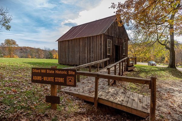
In 1974, the L-A-D Foundation of St. Louis, a non-profit organization, bought the property. In 1975, the foundation leased the mill and surrounding property to the Missouri Department of Natural Resources to operate as a state historic site. Also on the property is a building that once housed a general store owned by Adam Wilhite.
What to Photograph
The historic mill, the mill pond, the dam and waterfall as well as the Adam Wilhite General Store.
Where it is:
One mile south of Dillard off Highway 49 in Crawford County, just outside of Davisville.
Maps:
Interactive Google Map
Use the map + – controls to zoom in and out, click and drag the to move the map, use the Map drop-down to change to “Map”, “Satellite”, “Hybrid”, or “Terrain” views. Drag the little man icon from the upper left corner to a map location for street level view.
GPS:
37°43’3.185″ N 91°12’23.646″ W
Cost:
Hours:
PARK HOURS
HISTORIC SITE GROUNDS:
May through October
8 a.m. – 8 p.m. daily
November through April
8 a.m. – 5 p.m. daily
Closed Thanksgiving, Christmas and New Year’s days
DILLARD MILL HOURS
Tours:
May through October
10 a.m., 11 a.m., 12:30 p.m., 1:30 p.m. and 2:30 p.m. daily
November through April
10 a.m., 11 a.m., 12:30 p.m., 1:30 p.m. and 2:30 p.m. on Wednesday through Sunday
Tours on Monday and Tuesday by prior appointment only
HISTORIC SITE OFFICE HOURS
Historic Site Office Hours
May through October
10 a.m. – 4 p.m. daily
November through April
10 a.m. – 4 p.m. Wednesday through Sunday; closed Monday and Tuesday
Facilities:
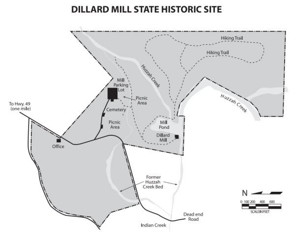
The historic site has picnic areas, restrooms and hiking trails.
Five picnic tables with pedestal grills are located at the parking lot area, where there is also a covered, accessible shelter.
There is a playground located in the picnic area.
Location Contact Information:
Dillard Mill Photo Gallery
Click Here for full page gallery
More Photographic Destinations in Missouri:
Interactive Google Map
Use the map + – controls to zoom in and out, use the Map drop-down to change to “Map”, “Satellite”, “Hybrid”, or “Terrain” views. Drag the little man icon from the upper left corner to a map location for street level view. Click on a pushpin for more information about the Photographic Destination, then click on the title to go to the location page.
Click Here for Photographic Destinations by State

