Crystal Mill

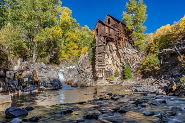
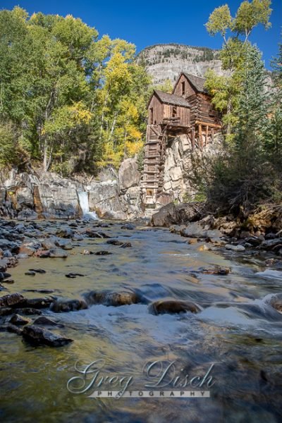
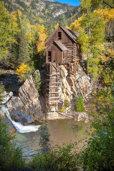
The Crystal Mill, or the Old Mill is an 1892 wooden powerhouse located on an outcrop above the Crystal River in Crystal, Colorado, United States. It is accessible from Marble, Colorado via 4×4. Although called a Watermill, it is more correctly denoted as a compressor station, which used a water turbine to drive an air compressor. Originally built with a horizontal wheel. The compressed air was then used to power other machinery or tools.
In the 21st century, the mill is usually called the Crystal Mill or the Old Crystal Mill. Many decades ago, when the mill was still in use, it was called the Sheep Mountain Power House at the Lost Horse Millsite, or simply the Lost Horse Mill. Sometimes it is erroneously called the Dead Horse Mill.
The mill was constructed in 1893 by George C. Eaton and B.S. Phillips, promoters of the Sheep Mountain Tunnel and Mining Company. It was built as a power plant for the Sheep Mountain Tunnel. Originally it had a horizontal waterwheel which generated compressed air for miners in the nearby silver mines. It fell into disuse in 1917 when the Sheep Mountain Mine closed. The mill was placed on the National Register of Historic Places on July 5, 1985.
History:
THE CRYSTAL MILL
This Structure located at Crystal City is considered by some to be the most photographed site in Colorado. It was constructed in 1893 by George C. Eaton and B.S. Phillips, promoters of the Sheep
Mountain Tunnel and Mining Company, as a power plant for the Sheep Mountain Tunnel. It was originally known as the Sheep Mountain Tunnel Mill and the name was commonly shortened to
“Crystal Mill,” though later writers sometimes called it by other names. It contained a horizontal wooden water wheel, turned by two one-inch water jets, at the base of the penstock shaft at river
level, and this powered a large air compressor. Power was transmitted via a steel driveshaft up to the gear house on the front Of the building, then to the compressor by a wide leather belt. The air was carried to the mine entrance by a 3-inch iron pipe, across the river and up to the base of Sheep Mountain. compressed air powered the air drills and provided ventilation for the tunnel which
in 1893 extended over 1500 feet into the mountain. The mill building has a privy in the overhanging corner which emptied directly into the river. The back end of the building contained a sleeping room for the attendant. In December 1893 the mill began operation, in spite of the 1893 silver panic, and continued sporadically until sometime in the 1920’s.
River water powered the water wheel and a wooden dam above the falls raised the water level to the top of the penstock shaft. High water runoff the next spring after construction washed out the
dam. It was rebuilt, and when it again washed out, water was obtained by building a long wooden flume which tapped the river far upstream on the east end of Crystal. Remnants of this flume can
still be seen on the south side of the river.
As the mine began to produce rich silver ore a stamp mill was built to the west of the mill to crush and concentrate the ore for shipping. It contained three large timbers tipped with iron which
were raised and dropped to crush the ore, and powered via a 12-inch wide leather belt from the power house. Evidence of crushed ore can be seen across the river but little other remains of the
stamp mill exist. This Structure never contained a saw mill and the powerhouse never had an electric generator.
The Crystal Mill is privately owned and not open for public inspection. A new wood shingle roof, just like the original, was installed in 1976 with help from a Bicentennial Grant of $2500, and
public donations. In 1984 several volunteers, with the advice of an engineer. installed supporting cables inside the building to raise and secure the gear house, which was pulling away from the
building and in danger of falling into the river.
Located in the Rock Creek Mining District this old power house is a picturesque remnant Of the
intense prospecting and mineral extraction activities which accompanied and supported early
settlement of this area.
OSCAR MCCOLLUM, HISTORIAN
FRONTIER HISTORICAL SOCIETY
1996
What to Photograph
Crystal Mill
Beaver Lake and Lizard Lake
On the way to Crystal Mill you will pass by two beautiful mountain lakes.
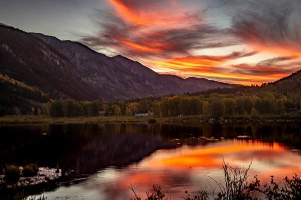
Beaver Lake (7,945 ft), also a State Wildlife Area, is a lake along Gunnison County Road 3 in Marble, CO. A trail wraps around the lake connected to the Crystal River.
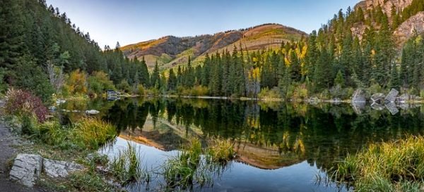
Lizard Lake is a lake in Gunnison County, Colorado. The lake is located within the boundaries of the White River National Forest, between Marble and the ghost town of Crystal, along Crystal City Road (FSR #314). The name Lizard Lake is a misnomer for the salamanders (not lizards) with feather-like gills inhabiting the lake, seen along the mud lake bottom and floating above the aquatic vegetation.
The town of Marble
The natural beauty of Marble inspires everyone, but especially those who are artistically or historically inclined and those who seek to refresh their soul. Marble is home to artists, artisans and galleries. The biggest art event of the year is of course the world renowned Marble Sculpting Symposium, which takes place every summer. Aside from the arts, there is also a fascinating wealth of history, which is evident all throughout town. If you are a history buff, Marble is for you. Refresh yourself and get inspired!
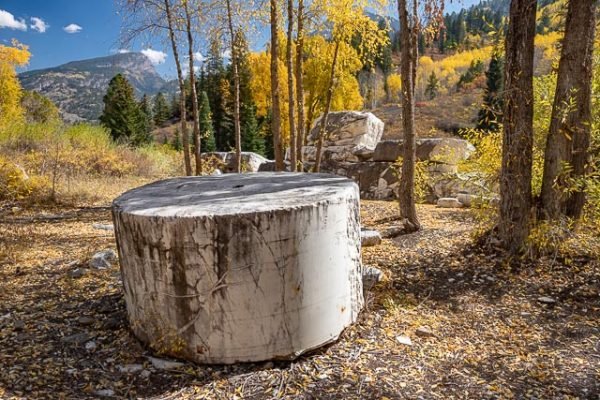
The Marble Mill Site Park is a 25 acre historic site that is now a park with large marble pillars and remains of the old Marble mill. The Marble Mill Site is listed on the National Register of Historic Places. Removal of marble, artifacts or plants from the park is illegal.
Where it is:
The Crystal Mill is located 6 miles east of Marble, just before the ghost town of Crystal. It is reachable only in the summer and fall months by a rough, one-lane, 4-wheel-drive road. If you are not interested in driving, or your vehicle does not have generous ground clearance, the trip to Crystal and The Mill can be reached by foot, mountain bike, or guided jeep tour. The Mill can also be accessed by horseback, but on a busy summer or fall day, riders will encounter many vehicles and the route is very rocky.
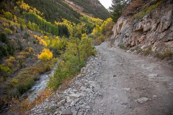
Gunnison County Road 3, Crystal Mill Road is a 4 miles dirt track located in Crystal, Colorado, United States, going to the Crystal Mill, a 1892 wooden powerhouse located on an outcrop above the Crystal River. It is reachable only in the summer and fall months by a rough, one-lane, 4-wheel-drive road.
Maps:
Interactive Google Map
Use the map + – controls to zoom in and out, click and drag the to move the map, use the Map drop-down to change to “Map”, “Satellite”, “Hybrid”, or “Terrain” views. Drag the little man icon from the upper left corner to a map location for street level view.
GPS:
39°3’33.179″ N 107°6’16.859″ W
Cost:
Hours:
There are no hours for this location.
Facilities:
There is a gift shop in the city of Crystal which is just above the mill
The nearest town is Marble which has a general store and a BBQ restaurant (which is very busy), no gas.
Location Contact Information:
Crystal Mill Photo Gallery
Click Here for full page gallery
More Photographic Destinations in Colorado:
Interactive Google Map
Use the map + – controls to zoom in and out, use the Map drop-down to change to “Map”, “Satellite”, “Hybrid”, or “Terrain” views. Drag the little man icon from the upper left corner to a map location for street level view. Click on a pushpin for more information about the Photographic Destination, then click on the title to go to the location page.
Click Here for Photographic Destinations by State
