Oysterville

Oysterville is a historical community nestled into the Willapa Bay on the Long Beach Peninsula in Washington State. The once lusty boomtown of the mid-nineteenth century faded with the oyster population, leaving behind lovely homes and pioneer descendants, several of whom still own their ancestral properties.
Oysterville was established and named in 1854 by J.A. Clark. It was a hub of oyster farming as the name suggests. It was the seat of Pacific County until the seat was relocated to South Bend in 1893.
The town has several historic buildings, including a school house and historic homes, many built prior to 1880. Most of the buildings in this once prosperous town have been lost to the sea and the elements. Oysterville was placed on the National Register of Historic Districts in 1976 as Oysterville Historic District.
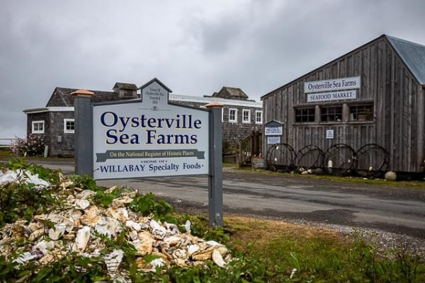
Oysterville Sea Farms is a Seafood market featuring fresh oysters and clams from our farms, open oysters, and our own line of Willabay Specialty Foods products, including homemade cereal, breading, dried fruits and baking mixes. Clam chowder, deli items, beer and wine are available to enjoy on our pier overlooking Willapa Bay.
The 80-acre Oysterville National Historic District and the areas immediately adjacent to it are the heart of Oysterville. With Willapa Bay as its backdrop, the historic district feels like a movie back lot version of a 19th century coastal community. In fact, some structures actually are from the 19th century. Eight houses, a church, the Oysterville cannery and a one-room schoolhouse are on the National Register of Historic Places.
Though Oysterville is a ghost town, it has life. Oysterville’s post office is the oldest continuously operating post office in Washington state. The Oysterville Store sells groceries, souvenirs and gifts and is open year round. Oysterville Sea Farms sells seafood from its farms and specialty foods from its bakery daily.
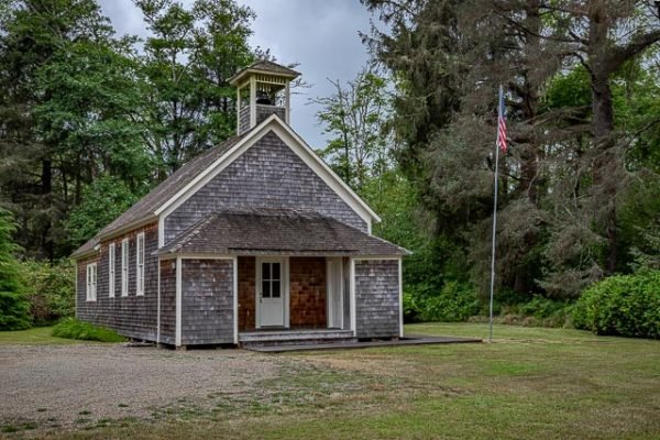
The Oysterville Church is open everyday of the year. The Oysterville cannery and all eight of the houses listed on the National Register of Historic Places create almost constant activity as they are maintained and repaired by their private owners. similar efforts are made by non-profit organizations to maintain and repair the church and one-room schoolhouse.
It was the California Gold Rush of 1849 that drew significant numbers of settlers of European descent to Oysterville. Gold miners loved to spend their gold on Willapa Bay oysters. Settlers and Chinook Peoples gladly filled schooners with oysters to be shipped to San Francisco.
Oysterville exists primarily as a state of mind. A walk through Oysterville can reveal the supremacy of nature; evoking connections to generations gone by, while subtly forecasting the folly of generations present and future. visitors often find themselves seeking sanctuary in the peace and insight they discovered here, long after they have left Oysterville.
What to Photograph
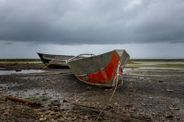
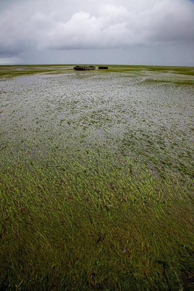
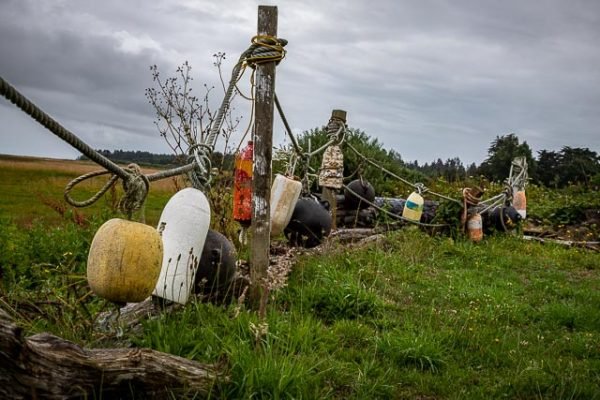
The entire town is very photographic with historic buildings and a quaint charm. Willapa bay at low tide seems to stretch on forever and the grounded boats at the Oysterville Sea Farms make for some dramatic photos.
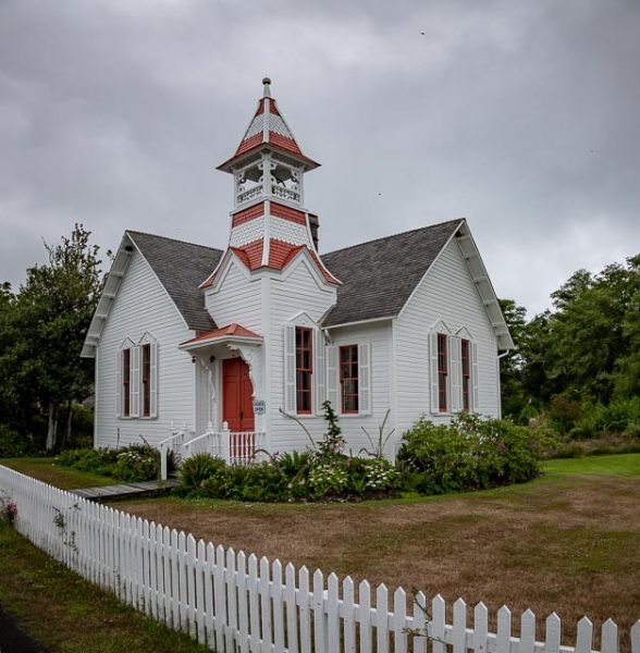
The Oysterville Church was a gift to the community from founder, R.H. Espy, who donated the land and money for construction in 1892. Over a hundred years later the picturesque little church of Oysterville continues to welcome visitors with open doors.
Where it is:
Oysterville is located in the lost corner of southwest Washington State. It is the most northern settlement on the North Beach Peninsula, which has the mighty Columbia River on its south, the Pacific Ocean on its west, and Willapa Bay on its east. Once you are on the Peninsula, drive north on Highway 103 until you reach a T-stop at Oysterville Road. Turn right driving east toward Willapa Bay. The road makes a gentle bend and turns into First Street.
Maps:
Interactive Google Map
Use the map + – controls to zoom in and out, click and drag the to move the map, use the Map drop-down to change to “Map”, “Satellite”, “Hybrid”, or “Terrain” views. Drag the little man icon from the upper left corner to a map location for street level view.
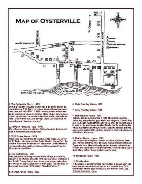
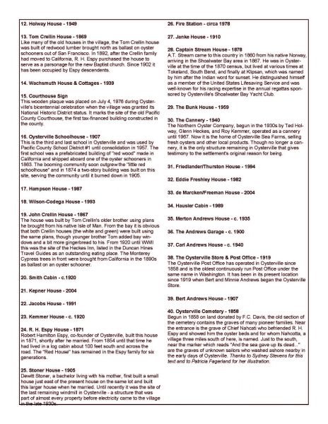
Click here for PDF download of walking tour map.
GPS:
46°32’59.297″ N 124°1’34.427″ W
Cost:
There is no cost to visit Oysterville.
Location Contact Information:
Oysterville Photo Gallery
Click Here for full page gallery
More Photographic Destinations in Washington:
Interactive Google Map
Use the map + – controls to zoom in and out, use the Map drop-down to change to “Map”, “Satellite”, “Hybrid”, or “Terrain” views. Drag the little man icon from the upper left corner to a map location for street level view. Click on a pushpin for more information about the Photographic Destination, then click on the title to go to the location page.
Click Here for Photographic Destinations by State
