Heceta Head Lighthouse

Head Lighthouse State Scenic Viewpoint is located in a cove at the mouth of Cape Creek. There are picnic tables sheltered from the wind and a great view of the ocean. A short trail leads to the historic Heceta Head lighthouse and assistant keeper’s house.
The trail is 1/2 a mile long and climbs 150 feet in elevation to get to the lighthouse. Heceta Head trail is part of a 7-mile network. Trails of varying difficulty feature beach and wildlife viewing areas. Wildlife refuge islands feature a view of common murres, cormorants, gulls, and other bird nesting areas. Sea lions and whales can be seen from the beach and cliff-top lighthouse.
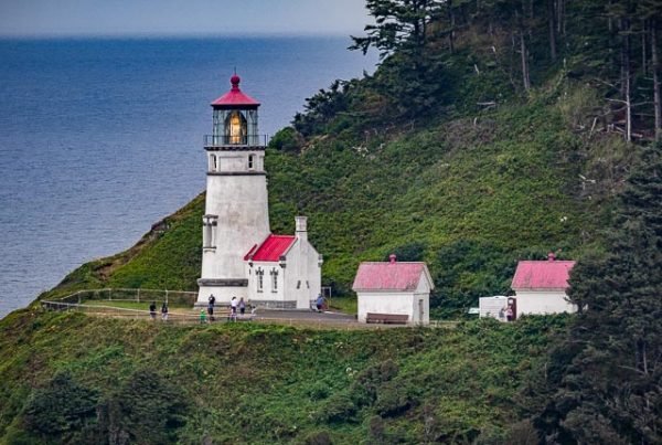
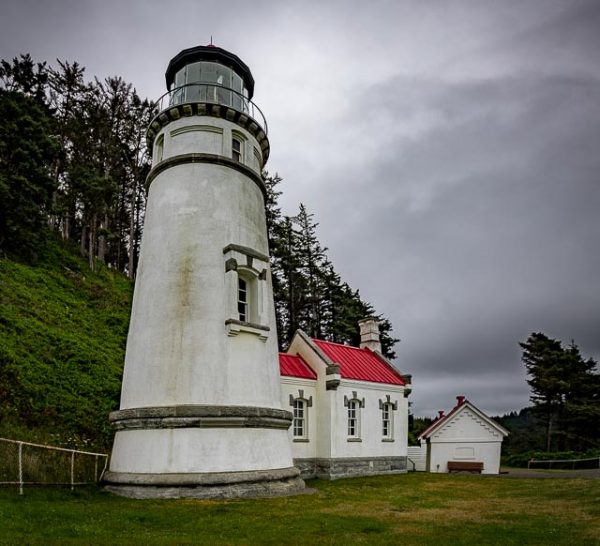
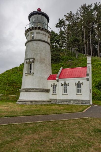
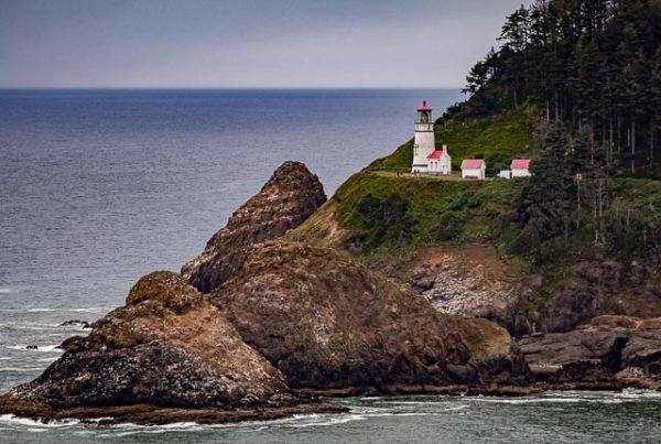
On the west side of 1,000-foot-high Heceta Head, 205 feet above the ocean, the lighthouse is one of the most photographed on the coast. The light at top of 56-foot tower was illuminated in 1894; the automated beacon, seen 21 miles from land, is rated as the strongest light on the Oregon coast. The historic assistant lighthouse keeper’s house (Heceta House; built 1893) offers bed and breakfast rentals and facilities for group events. The bed and breakfast is operated by a concessionaire of the U.S. Forest Service and can be reached at 1-866-547-3696 or http://hecetalighthouse.com/
Common murres, which lay their eggs on the bare rocks, can be easily seen by looking down, just over the railing near the lighthouse. Brown pelicans commonly fly by, as do bald eagles. Migrating gray whales can be seen as they travel to and from Alaska and Baja California. May is a great time to look right down on the migrating mothers and calves as they travel close to shore.
There are natural caves, tidepools, and a sandy beach for building sandcastles.
Park History
Heceta Head is named for Bruno de Heceta, a Spanish navigator and explorer, who surveyed the Oregon coast in 1775. The lighthouse was constructed between 1892 and 1893 and was listed in the National Register of Historic Places in 1978. The head lightkeeper’s house was demolished and the lumber purchased for $10 in 1940 following the move from kerosene to electricity to power the lighthouse. The salvaged wood was used to construct the Alpha-Bit Café in nearby Mapleton. The state of Oregon was granted a license to use the lighthouse and surrounding property by the Coast Guard in 1963, the same year that the lighthouse became fully automated. The assistant lightkeeper’s house, which still stands, is now a bed and breakfast operated by concessionaires of the U.S. Forest Service. In 1998, Heceta Head Lighthouse State Scenic Viewpoint was officially deeded to OPRD by ODOT. In 2001, the remaining Coast Guard property was transferred to OPRD.
What to Photograph
The historic lighthouse and the keepers order ambien online no prescription quarters which is a bed and breakfast managed by the forest service and the rugged Oregon Coast.
There is an excellent view of the lighthouse from a pullout on Hwy 101 south of the Lighthouse, you will need a long lens to get a good shot of the Lighthouse.
Where it is:
Heceta Head Light is a lighthouse on the Oregon Coast 13 miles north of Florence, and 13 miles south of Yachats. It is located at Heceta Head Lighthouse State Scenic Viewpoint, a state park.
Maps:
Interactive Google Map
Use the map + – controls to zoom in and out, click and drag the to move the map, use the Map drop-down to change to “Map”, “Satellite”, “Hybrid”, or “Terrain” views. Drag the little man icon from the upper left corner to a map location for street level view.
Click here to download PDF map
GPS:
44°8’14.442″ N 124°7’41.956″ W
Hours:

The Heceta Lighthouse B&B, in the Light Keeper’s home, is perched on a cliff with a magnificent view of the Pacific Ocean and the beach below. Paths from the Light Keeper’s Home lead both to the beach and to the lighthouse.
Cost:
Day-use parking permits are required year round at Heceta Head Lighthouse State Scenic Viewpoint. A daily ($5), 12-month or 24-month permit, an Oregon Coast Passport, or a valid state park camping receipt is required. Purchase daily permits from a machine at the park. The 12-month and 24-month permits are sold at most major state park offices.
Location Contact Information:
Heceta Head Lighthouse Photo Gallery
Click Here for full page gallery
More Photographic Destinations in Oregon:
Interactive Google Map
Use the map + – controls to zoom in and out, use the Map drop-down to change to “Map”, “Satellite”, “Hybrid”, or “Terrain” views. Drag the little man icon from the upper left corner to a map location for street level view. Click on a pushpin for more information about the Photographic Destination, then click on the title to go to the location page.
Click Here for Photographic Destinations by State


