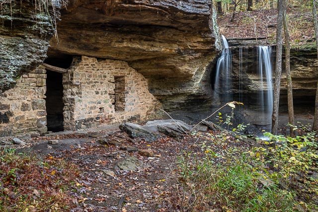
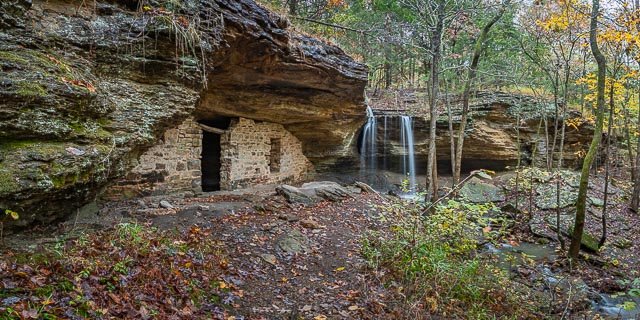
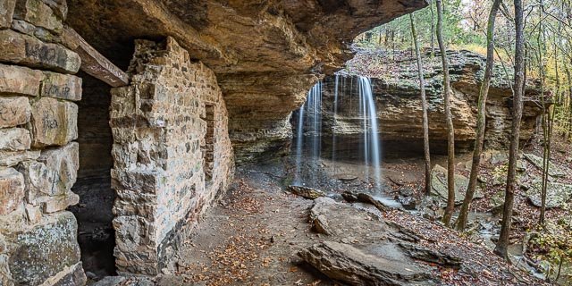
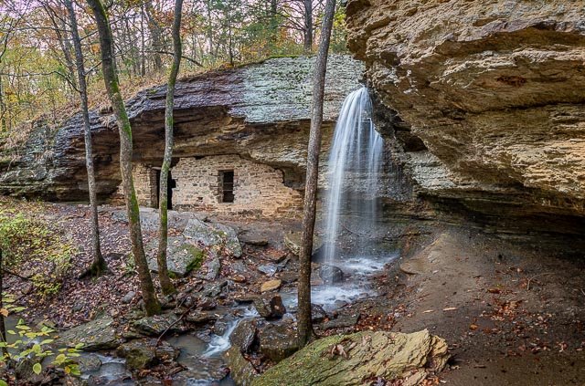
Moonshiners Cave

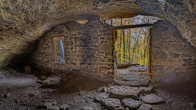
No one really knows if moonshine was every actually made at moonshiners cave, but the name comes from legend that says it was. This is not actually a cave, but a bluff shelter with a rock wall that was probably constructed in 1905, a date and initials that were carved into a rock next to the door which is no longer there. The shelter was originally used as a root cellar for a pioneer family.
If you visit after a good rain you can probably see the waterfall which adds to the location for photography. Don’t expect to see it if there has not been a lot of rain.
Where it is:
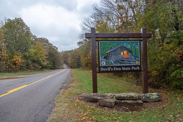
Moonshiners Cave is located just outside of the park boundary of Devil’s Den State park in Northwest Arkansas.
Directions:
As you leave the visitor center at Devil’s Den State Park, turn right on Highway 74. From your turn, you will travel two miles where you will park directly across from the park’s entrance sign.
On the south side of the road, you will walk about 50 yards hack towards the park and turn left on a rugged “ATV” trail. There are no signs or trail markings, this is not an official or maintained trail. The trail is fairly steep and very rocky.
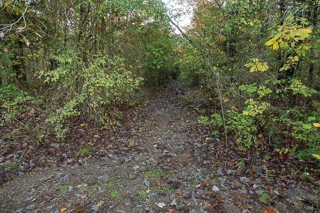
The trail will descend about 1/4 mile before you “T” onto an old road. There you will turn left and continue downhill. After hiking another 1/4 mile, you should notice an area heavily impacted by foot traffic. By Walking to the edge of that area, you will see the waterfall when it is flowing, or a corner of the walled-up bluff.
GPS:
35°46’48.342″ N 94°13’55.812″ W
Maps:
Interactive Google Map
Use the map + – controls to zoom in and out, click and drag the to move the map, use the Map drop-down to change to “Map”, “Satellite”, “Hybrid”, or “Terrain” views. Drag the little man icon from the upper left corner to a map location for street level view.
Hours:
The location is accessible 24 hours per day.
There is not cost to visit Moonshiners Cave or Devil’s Den State Park.
Location Contact Information:
Devil’s Dens State Park
Facilities:
Photo Gallery
Click Here for full page gallery
More Photographic Destinations in Arkansas Interactive Google Map
Use the map + – controls to zoom in and out, use the Map drop-down to change to “Map”, “Satellite”, “Hybrid”, or “Terrain” views. Drag the little man icon from the upper left corner to a map location for street level view. Click on a pushpin for more information about the Photographic Destination, then click on the title to go to the location page.
Click Here for Photographic Destinations by State