
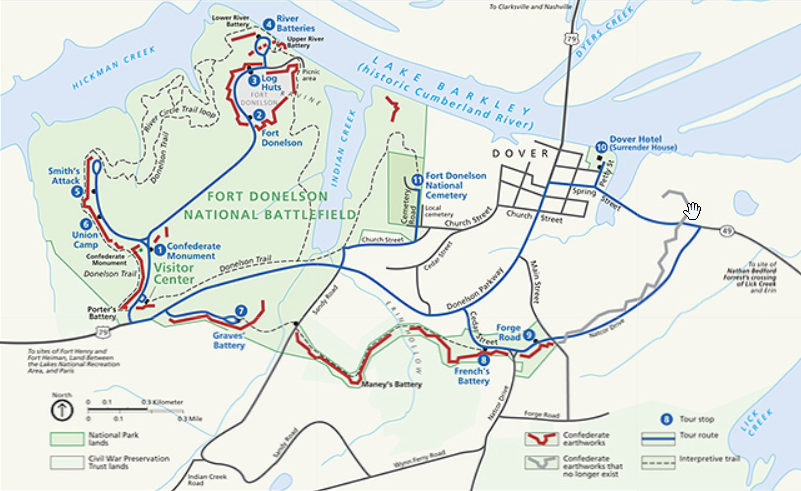
Fort Donelson National Battlefield

Fort Donelson National Battlefield preserves Fort Donelson and Fort Heiman, two sites of the American Civil War Forts Henry and Donelson Campaign, in which Union Army Brigadier General Ulysses S. Grant and Flag Officer Andrew Hull Foote captured three Confederate forts and opened two rivers, the Tennessee River and the Cumberland River, to control by the Union Navy. The commanders received national recognition for their victories in February 1862, as they were the first major Union successes of the war. The capture of Fort Donelson and its garrison by the Union led to the capture of Tennessee’s capital and industrial center, Nashville, which remained in Union hands from February 25, 1862 until the end of the war, and gave the Union effective control over much of Tennessee. This struck a major blow to the Confederacy early in the war.
The main portion of the park, in Dover, Tennessee, commemorates the Battle of Fort Donelson. Fort Heiman, in nearby Calloway County, Kentucky, was a Confederate battery in the Battle of Fort Henry.
The most vulnerable area in the Confederate defensive line in the Western Theater was the state of Kentucky. The Tennessee and Cumberland rivers were potential avenues for a Union invasion of the South through Kentucky and into Tennessee and beyond. Since Kentucky had declared neutrality, the Confederacy could not build defensive works within the state without risking alienating the local population. The local population in western Kentucky was pro-Confederate. Kentucky’s westernmost (First) congressional district elected a secessionist and Lincoln proclaimed it to be in rebellion.
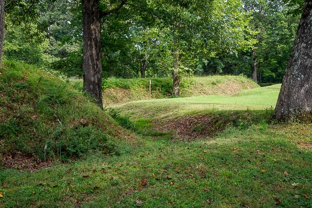
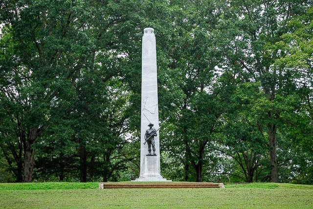
Adna Anderson and William F. Foster, two engineers detached from the Confederate 1st Tennessee Infantry, set to work on May 10, 1861, to find suitable ground just inside the Tennessee border to cover the two strategic rivers. They surveyed possible sites along the Cumberland River, noting the high ridges and deep hollows near the Kentucky border. In mid-May, on the west bank of the river not far below Dover, Anderson laid out the water battery of Fort Donelson, twelve miles from the Kentucky line. The new fort was named in honor of the Confederate General Daniel S. Donelson who, along with Colonel Bushrod Johnson of the Corps of Engineers, approved of the site. Construction was begun by a large force of men brought from the nearby Cumberland Iron Works.
The site was established as Fort Donelson National Military Park on March 26, 1928. The national military park and national cemetery were transferred from the War Department to the National Park Service on August 10, 1933. The park was listed on the National Register of Historic Places on October 15, 1966. It was re-designated a national battlefield on August 16, 1985.
The Fort Donelson National Cemetery, at 15.34 acres in Stewart County, contains 670 Union dead, reinterred in 1867. There are numerous veterans from later wars. The cemetery is presently unavailable for additional burials.
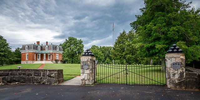
In 1867, Fort Donelson Cemetery was established as the final resting for Union soldiers and sailors initially buried in the Fort Donelson area.
Where it is:
The main unit of Fort Donelson National Battlefield is located in Dover, Tennessee, and can be accessed from US Highway 79.
From Nashville, it is best to take I-24 to Clarksville, and, in Clarksville, take Highway 79 South to Dover.
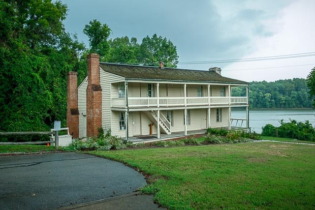
Built between 1851 and 1853, the Dover Hotel accommodated riverboat travelers before and after the Civil War. General Buckner and his staff used the hotel as their headquarters during the battle. It also served as a Union hospital after the surrender.
Maps:
Interactive Google Map
Use the map + – controls to zoom in and out, click and drag the to move the map, use the Map drop-down to change to “Map”, “Satellite”, “Hybrid”, or “Terrain” views. Drag the little man icon from the upper left corner to a map location for street level view.
GPS:
36°28’52.698″ N 87°51’49.8″ W
Cost:
Hours:
Fort Donelson NB Visitor Center is open Thursday – Sunday, 10 am – 4 pm CST.
The park is closed Thanksgiving, December 25, and January 1.
Hours change seasonally.
Dover Hotel hours are 10 am – 4:00 pm CST daily.
Mid-March (Spring time change) to Memorial Day: 8:00 am to 6:00 pm CST
Memorial Day to Labor Day: 8:00 am to 8:00 pm CST
Labor Day to Mid-October (Fall time change): 8:00 am to 6:00 pm CST
Mid-October (Fall time change) to Mid-March (Spring time change): 8:00 am to 4:30 pm CST
Facilities:
There is a visitor center at the battlefield, the park is located in the town of Dove TN which has restaurants and lodging.
Location Contact Information:
Fort Donelson National Battlefield Photo Gallery
Click Here for full page gallery
More Photographic Destinations in Tennessee:
Interactive Google Map
Use the map + – controls to zoom in and out, use the Map drop-down to change to “Map”, “Satellite”, “Hybrid”, or “Terrain” views. Drag the little man icon from the upper left corner to a map location for street level view. Click on a pushpin for more information about the Photographic Destination, then click on the title to go to the location page.
Click Here for Photographic Destinations by State