Horseshoe Bend

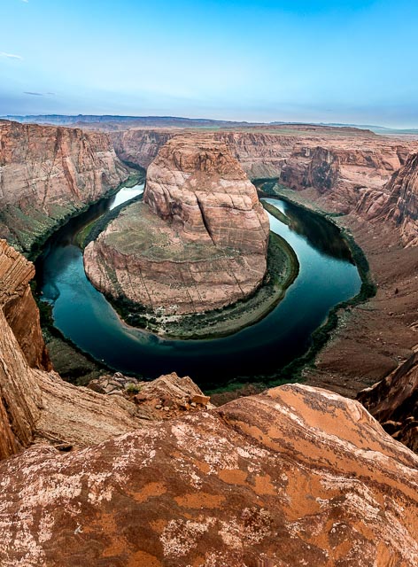
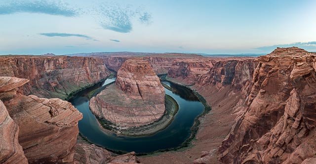
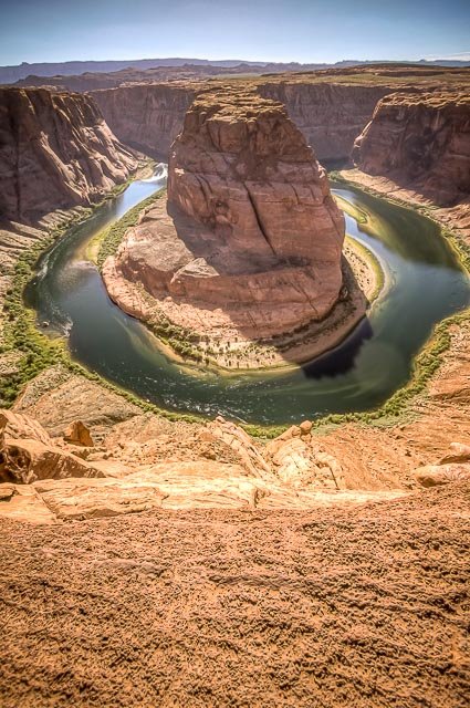
Horseshoe Bend is a horseshoe-shaped incised meander of the Colorado River located near the town of Page, Arizona, United States. It is also referred to as the “east rim of the Grand Canyon.”
Below the rim, the Colorado River makes a wide sweep around a sandstone escarpment. On its long downward journey to the sea, the river meandered, sometimes making wide bends, but always seeking the path of least resistance. Around 5 million years ago, the Colorado Plateau uplifted and the meandering rivers that crossed the ancient landscape were trapped in their beds. Over time, the rivers cut through the uplifted layers of sandstone.
Here at Horseshoe Bend, the Colorado River created a roughly 1,000 ft (305 m) deep, 270º horseshoe-shaped bend in Glen Canyon.
Horseshoe Bend is located 5 miles downstream from the Glen Canyon Dam and Lake Powell within Glen Canyon National Recreation Area, about 4 miles southwest of Page.
The hike to the overlook is a gentle slope of 1.5 miles round-trip over flat terrain. The trail is wide, easy for low-impact walkers, and accessible to wheelchairs. It has two shade stations along the way.
The overlook is 4,200 feet above sea level, and the Colorado River is at 3,200 feet above sea level, making it a 1,000-foot drop.
Where it is:
Horseshoe Bend is located 5 miles downstream from the Glen Canyon Dam and Lake Powell within Glen Canyon National Recreation Area, about 4 miles southwest of Page. It is accessible via hiking a 1.5-mile round trip from a parking area just off U.S. Route 89 within southwestern Page.
The entire ADA- accessible trail, including shade structures and a viewing area with railing opened January 2020. Much of the rim remains exposed, so watch your footing and keep track of children.
Best Time to Visit:
The busiest times of the day are between 9:00am to 11:00am in the morning and 4:30pm to 6:30pm in the evening. If you enjoy fewer crowds, try scheduling your hike around these busy times. There is no overnight parking or camping allowed.
Maps:
Interactive Google Map
Use the map + – controls to zoom in and out, click and drag the to move the map, use the Map drop-down to change to “Map”, “Satellite”, “Hybrid”, or “Terrain” views. Drag the little man icon from the upper left corner to a map location for street level view.
GPS:
36°52’46.026″ N 111°30’38.034″ W
Cost:
Parking Fees
Horseshoe Bend itself is in the park, but the parking lot is on city land. The City of Page requires visitors to pay for parking at the Horseshoe Bend trailhead. National Park Service passes do not apply for the parking lot.
Horseshoe Bend Fees are as follows:
- Motorcycle: $5
- Car or RV: $10
- Commercial Van/Bus: (Passenger Capacity up to 14) $35
- Commercial Bus: (Passenger Capacity 15-35) $70
- Commercial Bus: (Passenger Capacity over 35) $140
Entrance fees are based on the passenger capacity of the vehicle, not the number of passengers. There is absolutely no parking anywhere along Hwy 89, as this is a 65 mph highway, and vehicles will be ticketed and towed. The City of Page has passed an emergency ordinance prohibiting passenger drop-offs and pickups at the Horseshoe Bend entrance or along the Highway 89 corridor.
Hours:
Glen Canyon National Recreation Area is open 24 hours per day, year-round.
Horseshoe Bend is open year-round from sunrise to sunset.
Location Contact Information:
Horseshoe Bend Photo Gallery
Click Here for full page gallery
More Photographic Destinations in Arizona:
Interactive Google Map
Use the map + – controls to zoom in and out, use the Map drop-down to change to “Map”, “Satellite”, “Hybrid”, or “Terrain” views. Drag the little man icon from the upper left corner to a map location for street level view. Click on a pushpin for more information about the Photographic Destination, then click on the title to go to the location page.
Click Here for Photographic Destinations by State


