Black Canyon of the Gunnison National Park

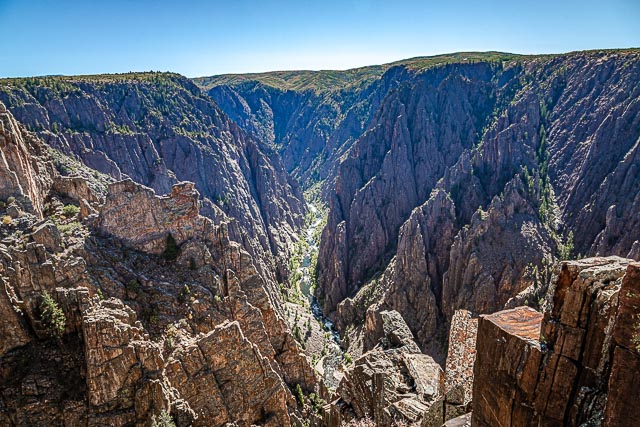
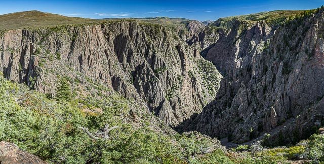
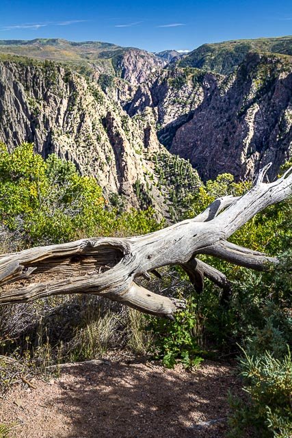
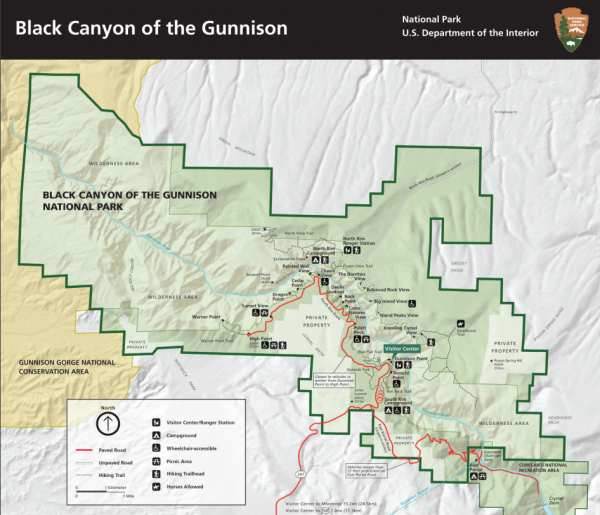
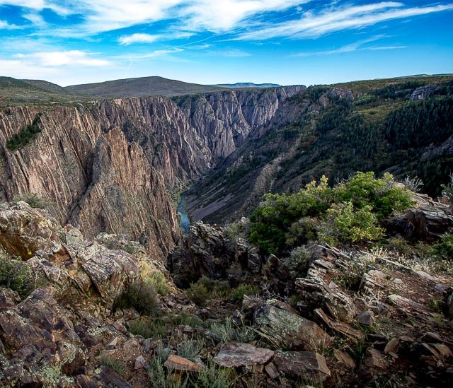
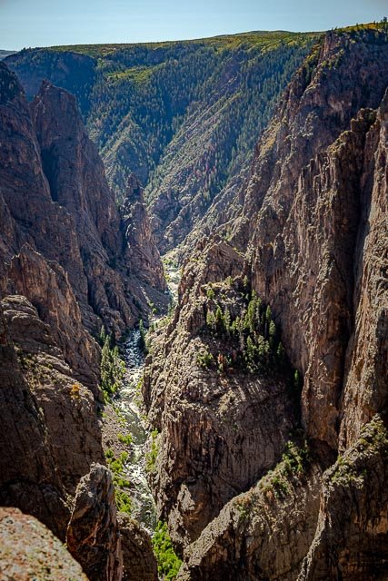
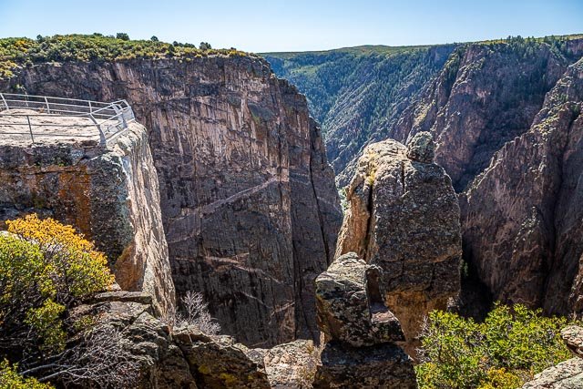
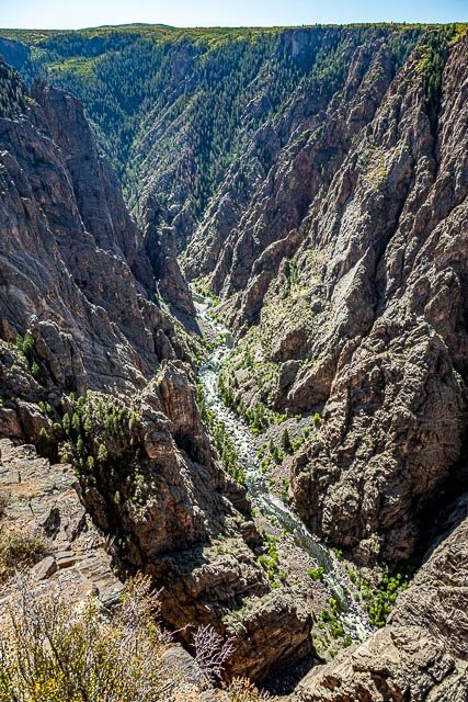
Black Canyon of the Gunnison National Park is in western Colorado and managed by the National Park Service. There are two primary entrances to the park: the south rim entrance is located 15 miles east of Montrose, while the north rim entrance is 11 miles south of Crawford and is closed in the winter. The park contains 12 miles of the 48-mile long Black Canyon of the Gunnison River. The national park itself contains the deepest and most dramatic section of the canyon, but the canyon continues upstream into Curecanti National Recreation Area and downstream into Gunnison Gorge National Conservation Area. The canyon’s name owes itself to the fact that parts of the gorge only receive 33 minutes of sunlight a day. As a result, the canyon is often shrouded in shadow, causing the rocky walls to appear black. At its narrowest point the canyon is only 40 ft wide at the river.
The Gunnison River drops an average of 34 feet per mile through the entire canyon, making it the 5th steepest mountain descent in North America. By comparison, the Colorado River drops an average of 7.5 feet per mile through the Grand Canyon. The greatest descent of the Gunnison River occurs within the park at Chasm View dropping 240 feet per mile. The Black Canyon is so named because its steepness makes it difficult for sunlight to penetrate into its depths. The extreme steepness and depth of the Black Canyon formed as the result of several geologic processes acting together. The Gunnison River is primarily responsible for carving the canyon, though several other geologic events had to occur in order to form the canyon as it is seen today.
The Black Canyon of the Gunnison was established as a national monument on March 2, 1933, and was redesignated a national park on October 21, 1999. During 1933-35, the Civilian Conservation Corps built the North Rim Road to design by the National Park Service. This includes fives miles of roadway and five overlooks; it is listed on the U.S. National Register of Historic Places as a historic district.
Where it is:
Black Canyon of the Gunnison National Park is located in southwest Colorado.
The South Rim is 7 miles north on CO Highway 347 from the intersection with U.S. Highway 50 east of Montrose.
The North Rim is 11 miles southwest of Crawford. From CO Highway 92, turn west on Black Canyon Road approximately 3 miles south of Crawford. Follow the road signs to the park. The last 7 miles are unpaved. The North Rim is closed to vehicles in the winter.
There is no bridge across the canyon. Allow 2 to 3 hours to drive from one rim to the other. The North Rim is closed to vehicles in the winter.
Maps:
Interactive Google Map
Use the map + – controls to zoom in and out, click and drag the to move the map, use the Map drop-down to change to “Map”, “Satellite”, “Hybrid”, or “Terrain” views. Drag the little man icon from the upper left corner to a map location for street level view.
GPS:
38.5754° N, 107.7416° W
Cost:
ENTRANCE FEES
7 Day Vehicle Pass $30.00
7 Day Motorcycle Pass $25.00
7 Day Individual Pass $15.00 (pedestrian or bicycle)
Black Canyon Annual Pass $55.00
Entrance fees cover all persons in a single, private, noncommercial vehicle. There is no fee charged for persons 16 years of age or younger.
National Park Passes are acepted.
Hours:
South Rim
Open every day. The South Rim Drive is usually open to vehicles from early April to mid-November. In winter, the South Rim Road is open to Gunnison Point at the visitor center. The remainder of the road is closed to vehicles, but open to cross country skiing and snowshoeing when conditions permit.
North Rim
North Rim Road and ranger station are closed to vehicles in winter. The road typically closes late November and reopens mid-April.
East Portal
East Portal Road is closed in winter. The road typically closes mid-November and reopens mid-April.
SOUTH RIM VISITOR CENTER
Location: 7 miles north on CO Highway 347 from the intersection with U.S. Highway 50.
GPS: N 38.5550 W -107.6866
South Rim Visitor Center is open every day of the year except Thanksgiving and Christmas Day.
January 1, 2020 to April 25, 2020: Open 9:00 am – 4:00 pm
April 26, 2020 to May 21, 2020: Open 8:00 am – 5:00 pm
May 22, 2020 to September 7, 2020: 8:00 am – 6:00 pm
September 8, 2020 to October 24, 2020: 8:00 am – 5:00 pm
October 25, 2020 to Winter 2020: 9:00 am – 4:00 pm
Location Contact Information:
National Park Service
102 Elk Creek
Gunnison, CO 81230
PARK HEADQUARTERS PHONE:
(970) 641-2337
PARK HEADQUARTERS FAX:
(970) 641-3127
Facilities:
Restrooms and drinking water are available at the visitor center on the south rim (Water is not available during cold months).
Black Canyon of the Gunnison National Park Photo Gallery
Click Here for full page gallery
More Photographic Destinations in Colorado:
Interactive Google Map
Use the map + – controls to zoom in and out, use the Map drop-down to change to “Map”, “Satellite”, “Hybrid”, or “Terrain” views. Drag the little man icon from the upper left corner to a map location for street level view. Click on a pushpin for more information about the Photographic Destination, then click on the title to go to the location page.
Click Here for Photographic Destinations by State