Centennial Land Run Monument

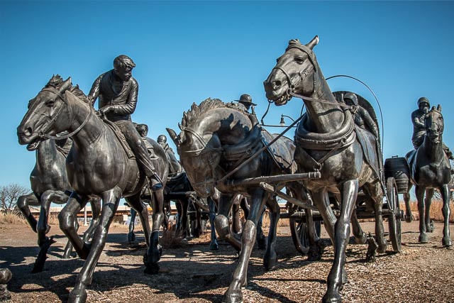
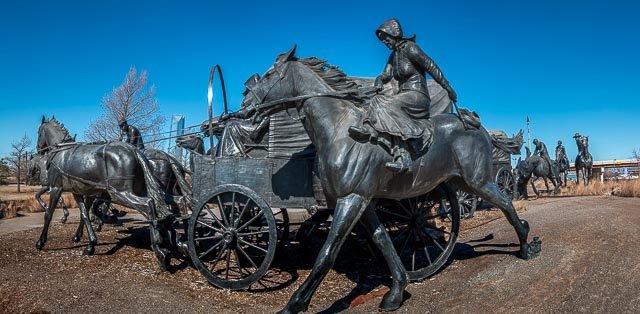
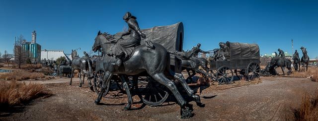
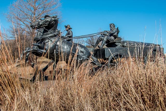
The Centennial Land Run Monument commemorates the opening of the Unassigned Land in Oklahoma Territory with the Land Run of 1889. The frenzied energy and emotion from one instant during the run is captured in bronze by artist Paul Moore. It is one of the world’s largest bronze sculptures featuring 45 heroic figures of land run participants, frozen in motion as they race to claim new homesteads.
The Oklahoma Land Rush of 1889 was the first land run into the Unassigned Lands. The area that was opened to settlement included all or part of the Canadian, Cleveland, Kingfisher, Logan, Oklahoma, and Payne counties of the US state of Oklahoma. The land run started at high noon on April 22, 1889, with an estimated 50,000 people lined up for their piece of the available two million acres.
The Unassigned Lands were considered some of the best unoccupied public land in the United States. The Indian Appropriations Act of 1889 was passed and signed into law with an amendment by Illinois Representative William McKendree Springer that authorized President Benjamin Harrison to open the two million acres for settlement. President Abraham Lincoln signed the Homestead Act of 1862 which allowed settlers to claim lots of up to 160 acres, provided that they lived on the land and improved it
Where it is:
Located in Oklahoma City on the S end of the Bricktown canal walkway. The entrance is at 200 Centennial Ave, just off Reno Ave, between the Bass Pro Shops and the Residence Inn Hotel. Parking is adjacent to the monument, just to the east.
Maps:
Interactive Google Map
Use the map + – controls to zoom in and out, click and drag the to move the map, use the Map drop-down to change to “Map”, “Satellite”, “Hybrid”, or “Terrain” views. Drag the little man icon from the upper left corner to a map location for street level view.
GPS:
35°27’39.1665″ N 97°30’18.7549″ W
Hours:
Centennial Land Run Monument Photo Gallery
Click Here for full page gallery
More Photographic Destinations in Oklahoma
Interactive Google Map
Use the map + – controls to zoom in and out, use the Map drop-down to change to “Map”, “Satellite”, “Hybrid”, or “Terrain” views. Drag the little man icon from the upper left corner to a map location for street level view. Click on a pushpin for more information about the Photographic Destination, then click on the title to go to the location page.
Click Here for Photographic Destinations by State


