Shakespeare Ghost Town

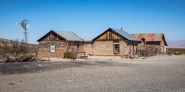
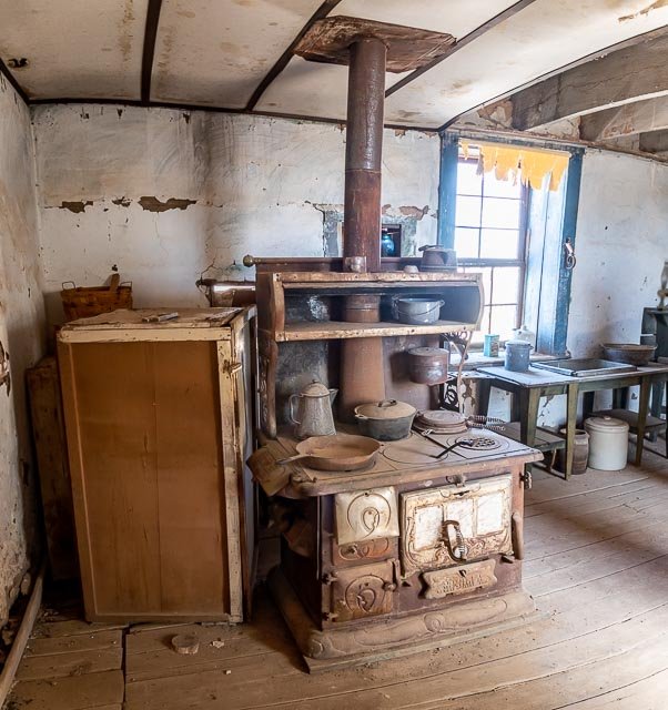
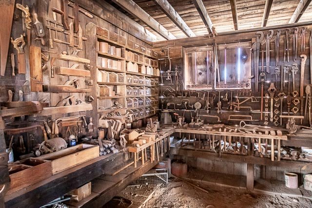
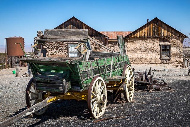
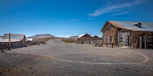
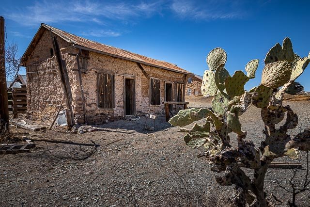
Shakespeare is as authentic of a Ghost Town that you will find. Frank and Rita Hill purchased the ghost town of Shakespeare in 1935. Frank and Rita and later their daughter Janaloo and her husband, Manny Hough, and now other family members have struggled to preserve this historic site. Most of the remaining buildings are original and contain artifacts original to the town. In addition a great deal of the history has been preserved in the museum.
History
Shakespeare has had several names through the years and only acquired its present one in 1879 at the beginning of its second mining boom. It is located here because there was a small but reliable spring located in the arroyo west of the town. The reliable water sourcePyramid
Mountain Mines attracted many people, Indians who ground mesquite beans left their metates scattered about, probably a few Spaniards stopped by, and then some of the Forty-niners who were taking the southern route to the gold fields of California, watered their stock at this little spring. About 1856 a building was built here by the Army, evidently to serve as a relay station on the Army Mail line between Fort Thorn on the Rio Grande and Fort Buchanan, south of Tucson. This spring served as an alternate stopping place for the San Antonio and San Diego mail line but was bypassed by the first Butterfield coaches. However before the Butterfield quit running in 1861, they had moved the road back up in the hills and had built a square adobe stage station here. During this time the spring was sometimes called Mexican Spring according to old timers.
The outbreak of the Civil War completely disrupted the stage line, what with fighting around the eastern terminals and Union soldiers being moved back East, leaving the Southwest to the mercy of the Apaches. But the Civil War brought more people to Mexican Spring– soldiers of both sides. First a small detachment of hard-riding Texans led by Colonel Sherod Hunter traveled through this area on their way to Tucson, and from there, they hoped, to the gold fields of California. Their hopes were futile because California was overwhelmingly Union in its sentiments. Carelton and the California Volunteers rode east across Arizona and met the tattered Texans at Picacho Pass, west of Tucson. The Texans were defeated and trailed back to Texas, their dreams of California gold crushed under overwhelming numbers. During this time one or two more buildings were built at Mexican Spring by the Soldiers. The largest one was later referred to as the “old stone fort.”
With the close of the Civil War a new stage line was started by Kerens and Mitchell. They hired men in San Diego to reopen some of the Butterfield’s stations. A man named John Eversen was hired to reopen this station. Evensen came here in 1865 and lived on here until his death in 1887.
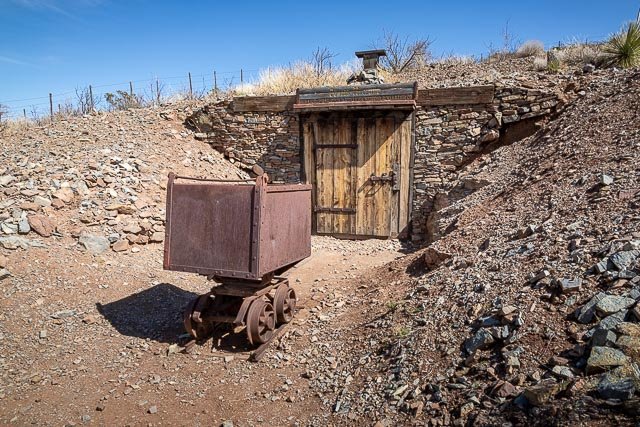
In 1870, some of the prospectors hanging around this little station discovered samples of very rich silver ore in the surrounding hills and they went hunting for financing to develop their new mines. Some of them must have had San Francisco connections because they interested the group of financiers connected with William Ralston, President of the Bank of California. A company was formed and the town was named in Ralston’s honor. The town grew rapidly and newspapers as far away as San Diego carried stories about the promising new camp.
The population boomed to 3000 people with independent miners flocking in to try to get a piece of the action. The company had some hired fighting men on their payroll to keep these independent miners off. The rich silver mined out very rapidly but then the rumor began to circulate that diamonds had been discovered on Lee’s Peak west of town. The Hired Fighting men stayed on the payroll, the stages kept running, and the town boomed until sometime in 1872 when the diamond swindle was revealed as a hoax all over the country. Most people left town for fear of being implicated in the crooked work and the town almost emptied of people.
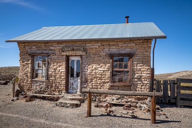
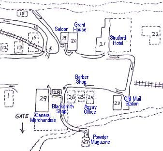
In 1879 Colonel William G. Boyle got hold of most of the good claims and renamed the town Shakespeare to eliminate memories of the earlier swindles. With financing coming from St. Louis this time he started the Shakespeare Gold and Silver Mining and Milling Company and the town enjoyed a second boom. More men brought their families and the place settled down to some extent but it never got a church , a school, a newspaper, or any real law. Occasionally there would be a serious fight and some of the losers might be hanged to the timbers of the Grant House dining room.
The railroad missed Shakespeare by about 3 miles and the beginning of the new railroad town of Lordsburg was the death knell for Shakespeare. Businesses gradually moved down to the new town to be closer to the source of supplies. The depression of 1893 caused the mines to close and most people moved away to find jobs elsewhere. People often took the roofs and of the town. The reliable water sourceRita Hillother salvageable material off of their houses and left the walls to crumble in the weather. In 1907 a new copper mine about a mile south of Shakespeare started to work and some of those miners rented remaining buildings in the old town. Many ghost stories date from this era when the older residents seemed to come back to haunt the newer ones. In 1935 the town and buildings were purchased by Frank and Rita Hill for a ranch. They maintained the buildings as well as they could with limited resources.
Shakespeare was declared a National Historic Site in 1970. Frank Hill passed away in 1970, Rita in 1985, Janaloo in 2005 and Manny Hough in 2018. They are buried at the top of the hill overlooking the town. The Shakespeare Foundation continues to work toward preserving the town as a monument to the Real Old West.
Many of Shakespeare’s more “colorful” residents, prospectors, and regular citizens of Shakespeare have their final resting place at Shakespeare Cemetery, You’ll see the cemetery on the left side of the road on your way to Shakespeare.
Where it is:
Shakespeare is in the Southwestern part of the U.S. in the State of New Mexico. It is just outside the city of Lordsburg.
Shakespeare is 2 1/2 miles south and west of Lordsburg on NM Hwy 494 from Lordsburg. To get to Shakespeare from Lordsburg take the Main Street exit (EXIT 22) from I-10 and turn South. Follow the signs 2 1/2 MILES on NM Hwy. 494 (Ghost Town Road) to reach the Town of Shakespeare.
Maps:
Interactive Google Map
Use the map + – controls to zoom in and out, click and drag the to move the map, use the Map drop-down to change to “Map”, “Satellite”, “Hybrid”, or “Terrain” views. Drag the little man icon from the upper left corner to a map location for street level view.
GPS:
32°19’33.72″ N 108°44’18.99″ W
Cost:
-
Regular Monthly Tour Admission $5.00 Adult – $3.00 Ages 6 Through 12.
- Private Tours are now available daily. Admission $7.00 Adult – $3.00 Ages 6 Through 12. You may call us from the Shakespeare Gate or as you’re nearing Lordsburg. Call 575.542.9034 to schedule a time and if a tour guide is available.
Hours:
Shakespeare is open only for regular monthly tours one weekend a month or daily for private tours when available. Call 575-542-9034 for tour availability.
Facilities:
Shakespeare is completely uncommercialized. On a hot summer day, guests are offered a drink of cold well water and a comfortable chair in the shade. There are restrooms in the visitor center.
Lordsburg, only 2 1/2 miles away, offers complete tourist facilities.
Location Contact Information:
SHAKESPEARE GHOST TOWN
P.O. BOX 253
LORDSBURG, NM 88045
575.542.9034
Email
Shakespeare Ghost Town Photo Gallery
Click Here for full page gallery
More Photographic Destinations in New Mexico
Interactive Google Map
Use the map + – controls to zoom in and out, use the Map drop-down to change to “Map”, “Satellite”, “Hybrid”, or “Terrain” views. Drag the little man icon from the upper left corner to a map location for street level view. Click on a pushpin for more information about the Photographic Destination, then click on the title to go to the location page.
Click Here for Photographic Destinations by State