Gila Cliff Dwellings National Monument

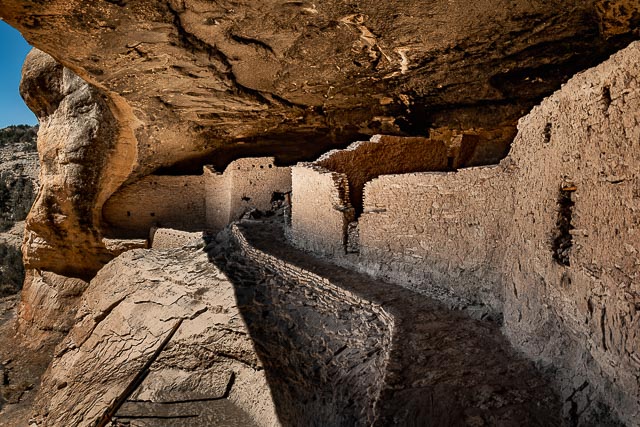
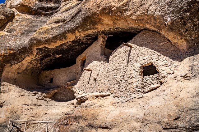
Gila Cliff Dwellings National Monument is a U.S. National Monument created to protect Mogollon cliff dwellings in the Gila Wilderness on the headwaters of the Gila River in southwest New Mexico. The 533-acre national monument was established by President Theodore Roosevelt through executive proclamation on November 16, 1907. It is located in the extreme southern portion of Catron County.
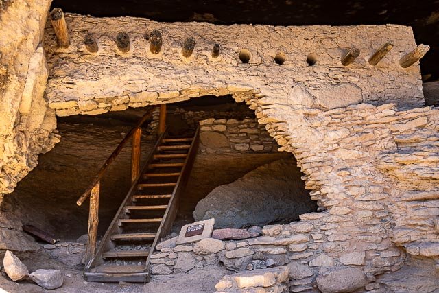
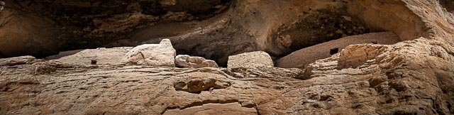
Cliff Dwellings Trail
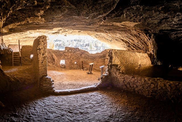
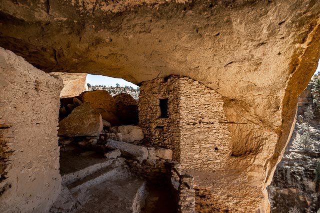
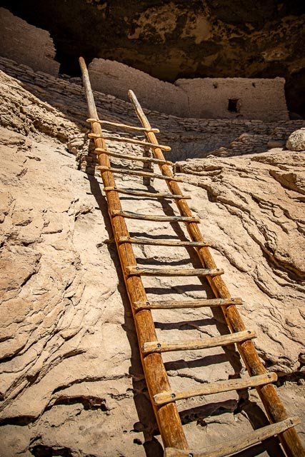
The one-mile loop trail to and through the cliff dwellings climbs 180 feet above the canyon floor to an elevation close to 6000 feet. Allow a minimum of one hour for the round-trip hike. The trail is not wheelchair accessible. Views of the some of cliff dwellings are possible after a 1/4-mile hike in the canyon bottom. The trail that continues to the dwellings is steep and rocky in places and can be muddy or icy at times. Wear sturdy shoes, pace yourself (use the benches), and carry water. The trail to the cliff dwellings is open starting at 9 am. Visitors must start the trail by 4 pm and exit the monument by 5 pm.
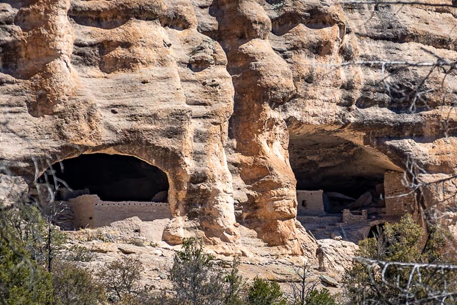
Considered by archaeologists to be on the northernmost portion of the Mogollon People’s sphere of influence, the Gila Cliff Dwellings National Monument is home to two prominent ruins sites among a collection of smaller sites located within the Gila Wilderness inside the Gila National Forest. The Monument landscape ranges in elevation from around 5,700 to 7,300 feet above sea level and follows the branches of the Gila River. The terrain around the ruins is rugged and arid, and contains steep-sided canyons cut by shallow spring rivers and mesas and bluffs forested with Ponderosa pine, Gambel’s oak, Douglas fir, New Mexico juniper, pinon pine, and alligator juniper (among others). The area geologic history stems from the Oligocene epoch and volcanic activity that subsequently covered the area with ash. The Monument’s hot springs are remnants of this volcanic history.
Where it is:
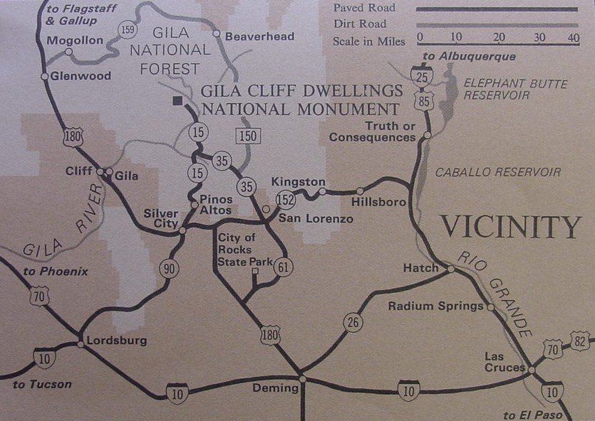
Gila Cliff Dwellings National Monument is located in the southwestern part of New Mexico, near Silver City. Although the monument is only 44 miles north of Silver City on New Mexico Highway 15, the narrow road is over windy, mountainous terrain. Travel time is approximately one and a half to two hours one way.
The roads approaching the monument are not plowed or maintained at night or on weekends, please use caution if traveling at these times.
By Car
Most visitors come from Silver City. Begin in Silver City on US Highway 180/Silver Heights Boulevard should take Pinos Altos Road which becomes New Mexico Highway 15 North. NM 15 begins in Silver City and only heads north. Continue for 42 miles until you reach the Gila Visitor Center. To reach the dwellings turn left just before reaching the visitor center and continue for 2 miles until the road ends.
The first 25 miles of NM 15 are narrow with steep sections of 10-12% grade for several miles and no center dividing line exists. Vehicles should use lower gears when driving to avoid overheating brakes and stay as far right as possible, especially on tight curves. An alternative route is New Mexico Highway 35.
Maps:
Interactive Google Map
Use the map + – controls to zoom in and out, click and drag the to move the map, use the Map drop-down to change to “Map”, “Satellite”, “Hybrid”, or “Terrain” views. Drag the little man icon from the upper left corner to a map location for street level view.
GPS:
33°13’45.948″ N 108°15’53.94″ W
Cost:
Entrance to Gila Cliff Dwellings National Monument is free.
Hours:
The trail to the Gila Cliff Dwellings is open to the public from 9 am to 4 pm. All visitors and staff must be off the trail and out of the Monument by 5 pm.
The Gila Cliff Dwellings, Gila Visitor Center and Gila Cliff Dwellings Trailhead Museum are open every day of the year except: Thanksgiving Day (the 4th Thursday of November), Christmas Day (December 25th), and New Year’s Day (January 1st) .
The Visitor Center contains a Park store operated by the Western National Parks Association. Many items related to the park, the Wilderness, and to the Continental Divide Trail are available; as well as hand made pottery, stone fetishes, and jewelry crafted by Zuni, Apache, Hopi, and other regional tribes. Wheelchair-accessible restrooms are outside the main visitor center and are always open for use. The Gila region is PACK IT IN–PACK IT OUT. There are no trash cans or dump stations. Please take all of your trash to a nearby city that has garbage recepticles and recycling.
Available Facilities
The Trailhead Museum is wheelchair accessible. Four vault toilets are placed around the parking lot. The trailhead to the cliff dwellings starts next to the Trailhead Museum.
Location Contact Information:
By Mail:
Gila Cliff Dwellings National Monument, 26 Jim Bradford Trail, Mimbres, NM, 88049
By Phone:
Visitor Information (575) 536-9461
By Fax:
(575) 536-9344
By E-mail:
Click here to e-mail us. (If you have difficulty with the link, our e-mail address is gicl_information@nps.gov.)
Other Information:
Fire Information for Gila National Forest: (575) 388-8271
Gila Wilderness Ranger District Headquarters: (575) 536-2250
Gila National Forest Supervisor’s Office: (575) 388-8201
Gila Cliff Dwellings National Monument
Photo Gallery
Click Here for full page gallery
More Photographic Destinations in New Mexico
Interactive Google Map
Use the map + – controls to zoom in and out, use the Map drop-down to change to “Map”, “Satellite”, “Hybrid”, or “Terrain” views. Drag the little man icon from the upper left corner to a map location for street level view. Click on a pushpin for more information about the Photographic Destination, then click on the title to go to the location page.
Click Here for Photographic Destinations by State