Pea Ridge National Military Park

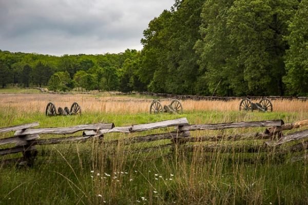
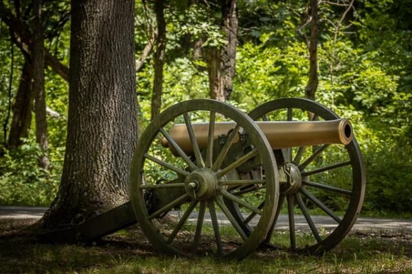
Canons on display at Pea Ridge National Military Park is a 4,300 acre Civil War Battlefield that preserves the site of the March 1862 battle that saved Missouri for the Union.
On March 7-8, 1862, over 23,000 soldiers fought here to decide the fate of Missouri and was a turning point of the war in the West. The 4,300 acre battlefield honors those who fought and died on these grounds. Pea Ridge was the most pivotal Civil War battle west of the Mississippi River and is one of the most intact Civil War battlefields in the United States.
The park also includes a two and one half mile segment of the Trail of Tears. The Elkhorn Tavern, site of bitter fighting on both days, is a NPS reconstruction on the site of the original.
The Pea Ridge Campaign
|
Pea Ridge was the most decisive Civil War battle west of the Mississippi River. Over 26,000 soldiers struggled for two days in Northwest Arkansas in the battle that would decide the fate of Missouri. But why was Missouri so important that so many men would risk their lives for it? Control of Missouri was the key to winning the war in the West. Military strategists, both North and South, were fully aware of this. Missouri provided an easy invasion route either north or south and controlled the Mississippi, Missouri, and Ohio Rivers. It had abundant natural resources, especially lead and iron ore, a large military-aged population and was the home of the Saint Louis Arsenal, with a stockpile of over 60,000 muskets. In December, 1861, the situation in Missouri was deadlocked. The Missouri State Guard, the pro-secession militia army, controlled the southern & western parts of the state, while the Federal Army controlled the northern & eastern parts, as well as the railroads & waterways. The Missouri State Guard had won important victories at Carthage, Lexington, and Wilson’s Creek, but had failed to force Missouri to secede from the Union. The Federal commander, Major General Henry Halleck, knew that the State Guard was a symbol of open defiance to Federal authority in Missouri and that its continued presence in the state might still encourage secession. He began to gather all his available forces at Lebanon, Missouri, and, on December 25, 1861, placed Brigadier General Samuel Ryan Curtis in command of them. Curtis’ orders were to destroy the Missouri State Guard at its winter quarters in Springfield or to drive it from the state. Curtis’ Army of the Southwest began its campaign on February 10, 1862. The army marched quickly over the rough, frozen roads, and caught the Missouri State Guard, and its commander, Major General Sterling Price, by surprise. Price abandoned Springfield on February 13, and retreated south into Arkansas. The two armies fought a series of skirmishes along the way and on February 17, one week after beginning its campaign, Curtis triumphantly telegraphed Halleck, “The flag of our Union again floats in Arkansas.” As the Federals crossed the border into Arkansas, a brass band played “Yankee Doodle” and “The Arkansas Traveler”. |
Where it is:
Getting to the Park
From the Northeast (Republic, MO): Take US 60 to Monett, MO, then south on MO 37 to Gateway, AR. Go west on US 62 to the new park entrance.
From the North (Joplin, MO): Take US 71 south until the Pea Ridge Exit and then go left on AR 72. At the town of Pea Ridge follow 72 to US 62. Turn left on US 62 and drive 1.3 miles to the Park.
From the South (Ft. Smith, AR): Take I-49 north. Go through Fayetteville, AR. Continue north on I-49 to the US 62 exit and follow signs to the park.
From the West (Tulsa, OK): Take the Cherokee Turnpike to US 412 to Siloam Springs and Springdale, AR. Take I-49 north to US 62 East and follow signs to the park.
Maps:
Interactive Google Map
Use the map + – controls to zoom in and out, click and drag the to move the map, use the Map drop-down to change to “Map”, “Satellite”, “Hybrid”, or “Terrain” views. Drag the little man icon from the upper left corner to a map location for street level view.
GPS:
36°26’34.77″ N 94°1’28.89″ W
Cost:
Hours:
Pea Ridge National Military Park Photo Gallery
Click Here for full page gallery
More Photographic Destinations in Arkansas
Interactive Google Map
Use the map + – controls to zoom in and out, use the Map drop-down to change to “Map”, “Satellite”, “Hybrid”, or “Terrain” views. Drag the little man icon from the upper left corner to a map location for street level view. Click on a pushpin for more information about the Photographic Destination, then click on the title to go to the location page.
Click Here for Photographic Destinations by State


