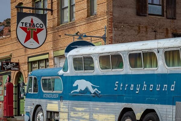
Erie Street Lowell Arizona

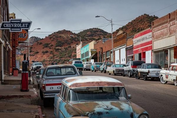
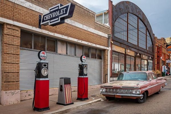
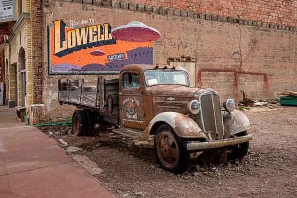
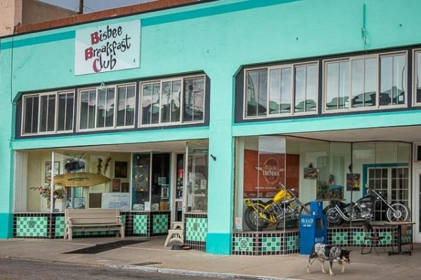
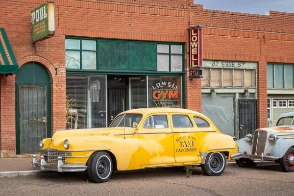
With an aesthetic that can only be described as “vintage,” the signage, storefronts, (non-functioning) gas pumps and a lot of the cars along this just-under-a-quarter-mile road date from 1940s, ’50s, ’60s and ’70s. It’s a carefully cultivated look this small community has crafted in recent years to ensure that Lowell stands out next to the equally colorful Bisbee.
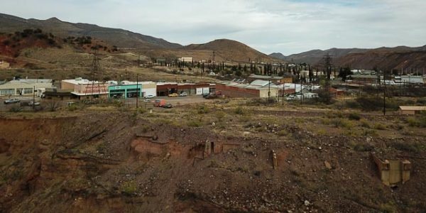
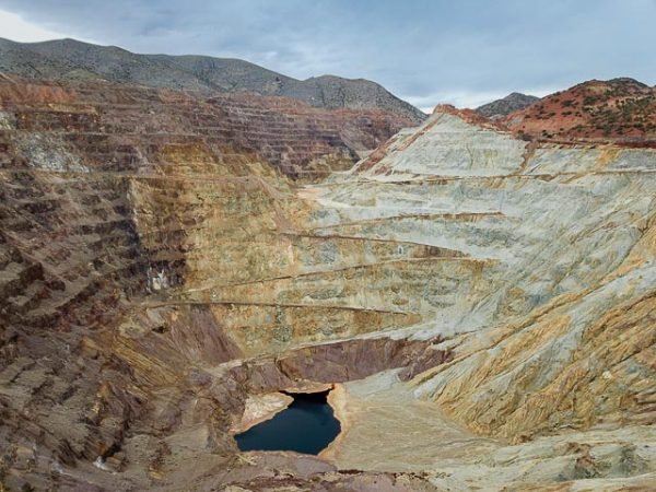
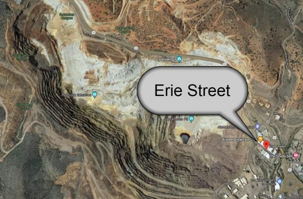
The small town of Lowell Arizona was once a thriving community with an active main street and a very active mining operation. As the mining grew the town was literally swallowed by the expansion of the mine. What was left was about 1000 foot long section of the main street. While Lowell has always been a one-street town, most of the surrounding communities were eventually razed as the open-pit Lavender Mine went into operation in the mid-1950s, leaving Erie Street a lone throwback to an earlier time.
According to the Bisbee Mining and History Museum, 19th century mine workers and their families established small clusters and communities to be close to their work in the era before cars. Lowell came from this tradition, with Erie Street being established as a business and social center near the Lowell and Hoasten Mines. Lowell was incorporated around the same time as Bisbee in the early 1900s and received an official post office in 1904. However, even then the “town” was Erie Street and two back alleyways, much as it is today.
The development of the Lavender Pit involved the area occupied by Lowell and other small suburbs. More than 250 homes and 20 businesses needed to be moved. Residents were offered the option of either receiving the market value for their home, which would then be demolished, or the company would pay to have the structures moved to a new site.
The Lowell district in Bisbee, Arizona used to be a thriving mining town that boasted a vibrant main street filled with a Five & Dime, auto dealerships, full service gas stations, a barbershop, bakery and a pharmacy. Over the years, following the closing of the mine in 1974, the town was slowly displaced, leaving behind Erie Street – a slice of Americana that appears to be frozen in time, reflecting a unique period in America’s history. The team behind the Lowell Americana Project, themselves vintage Americana enthusiasts, set about preserving and revitalizing Erie Street in Lowell, in the process creating an extraordinary public art project that celebrates the arts, their community, and American culture.
The Lowell Americana Project has garnered national and international media attention and praise for the project’s cultural preservation efforts, making this unique location one of the most photographed streets in the West. Erie Street in Lowell has been featured in an array of productions, from films to music videos, by artists such as Carrie Underwood, Rascal Flatts, and Steven King, among many others.
Where it is:
Turn off State Route 80 just before its junction with State Route 92 on the south end of Bisbee Arizona.
Maps:
Interactive Google Map
Use the map + – controls to zoom in and out, click and drag the to move the map, use the Map drop-down to change to “Map”, “Satellite”, “Hybrid”, or “Terrain” views. Drag the little man icon from the upper left corner to a map location for street level view.
GPS:
31°25’52.902″ N 109°53’41.796″ W
Erie Street Photo Gallery
Click Here for full page gallery
More Photographic Destinations in Arizona
Interactive Google Map
Use the map + – controls to zoom in and out, use the Map drop-down to change to “Map”, “Satellite”, “Hybrid”, or “Terrain” views. Drag the little man icon from the upper left corner to a map location for street level view. Click on a pushpin for more information about the Photographic Destination, then click on the title to go to the location page.
Click Here for Photographic Destinations by State
