Aransas National Wildlife Refuge

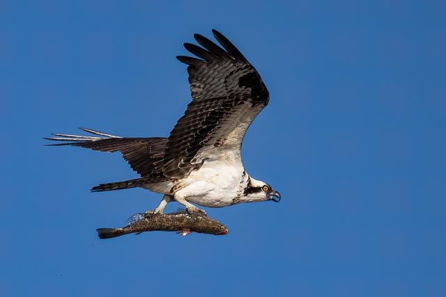
It is the principal wintering ground for the rare whooping crane and also attracts almost 400 species of other waterfowl and other birds, who vary with the seasons—especially geese, ducks, pelicans, herons, egrets, gulls, sundial cranes, roseate spoonbills, ibises, quail, osprey, a variety of migrating songbirds, and various shorebirds. Deer, javelinas (peccaries), armadillos, alligators, and turkeys are also abundant.
Bird-watching is the primary recreational activity. Although much of the refuge is closed to visitors, available facilities include an observation tower, an automobile touring road, a wildlife education center, and some hiking trails. The refuge was established in 1937 by presidential executive order to save the whooping cranes, then faced with extinction. The refuge’s resources are still largely devoted to this purpose, and Aransas has helped boost the species’ population. Headquarters are in Austwell.
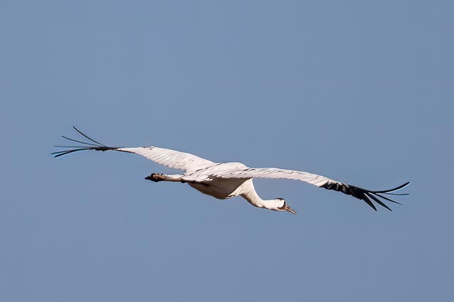
Whooping Crane
Named for its whooping sound, the whooping crane is the tallest North American bird. It is an endangered crane species. Along with the sandhill crane, it is one of only two crane species native to North America. The whooping crane’s lifespan is estimated to be 22 to 24 years in the wild.
After being pushed to the brink of extinction by unregulated hunting and loss of habitat to just 21 wild and two captive whooping cranes by 1941, conservation efforts have led to a limited recovery. The total number of cranes in the surviving migratory population, plus three reintroduced flocks and in captivity, now exceeds 800 birds.
The best time of year to see Whooping Cranes is from December to February, though they typically begin arriving by mid-October and leave mid-April. Watch for them feeding in the refuge’s marshes during daylight hours. Visitors can also enjoy seeing the birds from boat tours offered by private operators.
Photography Recommendation
If you are wanting to photography the Whooping Cranes and other shorebirds I recommend taking a commercial tour by boat into the refuge. While there is the chance to see them anywhere in the area the tour operators know where the birds are and stand a good chance of getting you close enough for good photos.
Where it is:
Directions
From the South: Follow Highway 35N to the FM 774 exit. Turn right on FM 774 and go approximately 6 miles, winding through the farm fields. Turn right again on FM 2040. Drive another 6 miles to the Refuge gate. Go to the Visitor Contact Station to register.
From the North: Travel south on Hwy 35 to Tivoli. Continue past Tivoli approximately 1 mile to the FM 239 exit (on your left). Follow FM 239 to Austwell. Upon entering Austwell, FM 239 turns into FM 774 at the curve. Continue on FM 774. Follow 774 and take a right at the stop sign. At the end of the street, take a right again. As you exit Austwell, drive ½ mile to the FM 2040 intersection. Turn left on FM 2040 and drive 6 miles to the Refuge gate. Go to the Visitor Contact Station to register.
Maps:
Interactive Google Map
Use the map + – controls to zoom in and out, click and drag the to move the map, use the Map drop-down to change to “Map”, “Satellite”, “Hybrid”, or “Terrain” views. Drag the little man icon from the upper left corner to a map location for street level view.
GPS:
28.313449,-96.804022

The Brown Pelican is a comically elegant bird with an oversized bill, sinuous neck, and big, dark body. Squadrons glide above the surf along southern and western coasts, rising and falling in a graceful echo of the waves. They feed by plunge-diving from high up, using the force of impact to stun small fish before scooping them up. They are fairly common today—an excellent example of a species’ recovery from pesticide pollution that once placed them at the brink of extinction.
Cost:
General Entrance Fees
18 years and under, entrance is free
$3 – one adult in a vehicle
$5 – two or more adults in a vehicle
$25 – commercial vehicle (van or bus) with up to 20 people
$50 – commercial vehicle with 21 or more people
Entrance is free to the Aransas Refuge with the following federal park passports:
Aransas Annual Pass
Federal Duck Stamp
Federal Duck Stamp
Annual Pass for Active Military
Senior Pass
Access Pass
“Every Kid in a Park” 4th Grade Annual Pass

A boldly patterned shorebird with red-yellow eyes and a vivid red-orange bill, American Oystercatchers survive almost exclusively on shellfish—clams, oysters, and other saltwater molluscs. Because of this specialized diet, oystercatchers live only in a narrow ecological zone of saltmarshes and barrier beaches. Along much of the Pacific Coast they are replaced by the similar but all-dark Black Oystercatcher.
Hours:
Auto tour and trails are open daily from half an hour before sunrise to half an hour after sunset.
Visitor Center:
October 15-April 14: 9 am – 4 pm daily
April 15-October 14: 9 am – 4 pm Wednesday – Sunday (Closed Monday-Tuesday)
Closed for all Federal Holidays

Unique among North American raptors for its diet of live fish and ability to dive into water to catch them, Ospreys are common sights soaring over shorelines, patrolling waterways, and standing on their huge stick nests, white heads gleaming. These large, rangy hawks do well around humans and have rebounded in numbers following the ban on the pesticide DDT. Hunting Ospreys are a picture of concentration, diving with feet outstretched and yellow eyes sighting straight along their talons.
Aransas National Wildlife Refuge Photo Gallery
Click Here for full page gallery
More Photographic Destinations in Texas
Interactive Google Map
Use the map + – controls to zoom in and out, use the Map drop-down to change to “Map”, “Satellite”, “Hybrid”, or “Terrain” views. Drag the little man icon from the upper left corner to a map location for street level view. Click on a pushpin for more information about the Photographic Destination, then click on the title to go to the location page.
Click Here for Photographic Destinations by State


