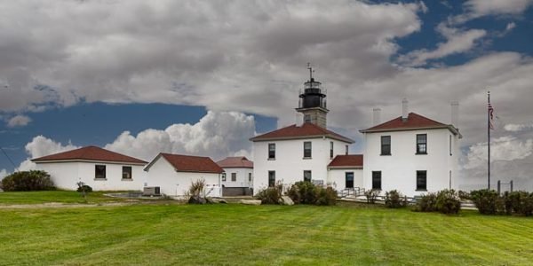
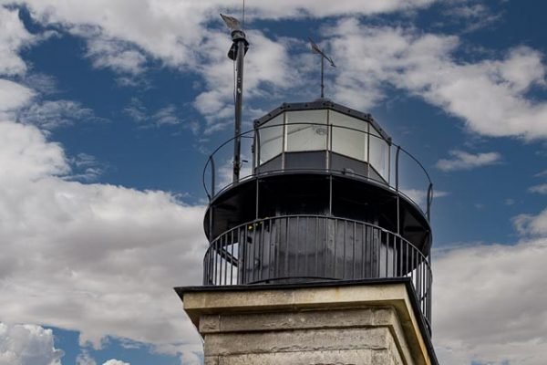
Beavertail Lighthouse

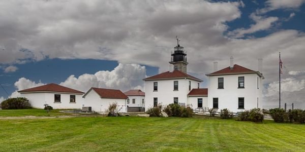
Beavertail Lighthouse was built in 1856 and is the premier lighthouse in Rhode Island, marking the entrance to Narragansett Bay. The 64-foot lighthouse lies on the southernmost point of Conanicut Island in the town of Jamestown, Rhode Island in Beavertail State Park, on a site where beacons have stood since the early 18th century. The light provides navigation for boats and ships entering Narragansett Bay in the East Passage between Conanicut Island and Newport, Rhode Island on Aquidneck Island.
A wooden tower was built in 1749, and the light became the third lighthouse established in the Thirteen Colonies, known at the time as “Newport Light”. A fire was lit at the top of the tower, as was common for the time. Four years later, it burned down and was replaced by a stone tower.
British sailors retreating from Newport near the end of the American Revolutionary War left a trail of destruction behind them in 1779. This included burning the lighthouse and removing the optics, which left the light dark for the rest of the war.
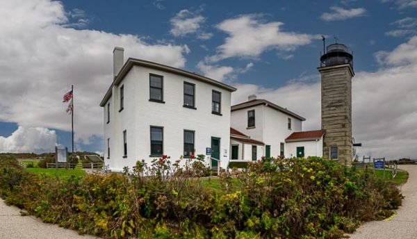
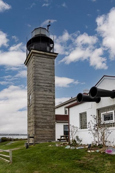
In 1856, the tower was replaced with the current tower, made of granite which is 10 ft square and 64 feet from ground to beacon. A 3rd order Fresnel lens was placed in service, and it was the site of numerous fog-signal tests over the next 40 years under the supervision of the United States Lighthouse board. In 1898, quarters were added to the keeper’s house for an assistant keeper; the assistant helped with fog-signaling, among other things.
The building was restored and opened to the public in 1989, following a joint effort by the US Coast Guard, Rhode Island Parks Management, the Rhode Island Department of Environmental Management, and the town of Jamestown. In 1993, Beavertail Lighthouse Museum Association (BLMA) was established to oversee the operations of the Beavertail Lighthouse Museum, which is located in the assistant keeper’s house.
Where it is:
From Highway 138 on the eastern side of Conanicut Island, take Canonicus Avenue south 0.9 miles to Narragansett Avenue. Turn right on Narragansett and drive 0.4 miles to S. West Avenue. Turn left on S. West Avenue and follow it to the narrow neck of land, which leads to the second lobe of the island. At this point, the road becomes Beaver Tail Road. Follow Beaver Tail Road to its end at Beaver Tail State Park, where you will find the lighthouse.
Maps:
Interactive Google Map
Use the map + – controls to zoom in and out, click and drag the to move the map, use the Map drop-down to change to “Map”, “Satellite”, “Hybrid”, or “Terrain” views. Drag the little man icon from the upper left corner to a map location for street level view.
GPS:
Cost:
there is no cost to visit the Beavertail State Park and lighthouse grounds. There is a $5 donation to climb the tower when open.
Hours:
The museum is open daily during the summer and on weekends in late spring and early fall. The tower is open for climbing on select days. Click here for visitor information, or you can reach the museum at (401) 423-3270.
Location Contact Information:
Beavertail Lighthouse Photo Gallery
Click Here for full page gallery
More Photographic Destinations in Rhode Island
Interactive Google Map
Use the map + – controls to zoom in and out, use the Map drop-down to change to “Map”, “Satellite”, “Hybrid”, or “Terrain” views. Drag the little man icon from the upper left corner to a map location for street level view. Click on a pushpin for more information about the Photographic Destination, then click on the title to go to the location page.
Click Here for Photographic Destinations by State
