Sandstone Falls – New River Gorge National Park

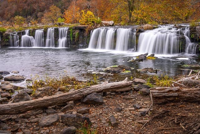
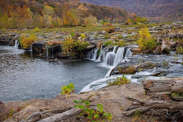
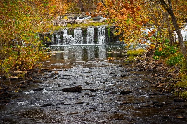
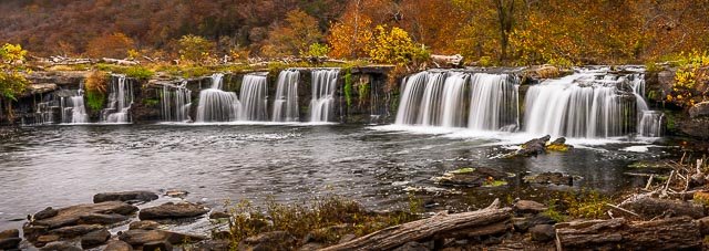
The largest waterfall on the New River, Sandstone Falls spans the river where it is 1500 feet wide. Divided by a series of islands, the river drops 10 to 25 feet.
Sandstone Falls marks the transition zone of the New River from a broad river of large bottomlands, to a narrow mountain river roaring through a deep boulder strewn V- shaped gorge. The falls form the dramatic starting line for the New Rivers final rush through the New River Gorge to its confluence with the Gauley River to form the Kanawha River.
Most visitors will find the best starting point for their journey to Sandstone Falls at the Sandstone Visitor Center at the Sandstone exit 139 on I-64. The Visitor Center has excellent exhibits on the New River watershed, water resources, and natural and cultural history of the upper New River Gorge, plus park maps and information.
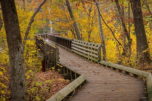
The walk begins by crossing a short bridge that spans a manmade channel that once diverted water for a water powered gristmill used for grinding the local farmers corn and wheat. The first island offers a view of the lower falls, the one half mile Island Loop Trail, and one of the most unique botanical ecosystems in West Virginia, the Appalachian riverside flat rock plant community. This community is found in only five areas in the state and consists of several southern plant species that have migrated along the north flowing New River and have adapted to the thin rock strewn soil and occasional scouring floods on this elevated island below the falls.
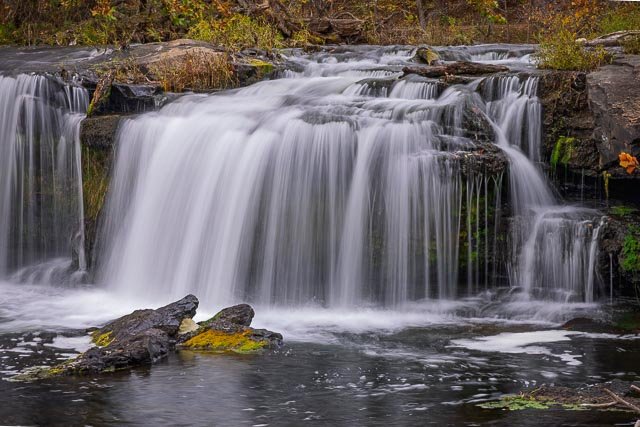
The second bridge, a mini arch cor-ten steel structure, crosses a wide, naturally formed channel bringing you onto a low-lying island covered with a floodplain forest community and views of the impressive main falls.
Sandstone Falls was created by the powerful flow of the New River eroding the soft conglomerate rock layer that lies below the hard sandstone layer from which the falls gets its name. Through eons of time as the river washed away the conglomerate beneath the harder sandstone, the precipice of the falls and the great boulders below were created. The falls are still a dynamic geological environment as slowly but surely the falls, through time are advancing upstream.
A journey to Sandstone Falls provides a rare riverside scenic drive, the beautiful falls, and the dramatic interface of the New River’s transformation from a broad mountain stream into a raging whitewater gorge in its final descent through the Appalachian Mountains.
Where it is:
Most visitors will find the best starting point for their journey to Sandstone Falls at the Sandstone Visitor Center at the Sandstone exit 139 on I-64. The Visitor Center has excellent exhibits on the New River watershed, water resources, and natural and cultural history of the upper New River Gorge, plus park maps and information.
As you drive south, high above the river on Route 20 to Hinton you will pass two park vistas. The Sandstone Falls Overlook provides an aerial view of the falls from 600 feet above the river. Brooks Overlook looks down on the mile-long Brooks Island, a perennial bald eagle nesting site.
Hinton is the southern gateway to New River Gorge National Park and Preserve. A once booming railroad center, the town has a large historic district, railroad museum, antique shops, and restaurants.
After crossing the bridge at Hinton you will begin driving alongside the New River down River Road. There are great riverside vistas, several river access points, a trail, picnic area and small boardwalk view at Brooks Falls, a powerful Class III rapid. The journey ends at the Sandstone Falls day use area, where you begin your walk along the boardwalk and bridges that span the two islands below the falls.
Maps:
Interactive Google Map
Use the map + – controls to zoom in and out, click and drag the to move the map, use the Map drop-down to change to “Map”, “Satellite”, “Hybrid”, or “Terrain” views. Drag the little man icon from the upper left corner to a map location for street level view.
Cost:
Free an entrance pass is not required to access New River Gorge National Park & Preserve.
Links:
Hours:
The park is open year-round.
Click Here for full page gallery
More Photographic Destinations in West Virginia
Interactive Google Map
Use the map + – controls to zoom in and out, use the Map drop-down to change to “Map”, “Satellite”, “Hybrid”, or “Terrain” views. Drag the little man icon from the upper left corner to a map location for street level view. Click on a pushpin for more information about the Photographic Destination, then click on the title to go to the location page.