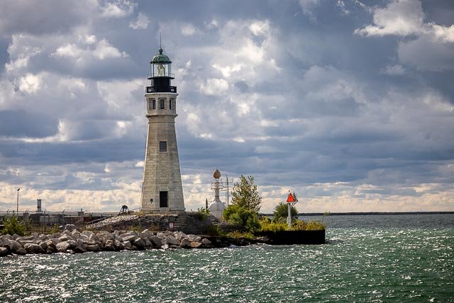
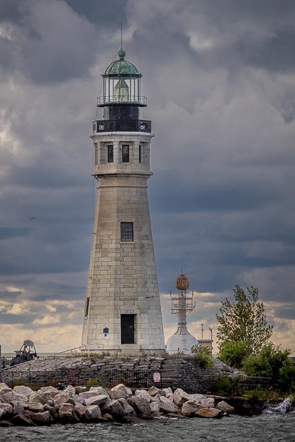
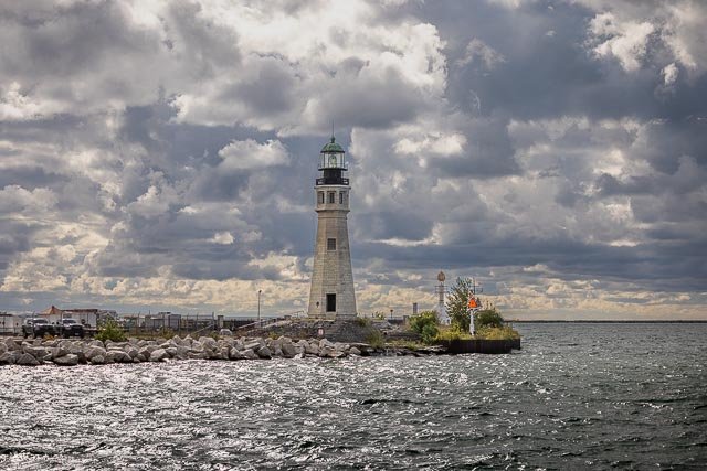
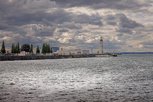
Buffalo Main Lighthouse

The lighthouse was established and lit in 1833 and was deactivated in 1914. The foundation material was stone molehead and the lighthouse was constructed out of limestone and cast iron. The shape of the tower was octagonal and was 60 feet high. The lens installed in 1857 was a third order Fresnel lens. The lens was later removed to the Buffalo History Museum.
This 60-foot-tall, octagonal limestone structure is the oldest still standing in its original location in the city of Buffalo. It replaced the original 1818 light on this site along the Lake Erie shore at the mouth of the Buffalo River. Presently, it is part of an outdoor museum located on the grounds of the United States Coast Guard Station.
It was listed on the National Register of Historic Places in 1984.
In 2010, the Coast Guard announced it would relinquish 4.6 acres of its 31 acres on the point and Congressman Brian Higgins obtained over $6 million to reconfigure the Coast Guard station to allow public access to the lighthouse. In April 2011, Erie Canal Harbor Development Corporation approved a grant of $170,700 to repair and restore the lighthouse in anticipation of public tours. The work was completed in August 2011.
Where it is:
Physical Address of Lighthouse Point, site of the 1833 lighthouse, is 1 Fuhrmann Boulevard, Buffalo NY.
Buffalo (Main) Light is a lighthouse at the mouth of Buffalo River/Erie Canal, directly across from the Erie Basin Marina in Buffalo, New York.
From Highway 5, a mile or so south of its intersection with Interstate 190 exit onto Fuhrmann Boulevard and follow the signs to the Coast Guard Station.
GPS:
42°52′40.15″N 78°53′22.20″W
Hours:
The iconic 1833 Buffalo Lighthouse, the historic tower that stood at the nationally important junction of the Erie Canal and the Great Lakes, welcomes visitors and tour groups seasonally from late May to early October.
Open Hours: Schedules for the site depend on volunteer staffing, and are updated on the Buffalo Lighthouse page on Facebook. Generally, in season the site is open on Fridays and Saturdays and a weekday evening.
Cost:
There is a small fee to support the site.
Click Here for full page gallery
More Photographic Destinations in New York
Interactive Google Map
Use the map + – controls to zoom in and out, use the Map drop-down to change to “Map”, “Satellite”, “Hybrid”, or “Terrain” views. Drag the little man icon from the upper left corner to a map location for street level view. Click on a pushpin for more information about the Photographic Destination, then click on the title to go to the location page.