Rush Ghost Town

The Rush Historic District is a zinc mining region of the Ozark Mountains in Arkansas. Now located within Buffalo National River, the district includes ruins dating from 1880 to 1940. The area was an important part of what became known as the North Arkansas Lead and Zinc District, and played a role in the development of railroads and modern infrastructure in the area.
During World War I the Rush Creek mines were the center of the zinc industry in Arkansas. Ten mining companies operated 13 developed mines within the district, more than in any other mining district within the North Arkansas District.
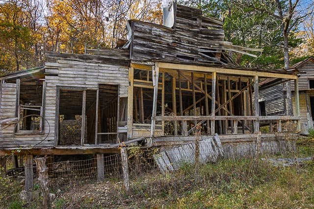
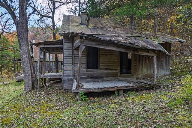
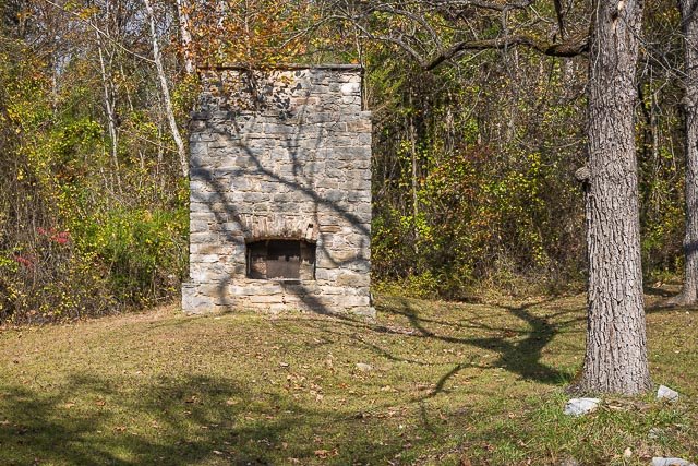
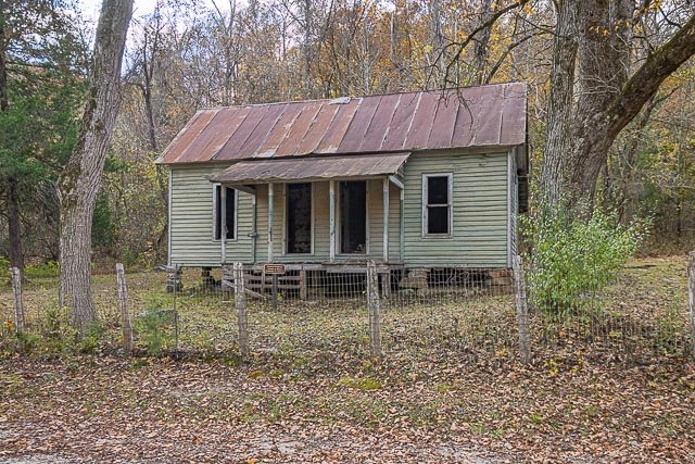
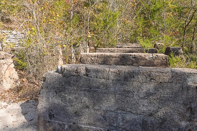
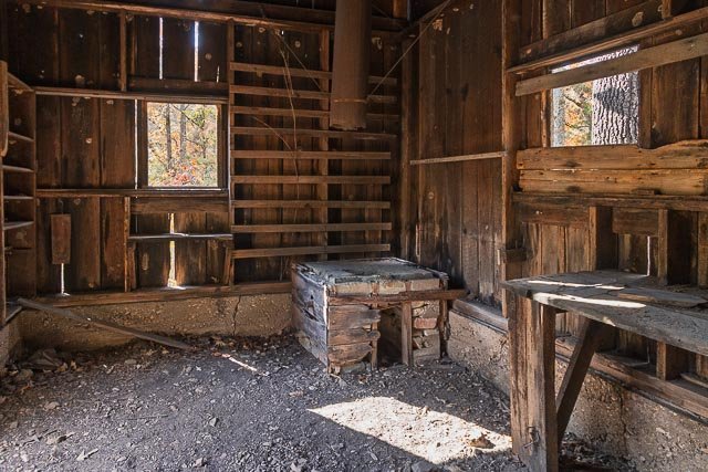
The buildings, structures, and ruins at Rush are the last visible remains of historic zinc mining activity in Arkansas. Of the other mining districts which once stretched across northern Arkansas, only limited debris now marks those sites. Rush is the only area left to retain not only the mines, but also buildings, structures, and ruins pertaining to mining and community life. The Rush Historic District exists today within the same environment and setting as it did during its periods of historic significance. Nearly as isolated today as it was historically, it has been little touched by time. The ghost town, mines, and waste piles visible on the bluffs immediately set the flavor of the district as an abandoned mountain mining community. The buildings, structures, ruins, and sites in the district exist in the same relationships as they did during the mining era.
The district was listed on the National Register of Historic Places in 1987.
Where it is:
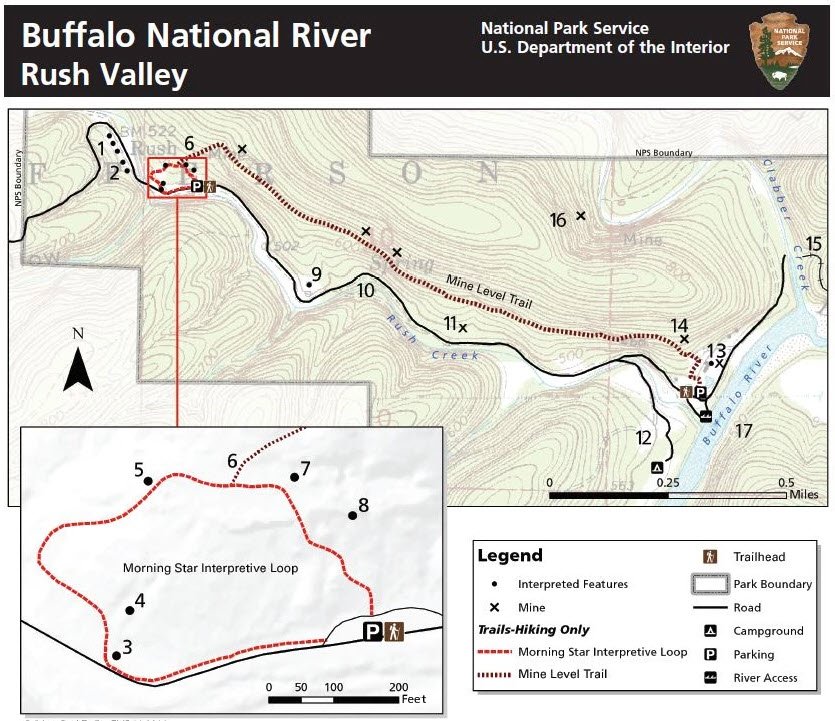
Take Highway 14 south out of Yellville and travel approximately 10 miles to the intersection of County Road 6035. Go left and travel 5 miles. You can gain access to the Morning Star Interpretive Loop and the Rush Mine Level Trail from the small gravel parking lot on the left. Look for a wooden shelter with interpretive signage. You can also start the Mine Level Trail from the Rush Launch Parking Lot at the very end of the road.
GPS:
36°7’56.526″ N 92°34’14.028″ W
Hours:
The area is open year round any time of day.
Cost:
There is no cost to visit Rush Historic District
Location Contact Information:
U.S. Department of the Interior
402 N Walnut, Suite 136
Harrison, AR 72601
870 365-2700 Headquarters
870 449-4311 Buffalo Point
888-692-1162 24-hour Dispatch Office
Facilities:
There are no facilities at Rush Historic District, there are vault toilets at the canoe launch a short distance away.
Click Here for full page gallery
More Photographic Destinations in Arkansas
Interactive Google Map
Use the map + – controls to zoom in and out, use the Map drop-down to change to “Map”, “Satellite”, “Hybrid”, or “Terrain” views. Drag the little man icon from the upper left corner to a map location for street level view. Click on a pushpin for more information about the Photographic Destination, then click on the title to go to the location page.