
Pipestone National Monument

Pipestone National Monument is a national monument located in southwestern Minnesota, just north of the city of Pipestone. It is home to catlinite rock quarries culturally significant to 23 Native Americans tribal nations of North America.
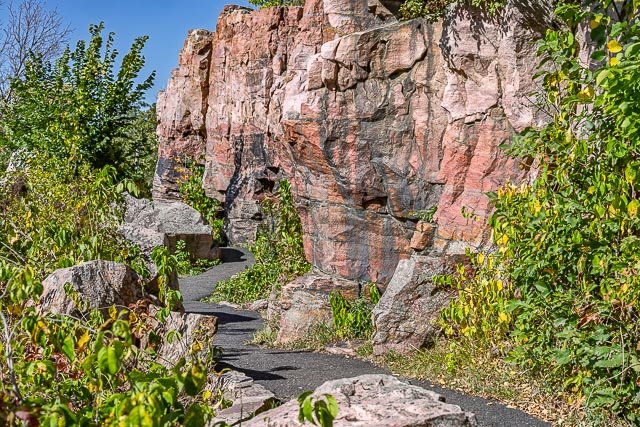
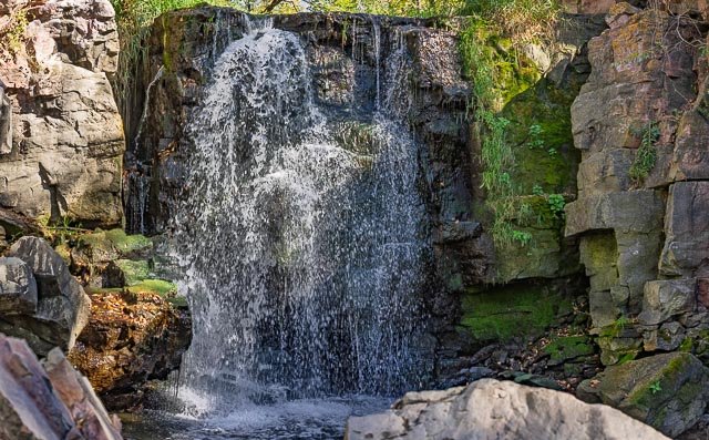
The Circle Trail is a 3/4-mile long paved path. It cuts through a Tallgrass Prairie, along a creek with the endangered Topeka Shiner, in front of a waterfall, and past ancient quarries still used by Native Americans today.
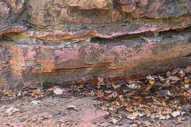
Those known to have actually occupied the site chronologically are the Yankton Dakota, Iowa, and Omaha peoples. The quarries were considered a neutral territory in the historic past where all tribal nations could quarry “pipestone” for ceremonial pipes vitally important to Plains Indian traditional practices. Archeologists believe the site has been in use for over 3000 years, with Minnesota pipestone having been found in ancient North American burial mounds across a large geographic area.
The National Monument was established by an act of Congress on August 25, 1937, with the establishing legislation reaffirming the quarrying rights of the Native Americans. Any enrolled member of a federally recognized American Indian tribe may apply for a free quarry permit to dig for the pipestone. The National Park Service regularly consults with representatives from 23 affiliated tribal nations to discuss land management practices, historic preservation, exhibit design, and other facets of the park’s management. The historic area is listed on the National Register of Historic Places under the heading “Cannomok’e—Pipestone National Monument”. Cannomok’e means “pipestone quarry” in the Dakota language. The pipestone quarries within the monument are also designated as a Minnesota State Historic Site.
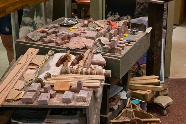
The Upper Midwest Indian Cultural Center is located inside the national monument’s visitor center, and during the summer months sponsors demonstrations of pipemaking by Native craftworkers using the stone from the quarries. Local Native Americans carve the stones using techniques passed down from their ancestors. Many of the demonstrators are third or fourth generation pipe makers.
Where it is:
Pipestone National Monument is located on the north side of Pipestone, Minnesota. The easiest access is from U.S. Hwy 75, which runs north & south through town. Directional signs can be found north of the MN Hwy 23 & U.S. Hwy 75 junction.
Pipestone National Monument is easily accessible from the following highways. When you reach the city of Pipestone, road signs will lead you to Pipestone National Monument.
- I-90 Luverne, MN Exit north on US Highway 75 to Pipestone, MN – 25 miles
- I-90 north on MN Highway 23 to Pipestone, MN – 27 miles.
- Marshall, MN, southwest on MN Highway 23 to Pipestone, MN – 45 miles.
- Slayton, MN, west on MN Highway 30 to Pipestone, MN – 29 miles.
- Lake Benton, MN, south on US Highway 75 to Pipestone, MN – 19 miles.
- I-29 north of Sioux Falls, SD to Exit 109 (Madison/Colman exit) go east on SD Hwy 34 which becomes MN Hwy 30 to Pipestone, MN – 55 miles
- I-29 Brookings, SD exit, go east on Hwy 14 to Lake Benton, MN, south on US Highway 75 to Pipestone, MN.
Hours:
The grounds are open 24 hours a day year-round so that visitors may walk the 3/4-mile Circle Trail at any time.
Cost:
There is no fee to visit Pipestone National Monument. No passes are required for admission, parking, or activities within the park.
Location Contact Information:
36 Reservation Ave.
Pipestone, MN 56164
(507) 825-5464
Facilities:
Restrooms, visitor center, food and drink vending machines.
Click Here for full page gallery
More Photographic Destinations in Minnesota
Interactive Google Map
Use the map + – controls to zoom in and out, use the Map drop-down to change to “Map”, “Satellite”, “Hybrid”, or “Terrain” views. Drag the little man icon from the upper left corner to a map location for street level view. Click on a pushpin for more information about the Photographic Destination, then click on the title to go to the location page.