Valley of Fires Recreation Area

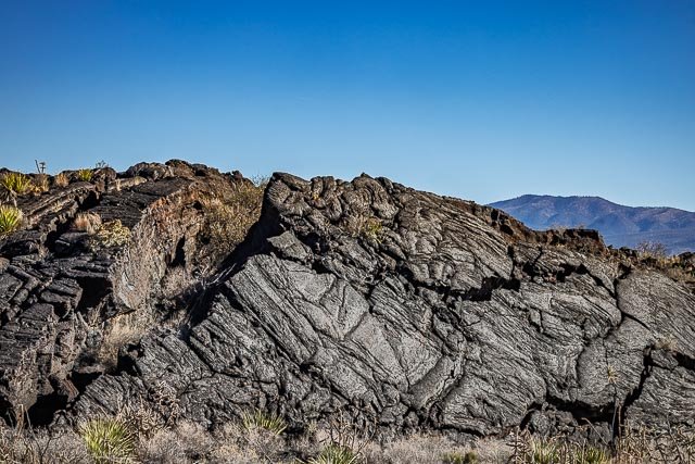
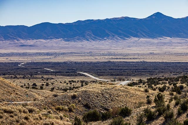
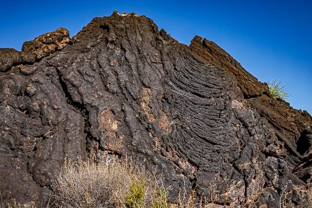
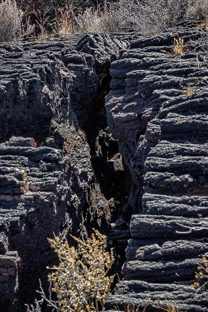
Valley of Fires recreation area is located immediately adjacent to the Malpais Lava Flow. Approximately 5,000 years ago, Little Black Peak erupted and flowed 44 miles into the Tularosa Basin, filling the basin with molten rock. The resulting lava flow is four to six miles wide, 160 feet thick and covers 125 square miles. The lava flow is considered to be one of the youngest lava flows in the continental United States.
The Bureau of Land Management maintains and manages the Valley of Fires Recreation area, which is located four miles west of Carrizozo, NM, on US Highway 380. Valley of Fires offers both camping and day use. 20 of the campsites have 30 and 50 amp electrical hookups and water hookups, all sites have picnic shelters, tables, trashcans and barbeque grills. Two of the RV sites are accessible, as are the restrooms. Showers are provided in the main restroom/shower house. An RV dump station is also available. Two group shelters are accessible and available for rental. The 3/4 mile Malpais Nature Trail offers a close-up look of the lava surface.
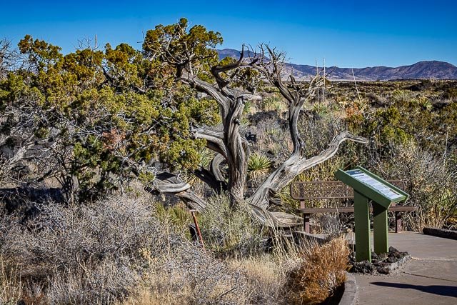
The Malpais Nature trail offers a unique experience of getting trail users out into the lava. The trail is paved and accessible. Wildlife is commonly seen on or from the trail during the warm months, especially in the early morning and late evening hours. The interpretive signage along this trail and the hilltop vista at the Valley of Fires Recreation Area has been updated. These new signs provide updated information, including photos and artwork, about the lava flow, its inhabitants, and the surrounding area.
From a distance, Valley of Fires appears as barren rock but when you walk through the nature trail there are many varieties of flowers, cactus, trees and bushes typical of the Chihuahuan desert. Animals include bats, roadrunners, quail, cottontails, mule deer, barbary sheep, and lizards. It’s also a virtual birdwatcher’s paradise with great horned owls, burrowing owls, turkey vultures, hawks, gnat catchers, cactus wrens, sparrows and golden eagles.
Where it is:
Travel four miles west of the town of Carrizozo on U.S. Highway 380. Valley of Fires recreation area is on the left.

Hours:
Open year round.
Cost:
Day Use – single vehicle, $5.
Location Contact Information:
Facilities:
Each camp site features picnic shelter and picnic tables, tent pads (tent camping area), pedestal grills, campfire rings (most sites) as well as a trash can. There is a shower house with flush toilets centrally located within the campground.,
The bookstore and gift shop offers information on the recreation area, wildlife and other nearby activities as well as offering the opportunity to purchase a wide variety of stuffed animals, books and other recreation area keepsakes.
This nearest location to acquire food and gas is four miles away in Carrizozo.
Click Here for full page gallery
More Photographic Destinations in New Mexico
Interactive Google Map
Use the map + – controls to zoom in and out, use the Map drop-down to change to “Map”, “Satellite”, “Hybrid”, or “Terrain” views. Drag the little man icon from the upper left corner to a map location for street level view. Click on a pushpin for more information about the Photographic Destination, then click on the title to go to the location page.