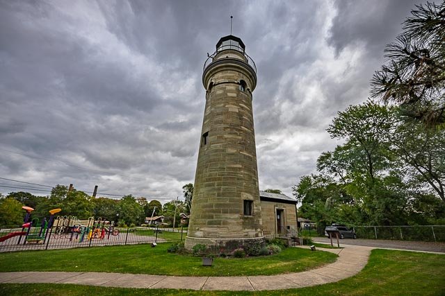
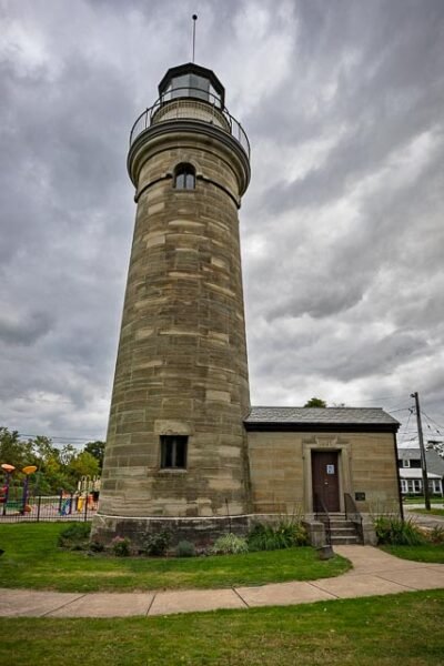
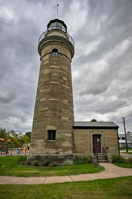
Erie Land Lighthouse

The Erie Land Lighthouse, as it is now commonly referred to, was the first commissioned lighthouse along the Great Lakes in the United States.
The light was positioned on a cliff overlooking the entrance to Presque Isle Bay, which is now the foot of Lighthouse Street in Erie, PA. The original structure was a 20-foot-high square wooden tower with an enclosed lantern room. The lamp that would light the way for ships was a nine-lamp array that was fueled by oil.
The lighthouse’s location was strategically chosen at the entrance of what was then an ‘s’ shaped entrance to the bay and the port of Erie. Presque Isle is a dynamic landmass, called a sandspit, that changes over time. In the early 1800s, submerged sandbars made the bay nearly impassable. A proposal to engineer a uniform channel depth was made to Congress around the same time at funds were secured to construction the Land Lighthouse.
This lighthouse aided travelers for nearly 50 years before the structure began to fail. Over time, the lighthouse started to lean. Metal bands were placed around the light to attempt to stabilize it, but these efforts for unsuccessful and it was clear the tower needed to be replaced.
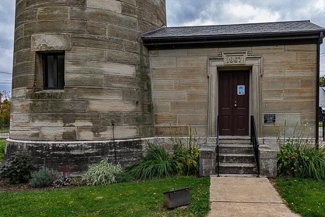
The lighthouse operated until 1880 when, based on the recommendation of the inspector of the Tenth Lighthouse District, it was discontinued. The property then fell into private hands for a short time until, after public protest, Congress appropriated $7,000 for the reestablishment of the lighthouse in 1884. The light remained active until 1899 when it was finally closed. The lens and lantern room were removed and taken to Marblehead Lighthouse in Sandusky, OH.
Today, the Erie Land Lighthouse has been restored thanks to the efforts of the City of Erie and the Erie Port Authority. While no longer an active aid to navigation, the site provides spectacular views of Lake Erie and Presque Isle and is open to visitors seasonally.
Where it is:
Located at the foot of Lighthouse St, in Erie, PA
2 Lighthouse St., Erie, PA 16507
Maps:
Interactive Google Map
Use the map + – controls to zoom in and out, click and drag the to move the map, use the Map drop-down to change to “Map”, “Satellite”, “Hybrid”, or “Terrain” views. Drag the little man icon from the upper left corner to a map location for street level view.
Cost:
Erie Land Lighthouse Tower Climb
$6, Free for Members
- Includes self-guided access to grounds
- Available every 20-minutes, no reservation required
- Must be 44″ tall to climb
-
.
Links:
GPS:
42°8’38.352″ N 80°3’44.49″ W
Hours:
Open for the summer season
The Erie Land Lighthouse will be open Fridays through Mondays from 10 a.m. to 3 p.m. through Memorial Day and then will be open Fridays through Mondays from 10 a.m. to 5 p.m. through Labor Day.
Grounds open dawn to dusk.
Closed July 4th and August 17th
Click Here for full page gallery
More Photographic Destinations in Pennsylvania
Interactive Google Map
Use the map + – controls to zoom in and out, use the Map drop-down to change to “Map”, “Satellite”, “Hybrid”, or “Terrain” views. Drag the little man icon from the upper left corner to a map location for street level view. Click on a pushpin for more information about the Photographic Destination, then click on the title to go to the location page.