Waitsfield Covered Bridge

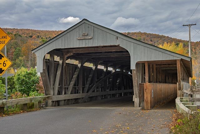
The Great Eddy Covered Bridge, also called the Big Eddy Covered Bridge or Waitsfield Covered Bridge, is a wooden covered bridge that crosses the Mad River in Waitsfield, Vermont on Bridge Street. Built in 1833, it is one of Vermont’s oldest covered bridges. It was listed on the National Register of Historic Places in 1974.
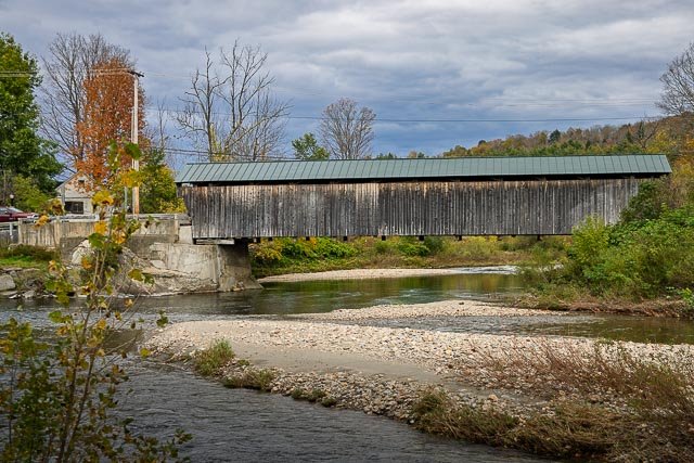
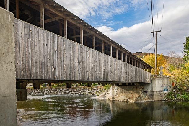
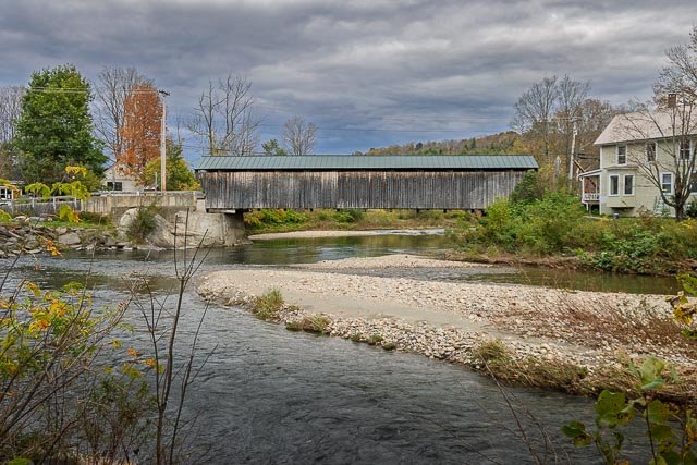
The Great Eddy Covered Bridge stands just east of Waitsfield’s center, spanning the Mad River in a roughly north-south orientation. It is a single-span Burr truss structure, 105 feet in length. Each truss incorporates a laminated arch, and laminated stringers have been added underneath the deck for added strength. The bridge is covered by a metal roof, which extends on the east side over a walkway on the outside of the eastern truss. The bridge was built in 1833, and is at least the second-oldest covered bridge (after only the Pulp Mill Covered Bridge, which may have been built at a later date). It is also the state’s longest single-span Burr truss bridge.
The bridge is of burr arch truss design. A sign on the bridge also identifies it as the Village covered bridge, and most news accounts about it refer to it by that name. The name is appropriate as it is located right in the village of Waitsfield (whereas a vast majority of surviving covered bridges tend to be off the beaten path).
The bridge was closed for repairs in spring 2015 and reopened on November 12, 2016.
Since then, although a sign was put up in 2016, people of all ages continue to jump off of the green metal roof of the bridge, out slits in the side, out of the windows of the walkway, and off of the concrete structure. Within various groups of people it is a common challenge to do a stunt off the roof, such as riding a scooter or doing a flip. A section of the river directly below is approximately twelve feet deep.
Where it is:
The Waitsfield or The Great Eddy Covered Bridge stands just east of Waitsfield’s center, spanning the Mad River in a roughly north-south orientation.
GPS:
44°11’21.03″ N 72°49’23.982″ W
Hours:
The bridge is on a public road and open 24 per day.
Cost:
There is no cost to visit Gold Brook Covered Bridge
Click Here for full page gallery
More Photographic Destinations in Vermont
Interactive Google Map
Use the map + – controls to zoom in and out, use the Map drop-down to change to “Map”, “Satellite”, “Hybrid”, or “Terrain” views. Drag the little man icon from the upper left corner to a map location for street level view. Click on a pushpin for more information about the Photographic Destination, then click on the title to go to the location page.