Cimarron National Grassland

Cimarron National Grassland is located in the very southwest corner of Kansas ,primarily in Morton County. The Cimarron National Grassland is the largest parcel of public land in the state of Kansas, comprising over100,000 acres. The multipurpose land is used for hiking, fishing, hunting, camping and bird watching. The Cimarron river, normally a dry sand bed, flows underground thru the grassland.
A large rock outcropping called Point of Rocks was an important landmark for travelers heading west on the Cimarron Cutoff of the Sante Fe Trail, which can still be seen from Point of Rocks. This is the third highest point in the state of Kansas with an elevation at its summit of 3,540 ft. The Cimarron National Grassland contains the longest public owned section of the historic Santa Fe Trail, approximately 23 miles, which is marked with limestone fenceposts. Just down the road is Middle Spring which was one of the rare reliable water sources on this section of the trail.
Cimarron National Grassland Auto Tour
This self-guided tour, in “The Sea of Grass” brochure, highlights many points of interest, scenery, and amenities found on the Grassland. It is approximately 30 miles long, so plan on about 2-3 hours. Roads are good when dry, but use caution if there`s been rain. Sites include a Prairie Dog Town, the Santa Fe Trail, Point of Rocks, the Cimarron River, and much more.
The drought of the 1930’s, known as the “Dust Bowl” era, left the land in poor condition. In 1938 the federal government began purchasing the devastated land to restore it. Originally known as Land Utilization Projects, the lands were renamed Cimarron National Grassland in June 1960. Today the land is managed for wildlife, water conservation, livestock grazing, recreation and minerals production. Federal and private land are interspersed, so please respect the property of others.
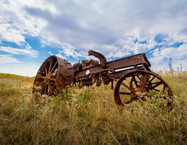
During the late 1930’s, a series of floods plagued the Cimarron River and Morton County. It was during one of these floods, that the obsolete steam engines were used to protect the southern end of the K27 bridge. There are reports of local farmers being paid $5 to park the old steam engines in the sand along the river bank.
The K27 bridge over the Cimarron was replaced several times through the years. Each replacement was at a different location than the previous one as the river channel changed. Prior to construction of a new bridge in 2003 this engine was uncovered. It was remarkable well preserved in the dry sand.
Cost:
There is no fee for this area.
Best Time to Visit:
The grassland has something different in every season, the key to finding interesting photos is to get off the highway and out of the car to see the area up close.
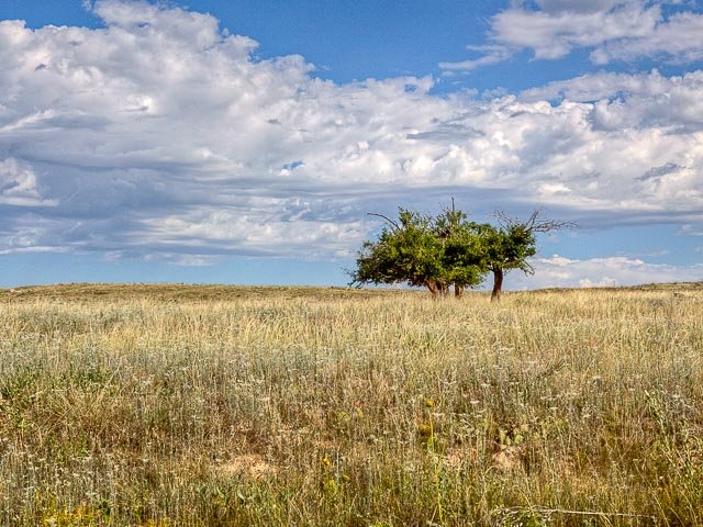
Trees are few and far between in the Cimarron National Grassland in Western Kansas.
Where it is:
The very southwest corner of Kansas, all around the town of Elkhart.
Directions:
The District Office, identified as the Cimarron National Grasslands Range Station, is on U.S. 56 in Elkhart. Stop here (hours: M-F, 8-5) to pick up a map, wildlife checklist, and the self-guided auto tour booklet; or write for the material: (see contact info below) The self-guided auto tour begins 2 miles north of Elkhart on K-27. There is a picnic area south of the river 7.5 miles north of Elkhart on K-27. South of the picnic area is a road east to a campground. Middle Spring and Point of Rocks are reached from K-27 by turning west, 0.5 miles north of the Cimarron River bridge.
Map:
Cimarron National Grassland Map
Links:
History of Point of Rocks area
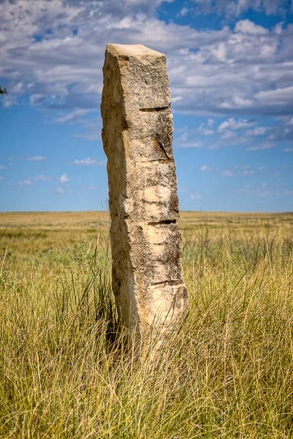
Old limestone fence posts mark the route of the Santa Fe Trail thru the Cimarron National Grassland in Western Kansas.
Contact:
242 East Highway 56
P.O. Box 300
Elkhart, Kansas 67950
Phone (620) 697-4621
Fax(620) 697-4340
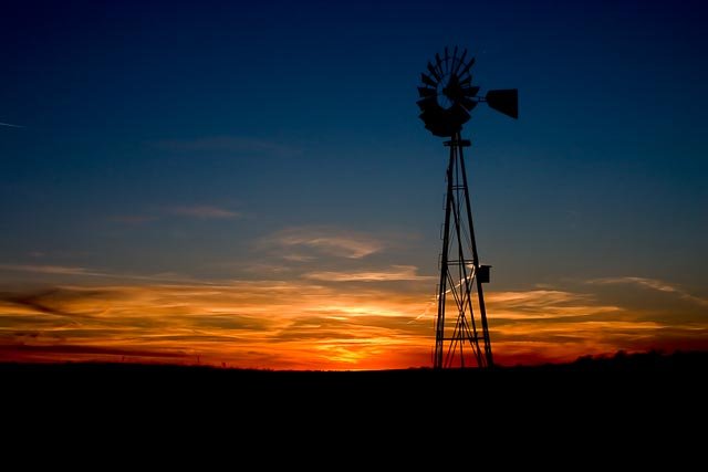
A windmill during sunset on the Cimarron National Grassland in Western Kansas.
Weather:
The climate here is characterized by mild winters, hot dry summers and cool evenings. Spring and fall seasons have moderate temperatures accompanied by an occasional windy day. Precipitation, usually less than 16 inches per year, is concentrated from April to September. Snowfall is minimal and short-lived.
Tips for the Photographer
Equipment:
You can use just about any photo equipment depending upon what you are photographing. A wide angle for sweeping vistas of the grassland to a long telephoto for wildlife.
What to Photograph:
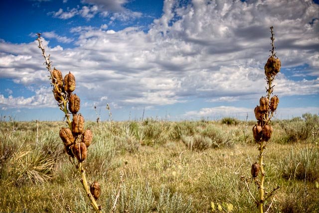
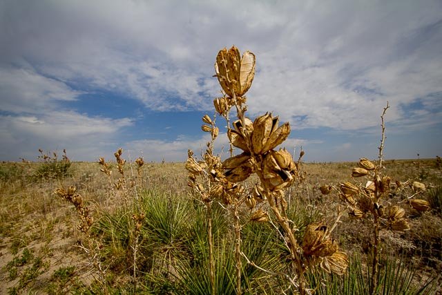
Rock cliffs, cottonwood groves, grassy fields, yucca and sage brush are scattered throughout the land. Deer, Elk, and pronghorns are found in the grassland along with the over 360 species of birds.
Photography Tips:
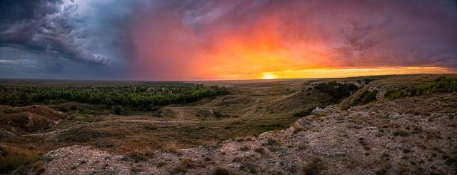
This is a great place for fantastic sunsets, you just need to be sure there are some clouds in the sky to add drama, find a place with a windmill or oil pump to place in the foreground and underexpose to create a silhouette and great photos are almost guaranteed.The yucca plants, cactus, sunflowers and many other grassland plants make some very interesting closeup shots.
Cimarron National Grassland Photo Gallery
Click Here for full page gallery
More Photographic Destinations in Kansas:
Interactive Google Map
Use the map + – controls to zoom in and out, use the Map drop-down to change to “Map”, “Satellite”, “Hybrid”, or “Terrain” views. Drag the little man icon from the upper left corner to a map location for street level view. Click on a pushpin for more information about the Photographic Destination, then click on the title to go to the location page.
Click Here for Photographic Destinations by State