
Valley of the Gods

The Valley of the Gods is included in the newly designated Bears Ears National Monument
The Valley of the Gods area may be toured via a 17-mile gravel road that winds around the formations. The road is rather steep and bumpy in parts but is passable by non-four-wheel drive vehicles in dry weather. The western end joins UT 261 shortly before its 1,200-foot ascent up Cedar Mesa at Moki Dugway, while the eastern end starts 9 miles from the town of Mexican Hat along US 163 and heads north, initially crossing flat, open land and following the course of Lime Creek, a seasonal wash, before turning west towards the buttes and pinnacles. In addition to the gravel road, the area is also crisscrossed by off-road dirt trails.
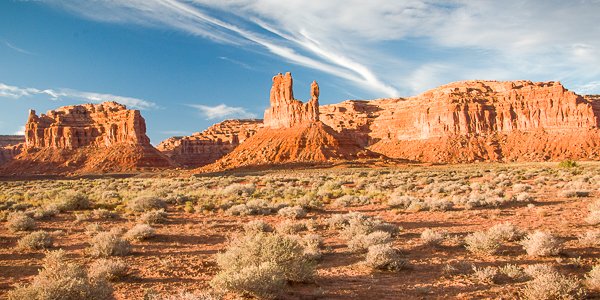
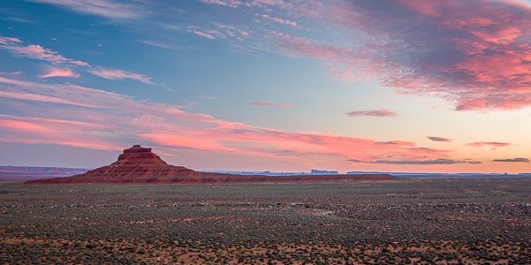
The terrain and scenery is very similar to the more popular Monument Valley located a few miles away. The Valley of the Gods is at the base of the Cedar Mesa which rises more than 2000 feet above the valley.
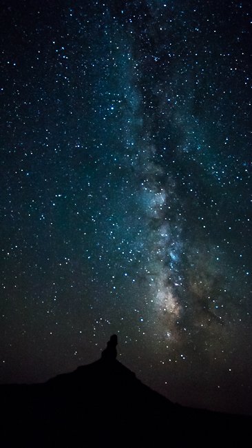
The statuesque sentinels in the Valley of the Gods, as well as other area features, are all sculpted from Cedar Mesa sandstone dating to the Permian age, 250 million years old. The 1200 foot thick sandstone was cemented by calcium carbonate interspersed with lenses of red siltstone and was deposited in huge sand dunes near the shores of an ancient sea. Erosion by water, wind and ice over millions of years chiseled rock formations into the unique shapes we see today.
There are no designated hiking trails, but you can hike anywhere you like, as well as primitive camping. There are no services in the Valley of the Gods be sure to bring plenty of water and everything else you will need.
Admission & Hours
Open year-round, no closures
Entrance Fees
There are no fees or permits required for this area.
Getting There:
GPS Coordinates to the west entrance
(37.264275, -109.932515)
Driving Directions
The Valley of the Gods Road runs between Highways 163 and 261. The road forks away from Hwy 163 about 7.5 miles north of Mexican Hat. It winds north and west and then connects with Hwy 261 about 6.5 miles northwest of the point where Hwy 261 forks from Hwy 161.
This is a rough road and a high clearance vehicle is recommended, however when dry a regular passenger car should be able to travel the road, when wet you may need a four wheel drive or it may become impassible.
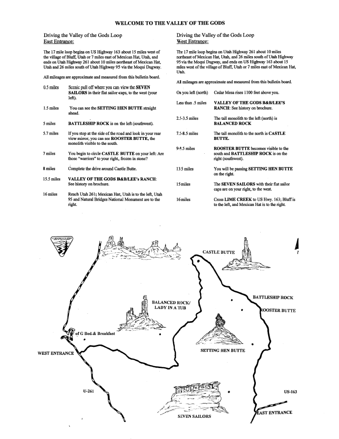
Driving the Valley of the Gods Loop from the East Entrance on US Highway 163
|
0.5 miles |
Scenic pull off. The SEVEN SAILORS formation is on your left (west). The SEVEN SAILORS appear to have flat sailor caps. |
|
1.5 miles |
SETTING HEN BUTTE can be viewed straight in front of you. |
|
5 miles |
BATTLESHIP ROCK is on your left (southwest). |
|
5.7 miles |
If you pull over at this point, look in your rear view mirror. The ROOSTER BUTTE, a monolith, will be visible to the south. |
|
7 miles |
At this point, you begin to circle CASTLE BUTTE on your left. |
|
8 miles |
The drive around CASTLE BUTTE is complete. |
|
15.5 miles |
VALLEY OF THE GODS BED AND BREAKFAST/LEE’S RANCH is at this point. |
|
16 miles |
You have reached Utah Highway 261. Turn left to go to the Goosenecks State Park, US 163, Mexican Hat and Monument Valley. Turn right to go up the Moki Dugway, and access Muley Point and Cedar Mesa. Utah Highway 95 is also to the right, which leads you to Natural Bridges National Monument. |
Driving the Valley of the Gods Loop from the West Entrance on Utah Highway 261
|
Entrance |
On your left (north), note Cedar Mesa which rises 1,100 feet above you. |
|
Less than 0.5 miles |
You have reached VALLEY OF THE GODS BED AND BREAKFAST/LEE’S RANCH. |
|
2.5-3.5 miles |
The tall monolith to the left (north) is BALANCED ROCK. |
|
7.5 – 8.5 miles |
The tall monolith to the north is CASTLE BUTTE. |
|
9 – 9.5 miles |
ROOSTER BUTTE becomes visible to the south and BATTLESHIP ROCK is on the right (southwest). |
|
13.5 miles |
To your right, you will be passing SETTING HEN BUTTE. |
|
15 miles |
The SEVEN SAILORS formation with their flat, sailor caps are on the right (west). |
|
16 miles |
Cross LIME CREEK to reach US Highway 163. Bluff is to the left. Mexican Hat is to the right. |
Source: The Bureau of Land Management’s Valley of the Gods brochure. Accessed October 17, 2012.
Maps:

Interactive Google Map
Use the map + – controls to zoom in and out, click and drag the to move the map, use the Map drop-down to change to “Map”, “Satellite”, “Hybrid”, or “Terrain” views. Drag the little man icon from the upper left corner to a map location for street level view.
Facilities
There are no facilities in the area of any kind, you must bring everything you need.
Location Contact Information:
Nearest City or Town:
Mexican Hat Utah
Valley of the Gods Gallery
Click Here for full page gallery
More Photographic Destinations in Utah:
Interactive Google Map
Use the map + – controls to zoom in and out, use the Map drop-down to change to “Map”, “Satellite”, “Hybrid”, or “Terrain” views. Drag the little man icon from the upper left corner to a map location for street level view. Click on a pushpin for more information about the Photographic Destination, then click on the title to go to the location page.
Thanks for the information, Greg. We plan to be up there in two weeks…should be fun photography!