
Atchafalaya Swamp

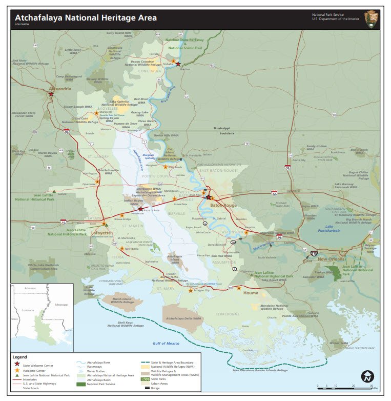
The Atchafalaya Basin, or Atchafalaya Swamp, is the largest wetland and swamp in the United States. Located in south central Louisiana, it is a combination of wetlands and river delta area where the Atchafalaya River and the Gulf of Mexico converge. The river stretches from near Simmesport in the north through parts of eight parishes to the Morgan City southern area.
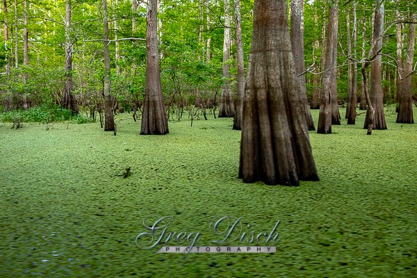
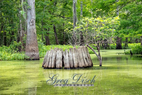
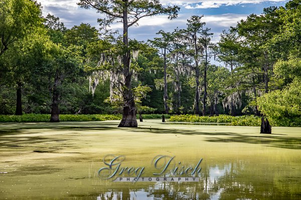
The Atchafalaya is different among Louisiana basins because it has a growing delta system with wetlands that are almost stable. The basin contains about 70% forest habitat and about 30% marsh and open water. It contains the largest contiguous block of forested wetlands remaining in the lower Mississippi River valley and the largest block of floodplain forest in the United States. Best known for its iconic cypress-tupelo swamps, at 260,000 acres, this block of forest represents the largest remaining contiguous tract of coastal cypress in the US.
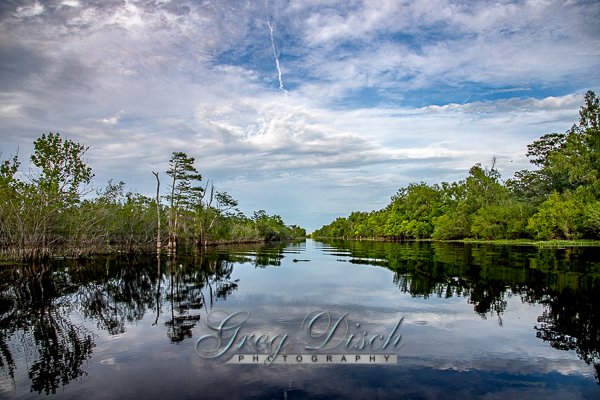
The Atchafalaya Basin and the surrounding plain of the Atchafalaya River is filled with bayous, bald cypress swamps, and marshes, which give way to brackish estuarine conditions, and end in the Spartina grass marshes where the Atchafalaya River meets the Gulf of Mexico. It includes the Lower Atchafalaya River, Wax Lake Outlet, Atchafalaya Bay, and the Atchafalaya River and bayous Chêne, Boeuf, and Black navigation channel.
The Basin, which is susceptible to long periods of deep flooding, is sparsely inhabited. The Basin is about 20 miles in width from east to west and 150 miles in length. The Basin is the largest existing wetland in the United States with an area of 1,400,000 acres, including the surrounding swamps outside of the levees that historically were connected to the Basin. The Basin contains nationally significant expanses of bottomland hardwoods, swamplands, bayous, and back-water lakes. The Basin’s thousands of acres of forest and farmland are home to the Louisiana black bear, which has been on the United States Fish and Wildlife Service threatened list since 1992.
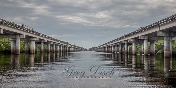
The few roads that cross the Basin follow the tops of levees. Interstate 10 crosses the basin on elevated pillars on a continuous 18.2 mile bridge from Grosse Tete, Louisiana, to Henderson, Louisiana. When it was built in 1973, the Atchafalaya Basin Bridge was the longest in the United States. Its 18-mile stretch offers a view of the wetlands from Interstate 10.
What to Photograph
At almost a million acres, the Atchafalaya River Basin is North America’s largest floodplain swamp. The Atchafalaya Basin’s deep woods, fertile marshes, and meandering waters provide essential habitat for more than 300 species of wildlife and 100 different aquatic species, as well as a rich diversity of native plants.
- It is larger than the Florida Everglades
- It’s five times more productive than any other river basin in North America
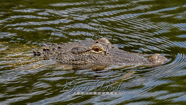
- About 65 species of reptiles and amphibians inhabit and Basin
- Over 250 known species of birds fly in the Basin
- Other species of animals found in the area include black bear, nutria, fox, muskrat, beaver, otter and raccoon
- The Basin is home to the largest nesting concentration of bald eagles in the south central United States
- There are more than 100 different species of fish and aquatic life in the Basin
- The Basin has an estimated average annual commercial harvest of nearly 22 million pounds of crawfish
- The Basin contains the largest contiguous bottomland hardwood forest in North America and is the largest overflow alluvial hardwood swamp in the United States
Where it is:
Located in south central Louisiana, it is a combination of wetlands and river delta area where the Atchafalaya River and the Gulf of Mexico converge.
Maps:
Interactive Google Map
Use the map + – controls to zoom in and out, click and drag the to move the map, use the Map drop-down to change to “Map”, “Satellite”, “Hybrid”, or “Terrain” views. Drag the little man icon from the upper left corner to a map location for street level view.
Cost:
Location Contact Information:
For visitor information, call the Atchafalaya Welcome Center at (337) 228-1094
Mailing Address:
Louisiana Department of Culture, Recreation & Tourism
P. O. Box 44243
Baton Rouge, , LA 70804-4243
Phone:
(337) 228-1094
Links
Atchafalaya Swamp Photo Gallery
Click Here for full page gallery
More Photographic Destinations in Louisiana:
Interactive Google Map
Use the map + – controls to zoom in and out, use the Map drop-down to change to “Map”, “Satellite”, “Hybrid”, or “Terrain” views. Drag the little man icon from the upper left corner to a map location for street level view. Click on a pushpin for more information about the Photographic Destination, then click on the title to go to the location page.
Click Here for Photographic Destinations by State