Falling Spring Mill

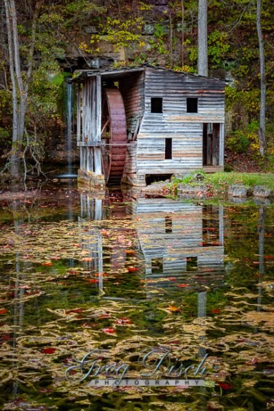
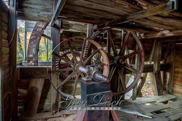
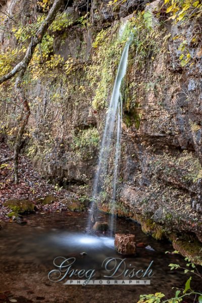
The spring, known as Falling Spring because it pours out of the rock as a small waterfall, provided power for two mills. The second mill, which still stands, was built between 1927 and 1929, Falling Spring Mill, was used to grind corn for feed, saw out shingles, saw firewood, and generate electricity on the site. This mill had a metal wheel, the original structure had a wooden wheel. The mill was first constructed of timer, then later enclosed with sawboard siding. The mill’s present overshot wheel came from Johnson Spring, located approximately three miles down Hurricane Creek from Falling Spring.
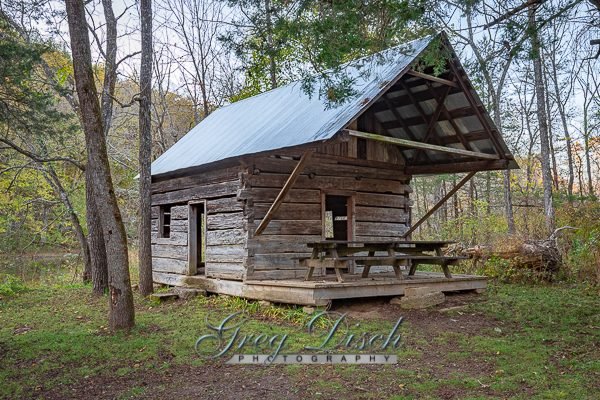
Also located on the site is a log cabin over 100 years old. This cabin is the first of four houses built near this site. Constructed with half-dovetail notches at the corners, this helps to shed water away from the cabin, and may be one reason why it still stands today.
The Thomas Brown Cabin is located at the Falling Springs Mill in the Mark Twain National Forest in Missouri. Thomas and Jane Brown homesteaded the Falling Spring Area in 1851. They settled in a land which looked very similar to their homeland, Tennessee.
The area around Falling Spring provided for their basic needs – water for livestock and personal use, and trees from which to build a cabin.
What to Photograph
The spring and surrounding pond with the waterfall, the 100 year old Falling Springs Mill, and the log cabin.
Where it is:
From Winona: From US Hwy 60, travel South on MO Hwy 19 approx. 9.6 miles. Turn Left/East onto FR#3170. This buy clonazepam with no prescription road immediately splits; follow FR#3164 to your Left. Keep right at an intersection at approx 2 miles, then Falling Spring will be on your right at approx. 2.3.
From Alton: Travel North on MO Hwy 19 approx. 16.3 miles. Turn Right/East onto FR#3170. This road immediately splits; follow FR#3164 to your Left. Keep right at an intersection at approx 2 miles, then Falling Spring will be on your right at approx. 2.3.
Maps:
Interactive Google Map
Use the map + – controls to zoom in and out, click and drag the to move the map, use the Map drop-down to change to “Map”, “Satellite”, “Hybrid”, or “Terrain” views. Drag the little man icon from the upper left corner to a map location for street level view.
GPS:
36°52’3.485″ N 91°17’41.448″ W
Cost:
Hours:
The Falling Springs Picnic area is open at all times
Facilities:
There are picnic tables and pit toilets, there is no running water.
Location Contact Information:
Eleven Point Ranger District
District Ranger: Matt Dillon
Address:
# 4 Confederate Ridge Road
Doniphan, MO 63935
Phone: (573) 996-2153
FAX: (573) 996-7745
Office Hours:
M-F: 8:00am – 4:30pm
Falling Springs Mill Photo Gallery
Click Here for full page gallery
More Photographic Destinations in Missouri:
Interactive Google Map
Use the map + – controls to zoom in and out, use the Map drop-down to change to “Map”, “Satellite”, “Hybrid”, or “Terrain” views. Drag the little man icon from the upper left corner to a map location for street level view. Click on a pushpin for more information about the Photographic Destination, then click on the title to go to the location page.
Click Here for Photographic Destinations by State

