
Fort Davis National Historic Site

Established in October 1854 along the Limpia Creek at Painted Comanche Camp by Bvt. Maj. Gen. Persifor Frazer Smith, Fort Davis was named after Secretary of War Jefferson Davis. “Hoping to protect the garrison from winter northers, Smith tucked the fort into a canyon flanked on three sides by sheer rock walls.” Commanding the post was 8th Infantry Regiment commander Lt. Col. Washington Seawell.
Other forts in the frontier fort system were Forts Griffin, Concho, Belknap, Chadbourne, Stockton, Richardson, Bliss, McKavett, Clark, McIntosh, Inge, and Phantom Hill in Texas, and Fort Sill in Oklahoma. “Sub posts or intermediate stations” also were used, including Bothwick’s Station on Salt Creek between Fort Richardson and Fort Belknap, Camp Wichita near Buffalo Springs between Fort Richardson and Red River Station, and Mountain Pass between Fort Concho and Fort Griffin.
From 1854 to 1891, Fort Davis was strategically located to protect emigrants, mail coaches, and freight wagons on the trans-Pecos portion of the San Antonio-El Paso Road and the Chihuahua Trail, and to control activities on the southern stem of the Great Comanche War Trail and Mescalero Apache war trails.
The fort was evacuated in April 1861 under orders from General David E. Twiggs at the start of the Civil War. During John R. Baylor’s invasion of New Mexico, only 20 Confederate States Army troops manned the fort. On the night of 4 August 1861, Mescalero Apaches raided a nearby cattle pen, and during the pursuit on 11 August, Lt. Reuben E. Mays and all but one of his 13-man patrol were killed in an ambush. This defeat convinced Baylor to staff the fort with three officers and 70 enlisted men. The Confederates evacuated the fort and all other posts west of Fort Clark in August 1862.
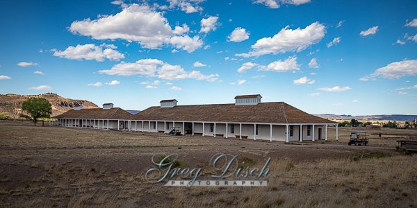
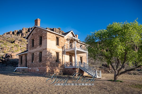
Fort Davis is important in understanding the presence of African Americans in the West and in the frontier military because the 24th and 25th U.S. Infantry regiments and the 9th and 10th U.S. Cavalry regiments, all-black regiments (known as the buffalo soldiers), which were established after the Civil War, were stationed at the post. Lt. Col. Wesley Merritt led Troops C, F, H, and I of the 9th Cavalry in reoccupying the fort on 29 June 1867. They rebuilt the fort, using limestone and adobe, outside the canyon walls.
What to Photograph
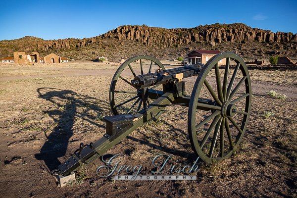
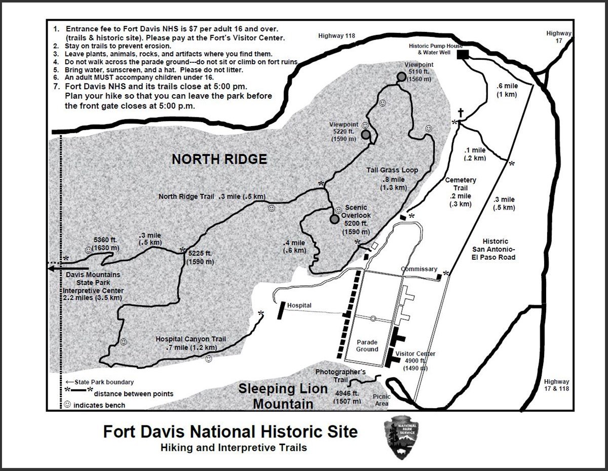
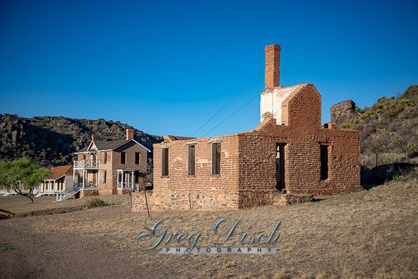
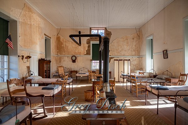
Today, 24 restored historic buildings and over 100 ruins and foundations are part of Fort Davis National Historic Site. Five of the historic buildings have been refurbished to the 1880s, making it easy for visitors to envision themselves being at the fort at the height of its development.
Where it is:
From El Paso: Take I-10 east to Van Horn. At Van Horn take Highway 90 east. Just south of Valentine take Highway 505 and then 166 east. Turn left on Highway 17 and follow it to Fort Davis or continue south on Highway 90 to Marfa and then turn left on Highway 17 to Fort Davis. Alternate Route: From Van Horn take I-10 east to Kent and then turn south on 118 to Fort Davis. (About 4 hours) map
From Midland/Odessa: Take I-20 west to Pecos. From Pecos take Highway 17 south through Balmorhea to Fort Davis. (About 2.5 hours) map
From San Antonio: Take I-10 west to Balmorhea. Then take Highway 17 south to Fort Davis. (About 7 hours) map
From Del Rio: Take Highway 90 west to Alpine. From Alpine take Highway 118 north to Fort Davis. (About 3.5 hours) map

Maps:
Interactive Google Map
Use the map + – controls to zoom in and out, click and drag the to move the map, use the Map drop-down to change to “Map”, “Satellite”, “Hybrid”, or “Terrain” views. Drag the little man icon from the upper left corner to a map location for street level view.
GPS:
30°35’56.094″ N
103°53’11.297″ W
Cost:
Entrance Fees
Park Entrance fee is $10.00 per person for visitors 16 years and older. Children 15 and under are free.
Group Visit Fees
There are 3 options:
$10.00 per person – 7 Days
$20.00 per vehicle – 7 Days
$15.00 per motorcycle – 7 Days
Specific passes for free entrance to the park are honored and are also available at the Visitor Center. These include Senior (Golden Age), Access (Golden Access), Interagency Annual, Interagency Military and Fourth Grade passes.
Hours:
Open:8:00 a.m. to 5:00 p.m. Central Time
Holiday Closures:Thanksgiving Day, Christmas Day, New Year’s Day, and Martin Luther King Jr. Holiday.
Facilities:
The park has no food or lodging. Please visit the Fort Davis Chamber of Commerce for area info.
There are restrooms and a visitor center with a bookstore on site. The site is located within the city of Fort Davis.
Location Contact Information:
Fort Davis National Historic Site Photo Gallery
Click Here for full page gallery
More Photographic Destinations in Texas:
Interactive Google Map
Use the map + – controls to zoom in and out, use the Map drop-down to change to “Map”, “Satellite”, “Hybrid”, or “Terrain” views. Drag the little man icon from the upper left corner to a map location for street level view. Click on a pushpin for more information about the Photographic Destination, then click on the title to go to the location page.
Click Here for Photographic Destinations by State