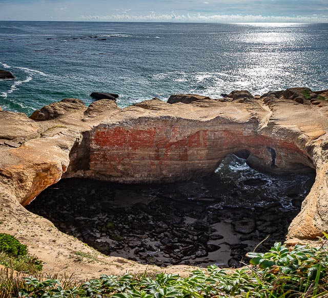
Devils Punchbowl

Devils Punch Bowl State Natural Area is a state day use park on the central Oregon Coast in the United States. It is centered on a large bowl naturally carved in a rock headland which is partially open to the Pacific Ocean. Waves enter the bowl and often violently churn, swirl, and foam. Outside the bowl, ocean conditions are attractive to surfers near a large offshore rock pinnacle named Gull Rock, located about 1⁄2 mile west-northwest of Devils Punch Bowl, which funnels and concentrates waves easily seen from the park. There are at least seventeen large rocks, part of Oregon Islands National Wildlife Refuge, which provide interesting wave viewing, and attract and provide a home for wildlife.
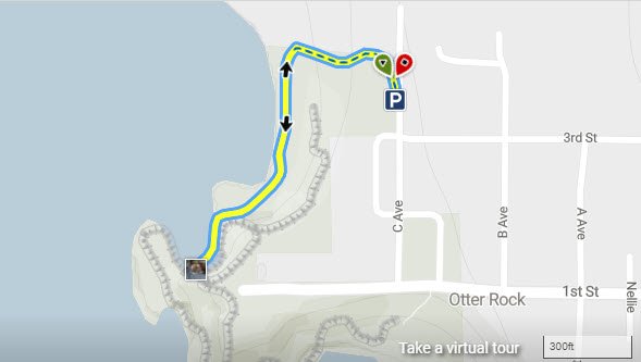
Devils Punch Bowl is located about 5 miles south of Depoe Bay, and about 8 miles north of Newport in the community of Otter Rock, and about 1⁄4 mile west of U.S. Route 101. The park encompasses 5.34 acres, which includes picnic grounds. There is a trail for access to the beach, and tide pools.
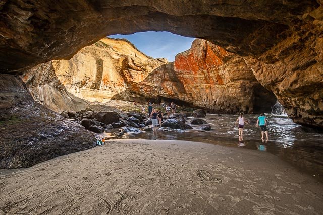
The bowl is thought to have been created when two caves carved by the ocean collapsed.
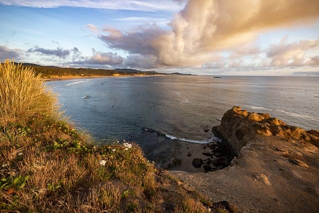
Whales migrate past the park, in season, and the park, which projects into the Pacific, provides panoramic views of the ocean and good whale watching.
What to Photograph
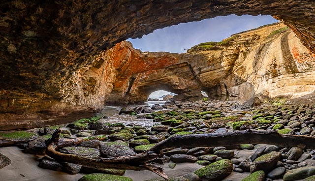
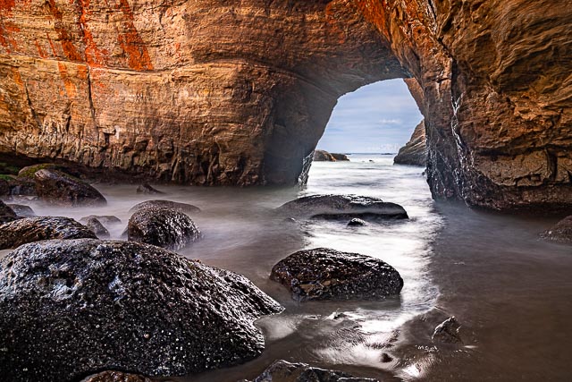
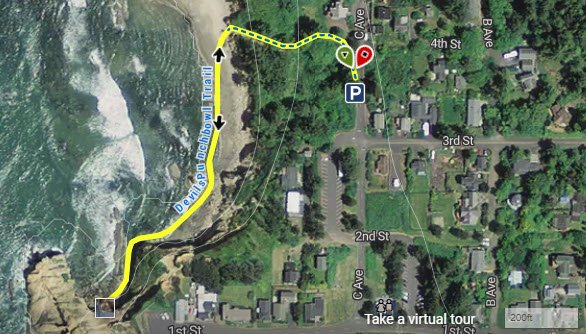
The main attraction is the Devils Punchbowl which can easily be photographed from above only a few steps from the parking area. During Low Tide the inside can be accessed from the beach for some great photos. This can be dangerous and can only be done at low tide.
Whales migrate past the park, in season, and the park, which projects into the Pacific, provides panoramic views of the ocean and good whale watching.
Where it is:
Devils Punch Bowl is located about 5 miles south of Depoe Bay, and about 8 miles north of Newport in the community of Otter Rock, and about 1⁄4 mile west of U.S. Route 101.
Maps:
Interactive Google Map
Use the map + – controls to zoom in and out, click and drag the to move the map, use the Map drop-down to change to “Map”, “Satellite”, “Hybrid”, or “Terrain” views. Drag the little man icon from the upper left corner to a map location for street level view.
At Low Tide you can hike to Devils Punchbowl and photograph from the inside. There is a beach access on C Avenue, use this to access the beach and then work your way over the rocks and down the beach and you will find an entrance to the sea cave. Use caution the rocks are very slick and this can only be done at low tide.
GPS:
44°44’51.004″ N 124°3’54.766″ W
Hours:
The Devils Punchbowl State Natural Area is always open.
Cost:
Admittance to Devils Punchbowl State Natural Area is free.
Location Contact Information:
Devils Punchbowl Photo Gallery
Click Here for full page gallery
More Photographic Destinations in Oregon:
Interactive Google Map
Use the map + – controls to zoom in and out, use the Map drop-down to change to “Map”, “Satellite”, “Hybrid”, or “Terrain” views. Drag the little man icon from the upper left corner to a map location for street level view. Click on a pushpin for more information about the Photographic Destination, then click on the title to go to the location page.
Click Here for Photographic Destinations by State