
Fort Larned National Historic Site

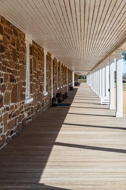
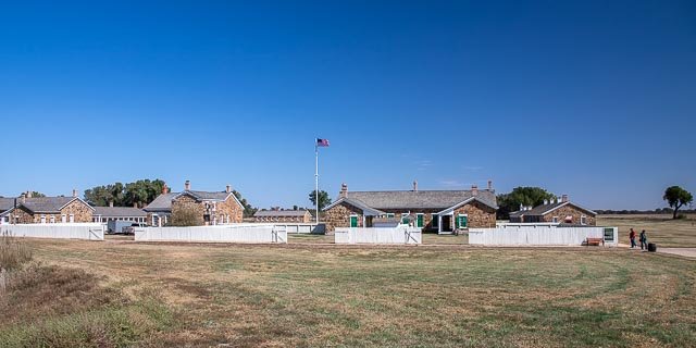
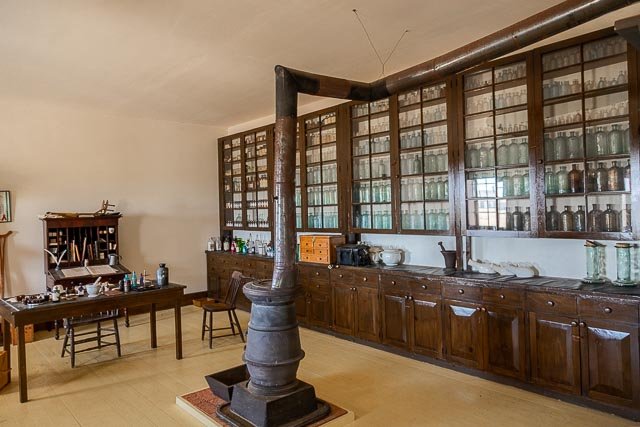
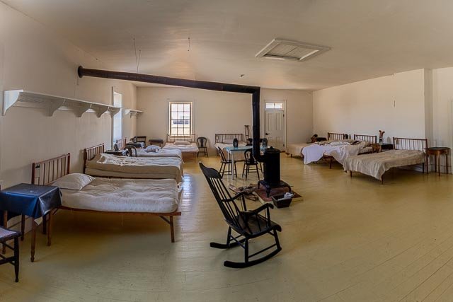
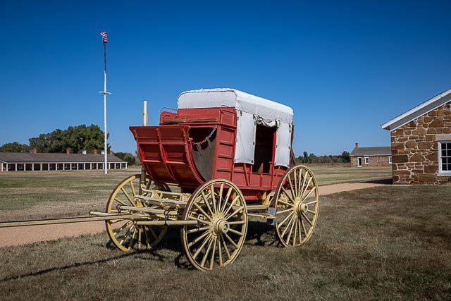
Discover a complete and authentic army post from the 1860s -1870s! This well-preserved fort on the Santa Fe Trail shares a tumultuous history of the Indian Wars era. The sandstone constructed buildings sheltered troops who were known as the Guardians of the Santa Fe Trail.
Fort Larned National Historic Site preserves Fort Larned which operated from 1859 to 1878.
Renovations to Fort Larned took place between 1866 and 1868. The original sod and adobe structures were removed and replaced with the sandstone buildings that make up the fort today. The post was abandoned on July 13, 1878, and on March 26, 1883, the Fort Larned Military Reservation was transferred from the War Department to the General Land Office of the Department of the Interior.
From 1885 to 1966, the buildings housed the headquarters of a ranch, with the owners living in the house of the commanding officer and the employees residing in what had been the officers’ quarters. In 1957 the Fort Larned Historical Society was founded to develop and open the site as a tourist attraction. The fort was designated as a National Landmark in 1961, and in 1964 it was incorporated as a unit of the National Park System.
What to Photograph
A complete and authentic 1860s army post.
Where it is:
Fort Larned National Historic Site is located on KS Hwy 156, six miles west of Larned, KS.
From I-70 Westbound
Take exit 225 for KS 156. Turn left and follow KS 156 approximately 82 miles to Fort Larned National Historic Site.
From I-70 Eastbound
Take exit 159 for US Hwy 183 south. Follow Hwy 183 about 49 miles south to KS 156. Turn left on KS 156 and continue about 5 miles to Fort Larned National Historic Site.
From Dodge City
Follow Hwy 56 to Hwy 183 north. Follow 183 north to KS 156. Turn right on KS 156 and continue 5 miles to Fort Larned NHS.
From Wichita
There are several possible routes. If you prefer major highways, follow Hwy 54 west of Wichita to Hwy 183 north in Greensburg, KS. Follow Hwy 183 north to KS 156. Turn right on KS 156 and continue 5 miles to Fort Larned NHS. If you prefer a shorter distance, follow KS 96 north from Wichita to US Hwy 50 west in Hutchinson. Follow US Hwy 50 west to KS 19. Follow KS 19 north into Larned. Turn left on KS 156 and continue 6 miles to Fort Larned NHS.
Fort Larned’s parking lot is about a 1/4 mile from the park entrance. There is a section for both cars and buses and RVs. From the parking lot, it is a short walk across the river to the fort. Handicap parking is located by the walkway leading to the footbridge crossing the river.
Maps:
Interactive Google Map
Use the map + – controls to zoom in and out, click and drag the to move the map, use the Map drop-down to change to “Map”, “Satellite”, “Hybrid”, or “Terrain” views. Drag the little man icon from the upper left corner to a map location for street level view.
Links:
GPS:
38°10’57.318″ N 99°13’3″ W
Hours:
Cost:
There is no entrance fee or charge to visit.
Facilities:
Fort Larned Visitor Center
Located in one of the two historic enlisted barracks, the park visitor center provides orientation to the grounds, a 10 minute AV program, and museum exhibits.
Restrooms and drinking fountains are available in the visitor center and the picnic area.
Location Contact Information:
Fort Larned National Historic Site Photo Gallery
Click Here for full page gallery
More Photographic Destinations in Kansas:
Interactive Google Map
Use the map + – controls to zoom in and out, use the Map drop-down to change to “Map”, “Satellite”, “Hybrid”, or “Terrain” views. Drag the little man icon from the upper left corner to a map location for street level view. Click on a pushpin for more information about the Photographic Destination, then click on the title to go to the location page.
Click Here for Photographic Destinations by State