Bandelier National Monument

Bandelier National Monument protects over 33,000 acres of rugged but beautiful canyon and mesa country as well as evidence of a human presence here going back over 11,000 years. Petroglyphs, dwellings carved into the soft rock cliffs, and standing masonry walls pay tribute to the early days of a culture that still survives in the surrounding communities.
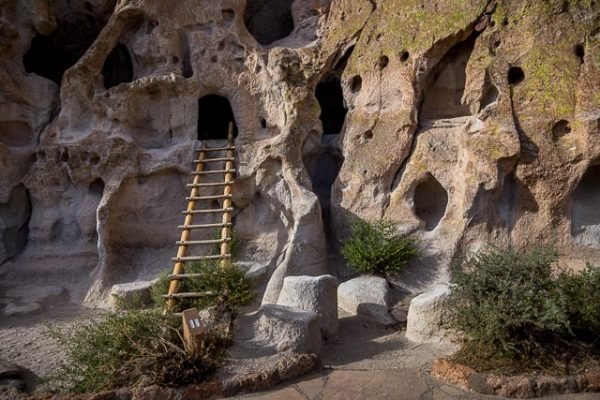
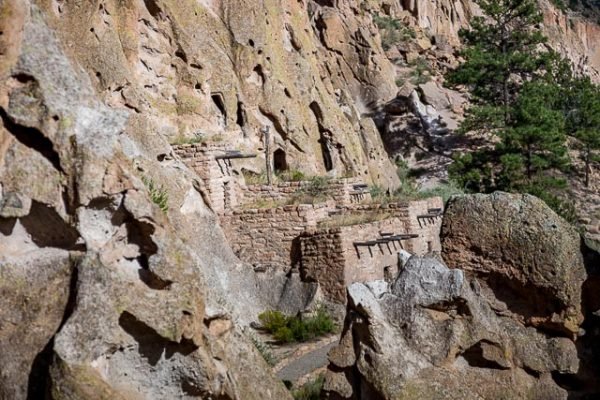
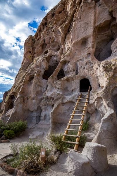
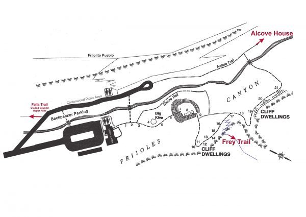
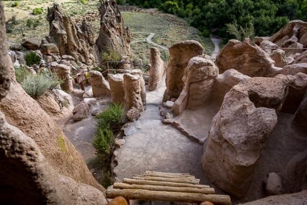
Frijoles Canyon contains a number of ancestral pueblo homes, kivas (ceremonial structures), rock paintings, and petroglyphs. Some of the dwellings were rock structures built on the canyon floor; others were cavates produced by voids in the volcanic tuff of the canyon wall and carved out further by humans. A 1.2-mile, predominantly paved, “Main Loop Trail” from the visitor center affords access to these features. A trail extending beyond this loop leads to Alcove House (formerly called Ceremonial Cave, and still so identified on some maps), a shelter cave produced by erosion of the soft rock and containing a small, reconstructed kiva that hikers may enter via ladder.
Bandelier’s 33,000 acres encompasses numerous scenic views with its sloped mesas and steep-walled canyons, from over 10,000 feet at Cerro Grande to just over 5,000 feet at the Rio Grande.
Bandelier was designated by President Woodrow Wilson as a National Monument on February 11, 1916, and named for Adolph Bandelier, a Swiss-American anthropologist who researched the cultures of the area and supported preservation of the sites. The park infrastructure was developed in the 1930s by crews of the Civilian Conservation Corps and is a National Historic Landmark for its well-preserved architecture.
What to Photograph
The main attraction is the some of the most unusual Anasazi ruins in the Southwest.
Where it is:
Directions from Santa Fe
1 hour each way
- Take Saint Francis Drive (HWY 84/285) north toward Los Alamos.
- After passing Pojoaque, merge right onto New Mexico 502 to Los Alamos.
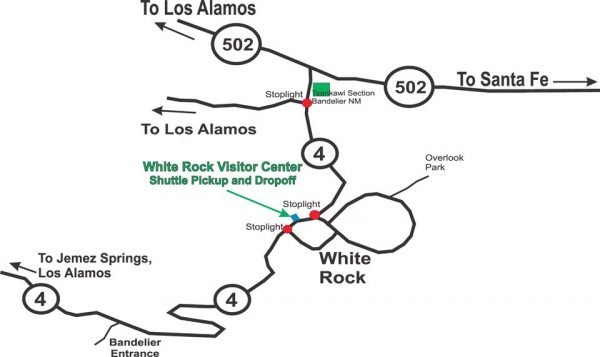
- Continue up 502 toward Los Alamos. Bear right and exit onto New Mexico 4 towards White Rock. Continue for 12 miles, passing White Rock.
- Bandelier’s entrance is on your left.
Directions from Albuquerque
Approximately 2 hours each way
- Take I-25 north towards Santa Fe for approx 45 miles.
- Take exit for US599 to avoid Santa Fe traffic (otherwise continue to exit for 84/285 and follow directions from Santa Fe). Continue for 13 miles.
- Bear left to merge onto U.S. 84/285 towards Los Alamos.
- After passing Pojoaque, merge right onto New Mexico 502 to Los Alamos.
- At the top of a big uphill climb bear right onto New Mexico 4 towards White Rock. Continue for 12 miles, passing White Rock.
- Bandelier’s entrance is on the left.
Scenic Route (approx 2.5 hours, not recommended on snowy days)
- Take I-25 north towards Santa Fe for approx. 15 miles.
- Take for US 550 towards Rio Rancho.
- At San Ysidro, turn right onto New Mexico 4.
- Travel over the Jemez Mountains through Jemez Springs and past the turnoff for Los Alamos (NM 501). Continue straight on Hwy 4.
- Bandelier’s entrance is on the right.
GPS:
Visitor Center 35°46’45.431″ N 106°16’16.044″ W
Maps:
Interactive Google Map
Use the map + – controls to zoom in and out, click and drag the to move the map, use the Map drop-down to change to “Map”, “Satellite”, “Hybrid”, or “Terrain” views. Drag the little man icon from the upper left corner to a map location for street level view.
Hours:
Automobile/Vehicle 7-Day Entry Permit $25.00
7-Day Single Entry Permit $15.00 Per person entrance fee for visitors (16 years of age and older) traveling on foot or bicycle.
Motorcycle 7 Day Entry Permit $20.00
Bandelier National Monument Annual Pass $45.00
All National Parks Passes, Golden Access and Golden Age Passports will continue to be honored according to the provisions of the pass.
Shuttle Bus Required mid May – mid October, 2020
Visitors are required to take a shuttle bus from the White Rock visitor center to access the main visited area of Bandelier National Monument between the hours of 9 AM and 3 PM, including the visitor center, Main Loop Trail, and Falls Trail. Shuttles run approximately every 30 minutes weekdays, and 20 minutes weekends. Last shuttle leaves the Frijoles Canyon Visitor Center at 5 PM.
You may drive directly to the monument and into Frijoles canyon if you meet the following exemptions:
- It is before 9 AM or after 3 PM
- Vehicles displaying a disability tag or plate
- Vehicles with a pet on board (Please note: Pets are not allowed on ANY trails)
- Juniper Campground access (A shuttle is still required into the canyon 9am to 3pm)
- Overnight backpackers whose trip starts in Frijoles Canyon
- Bicycles
- If you have official park business
- Unloading and loading of tour groups
Facilities:
There is no food in the park.
Location Contact Information:
Bandelier National Monument Photo Gallery
Click Here for full page gallery
More Photographic Destinations in New Mexico:
Interactive Google Map
Use the map + – controls to zoom in and out, use the Map drop-down to change to “Map”, “Satellite”, “Hybrid”, or “Terrain” views. Drag the little man icon from the upper left corner to a map location for street level view. Click on a pushpin for more information about the Photographic Destination, then click on the title to go to the location page.
Click Here for Photographic Destinations by State
