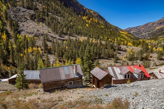
Ute Ulay Mine and Henson Town Site

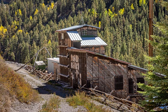
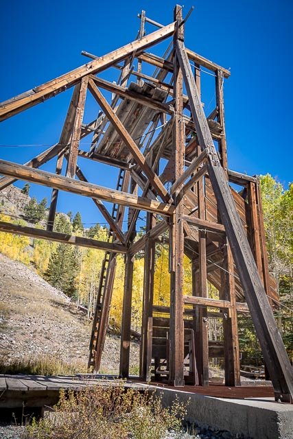
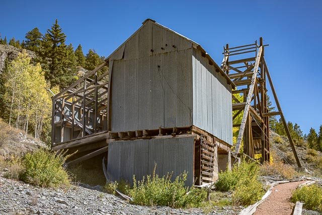
The Ute and Ulay mines were some of the best known silver and lead producers in Colorado. Between 1874 and 1903, the mines were responsible for 12 million worth of minerals which today would amount to more than 280 million in value. Located in Hinsdale County, the mines were largely responsible for the development of Lake City. The booming mining-based economy attracted many people to the area and the mines continued to produce on and off through the 1980s.
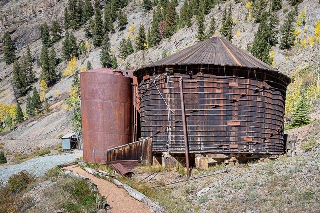
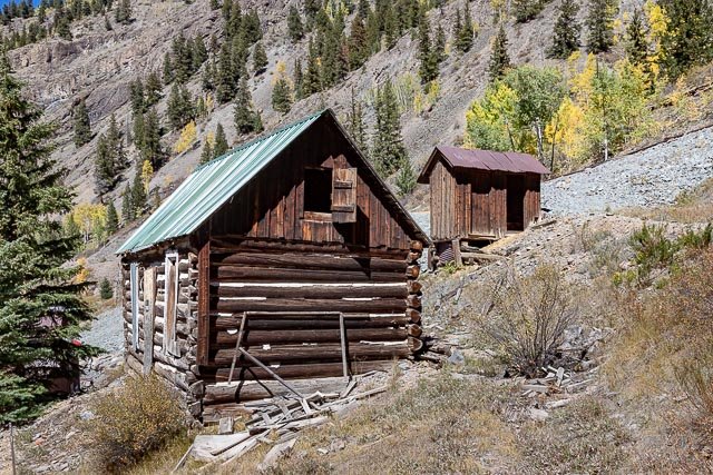
LKA Gold donated the ten-acre site to Hinsdale County. The site consists of 18 structures including residential cabins, a blacksmith shop, a boarding house, a red-cedar water tank, and assayer’s office. Over the past twenty years, the structures have continued to degrade during adverse weather and many are unstable. This project is a rare opportunity for you to see, first hand, mining structures that haven’t be altered or otherwise interpreted before the general public.
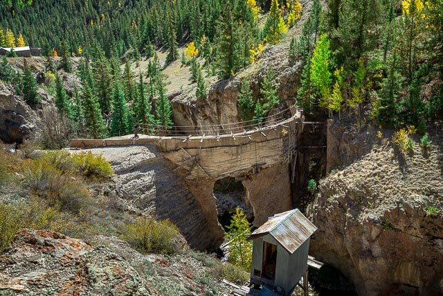
The Ute and Ulay mines, mill complex and surrounding Henson town site are rare examples of a more complete mining community with large amount of historic fabric remaining. The site’s location is along the Alpine Loop Backcountry Byway.
Henson is a ghost town in Hinsdale County, Colorado, United States. Its elevation is 9,235 feet. Henson’s name has historically been spelled several different ways, including Hansen, Hanson, Hensen, and Honsen; the Board on Geographic Names officially supported the current spelling in 1896. Henson was named for Henson Creek, which was named for a pioneer settler.
Where it is:
Henson, Colorado is a ghost town located about 3.5 miles west of Lake City on the Alpine Loop Backcountry Byway (County Road 20). The location is located just off of the road which is well maintained and is accessible with any vehicle coming from Lake City. County road 20 is closed from December to May.
Maps:
Interactive Google Map
Use the map + – controls to zoom in and out, click and drag the to move the map, use the Map drop-down to change to “Map”, “Satellite”, “Hybrid”, or “Terrain” views. Drag the little man icon from the upper left corner to a map location for street level view.

GPS:
38°1’11.232″ N 107°22’35.723″ W
Cost:
The is no cost to visit the Mine or Townsite.
Hours:
The location is accessible 24 hours per day. The road is closed from December to May.
Location Contact Information:
Ute Ulay Mine and Henson Town Site Photo Gallery
Click Here for full page gallery
More Photographic Destinations in Colorado:
Interactive Google Map
Use the map + – controls to zoom in and out, use the Map drop-down to change to “Map”, “Satellite”, “Hybrid”, or “Terrain” views. Drag the little man icon from the upper left corner to a map location for street level view. Click on a pushpin for more information about the Photographic Destination, then click on the title to go to the location page.
Click Here for Photographic Destinations by State