Alta Ghost Town

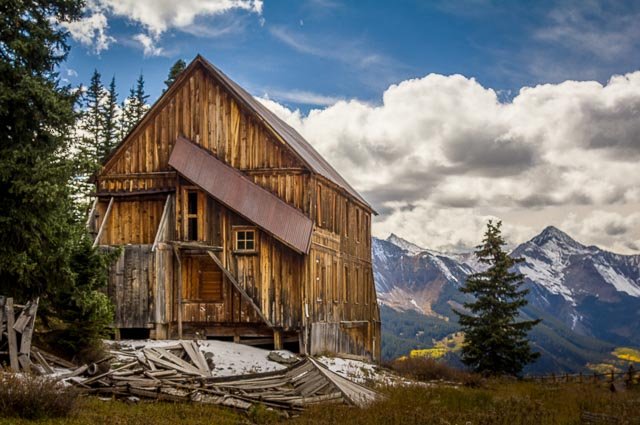
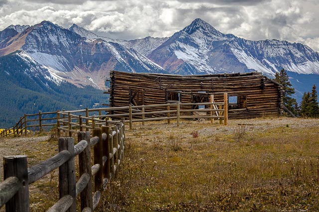
Alta is the most scenic Ghost Town that I have visited, it is located at 11,800 feet above see level and has tremendous views of Mount Wilson. Just up the road is Alta Lakes Recreation Area consisting of 3 pristine mountain lakes and a primitive camp ground. The site includes a number of nicely preserved buildings from the old mining town set against a fantastic Rocky Mountain background.
Constructed around the turn of the 20th century and active until the 1930s, the Gold King Mine at Alta Lakes, elevation 11,000 feet, was the first mine in the world to receive AC power. Built in 1939, Alta’s two-story boardinghouse comprises materials salvaged from the St. Louis mine’s boardinghouse. It stands as one of Colorado’s last extant major mining camp boardinghouses.
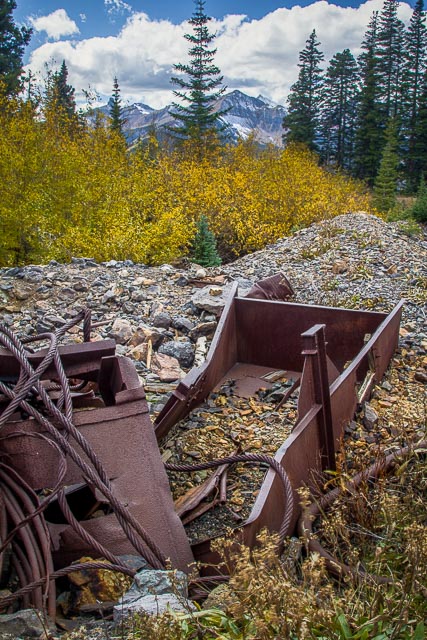
Alta was the center of gold mining activity from the 1870s to the 1940s, and in its heyday, hundreds of people lived there. Its demise came when a prominent mill burned down in 1948. As residents moved away, buildings and homes were left standing, abandoned and sacrificed to nature. Today, this Colorado ghost town is listed on the National Register of Historic Places, and includes original buildings like cabins, a boarding house and outhouses.
Where it is:
Alta is located between Telluride an d Rico at an elevation of 11,800 feet.
Take Alta Lakes Road six miles south of Telluride on Highway 145. Turn left and stay on the road for 4 miles to reach the ghost town of Alta. This is a narrow and steep road but is maintained and does not require a high clearance vehicle. Alta Lakes Road is closed in the winter. To reach Alta Lakes, you’ll need a high-clearance 4×4, just follow signs from Alta.
Maps:
Interactive Google Map
Use the map + – controls to zoom in and out, click and drag the to move the map, use the Map drop-down to change to “Map”, “Satellite”, “Hybrid”, or “Terrain” views. Drag the little man icon from the upper left corner to a map location for street level view.

GPS:
37°53’9.816″ N 107°51’8.58″ W

Cost:
There is no cost to visit Alta.

Hours:
There are no hours, the location is accessible 24 hour per day.
Alta Lakes is a popular dispersed camping area that offers fishing and camping in a spectacular alpine setting. There are approximately 16 primitive camping spots that are completely undeveloped.
Alta Ghost Town Photo Gallery
Click Here for full page gallery
More Photographic Destinations in Colorado:
Interactive Google Map
Use the map + – controls to zoom in and out, use the Map drop-down to change to “Map”, “Satellite”, “Hybrid”, or “Terrain” views. Drag the little man icon from the upper left corner to a map location for street level view. Click on a pushpin for more information about the Photographic Destination, then click on the title to go to the location page.
Click Here for Photographic Destinations by State
Gold King Basin has the most amazing wildflowers the end of July and beginning of August. After leaving Alta and heading toward Alta Lakes, there is a fork in the road. The left turn takes you to Alta Lakes, the right turn takes you to Gold King Basin. There is also a small stream with small waterfall that photograph nicely with wildflowers.