Kymulga Mill and Covered Bridge

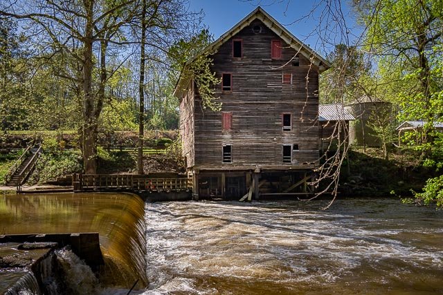
Kymulga Mill is a working gristmill built in 1864 by German contractor G.E. Morris for Confederate Army Major George H. Forney, who was later promoted to lieutenant colonel. Forney died at the Battle of the Wilderness in Virginia before construction was completed, but his wife allowed Morris to finish it. Union Army soldiers burned most of the gristmills throughout the area during the Civil War, but Kymulga Mill was missed. The mill was sold four times before being purchased by the Childersburg Heritage Committee from latest owner Edward Donahoo in 1988, though it remained in active service through many of those years.
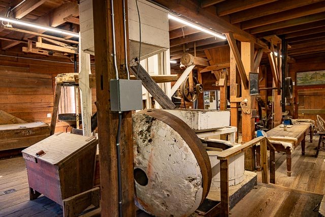
Three water powered turbines ran the four-story mill, including lights, grain elevator and millstones used for grinding grain. Two of its five sets are French buhrs, thought to be the hardest rock in the world. Kymulga Mill continues to operate to this day, though under electricity, still making corn meal with its huge millstones. The building is now a tourist attraction open for guided tours. It also serves as a gift shop and park office.
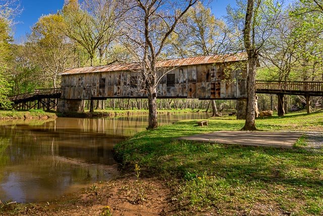
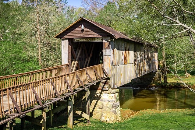
The Kymulga Covered Bridge is a wood & metal combination style covered bridge that spans Talladega Creek, located just east of Kymulga Mill within Kymulga Park. Built in 1861, the 105-foot bridge is a Howe truss construction over a single span. The Kymulga Covered Bridge is one of two 19th-century covered bridges extant in Alabama still remaining at its original location; the Waldo Covered Bridge, also located in Talladega County, is the other.
The bridge once provided access to the Old Georgia Road or the McIntosh Road, a Native American trade route which was used by settlers and frontiersmen who ventured the area. Eventually, farms and communities spawned along the former trail. The United States government purchased land adjacent to Kymulga Mill in 1941 for the Alabama Ordnance Works, a military installation. Settlements within the tract had to be relocated. Today, the Kymulga Covered Bridge leads park visitors to a series of nature trails north of Talladega Creek. People may still find remnants of the Old Georgia Road, as well as other traces of the past.
Where it is:
Located on Grist Mill Road four miles northeast of Childersburg, Alabama.
7346 Grist Mill Road Childersburg, AL 35044
Get Directions
(256) 378-7436
Maps:
Interactive Google Map
Use the map + – controls to zoom in and out, click and drag the to move the map, use the Map drop-down to change to “Map”, “Satellite”, “Hybrid”, or “Terrain” views. Drag the little man icon from the upper left corner to a map location for street level view.
GPS:
Mill 33°20’2.1931″ N 86°17’59.102″ W
Covered Bridge 33°20’3.738″ N 86°17’57.972″ W
Cost:
Hours:
Normal operating hours – Wednesday to Sunday, 9AM to 5PM.
Kymulga Mill & Covered Bridge Photo Gallery
Click Here for full page gallery
More Photographic Destinations in Alabama
Interactive Google Map
Use the map + – controls to zoom in and out, use the Map drop-down to change to “Map”, “Satellite”, “Hybrid”, or “Terrain” views. Drag the little man icon from the upper left corner to a map location for street level view. Click on a pushpin for more information about the Photographic Destination, then click on the title to go to the location page.
Click Here for Photographic Destinations by State


