Great Places for Great Photos

Let me help you to find a great location for your next photography adventure. I will list many lesser known destinations, as well as the famous “Icon Locations” for photography. I will provide photos (Lots of Photos), location information, consisting of what there is to photograph as well as other information about the destination. I will give costs, maps, directions, contact information, and other essential information for a successful photo trip. I will only post for locations that I have personally photographed to insure a quality guide to great locations for photography.

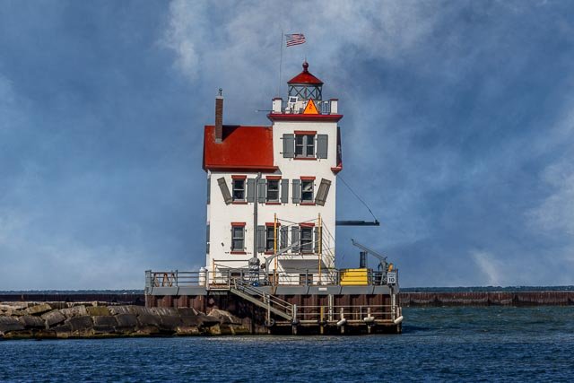
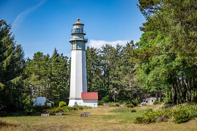
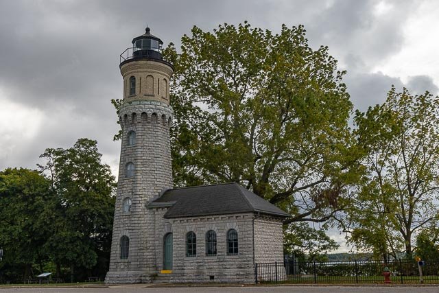
Lighthouse Photographic Destinations

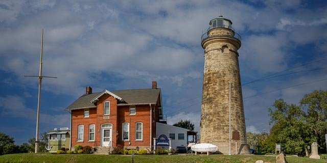
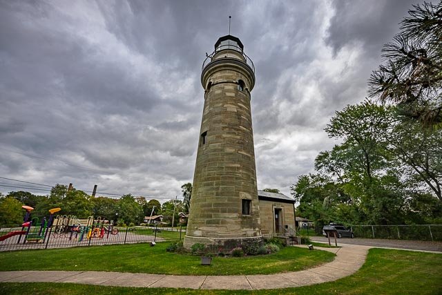
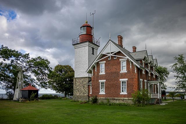
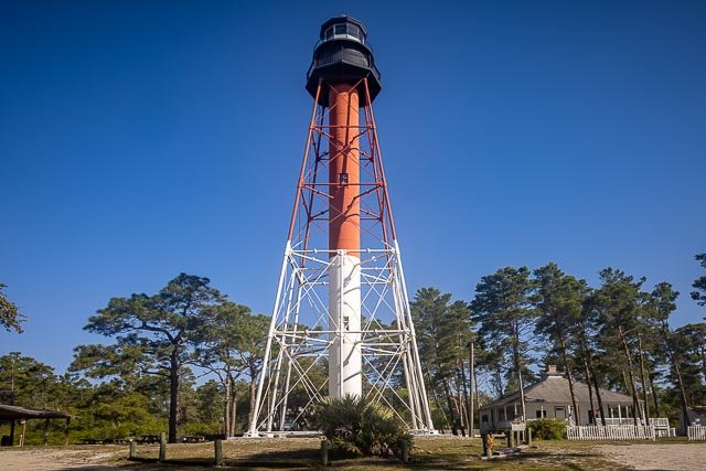
A lighthouse is a tower, building, or another type of structure designed to emit light from a system of lamps and lenses and to serve as a navigational aid for maritime pilots at sea or on inland waterways.

Lighthouses mark dangerous coastlines, hazardous shoals, reefs, rocks, and safe entries to harbors; they also assist in aerial navigation. Once widely used, the number of operational lighthouses has declined due to the expense of maintenance and has become uneconomical since the advent of cheaper and often much more effective electronic navigational systems.

The modern era of lighthouses began at the turn of the 18th century, as lighthouse construction boomed in lockstep with burgeoning levels of transatlantic commerce. Advances in structural engineering and new and efficient lighting equipment allowed for the creation of larger and more powerful lighthouses, including ones exposed to the sea. The function of lighthouses shifted toward the provision of a visible warning against shipping hazards, such as rocks or reefs.

Interactive Google Map

Use the map  + – controls to zoom in and out, use the Map drop-down to change to “Map”, “Satellite”, “Hybrid”, or “Terrain” views.  Drag the little man icon from the upper left corner to a map location for street level view. Click on a pushpin for more information about the Photographic Destination, then click on the title to go to the location page.

Lighthouse

Lighthouse Destinations
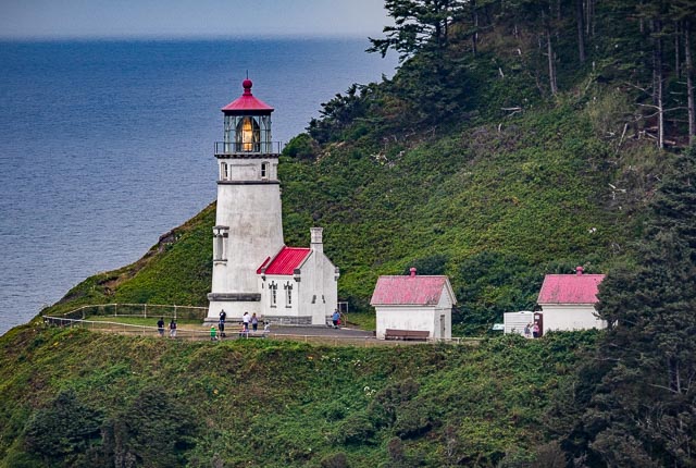
Yaquina Head Lighthouse The Yaquina Head Light, also known early in its existence as the Cape Foulweather Lighthouse, is a lighthouse on the Oregon Coast. It is located in Lincoln County, near the mouth of the Yaquina River near Newport at Yaquina Head. The tower stands 93 feet tall, and is the tallest lighthouse in Oregon. Made in Paris in 1868 and shipped to Oregon, Yaquina Head Light was first lit August 20, 1873, and automated in 1966. It is active with an identifying light characteristic of two seconds on, two seconds off, two seconds on, and 14 seconds off. A two-story keepers’ dwelling was built at the time the lighthouse tower and its adjoining oil house were constructed. In 1923, a one-story keepers’ house was added a short distance to the east. In 1938, a one-story building replaced the original two-story dwelling. Both dwellings and all outbuildings were then demolished in 1984. The space is now a grassy area. In 1939 the U.S. Coast Guard took over the management. During World War II, 17 servicemen were stationed at Yaquina Head to keep a lookout for enemy ships. The lighthouse still uses its original 1868 French-made, 1st order, Fixed Fresnel lens, visible 19 miles out to sea. In 1993, the lighthouse was listed in the National Register of Historic Places Yaquina Head outstanding Natural Area From exploring tide pools teeming with life to witnessing Oregon’s tallest lighthouse, there is something for every visitor at Yaquina Head.  Yaquina Head Outstanding Natural Area extends out from the Oregon coast, one mile into the Pacific Ocean. The interpretive center features exhibits on seabirds and marine life as well as human history from the headland. You can see the wheelhouse of an historic ship, check out a recreated rocky island and its inhabitants, and witness a full scale replica of the lighthouse lantern. All BLM exhibits and interpretive specialists deliver the rich history of Yaquina Head. Explore the tidepools at Cobble Beach with rangers every day, check the Tidepool Times to plan your visit. What to Photograph The historic Yaquina Head Lighthouse. Harbor seals can often be seen laying on the near-shore rocks off Cobble Beach and Quarry Cove. The best time to observe them is when the tide is out for best chances for viewing. A long lens will be needed to get a closeup shot. Birds are one of the most abundant, easily watched forms of wildlife at the Yaquina Headland. The availability and diversity of habitat at Yaquina attracts different bird species all year-round.  A long lens will be needed, the birds on large rocks offshore.       Cobble Beach and the tidepools, commonly seen animals include anemones, urchins, mussels,  barnacles, seastars, and many more.   Where it is: Yaquina Head is located on the central coast of Oregon at the north end of Newport. Newport is located 55 miles west of Corvallis on the central Oregon coast. Take Hwy. 20 to U.S. Hwy. 101 to Newport. Turn right onto Hwy. 101 and proceed north 4.5 miles to Lighthouse Drive and turn left to enter Yaquina Head. Driving from the north on Hwy. 101, turn right onto Lighthouse Drive approximately 0.5 mile south of the Newport city limit sign. There are signs on the highway and at the stop light at the intersection of Hwy. 101 and Lighthouse Drive to help direct you to Yaquina Head. Maps: Interactive Google Map Use the map  + – controls to zoom in and out, click and drag the to move the map, use the Map drop-down to change to “Map”, “Satellite”, “Hybrid”, or “Terrain” views.  Drag the little man icon from the upper left corner to a map location for street level view.     GPS: 44°40’35.73″ N 124°4’45.107″ W   Hours: Park Grounds 7 a.m. – sunset, July 1 through September 15 8 a.m. – sunset, Fall, Winter, Spring Interpretive Center 10 a.m. to 5 p.m. July 1 through September 15 10 a.m. to 4 p.m. Fall, Winter, Spring Lighthouse The lighthouse is open for limited ranger-led tours, as weather, conditions and staffing permit. Reservations are required. For important tour and reservation information: Tour Info Cost: Yaquina Head honors and issues all America the Beautiful National Parks and Federal Recreational Lands passes (senior, annual, military, access, volunteer and 4th grade). Yaquina Head also honors and issues Oregon Pacific Coast passes. Personal passenger vehicle: $7 for a 3 day pass Annual Yaquina Head: $15 for a 12 month pass Motorcycle: $3 for a 3 day pass Bicyclist, walker: free 1 day pass Commercial van, < 21 passenger capacity: $25 for a 1 day pass Commercial bus, >21 passenger capacity: $50 for a 1 day pass Location Contact Information: Call 541-574-3100 or email blm_or_no_yhona_comments@blm.gov for the most up-to-date information. Drone Regulations: Flying kites, model airplanes, and drones is disruptive to wildlife and not permitted.   Yaquina Head Lighthouse Photo Gallery Click Here for full page gallery   More Photographic Destinations in Oregon: Interactive Google Map Use the map  + – controls to zoom in and out, use the Map drop-down to change to “Map”, “Satellite”, “Hybrid”, or “Terrain” views.  Drag the little man icon from the upper left corner to a map location for street level view. Click on a pushpin for more information about the Photographic Destination, then click on the title to go to the location page. Click Here for Photographic Destinations by State    All the information in this post was believed to be accurate at the time it was published.  Please be sure to double check with the location before relying on this information as everything changes over time, especially hours, prices, and whether the location is still open.   Great Places for Great Photos   Let me help you to find a great location for your next photography adventure.  I will list many lesser-known destinations, as well as the famous "Icon Locations" for photography.  I will provide photos (Lots of Photos), location information, consisting of what there is to photograph as well as other information about the destination.  I will give costs, maps, directions, contact information, and other essential information for a successful photo trip.  I will only post for locations that I have personally photographed to ensure a quality guide to great locations for photography. If you know of great places that are not posted, please send me the details, I may just decide that is a place I need to go!     Greg Disch is a freelance photographer located in Arkansas. Greg specializes in nature, scenic, wildlife, and other outdoor subjects in Arkansas and other areas of the country.  Most of the images on this site are available for sale as prints, personal use, or rights managed stock photos. Greg offers both classroom instruction and in the field hands on photographic workshops. Classroom sessions are normally held in Fort Smith Arkansas, but arrangements can be made to bring a class to your group. All classes and workshops have small class sizes designed to provide an optimum student to instructor ratio, where you can get the personal attention, you need.  Most classes and workshops are limited to a maximum of six participants and will be held with a minimum of only two. If you are looking for a wonderful opportunity to get personal individual instruction, I do private workshops and classes at a location of your choice, whether doing a location photo shoot, coming to your home or business, traveling across the country on a road trip, or at my classroom.  This is a fantastic way to learn digital workflow and be sure that your computer equipment is properly configured for optimum performance. [...]Read more...
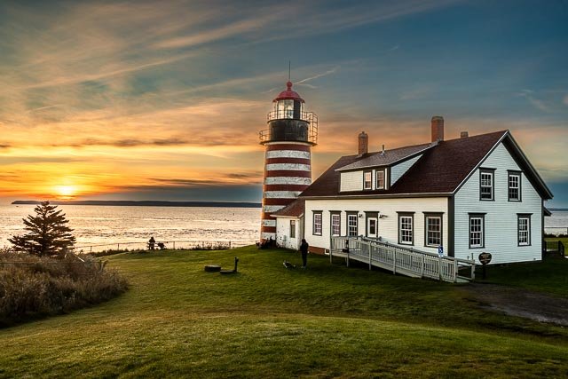
West Quoddy Head Lighthouse   West Quoddy Head, in Quoddy Head State Park, Lubec, Maine, is the easternmost point of the contiguous United States. In 1808 a lighthouse was constructed at the site to guide ships through the Quoddy Narrows. The current tower, with distinctive red-and-white stripes, was constructed in 1858 and is an active aid to navigation. The 3rd order Fresnel lens is the only 3rd order and one of only eight Fresnel lenses still in use on the Maine Coast. The light station was added to the National Register of Historic Places as West Quoddy Head Light Station on July 4, 1980. A stone sign describes the lighthouse as the “easternmost point in the U.S.A.” It is the easternmost building in the United States (a nearby sign proclaims the “easternmost giftshop in the U.S.”), but the easternmost point is at rocks extending eastward from the shore. The present light station includes a tower, former keeper’s quarters, service building, and oil house. The tower is circular, and is 49 feet in height, with the beacon at 83 feet above sea level. The light, magnified by a third-order Fresnel lens, has a range of 18 miles. The tower is built of brick, and painted in alternating horizontal red and white stripes. A small gabled entry vestibule, also brick, projects from the tower. The keeper’s house is a wood-frame structure. A lighthouse at West Quoddy Head, Maine, was authorized by Congress in 1806. The light station was finished on April 21, 1808, at a cost of $5,000. In 1820, Congress authorized the first fog signal at the station, a 500-pound bell, for a cost of $1,000 . The current tower was built in 1858. The present station was built in 1858. The former keeper’s house now serves as a museum and visitor’s center. In 1990, the U.S. Postal Service issued a 25-cent stamp featuring the West Quoddy Head Light. Where it is: From Route 1 in Whiting, continue east on Highway 189 for just under ten miles towards Lubec. Before reaching Lubec, turn south on Boot Cove Road as indicated by the lighthouse signs. After 2.8 miles, the road turns east and becomes Quoddy Head Road. Follow this road into Quoddy Head State Park, where you can park and walk a short distance to the lighthouse.   Maps: Interactive Google Map Use the map  + – controls to zoom in and out, click and drag the to move the map, use the Map drop-down to change to “Map”, “Satellite”, “Hybrid”, or “Terrain” views.  Drag the little man icon from the upper left corner to a map location for street level view. GPS: 44°48’55.212″ N 66°57’3.426″ W Cost: Day use fee is $3 for Adult Maine Resident, $4 for Adult Non Resident, $1 for Senior Non Resident. Hours: West Quoddy Lighthouse is open daily from Memorial Day to mid-October from 10:00 a.m. to 4:00 p.m. Call (207) 733-2180 for more information. Tours to the top of the tower are given at intervals during the summer, typically every Saturday in the months of July and August. And during West Quoddy Annual Lighthouse Celebration in July. Also the second Saturday in September for Maine Open Lighthouse Day. Open 9:00 a.m. to sunset daily from May 15 through October 15 unless otherwise posted. Off-season, visitors are welcome during daylight hours Facilities: Picnic area with tables, grills and privies. Location Contact Information: Quoddy Head State Park (May 15-October 15) 973 South Lubec Road Lubec, Maine 04652 207-733-0911 www.maine.gov/quoddyhead West Quoddy Head Lighthouse Photo Gallery Click Here for full page gallery   More Photographic Destinations in Maine Interactive Google Map Use the map  + – controls to zoom in and out, use the Map drop-down to change to “Map”, “Satellite”, “Hybrid”, or “Terrain” views.  Drag the little man icon from the upper left corner to a map location for street level view. Click on a pushpin for more information about the Photographic Destination, then click on the title to go to the location page. Click Here for Photographic Destinations by State    All the information in this post was believed to be accurate at the time it was published.  Please be sure to double check with the location before relying on this information as everything changes over time, especially hours, prices, and whether the location is still open.   Great Places for Great Photos   Let me help you to find a great location for your next photography adventure.  I will list many lesser-known destinations, as well as the famous "Icon Locations" for photography.  I will provide photos (Lots of Photos), location information, consisting of what there is to photograph as well as other information about the destination.  I will give costs, maps, directions, contact information, and other essential information for a successful photo trip.  I will only post for locations that I have personally photographed to ensure a quality guide to great locations for photography. If you know of great places that are not posted, please send me the details, I may just decide that is a place I need to go!     Greg Disch is a freelance photographer located in Arkansas. Greg specializes in nature, scenic, wildlife, and other outdoor subjects in Arkansas and other areas of the country.  Most of the images on this site are available for sale as prints, personal use, or rights managed stock photos. Greg offers both classroom instruction and in the field hands on photographic workshops. Classroom sessions are normally held in Fort Smith Arkansas, but arrangements can be made to bring a class to your group. All classes and workshops have small class sizes designed to provide an optimum student to instructor ratio, where you can get the personal attention, you need.  Most classes and workshops are limited to a maximum of six participants and will be held with a minimum of only two. If you are looking for a wonderful opportunity to get personal individual instruction, I do private workshops and classes at a location of your choice, whether doing a location photo shoot, coming to your home or business, traveling across the country on a road trip, or at my classroom.  This is a fantastic way to learn digital workflow and be sure that your computer equipment is properly configured for optimum performance. [...]Read more...
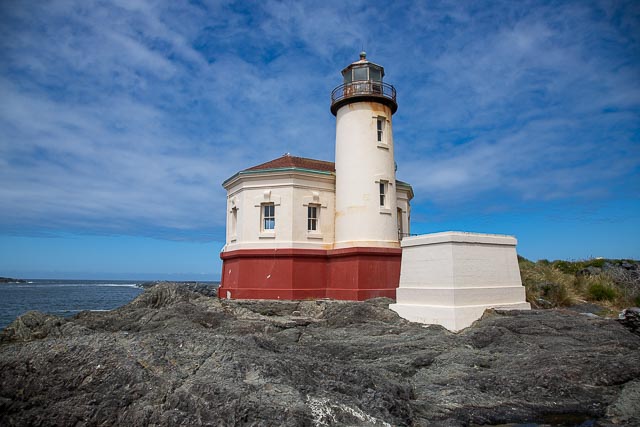
Umpqua River Lighthouse The lighthouse is part of Umpqua River State Park and is managed by Douglas County Parks, which also oversees the museum about a block away in a historic Coast Guard building. Located at the mouth of Winchester Bay, Oregon, the first Umpqua River Light was built in 1855 and lit in 1857. Built along the river channel, the original light was vulnerable to seasonal flooding. This led to yearly erosion of the sand embankment of the light. In October 1863, the building’s foundations had become too unstable and the structure soon collapsed. Before its collapse, the Light House Board had foreseen the need to build a new light at the location. However, it was 1888 before Congress approved of a construction of a new light. Construction started on the new light in 1892, and it was first lit in 1894. Built at the same time as Heceta Head Light, it was built from the same plans and is virtually identical to its more northern sister. Unlike its predecessor, the new light had several advantages over the original light. Built 100 feet above the river, the new light was safe from flooding. This was partly due to the Light House Board’s insistence that ships be able to plot a course based on visible lighthouses. The original light was not visible at sea and was only usable as an aid to ships approaching the river. The new light used a clockwork mechanism to rotate the Fresnel lens, and was eventually automated in 1966. The rotation mechanism served in the light for 89 years before it finally broke down and was removed. The Coast Guard, in charge of the light at this point, wanted to replace the mechanism with a new one. However, strong public outcry forced those plans to be aborted, and in 1985, the old mechanism was returned to its position after being fully restored. The structure was listed on the National Register of Historic Places in 1977. Visitors can tour the lighthouse and adjacent Coastal History Museum from May through September. The museum is located in a historic U.S. Coast Guard station and features exhibits on the lighthouse, local history and the U.S. Coast Guard history on the Umpqua River.   What to Photograph The lighthouse can be photographed from outside of the fence or can be accessed via a tour available from the museum.  The keepers house and several outbuildings as well as a Where it is: The lighthouse and museum are located six miles south of Reedsport above the entrance to Winchester Bay. The address of the lighthouse is 1020 Lighthouse Road, Winchester Bay, OR. Off of Highway 101, take Salmon Harbor Drive toward the bay, after a little over a mile, take a left onto Lighthouse Road and you will see the museum on your right.  It is one of the few you can drive right up to. Maps: Interactive Google Map Use the map  + – controls to zoom in and out, click and drag the to move the map, use the Map drop-down to change to “Map”, “Satellite”, “Hybrid”, or “Terrain” views.  Drag the little man icon from the upper left corner to a map location for street level view.   GPS: 43°39’44.808″ N 124°11’55.302″ W Hours: Open daily 10 am – 5 pm There is no set schedule for lighthouse tours, and for a small donation, a volunteer takes group to the lighthouse, which is only accessible by taking a tour. Cost: Lighthouse Tours & MuseumTours are available year-round. Lighthouse Tours & Museum Tours are available year-round. Members = FREE Preschool (0 – 4) = FREE Children (5 – 17) = $4.00 Adults = $8.00 Location Contact Information: Info: 800.551.6949 State Park: 541-271-4118 ADDRESS & PHONE 1020 Lighthouse Road Winchester Bay, OR 97467 +1 (541) 271-4631   Umpqua River Lighthouse Photo Gallery Click Here for full page gallery   More Photographic Destinations in Oregon: Interactive Google Map Use the map  + – controls to zoom in and out, use the Map drop-down to change to “Map”, “Satellite”, “Hybrid”, or “Terrain” views.  Drag the little man icon from the upper left corner to a map location for street level view. Click on a pushpin for more information about the Photographic Destination, then click on the title to go to the location page. Click Here for Photographic Destinations by State    All the information in this post was believed to be accurate at the time it was published.  Please be sure to double check with the location before relying on this information as everything changes over time, especially hours, prices, and whether the location is still open.   Great Places for Great Photos   Let me help you to find a great location for your next photography adventure.  I will list many lesser-known destinations, as well as the famous "Icon Locations" for photography.  I will provide photos (Lots of Photos), location information, consisting of what there is to photograph as well as other information about the destination.  I will give costs, maps, directions, contact information, and other essential information for a successful photo trip.  I will only post for locations that I have personally photographed to ensure a quality guide to great locations for photography. If you know of great places that are not posted, please send me the details, I may just decide that is a place I need to go!     Greg Disch is a freelance photographer located in Arkansas. Greg specializes in nature, scenic, wildlife, and other outdoor subjects in Arkansas and other areas of the country.  Most of the images on this site are available for sale as prints, personal use, or rights managed stock photos. Greg offers both classroom instruction and in the field hands on photographic workshops. Classroom sessions are normally held in Fort Smith Arkansas, but arrangements can be made to bring a class to your group. All classes and workshops have small class sizes designed to provide an optimum student to instructor ratio, where you can get the personal attention, you need.  Most classes and workshops are limited to a maximum of six participants and will be held with a minimum of only two. If you are looking for a wonderful opportunity to get personal individual instruction, I do private workshops and classes at a location of your choice, whether doing a location photo shoot, coming to your home or business, traveling across the country on a road trip, or at my classroom.  This is a fantastic way to learn digital workflow and be sure that your computer equipment is properly configured for optimum performance. [...]Read more...
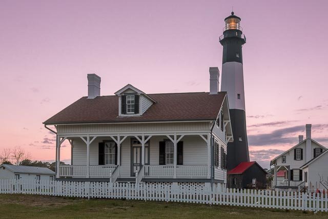
  Tybee Island Lighthouse Tybee Island Light is a lighthouse next to the Savannah River Entrance, on the northeast end of Tybee Island, Georgia. It is one of seven surviving colonial era lighthouse towers, though highly modified in the mid 1800s. The current lighthouse is the fourth tower at this station, though neither of its first two predecessors were lit. The first tower was built at the direction of James Oglethorpe and was constructed of wood; erected in 1736, it was felled by a storm in 1741. The following year a replacement was erected, this time of stone and wood, but still without illumination; instead, it was topped with a flag pole. This tower succumbed to shoreline erosion The third tower was constructed in 1773 by John Mullryne, a brick tower originally 100 ft in height. It was first fitted with a system of reflectors and candles, but this was upgraded to oil lamps after it was ceded to the federal government in 1790. A second tower was added to the site in 1822 to form a range. Both towers received Fresnel lenses in 1857, with the lower front tower being equipped with a 4th order lens, while the main tower received a larger 2nd order lens. Confederate forces burned the light in 1862 during the Civil War and removed the lens as they retreated to Fort Pulaski. Reconstruction of the light was begun in 1866 but was delayed by a cholera outbreak. A new tower was constructed atop the first 60 ft of the old tower, raising the height of the whole to 154 ft. This tower was equipped with a 1st order lens. The front beacon was now a 50 ft wooden skeleton tower equipped with a new 4th order lens. The main tower was severely damaged in a hurricane in 1871, and developed such serious cracking that a $50,000 appropriation was requested for its replacement. Instead a new front tower (which had already been moved twice) was constructed of iron. New keepers dwellings were constructed in 1881 and 1885. The following year the tower was shaken by the 1886 Charleston earthquake, which damaged the lens and caused further cracking of the brickwork; these were both however immediately repaired. In 1933 the tower was electrified and the station reduced to a single keeper. The beacon was automated in 1972. Throughout its life the daymark of the tower was modified on numerous occasions. Originally all-white, the base and lantern were painted black in 1887; this was altered in 1914 and again in 1916, each time bringing the black at the top further down the tower until the illustrated configuration was reached. In 1967 the entire tower was repainted with a white base and a gray top. The gray faded severely and was painted black in 1970. In 1999 a major restoration project was begun under the auspices of the Tybee Island Historical Society, who took possession of the light station in 2002 under the National Historic Lighthouse Preservation Act.  As part of this project the tower was repainted in the 1916–1966 black-white-black daymark.  The beacon is still a functioning navigational aid, still using its original lens. The site is open to the public and retains its keepers houses and auxiliary buildings as well as the lighthouse tower. What to Photograph The historic Lighthouse and grounds  and Fort Screven which is right next to the Lighthouse. Also while on the island  the Tybee Island Pier.   Where it is: Tybee Island, Savannah Georgia From Interstate 516 in Savannah (just south of Interstate 16), take Highway 80/26 East for about 19 miles to Tybee Island. At the first stop light on the island, turn left onto Campbell Avenue. When Campbell Avenue ends take a left onto Van Horn Street and then a right onto Meddin Drive. Follow Meddin Drive to the north side of Tybee Island Lighthouse where there is public parking. Maps: Interactive Google Map Use the map  + – controls to zoom in and out, click and drag the to move the map, use the Map drop-down to change to “Map”, “Satellite”, “Hybrid”, or “Terrain” views.  Drag the little man icon from the upper left corner to a map location for street level view.   GPS: 32°1’19” N 80°50’40.999″ W Cost: Adults: $10 Seniors (62+): $8 Children (6-17): $8 Children (5 and under): Free Groups (10 people or more) with a reservation: $8 Military (Must present ID): $8 Coast Guard (Must present ID): Free Hours: Last Ticket Sold at 4:30PM. Mon: 9am – 5:30pm Tues: CLOSED Wed: 9am – 5:30pm Thu: 9am – 5:30pm Fri: 9am – 5:30pm Sat: 9am – 5:30pm Sun: 9am-5:30pm Last Ticket Sold at 4:30PM. ​ Grounds close by 5:30PM. Closed St. Patrick’s Day, Easter (tickets sold from 1:30pm-4:30pm), Closed Thanksgiving Day, Christmas Day, & New Years Day. Hours subject to change, specifically on Christmas Eve and New Year’s Eve. Drone Policy​ Drones are allowed to be flown over the site outside of operating hours. That means drones are not allowed to fly over the light station and museum every day except for Tuesdays, from 9AM-5:30PM. All facilities are available on Tybee Island. Location Contact Information: Tybee Island Historical Society Address: 30 Meddin Dr, Tybee Island, GA 31328, USA Phone: (912) 786-5801 Fax: (912) 786-6538 Tybee Island Lighthouse Photo Gallery Click Here for full page gallery   More Photographic Destinations in Georgia: Interactive Google Map Use the map  + – controls to zoom in and out, use the Map drop-down to change to “Map”, “Satellite”, “Hybrid”, or “Terrain” views.  Drag the little man icon from the upper left corner to a map location for street level view. Click on a pushpin for more information about the Photographic Destination, then click on the title to go to the location page. Click Here for Photographic Destinations by State    All the information in this post was believed to be accurate at the time it was published.  Please be sure to double check with the location before relying on this information as everything changes over time, especially hours, prices, and whether the location is still open.   Great Places for Great Photos   Let me help you to find a great location for your next photography adventure.  I will list many lesser-known destinations, as well as the famous "Icon Locations" for photography.  I will provide photos (Lots of Photos), location information, consisting of what there is to photograph as well as other information about the destination.  I will give costs, maps, directions, contact information, and other essential information for a successful photo trip.  I will only post for locations that I have personally photographed to ensure a quality guide to great locations for photography. If you know of great places that are not posted, please send me the details, I may just decide that is a place I need to go!     Greg Disch is a freelance photographer located in Arkansas. Greg specializes in nature, scenic, wildlife, and other outdoor subjects in Arkansas and other areas of the country.  Most of the images on this site are available for sale as prints, personal use, or rights managed stock photos. Greg offers both classroom instruction and in the field hands on photographic workshops. Classroom sessions are normally held in Fort Smith Arkansas, but arrangements can be made to bring a class to your group. All classes and workshops have small class sizes designed to provide an optimum student to instructor ratio, where you can get the personal attention, you need.  Most classes and workshops are limited to a maximum of six participants and will be held with a minimum of only two. If you are looking for a wonderful opportunity to get personal individual instruction, I do private workshops and classes at a location of your choice, whether doing a location photo shoot, coming to your home or business, traveling across the country on a road trip, or at my classroom.  This is a fantastic way to learn digital workflow and be sure that your computer equipment is properly configured for optimum performance. [...]Read more...
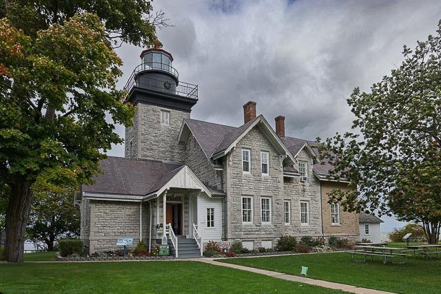
St. Simons Island Lighthouse The St. Simons Island Light is a lighthouse on the southern tip of St. Simons Island, Georgia, United States. It guides ships into St. Simons Sound and warns of the many sandbars in the area. The U.S. government constructed a new lighthouse to replace the original, building it to the west of the original’s location. It is a 104-foot brick structure completed in 1872 and was outfitted with a third-order, biconvex Fresnel lens. The lens is one of 70 such lenses that remain operational in the United States. Sixteen of those are in use on the Great Lakes, of which eight are in Michigan. The rotating lens projects four beams of light, with one strong flash every 60 seconds. A cast iron spiral stairway with 129 steps leads to the galley. In 1876, the lighthouse was overhauled. In 1934, the kerosene-burning lamp was replaced by a 1000-watt electrical light. On July 1, 1939, the United States Lighthouse Service was placed under the jurisdiction of the US Coast Guard.  In 1953 the lighthouse was fully automated. In 1972, the Coast Guard placed rear range lights on two towers at the entrance to the Frederica River off of St. Simons Sound. Entering the entrance channel at sea and proceeding inward, by keeping the lighthouse centered between the two rear range lights, keeps one in the center of the entrance channel. The lighthouse is therefore still an active navigational aid. In 1972, the light-keepers’ cottage was leased to Glynn County. The Coastal Georgia Historical Society spent three years restoring the two-story Victorian light keepers’ cottage, located at the base of the lighthouse, which was then converted into a museum. In 1984, they leased the historic lighthouse structure. For a fee, the public can tour the museum, and climb the 129 steps to the top of the lighthouse for a view of St. Simons Sound and the surrounding area. The tower underwent restoration in 1989–91 and again in 1997–98. May 26, 2004, ownership of the lighthouse was transferred to the Coastal Georgia Historical Society under the National Historic Lighthouse Preservation Act. Where it is: The Lighthouse is located on St. Simons Island in the Golden Isles of Georgia. The Lighthouse Museum is made up of the St. Simons Island Lighthouse and adjoining Keeper’s Dwelling, located on the south end of St. Simons in the Pier Village. 101 12th Street St. Simons Island, GA 31522 (912) 638-4666   Maps: Interactive Google Map Use the map  + – controls to zoom in and out, click and drag the to move the map, use the Map drop-down to change to “Map”, “Satellite”, “Hybrid”, or “Terrain” views.  Drag the little man icon from the upper left corner to a map location for street level view.   Click the image for a larger map.   GPS: 31°8’2″ N 81°23’35” W Cost: $12 for Adults $6 for Ages 6-12 $2 Military discount with ID Children under six and Society members are admitted free of charge.   Hours: Monday – Saturday 10 a.m. – 5 p.m. Sunday 12 p.m. – 5 p.m. Last tickets are sold at 4:30 p.m. each day The St. Simons Lighthouse Museum, World War II Home Front Museum, and Museum Stores are closed Thanksgiving Day, Christmas Eve, Christmas Day, New Year’s Day, and Easter Sunday. The Lighthouse tower may be closed to climbers during inclement weather.  The Society administrative offices are closed all major holidays. Facilities: There are restrooms and a museum store at the location.  You are located in the main business area of St. Simons Island with restaurants and lodging within walking distance. Location Contact Information: Coastal Georgia Historical Society PO Box 21136 St. Simons Island, GA 31522 Main Number: (912) 638-4666 Administrative Front Office: (912) 634-7090 (Monday – Friday; 9 a.m. – 5 p.m.) Fax: (912) 638-6609 St. Simons Island Lighthouse Photo Gallery Click Here for full page gallery   More Photographic Destinations in Georgia: Interactive Google Map Use the map  + – controls to zoom in and out, use the Map drop-down to change to “Map”, “Satellite”, “Hybrid”, or “Terrain” views.  Drag the little man icon from the upper left corner to a map location for street level view. Click on a pushpin for more information about the Photographic Destination, then click on the title to go to the location page. Click Here for Photographic Destinations by State    All the information in this post was believed to be accurate at the time it was published.  Please be sure to double check with the location before relying on this information as everything changes over time, especially hours, prices, and whether the location is still open.   Great Places for Great Photos   Let me help you to find a great location for your next photography adventure.  I will list many lesser-known destinations, as well as the famous "Icon Locations" for photography.  I will provide photos (Lots of Photos), location information, consisting of what there is to photograph as well as other information about the destination.  I will give costs, maps, directions, contact information, and other essential information for a successful photo trip.  I will only post for locations that I have personally photographed to ensure a quality guide to great locations for photography. If you know of great places that are not posted, please send me the details, I may just decide that is a place I need to go!     Greg Disch is a freelance photographer located in Arkansas. Greg specializes in nature, scenic, wildlife, and other outdoor subjects in Arkansas and other areas of the country.  Most of the images on this site are available for sale as prints, personal use, or rights managed stock photos. Greg offers both classroom instruction and in the field hands on photographic workshops. Classroom sessions are normally held in Fort Smith Arkansas, but arrangements can be made to bring a class to your group. All classes and workshops have small class sizes designed to provide an optimum student to instructor ratio, where you can get the personal attention, you need.  Most classes and workshops are limited to a maximum of six participants and will be held with a minimum of only two. If you are looking for a wonderful opportunity to get personal individual instruction, I do private workshops and classes at a location of your choice, whether doing a location photo shoot, coming to your home or business, traveling across the country on a road trip, or at my classroom.  This is a fantastic way to learn digital workflow and be sure that your computer equipment is properly configured for optimum performance. [...]Read more...
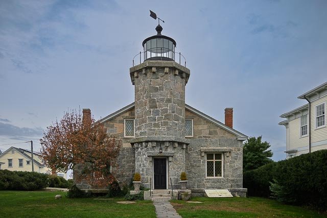
St. Marks Lighthouse The St. Marks Light is the second-oldest light station in Florida. The structure consists of the light keeper’s house attached to the 88 – foot tower, both resting on a 12- foot thick limestone base. According to local legend, the limestone blocks are from the ruins of old Fort San Marcos de Apalachee. There are 85 spiral steps that extend up brick tower to the lantern room; the first 72 are wood and the last thirteen are iron. The tower walls are four feet thick at the base, tapering to 18 inches at the top. From 1867 until 2014 the lantern room contained a fourth order Fresnel lens. Over the years, oil, kerosene, and electricity have powered the lamp which can be seen in the range of 12 – 14 miles, depending on light conditions. The St. Marks Lighthouse tower has always been white with a black lantern top. The keeper’s house has four- foot thick brick walls with twelve windows and two chimneys. Two exterior doors open onto the long covered porch. Where it is: St Marks Lighthouse is located on the east side of the mouth of the St. Marks River, on Apalachee Bay in the St. Marks National Wildlife Refuge. The Refuge’s Visitor Center and administrative office is located about 25 miles south of Tallahassee, FL. From Tallahassee, take SR 363 (Woodville Hwy) to Wakulla. Turn left (east) on SR 267 (Bloxham Cutoff). At US 98 (Coastal Hwy), turn left (east) and cross the St. Marks River. Turn right on Lighthouse Road (CR 59) and drive 3 miles to the Visitor Center/Office.  Continue for about 8 miles to the Lighthouse. Maps: Interactive Google Map Use the map  + – controls to zoom in and out, click and drag the to move the map, use the Map drop-down to change to “Map”, “Satellite”, “Hybrid”, or “Terrain” views.  Drag the little man icon from the upper left corner to a map location for street level view. GPS: 30°4’27.264″ N 84°10’46.53″ W Cost: $1 per bike/pedestrian $5 per vehicle $25 for annual refuge pass Federal Recreation Fee Passes are honored Hours: St. Marks is a Daylight Use Only refuge. The gates open at 6:00 a.m. and close at approximately at sunset, the actual time varying slightly with the season. Visitor Center and Administrative Office Monday – Friday 8 am – 4 pm Saturday and Sunday 10 am – 5 pm St. Marks Lighthouse Subject to change. Check the Events or call the Visitor Center, 850-925-6121, for latest schedule. Facilities: Food & Lodging – there is no place on the refuge to buy food or stay overnight, but picnic tables, drinking water. Restrooms are located inside the Visitor Center and at Tower Pond Trail. Location Contact Information: St. Marks National Wildlife Refuge (850) 925-6121 1255 Lighthouse RoadSt. Marks,FL32355   St. Marks Lighthouse Photo Gallery Click Here for full page gallery   More Photographic Destinations in Florida Interactive Google Map Use the map  + – controls to zoom in and out, use the Map drop-down to change to “Map”, “Satellite”, “Hybrid”, or “Terrain” views.  Drag the little man icon from the upper left corner to a map location for street level view. Click on a pushpin for more information about the Photographic Destination, then click on the title to go to the location page. Click Here for Photographic Destinations by State    All the information in this post was believed to be accurate at the time it was published.  Please be sure to double check with the location before relying on this information as everything changes over time, especially hours, prices, and whether the location is still open.   Great Places for Great Photos   Let me help you to find a great location for your next photography adventure.  I will list many lesser-known destinations, as well as the famous "Icon Locations" for photography.  I will provide photos (Lots of Photos), location information, consisting of what there is to photograph as well as other information about the destination.  I will give costs, maps, directions, contact information, and other essential information for a successful photo trip.  I will only post for locations that I have personally photographed to ensure a quality guide to great locations for photography. If you know of great places that are not posted, please send me the details, I may just decide that is a place I need to go!     Greg Disch is a freelance photographer located in Arkansas. Greg specializes in nature, scenic, wildlife, and other outdoor subjects in Arkansas and other areas of the country.  Most of the images on this site are available for sale as prints, personal use, or rights managed stock photos. Greg offers both classroom instruction and in the field hands on photographic workshops. Classroom sessions are normally held in Fort Smith Arkansas, but arrangements can be made to bring a class to your group. All classes and workshops have small class sizes designed to provide an optimum student to instructor ratio, where you can get the personal attention, you need.  Most classes and workshops are limited to a maximum of six participants and will be held with a minimum of only two. If you are looking for a wonderful opportunity to get personal individual instruction, I do private workshops and classes at a location of your choice, whether doing a location photo shoot, coming to your home or business, traveling across the country on a road trip, or at my classroom.  This is a fantastic way to learn digital workflow and be sure that your computer equipment is properly configured for optimum performance. [...]Read more...
St. Augustine Lighthouse The St. Augustine Light Station is a privately maintained aid to navigation and an active, working lighthouse in St. Augustine, Florida. The current lighthouse stands at the north end of Anastasia Island and was built between 1871 and 1874. The tower is the second lighthouse tower in St. Augustine, the first being lit officially by the American territorial government in May 1824 as Florida’s first lighthouse. In 1980, a small group of 15 women in the Junior Service League of St. Augustine (JSL) signed a 99-year lease with the county for the keeper’s house and surrounding grounds and began a massive restoration project. Shortly after the JSL adopted the restoration, the League signed a 30-year lease with the Coast Guard to begin a restoration effort on the lighthouse tower itself. The lighthouse was subsequently placed on the National Register of Historic Places in 1981 due to the efforts of local preservationist and author Karen Harvey. In 1994, the Lighthouse Museum of St. Augustine opened full-time to the public. A community-based board of trustees was created in 1998. The men and women of the volunteer board are charged with holding the site in trust for future generations. In 2002, under the direction of current Executive Director Kathy Fleming, ownership of the tower and historic Fresnel lens was transferred from the U.S. Coast Guard through the General Services Administration and the National Park Service to the St. Augustine Lighthouse and Museum, Inc. This was the first such transfer of a U.S. lighthouse to a non-profit organization. The Museum keeps the light burning as a private aid-to-navigation. In 2016 the museum changed its name to the St. Augustine Lighthouse & Maritime Museum. Where it is: Directions: From I-95, exit at Route 207 and take that into the City of St. Augustine. The 207 ends at Route 1, continue north on 1. Then take Route 214 east to A1A. From here, follow A1A until Busam Street. Followed Busam Street to Lighthouse Ave. From here you can park in the lot to visit the St. Augustine Lighthouse. GPS Address: 100 Red Cox Drive St. Augustine FL 32080   Maps: Interactive Google Map Use the map  + – controls to zoom in and out, click and drag the to move the map, use the Map drop-down to change to “Map”, “Satellite”, “Hybrid”, or “Terrain” views.  Drag the little man icon from the upper left corner to a map location for street level view. GPS: 29°53’7.2535″ N 81°17’17.3458″ W Cost: Adult $14.95 Senior (60 & over) $12.95 Child (12 & under and over 44″ tall) $12.95 Child under 44″ tall (cannot climb tower) FREE Hours: Open daily from 9:00 AM to 6:00 PM. Closed Thanksgiving Day and Christmas Day. We close at 3:00 PM on Christmas Eve. Facilities: Restrooms and gift shop.   Location Contact Information: St. Augustine Lighthouse & Maritime Museum (904) 829-0745 Anastasia Island 100 Red Cox Road, St. Augustine, FL 32080 Mailing Address: 81 Lighthouse Avenue St. Augustine, Florida 32080 info@staugustinelighthouse.org   St. Augustine Lighthouse Photo Gallery Click Here for full page gallery   More Photographic Destinations in Florida Interactive Google Map Use the map  + – controls to zoom in and out, use the Map drop-down to change to “Map”, “Satellite”, “Hybrid”, or “Terrain” views.  Drag the little man icon from the upper left corner to a map location for street level view. Click on a pushpin for more information about the Photographic Destination, then click on the title to go to the location page. Click Here for Photographic Destinations by State    All the information in this post was believed to be accurate at the time it was published.  Please be sure to double check with the location before relying on this information as everything changes over time, especially hours, prices, and whether the location is still open.   Great Places for Great Photos   Let me help you to find a great location for your next photography adventure.  I will list many lesser-known destinations, as well as the famous "Icon Locations" for photography.  I will provide photos (Lots of Photos), location information, consisting of what there is to photograph as well as other information about the destination.  I will give costs, maps, directions, contact information, and other essential information for a successful photo trip.  I will only post for locations that I have personally photographed to ensure a quality guide to great locations for photography. If you know of great places that are not posted, please send me the details, I may just decide that is a place I need to go!     Greg Disch is a freelance photographer located in Arkansas. Greg specializes in nature, scenic, wildlife, and other outdoor subjects in Arkansas and other areas of the country.  Most of the images on this site are available for sale as prints, personal use, or rights managed stock photos. Greg offers both classroom instruction and in the field hands on photographic workshops. Classroom sessions are normally held in Fort Smith Arkansas, but arrangements can be made to bring a class to your group. All classes and workshops have small class sizes designed to provide an optimum student to instructor ratio, where you can get the personal attention, you need.  Most classes and workshops are limited to a maximum of six participants and will be held with a minimum of only two. If you are looking for a wonderful opportunity to get personal individual instruction, I do private workshops and classes at a location of your choice, whether doing a location photo shoot, coming to your home or business, traveling across the country on a road trip, or at my classroom.  This is a fantastic way to learn digital workflow and be sure that your computer equipment is properly configured for optimum performance. [...]Read more...
  St George Island Lighthouse The first lighthouse on St. George Island was erected in 1833 near the island’s western tip. It marked the narrow entrance to Apalachicola Bay at West Pass between St. George Island and St. Vincent Island.  In 1847 Congress appropriated $8,000 for a new lighthouse on the cape, 2 miles southeast of the original site.  A hurricane in the fall of 1850 undermined it, and the fourth hurricane of the 1851 Atlantic hurricane season toppled the tower in August of that year.  The Cape St. George lighthouse was rebuilt in 1851–52, 250 yards inland from its previous site; construction was hastened by the salvage and re-use of two thirds of the bricks of the ruined tower. In 1995 Hurricane Opal washed away much of the sand around the tower, shifted it partially off its pilings and rotated it, leaving it leaning about 10° from vertical. In 1998 the tower was further damaged by Hurricane Georges. The tower was righted and a new foundation built under it in 2002. However, the base was still exposed to surf, and the new foundation began deteriorating. On Friday, October 21, 2005, the Cape St. George Light collapsed into the Gulf of Mexico. On Monday, December 1, 2008, the reconstructed lighthouse was opened to the public. First built in 1833 and rebuilt in 1848 and 1852 on what is now Little St. George Island, the Light finally succumbed to beach erosion and pounding waves. Working with state and federal government support, the St. George Lighthouse Association spearheaded the effort to salvage the pieces of the Light. Volunteers cleaned the mortar off thousands of the old bricks. The original plans were obtained from the National Archives in Washington, D.C. and the lighthouse was reconstructed on St. George Island, using as much of the original materials as possible. Construction of a replica of the original keeper’s house was begun next to the lighthouse in the fall of 2009. The two story brick building was opened in the summer of 2011 and houses a museum which tells the story of the lighthouse and its keepers and a gift shop that offers visitors the opportunity to take home a memento of their visit to the historic lighthouse Where it is: The Cape St. George Light is located in St. George Lighthouse Park at the center of St. George Island, where Island Drive (the road off the bridge) ends at Gulf Beach Drive. Parking is available in lots at either side of the park.   Maps: Interactive Google Map Use the map  + – controls to zoom in and out, click and drag the to move the map, use the Map drop-down to change to “Map”, “Satellite”, “Hybrid”, or “Terrain” views.  Drag the little man icon from the upper left corner to a map location for street level view. GPS: 29.663060°N 84.862702°W Cost:   Lighthouse Climbing Fees Adults age 13+ – $5.00 Youth age 7 to 12 – $3.00 Children age 6 and under – No Charge U.S Military Personnel or Veterans with ID – $3.00 Members of the St. George Lighthouse Association – No Charge Florida Lighthouse Association – No Charge St. Augustine Lighthouse & Museum – No Charge Group Rates Twelve or more people who make advance reservations. Adults – $3.00 Youth – $2.00 No Charge for entry to the Gift Shop and Museum or Free Climbing Day held annually in April each year. Hours: Fall/Winter Hours November 1 – February 28 Mon, Tues, Wed, Fri, Sat: Noon – 5 PM Sun: Noon – 5 PM Thurs: Closed Spring/Summer Hours of Operation March 1 – October 31 Mon, Tues, Wed, Fri, Sat: 10 AM – 5 PM Sun: Noon – 5 PM Thurs: Closed Facilities: Restrooms are on location along with museum and gift shop. Location Contact Information:  Cape St. George Lighthouse, Museum & Gift Shop 2B East Gulf Beach Drive St. George Island, Florida 32328 850-927-7745 info@stgeorgelight.org St George Island Lighthouse Photo Gallery Click Here for full page gallery   More Photographic Destinations in Florida Interactive Google Map Use the map  + – controls to zoom in and out, use the Map drop-down to change to “Map”, “Satellite”, “Hybrid”, or “Terrain” views.  Drag the little man icon from the upper left corner to a map location for street level view. Click on a pushpin for more information about the Photographic Destination, then click on the title to go to the location page. Click Here for Photographic Destinations by State    All the information in this post was believed to be accurate at the time it was published.  Please be sure to double check with the location before relying on this information as everything changes over time, especially hours, prices, and whether the location is still open.   Great Places for Great Photos   Let me help you to find a great location for your next photography adventure.  I will list many lesser-known destinations, as well as the famous "Icon Locations" for photography.  I will provide photos (Lots of Photos), location information, consisting of what there is to photograph as well as other information about the destination.  I will give costs, maps, directions, contact information, and other essential information for a successful photo trip.  I will only post for locations that I have personally photographed to ensure a quality guide to great locations for photography. If you know of great places that are not posted, please send me the details, I may just decide that is a place I need to go!     Greg Disch is a freelance photographer located in Arkansas. Greg specializes in nature, scenic, wildlife, and other outdoor subjects in Arkansas and other areas of the country.  Most of the images on this site are available for sale as prints, personal use, or rights managed stock photos. Greg offers both classroom instruction and in the field hands on photographic workshops. Classroom sessions are normally held in Fort Smith Arkansas, but arrangements can be made to bring a class to your group. All classes and workshops have small class sizes designed to provide an optimum student to instructor ratio, where you can get the personal attention, you need.  Most classes and workshops are limited to a maximum of six participants and will be held with a minimum of only two. If you are looking for a wonderful opportunity to get personal individual instruction, I do private workshops and classes at a location of your choice, whether doing a location photo shoot, coming to your home or business, traveling across the country on a road trip, or at my classroom.  This is a fantastic way to learn digital workflow and be sure that your computer equipment is properly configured for optimum performance. [...]Read more...
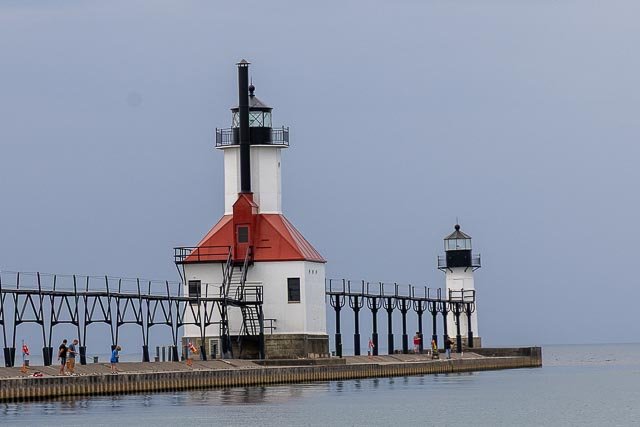
Sherwood Point Lighthouse Built in 1883 and automated 100 years later in 1983, Sherwood Point Lighthouse was the last lighthouse to be automated on the Great Lakes. The lighthouse, which is still an active navigation aide, and its grounds are closed to the public, but the lighthouse can be seen from across the water at Olde Stone Quarry County Park. There are some boat tours operating out of Sturgeon Bay which take visitors up close for viewing and photography from mid-May to mid-October. Situated on the west side of the north entrance to Sturgeon Bay, it was listed in the National Register of Historic Places in 1984. It is both the last Door County lighthouse to be automated and the last manned lighthouse on the Great Lakes. Where it is: The Sherwood Point lighthouse is located near Idlewild in Door County, Wisconsin. From Highway 42 south of Sturgeon Bay, take Idlewild Road/County Road M north for just over seven miles, and then turn left onto Sherwood Point Road. Sherwood Point Lighthouse is located at the end of the road. Maps: Interactive Google Map Use the map  + – controls to zoom in and out, click and drag the to move the map, use the Map drop-down to change to “Map”, “Satellite”, “Hybrid”, or “Terrain” views.  Drag the little man icon from the upper left corner to a map location for street level view. GPS: 44°53’33.1507″ N 87°26’0.3956″ W Cost: The lighthouse is not open to the public. Hours: The lighthouse is owned by the Coast Guard.  The station is open to the public every year during the annual Door County Lighthouse Walk which is held in mid May every year.   Facilities: There are no public facilities.   Location Contact Information: Sherwood Point Nasewaupee, WI 54235   Sherwood Point Lighthouse Photo Gallery Click Here for full page gallery   More Photographic Destinations in Wisconsin Interactive Google Map Use the map  + – controls to zoom in and out, use the Map drop-down to change to “Map”, “Satellite”, “Hybrid”, or “Terrain” views.  Drag the little man icon from the upper left corner to a map location for street level view. Click on a pushpin for more information about the Photographic Destination, then click on the title to go to the location page. Click Here for Photographic Destinations by State    All the information in this post was believed to be accurate at the time it was published.  Please be sure to double check with the location before relying on this information as everything changes over time, especially hours, prices, and whether the location is still open.   Great Places for Great Photos   Let me help you to find a great location for your next photography adventure.  I will list many lesser-known destinations, as well as the famous "Icon Locations" for photography.  I will provide photos (Lots of Photos), location information, consisting of what there is to photograph as well as other information about the destination.  I will give costs, maps, directions, contact information, and other essential information for a successful photo trip.  I will only post for locations that I have personally photographed to ensure a quality guide to great locations for photography. If you know of great places that are not posted, please send me the details, I may just decide that is a place I need to go!     Greg Disch is a freelance photographer located in Arkansas. Greg specializes in nature, scenic, wildlife, and other outdoor subjects in Arkansas and other areas of the country.  Most of the images on this site are available for sale as prints, personal use, or rights managed stock photos. Greg offers both classroom instruction and in the field hands on photographic workshops. Classroom sessions are normally held in Fort Smith Arkansas, but arrangements can be made to bring a class to your group. All classes and workshops have small class sizes designed to provide an optimum student to instructor ratio, where you can get the personal attention, you need.  Most classes and workshops are limited to a maximum of six participants and will be held with a minimum of only two. If you are looking for a wonderful opportunity to get personal individual instruction, I do private workshops and classes at a location of your choice, whether doing a location photo shoot, coming to your home or business, traveling across the country on a road trip, or at my classroom.  This is a fantastic way to learn digital workflow and be sure that your computer equipment is properly configured for optimum performance. [...]Read more...
  Sanibel Island Lighthouse In 2022, Hurricane Ian severely damaged the station, destroying both keeper’s houses and all of the remaining outbuildings. The tower lost one leg, but was still standing as of September 29, 2022. The Sanibel Island Light or Point Ybel Light was one of the first lighthouses on Florida’s Gulf coast north of Key West and the Dry Tortugas. The light, 98-foot above sea level, on an iron skeleton tower was first lit on August 20, 1884 and has a central spiral staircase beginning about 10 feet above the ground. It is located on the eastern tip of Sanibel Island, and was built to mark the entrance to San Carlos Bay for ships calling at the port of Punta Rassa, across San Carlos Bay from Sanibel Island. The grounds are open to the public, but the lighthouse itself is not. Residents of Sanibel Island first petitioned for a lighthouse in 1833, but no action was taken. In 1856 the Lighthouse Board recommended a lighthouse on Sanibel Island, but Congress took no action. In 1877 government workers surveyed the eastern end of the island and reserved it for a lighthouse. Congress finally appropriated funds for a lighthouse in 1883. The foundation for the new lighthouse was completed in early 1884, but the ship bringing ironwork for the tower sank two miles from Sanibel Island. A crew of hard-hat divers from Key West recovered all but two of the pieces for the tower. Punta Rassa became an important port in the 1830s and remained so up to the Spanish–American War. It was primarily used to ship cattle from Florida to Cuba. Until the railroads reached the area in the 1880s, ranchers drove their cattle from open ranges in central Florida to Punta Rassa for shipment to Cuba. The lighthouse was placed on the National Register of Historic Places in 1974. The City of Sanibel now owns the Point Ybel tract and structures, although the tower is still operational under U.S. Coast Guard control.   Where it is: The Lighthouse is located 110 Periwinkle Way, Sanibel, FL 33957 in Lighthouse Beach Park owned by the city of Sanibel Florida. From Interstate 75 just south of Fort Myers, take Exit 131 (Daniels Parkway) west to Summerlin Road. Follow Summerlin Road to the Sanibel Causeway, which requires a toll. Drive across the causeway onto Sanibel Island. At the four-way stop sign turn left on Periwinkle Way and follow it to the eastern end of the island, where you will find signs to guide you to metered parking for Sanibel Lighthouse.   Maps: Interactive Google Map Use the map  + – controls to zoom in and out, click and drag the to move the map, use the Map drop-down to change to “Map”, “Satellite”, “Hybrid”, or “Terrain” views.  Drag the little man icon from the upper left corner to a map location for street level view. GPS: 26.4530301178751, -82.01426872691904 Cost: Parking fee of 5.00 per hour 24 hours per day. Hours: Open 24 hours per day. Facilities: Temporally closed due to Hurricane Ivan in 2022 Handicapped Accessible (Free Handicapped Parking) Acreage = 44.77 152 Parking Spaces with Limited RV parking spaces Bike Racks Outside Showers Drinking Fountains Restrooms Picnic Areas Barbecue Grills Shade Pavilion Information Kiosks Fishing Pier Location Contact Information: Located in: Lighthouse Beach Park Address: 112 Periwinkle Way, Sanibel, FL 33957 Phone: (239) 472-3700 Sanibel Island Lighthouse Photo Gallery Click Here for full page gallery   More Photographic Destinations in Florida Interactive Google Map Use the map  + – controls to zoom in and out, use the Map drop-down to change to “Map”, “Satellite”, “Hybrid”, or “Terrain” views.  Drag the little man icon from the upper left corner to a map location for street level view. Click on a pushpin for more information about the Photographic Destination, then click on the title to go to the location page. Click Here for Photographic Destinations by State    All the information in this post was believed to be accurate at the time it was published.  Please be sure to double check with the location before relying on this information as everything changes over time, especially hours, prices, and whether the location is still open.   Great Places for Great Photos   Let me help you to find a great location for your next photography adventure.  I will list many lesser-known destinations, as well as the famous "Icon Locations" for photography.  I will provide photos (Lots of Photos), location information, consisting of what there is to photograph as well as other information about the destination.  I will give costs, maps, directions, contact information, and other essential information for a successful photo trip.  I will only post for locations that I have personally photographed to ensure a quality guide to great locations for photography. If you know of great places that are not posted, please send me the details, I may just decide that is a place I need to go!     Greg Disch is a freelance photographer located in Arkansas. Greg specializes in nature, scenic, wildlife, and other outdoor subjects in Arkansas and other areas of the country.  Most of the images on this site are available for sale as prints, personal use, or rights managed stock photos. Greg offers both classroom instruction and in the field hands on photographic workshops. Classroom sessions are normally held in Fort Smith Arkansas, but arrangements can be made to bring a class to your group. All classes and workshops have small class sizes designed to provide an optimum student to instructor ratio, where you can get the personal attention, you need.  Most classes and workshops are limited to a maximum of six participants and will be held with a minimum of only two. If you are looking for a wonderful opportunity to get personal individual instruction, I do private workshops and classes at a location of your choice, whether doing a location photo shoot, coming to your home or business, traveling across the country on a road trip, or at my classroom.  This is a fantastic way to learn digital workflow and be sure that your computer equipment is properly configured for optimum performance. [...]Read more...
  Sand Island Lighthouse Considered by many to be one of the most beautiful lighthouses on Lake Superior, the structure was built from sandstone quarried right at the building site. The design of the lighthouse was influenced by the Gothic style, popular during the Victorian period. The light tower begins as a square rising from the northwest corner of the dwelling, then gracefully flows into an octagon surmounted by the lantern and walkway. Carved wood trim decorates the steeply sloped gable end of the quarters. A fourth-order Fresnel lens produced a fixed white light from the top of the 44-foot tall tower. Sand Island lighthouse, near the western end of the Apostle Island chain, was occupied for a shorter period than any of the archipelago’s other lights. Built in 1881, it was the first of the group to be automated, in 1921. Sand Island light had only two principal keepers: Charles Lederle, from 1881-1891, and Emmanuel Luick, from 1892-1920. In 1885, Lederle gained praise for his daring rescue of the crew from the steamer Prussia. Spotting the burning ship, he rowed a small boat several miles out on the open lake, and rescued the entire crew. Luick also witnessed a shipwreck at close hand, but could do nothing to assist the victims. During a fierce September storm in 1905, he could only watch from the tower as the freighter Sevona broke apart near shore. Seven sailors, including the ship’s captain, drowned. The keepers at Sand Island were not as isolated from civilization as those at other Apostle Islands lights. During the years the light was staffed, Sand Island supported a small, year-round community of farmers and fishermen. The keepers and their families often walked or rowed two miles to visit neighbors and participate in social events. In 1921, the Lighthouse Service installed an acetylene light atop the tower, designed to run without need for daily attendance. Keepers from nearby Raspberry Island kept an eye on the beacon to make sure it was operating properly, and changed the fuel tanks when they emptied. Meanwhile, Keeper Luick moved to the lighthouse at Grand Marais, Minnesota, to finish his long career. His former home did not stay vacant long, however; for much of the 1920s and 30s, the Lighthouse Service rented the building to Gertrude Wellisch, a Minnesota schoolteacher who used it as a summer retreat. Ms Wellisch and a later tenant carried out critical maintenance and repairs, helping to preserve the historic structure. The station’s lamp was moved twice during the years of automation. The Lighthouse Service erected a 50-foot steel tower in front of the stone building some time around 1933, and placed the acetylene apparatus atop it. The beacon stood outside the lighthouse for more than half a century, but in 1985, the Coast Guard returned the signal to its historic home and removed the metal tower. Once again, the light shines from the tower in this jewel of the Apostles. Where it is: The Sand Island Light is a lighthouse located on the northern tip of Sand Island, one of the Apostle Islands, in Lake Superior in Bayfield County, Wisconsin, near the city of Bayfield. Close to the mainland, Sand Island is a popular destination for intermediate-level sea kayakers and private boaters who are prepared for the challenges of Lake Superior. There is no dock at the lighthouse, but nearby rock ledges and beaches may provide access in favorable weather conditions. Most of the Apostle Islands light stations may be reached on the Apostle Islands Cruise Service water taxi or by private boat during the summer. During the Annual Apostle Island Lighthouse Celebration ferry tour service is available for all the lighthouses. Maps: Interactive Google Map Use the map  + – controls to zoom in and out, click and drag the to move the map, use the Map drop-down to change to “Map”, “Satellite”, “Hybrid”, or “Terrain” views.  Drag the little man icon from the upper left corner to a map location for street level view. GPS: 47°0’12.732″ N 90°56’18.234″ W Cost: Apostle Islands National Lakeshore does not charge an entrance fee, but does have expanded amenity fees. These fees apply to overnight docking, parking at Meyer’s Beach Road, lighthouse tours, and camping.   Hours: In the summer season, National Park Service volunteers provide tours of the lighthouse, usually during the hours of 12:00 noon and 4:00 pm. Facilities: There are no facilities available on Sand Island Location Contact Information: Apostle Islands National Lakeshore 415 Washington Ave Bayfield, WI 54814 Park Main Line: 715-779-3398 General Information: ext 0 Visitor and Camping information: ext 2 Ice Line (from late-November to March): ext 3 Northern Great Lakes Visitor Center: 715-685-9983 Fax 715-779-3049     Sand Island Lighthouse Photo Gallery Click Here for full page gallery   More Photographic Destinations in Wisconsin Interactive Google Map Use the map  + – controls to zoom in and out, use the Map drop-down to change to “Map”, “Satellite”, “Hybrid”, or “Terrain” views.  Drag the little man icon from the upper left corner to a map location for street level view. Click on a pushpin for more information about the Photographic Destination, then click on the title to go to the location page. Click Here for Photographic Destinations by State    All the information in this post was believed to be accurate at the time it was published.  Please be sure to double check with the location before relying on this information as everything changes over time, especially hours, prices, and whether the location is still open.   Great Places for Great Photos   Let me help you to find a great location for your next photography adventure.  I will list many lesser-known destinations, as well as the famous "Icon Locations" for photography.  I will provide photos (Lots of Photos), location information, consisting of what there is to photograph as well as other information about the destination.  I will give costs, maps, directions, contact information, and other essential information for a successful photo trip.  I will only post for locations that I have personally photographed to ensure a quality guide to great locations for photography. If you know of great places that are not posted, please send me the details, I may just decide that is a place I need to go!     Greg Disch is a freelance photographer located in Arkansas. Greg specializes in nature, scenic, wildlife, and other outdoor subjects in Arkansas and other areas of the country.  Most of the images on this site are available for sale as prints, personal use, or rights managed stock photos. Greg offers both classroom instruction and in the field hands on photographic workshops. Classroom sessions are normally held in Fort Smith Arkansas, but arrangements can be made to bring a class to your group. All classes and workshops have small class sizes designed to provide an optimum student to instructor ratio, where you can get the personal attention, you need.  Most classes and workshops are limited to a maximum of six participants and will be held with a minimum of only two. If you are looking for a wonderful opportunity to get personal individual instruction, I do private workshops and classes at a location of your choice, whether doing a location photo shoot, coming to your home or business, traveling across the country on a road trip, or at my classroom.  This is a fantastic way to learn digital workflow and be sure that your computer equipment is properly configured for optimum performance. [...]Read more...
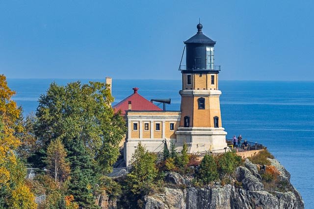
Sabine Pass Lighthouse The Sabine Pass Lighthouse, or Sabine Pass Light as it was referred to by the United States Coast Guard, is a historic lighthouse, as part of a gulf coast light station, on the Louisiana side of the Sabine River, in Cameron Parish, across from the community of Sabine Pass, Texas. It was first lit in 1857 and was deactivated by the Coast Guard in 1952. One of only three built in the United States of similar design, the light was listed on the National Register of Historic Places as “Sabine Pass Lighthouse” on December 17, 1981. After years of being passed between various federal and state agencies, the surviving structure was sold at auction in 1985 to a pair of businessmen who had plans to build a marina or restaurant featuring the tower. These plans were never realized, and in 2001 they donated it to the Cameron Preservation Alliance, which has constructed a road to the abandoned and decaying tower, This preservation group has plans to make the 42-acre property into a parish historical museum. Cheniere Energy has built an LNG terminal with an improved gravel road passing the plant and ending at the lighthouse property, Historical Information: Designed and built by Captain Leadbetter. Considered to be a “sister” lighthouse to Aransas Pass, Timbalier & Barataria towers. 1861 – Extinguished by the Confederates. January, 1862 – The lamps, lens and clockwork were dismantled and crated for storage. April, 1863 – Union forces attacked twice, and damaged the lens. June, 1886 – Storm created an 8-foot tide which surrounded the tower with 5-feet of water. All the buildings on the site, except the lighthouse itself, were washed away. 1915 – A powerful hurricane caused the tower to vibrate, thus putting the clockworks out of order. The keepers had to turn the revolving lens by hand. 1952 – The lighthouse was discontinued and sometime during the next two years was transferred to the State of Louisiana. 1986 – The property was transferred into private hands. Where it is: The Sabine Pass Lighthouse is on private property and must be accessed by using Lighthouse Road which travels through Cheniere LNG Terminal. You must check in at the Cheniere Energy entrance to visit the lighthouse.  You must contact the Cameron Parish Library Branch at Johnson Bayou 4586 Gulf Beach Hwy, Cameron, LA 70631  (337) 569-2892 to get on the visitors’ list. You can drive to the lighthouse, but you may need a four-wheel drive if it has recently rained. If you visit at high tide there will be several inches of water surrounding the lighthouse, plan on having some wading boots. Maps: Interactive Google Map Use the map  + – controls to zoom in and out, click and drag the to move the map, use the Map drop-down to change to “Map”, “Satellite”, “Hybrid”, or “Terrain” views.  Drag the little man icon from the upper left corner to a map location for street level view. GPS: 29°42’59.502″ N 93°51’0.432″ W Cost: The lighthouse has free admission and you don’t need to get tickets in advance. Hours: There are no set hours to visit the lighthouse. Facilities: There are no facilities available at the lighthouse. Location Contact Information: Cameron Parish Library Branch at Johnson Bayou 4586 Gulf Beach Hwy, Cameron, LA 70631 337-569-2892 Monday – Thursday 9AM to 5PM Friday 8AM to 4PM Sabine Pass Lighthouse Photo Gallery Click Here for full page gallery   More Photographic Destinations in Louisiana Interactive Google Map Use the map  + – controls to zoom in and out, use the Map drop-down to change to “Map”, “Satellite”, “Hybrid”, or “Terrain” views.  Drag the little man icon from the upper left corner to a map location for street level view. Click on a pushpin for more information about the Photographic Destination, then click on the title to go to the location page. Click Here for Photographic Destinations by State    All the information in this post was believed to be accurate at the time it was published.  Please be sure to double check with the location before relying on this information as everything changes over time, especially hours, prices, and whether the location is still open.   Great Places for Great Photos   Let me help you to find a great location for your next photography adventure.  I will list many lesser-known destinations, as well as the famous "Icon Locations" for photography.  I will provide photos (Lots of Photos), location information, consisting of what there is to photograph as well as other information about the destination.  I will give costs, maps, directions, contact information, and other essential information for a successful photo trip.  I will only post for locations that I have personally photographed to ensure a quality guide to great locations for photography. If you know of great places that are not posted, please send me the details, I may just decide that is a place I need to go!     Greg Disch is a freelance photographer located in Arkansas. Greg specializes in nature, scenic, wildlife, and other outdoor subjects in Arkansas and other areas of the country.  Most of the images on this site are available for sale as prints, personal use, or rights managed stock photos. Greg offers both classroom instruction and in the field hands on photographic workshops. Classroom sessions are normally held in Fort Smith Arkansas, but arrangements can be made to bring a class to your group. All classes and workshops have small class sizes designed to provide an optimum student to instructor ratio, where you can get the personal attention, you need.  Most classes and workshops are limited to a maximum of six participants and will be held with a minimum of only two. If you are looking for a wonderful opportunity to get personal individual instruction, I do private workshops and classes at a location of your choice, whether doing a location photo shoot, coming to your home or business, traveling across the country on a road trip, or at my classroom.  This is a fantastic way to learn digital workflow and be sure that your computer equipment is properly configured for optimum performance. [...]Read more...
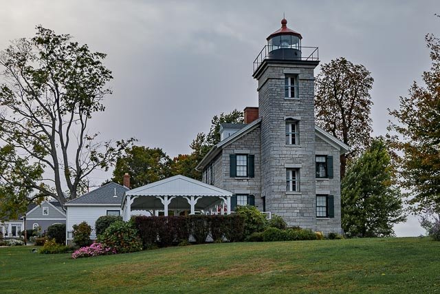
  Round Island Lighthouse Round Island Lighthouse stood from 1859 to 1998 on the southwest end of Round Island in the Mississippi Sound, 4 miles south of Pascagoula, Mississippi. In September 1998, the lighthouse was toppled by Hurricane Georges. In 2010, the base of the structure and other lighthouse remnants were removed from Round Island and relocated within the City of Pascagoula for restoration. In 1833, the United States Lighthouse Board contracted for construction of a lighthouse on Round Island in the Mississippi Sound. By 1854, the Lighthouse Board determined that the structure was poorly built and was too close to the water, which eroded the foundation. Construction of a second lighthouse along with a keeper’s dwelling was contracted and completed in 1859 at a cost of $7,130.97.  The 1859 tower stood 50 feet tall with a focal plane of 44 feet above sea level and had a visible range of 10 to 12 nautical miles; 19 to 23 kilometres (12 to 14 mi) from a fourth order Fresnel lens. During the American Civil War (1861-1865), the Fresnel lens was removed from Round Island Lighthouse by Confederate soldiers and transported to Montgomery, Alabama for safekeeping. Round Island Lighthouse was automated in 1944 but was deactivated 5 years later. After deactivation, the U.S. Coast Guard maintained the lighthouse as a day beacon, without illumination, through 1954. In 1955, the lighthouse, dwelling, pier, and outbuildings were declared excess property by the General Services Administration. Through the years, the lighthouse suffered from vandalism, disrepair, and wave erosion. In 1986, the lighthouse and approximately 50 acres of land were deeded to the City of Pascagoula by the Bureau of Land Management. The lighthouse was added the National Register of Historic Places on October 9, 1986. In September 1998, Round Island Lighthouse was toppled by Hurricane Georges. Plans were made to rebuild the lighthouse at its original location on Round Island, and construction was initiated. However, in August 2005, rebuilding efforts ended when Hurricane Katrina destroyed the partially reconstructed lighthouse. Because of the precarious location on Round Island, that exposed the lighthouse to erosion and destruction from future storms, the Pascagoula City Council made a decision to rebuild the lighthouse within the City of Pascagoula, using as much of the original construction materials as could be salvaged from the island. As of 2012, the original base of the lighthouse and the restored lantern gallery had been secured at their new location, just south of U.S. Route 90 in Pascagoula. By July 2014, the exterior of the lighthouse had been restored and topped with the original lantern gallery. Where it is: Pascagoula Mississippi, take Highway 90 to the east side of the Pascagoula River, and you will see the restored lighthouse on the south side of the road near the intersection with Pascagoula Street. Lighthouse Park: 815 Cypress Avenue, Pascagoula MS 39567   Maps: Interactive Google Map Use the map  + – controls to zoom in and out, click and drag the to move the map, use the Map drop-down to change to “Map”, “Satellite”, “Hybrid”, or “Terrain” views.  Drag the little man icon from the upper left corner to a map location for street level view. GPS: 30°22’14.004″ N 88°33’22.044″ W Cost: Tours are available 10am to 5pm on Fridays and Saturdays. Part of the Pascagoula Area Attractions Pass which offers admission to the Round Island Lighthouse, Grand Bay NERR, LaPointe-Krebs House and Museum, Pascagoula River Audubon Center, Scranton Museum, and Scranton Nature Center for $14 (adults) and $8 (children). Hours: The lighthouse is open for tours from 10 a.m. to 5 p.m. on Fridays and Saturdays. The lighthouse is owned by the City of Pascagoula. Grounds open, tower closed. Facilities: There are facilities at the location. Location Contact Information: City of Pascagoula Mississippi 603 Watts Avenue P.O. Drawer 908 Pascagoula, MS 39568 Phone:  228-762-1020 Fax:  228-938-6749 Round Island Lighthouse Photo Gallery Click Here for full page gallery   More Photographic Destinations in Mississippi Interactive Google Map Use the map  + – controls to zoom in and out, use the Map drop-down to change to “Map”, “Satellite”, “Hybrid”, or “Terrain” views.  Drag the little man icon from the upper left corner to a map location for street level view. Click on a pushpin for more information about the Photographic Destination, then click on the title to go to the location page. Click Here for Photographic Destinations by State    All the information in this post was believed to be accurate at the time it was published.  Please be sure to double check with the location before relying on this information as everything changes over time, especially hours, prices, and whether the location is still open.   Great Places for Great Photos   Let me help you to find a great location for your next photography adventure.  I will list many lesser-known destinations, as well as the famous "Icon Locations" for photography.  I will provide photos (Lots of Photos), location information, consisting of what there is to photograph as well as other information about the destination.  I will give costs, maps, directions, contact information, and other essential information for a successful photo trip.  I will only post for locations that I have personally photographed to ensure a quality guide to great locations for photography. If you know of great places that are not posted, please send me the details, I may just decide that is a place I need to go!     Greg Disch is a freelance photographer located in Arkansas. Greg specializes in nature, scenic, wildlife, and other outdoor subjects in Arkansas and other areas of the country.  Most of the images on this site are available for sale as prints, personal use, or rights managed stock photos. Greg offers both classroom instruction and in the field hands on photographic workshops. Classroom sessions are normally held in Fort Smith Arkansas, but arrangements can be made to bring a class to your group. All classes and workshops have small class sizes designed to provide an optimum student to instructor ratio, where you can get the personal attention, you need.  Most classes and workshops are limited to a maximum of six participants and will be held with a minimum of only two. If you are looking for a wonderful opportunity to get personal individual instruction, I do private workshops and classes at a location of your choice, whether doing a location photo shoot, coming to your home or business, traveling across the country on a road trip, or at my classroom.  This is a fantastic way to learn digital workflow and be sure that your computer equipment is properly configured for optimum performance. [...]Read more...
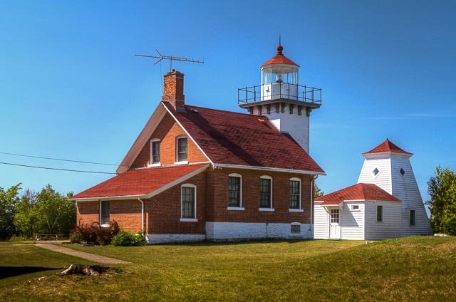
Raspberry Island Lighthouse The “Showplace of the Apostle Islands” was built at the urging of Henry Rice, the influential St. Paul politician who founded the city of Bayfield. A light on Raspberry Island would help mark the approach to the new port. Support from shipping interests added weight to Rice’s proposal, and in 1859 President Buchanan signed an order reserving the entire island for lighthouse use. Construction of the lighthouse began about two years later, and the structure was nearly ready for use by the end of 1862. Only one problem delayed the station’s entry into service: the lantern’s lens had not yet arrived. Lighthouse lenses are highly specialized optics, designed to focus the light from a small lamp into a beam that can be seen many miles across the water. The lens for the Raspberry lantern was crafted in France and took months to make its way over the ocean and across half a continent. It was not until mid-July of 1863 that the lens was installed and the light station officially began operation. The little lighthouse was hardly adequate for three keepers and their family members, so in 1906, the Lighthouse Service remodeled the building from the ground up. Portions of the old structure were incorporated into the new building, but final result was a lighthouse that was much larger and more imposing than the original. The new lighthouse was occupied until 1947, when the light was converted to automatic operation. The lens remained in the tower until 1957, when the Coast Guard replaced it with a battery-operated beacon mounted on a pole in front of the lighthouse. Today, visitors can see the original Raspberry Island lens on display at the Wisconsin State Historical Society Museum on Madeline Island. While the lighthouse we see on Raspberry Island appears much the same as it did in 1906, the surrounding setting has changed substantially. When the lighthouse was built, the surrounding area was cleared of trees so that ships would have a clear view of the beacon. Photos taken as recently as the 1940s show an open area of several acres around the station. Today, forest has encroached upon the site, and only a portion of the original clearing remains. More ominously, the bluff in front of the lighthouse has suffered severe erosion. The steep clay banks face the force of Lake Superior at their base, while the upper sections are subject to “slumping,” or collapse. Despite some efforts at erosion control in the 1980s, engineers warn that the receding bank could threaten the light station structures in as little as ten years. Fortunately, Congress has acted to protect the historic treasure known as the Raspberry Island lighthouse. Funds were appropriated to institute erosion control measures that will combine construction of a seawall at the base of the bluff, regrading the slope to a stable angle, drainage improvement, and planting vegetation. During the summer and fall of 2002, visitors to Raspberry Island were able to see the work in progress. By the end of October, more than half the project was complete. Work resumed in the spring of 2003, and the project was completed in July. Where it is: Raspberry Island, accessible by boat only. The Raspberry Island lighthouse is the most readily accessible of the six Apostle Island stations. During the summer season, Apostle Islands Cruise Service tour boats stop at the island. Raspberry Island Lighthouse is best seen from the water, or by landing on the island and visiting the lighthouse on a ranger-guided tour offered by the park service from mid-June to mid-September. Maps: Interactive Google Map Use the map  + – controls to zoom in and out, click and drag the to move the map, use the Map drop-down to change to “Map”, “Satellite”, “Hybrid”, or “Terrain” views.  Drag the little man icon from the upper left corner to a map location for street level view.   GPS: 46°58’13.998″ N 90°48’18” W Cost: Apostle Islands National Lakeshore does not charge an entrance fee, but does have expanded amenity fees. These fees apply to overnight docking, parking at Meyer’s Beach Road, lighthouse tours, and camping. The Lighthouse tour fall under the pricing for Interpretive Programs. Interpretive Programs Regularly scheduled on or off-site, per child (up to age 16) $3 Regularly scheduled on or off-site, per adult $5 Regularly scheduled on or off-site, per family $10   Hours: During the summer season National Park Service rangers conduct tours of the historic tower from 9:00 am to 4:00 pm. Facilities: There are primitive restrooms on the island but there are no other facilities. Location Contact Information: Apostle Islands National Lakeshore 415 Washington Ave Bayfield, WI 54814 Park Main Line: 715-779-3398 General Information: ext 0 Visitor and Camping information: ext 2 Ice Line (from late-November to March): ext 3 Northern Great Lakes Visitor Center: 715-685-9983 Fax 715-779-3049 Apostle Islands Cruises P.O. Box 691 715-779-3925 1-800-323-7619 Bayfield, WI 54814 Raspberry Island Lighthouse Photo Gallery Click Here for full page gallery   More Photographic Destinations in Wisconsin: Interactive Google Map Use the map  + – controls to zoom in and out, use the Map drop-down to change to “Map”, “Satellite”, “Hybrid”, or “Terrain” views.  Drag the little man icon from the upper left corner to a map location for street level view. Click on a pushpin for more information about the Photographic Destination, then click on the title to go to the location page. Click Here for Photographic Destinations by State    All the information in this post was believed to be accurate at the time it was published.  Please be sure to double check with the location before relying on this information as everything changes over time, especially hours, prices, and whether the location is still open.   Great Places for Great Photos   Let me help you to find a great location for your next photography adventure.  I will list many lesser-known destinations, as well as the famous "Icon Locations" for photography.  I will provide photos (Lots of Photos), location information, consisting of what there is to photograph as well as other information about the destination.  I will give costs, maps, directions, contact information, and other essential information for a successful photo trip.  I will only post for locations that I have personally photographed to ensure a quality guide to great locations for photography. If you know of great places that are not posted, please send me the details, I may just decide that is a place I need to go!     Greg Disch is a freelance photographer located in Arkansas. Greg specializes in nature, scenic, wildlife, and other outdoor subjects in Arkansas and other areas of the country.  Most of the images on this site are available for sale as prints, personal use, or rights managed stock photos. Greg offers both classroom instruction and in the field hands on photographic workshops. Classroom sessions are normally held in Fort Smith Arkansas, but arrangements can be made to bring a class to your group. All classes and workshops have small class sizes designed to provide an optimum student to instructor ratio, where you can get the personal attention, you need.  Most classes and workshops are limited to a maximum of six participants and will be held with a minimum of only two. If you are looking for a wonderful opportunity to get personal individual instruction, I do private workshops and classes at a location of your choice, whether doing a location photo shoot, coming to your home or business, traveling across the country on a road trip, or at my classroom.  This is a fantastic way to learn digital workflow and be sure that your computer equipment is properly configured for optimum performance. [...]Read more...
  Port Isabel Lighthouse The Point (Port) Isabel Lighthouse is a historic lighthouse located in Port Isabel, Texas, United States that was built in 1852 to guide ships through the Brazos Santiago Pass to Port Isabel. The lighthouse was added to the National Register of Historic Places on April 30, 1976. On September 28, 1850, the United States Congress authorized an appropriation of $15,000 for “a lighthouse and beacon light” at Brazos Santiago Pass. Work began in February 1852. When complete, the lighthouse was an 82-foot-high brick tower and had four lights. By 1854, it had 15 lamps and 21 reflectors. A third order fresnel lens was installed in 1857 and the fixed light was varied by flashes. The Texas State Park Board began restoring the lighthouse in 1951, and it was opened to the public in 1952. Today the lighthouse is operated as Port Isabel Lighthouse State Historic Site. In September 1996, a new visitors center was completed. Where it is: Take Highway 100 into Port Isabel. The lighthouse is located alongside Highway 100 just before the causeway leading to South Padre Island. Maps: Interactive Google Map Use the map  + – controls to zoom in and out, click and drag the to move the map, use the Map drop-down to change to “Map”, “Satellite”, “Hybrid”, or “Terrain” views.  Drag the little man icon from the upper left corner to a map location for street level view.   GPS: 26°4’39.8676″ N 97°12’26.7249″ W Cost: Ticket prices are $5.00 (adults); $4.00 (seniors 55+); $3.00 (children4 – 12 yrs.) Purchase tickets at the Keeper’s Cottage Visitor Center or at the Lighthouse. (956-943-2262) Children must be 4 years old and 38” tall to tour the lighthouse. A child may not be carried by an adult. Hours: The historic Port Isabel Lighthouse is open to the public, weather permitting. Tuesday – Thursday 10am-6pm and Friday – Monday 9am – 7pm. Last ticket sold 30 minutes before closing. The park at the Lighthouse is open to the public. The Keeper’s Cottage Visitors Center/Chamber of Commerce is open Monday – Friday, 9 a.m. to 5 p.m. Closed Thanksgiving, Christmas & New Year’s Day.   Facilities:  All facilities are available in the town of Port Isabell.   Location Contact Information: 421 East Queen Isabella Blvd Port Isabel, TX 78578 956-943-2262 Email: info@portisabel-texas.com Port Isabel Lighthouse Photo Gallery Click Here for full page gallery   More Photographic Destinations in Texas Interactive Google Map Use the map  + – controls to zoom in and out, use the Map drop-down to change to “Map”, “Satellite”, “Hybrid”, or “Terrain” views.  Drag the little man icon from the upper left corner to a map location for street level view. Click on a pushpin for more information about the Photographic Destination, then click on the title to go to the location page. Click Here for Photographic Destinations by State    All the information in this post was believed to be accurate at the time it was published.  Please be sure to double check with the location before relying on this information as everything changes over time, especially hours, prices, and whether the location is still open.   Great Places for Great Photos   Let me help you to find a great location for your next photography adventure.  I will list many lesser-known destinations, as well as the famous "Icon Locations" for photography.  I will provide photos (Lots of Photos), location information, consisting of what there is to photograph as well as other information about the destination.  I will give costs, maps, directions, contact information, and other essential information for a successful photo trip.  I will only post for locations that I have personally photographed to ensure a quality guide to great locations for photography. If you know of great places that are not posted, please send me the details, I may just decide that is a place I need to go!     Greg Disch is a freelance photographer located in Arkansas. Greg specializes in nature, scenic, wildlife, and other outdoor subjects in Arkansas and other areas of the country.  Most of the images on this site are available for sale as prints, personal use, or rights managed stock photos. Greg offers both classroom instruction and in the field hands on photographic workshops. Classroom sessions are normally held in Fort Smith Arkansas, but arrangements can be made to bring a class to your group. All classes and workshops have small class sizes designed to provide an optimum student to instructor ratio, where you can get the personal attention, you need.  Most classes and workshops are limited to a maximum of six participants and will be held with a minimum of only two. If you are looking for a wonderful opportunity to get personal individual instruction, I do private workshops and classes at a location of your choice, whether doing a location photo shoot, coming to your home or business, traveling across the country on a road trip, or at my classroom.  This is a fantastic way to learn digital workflow and be sure that your computer equipment is properly configured for optimum performance. [...]Read more...
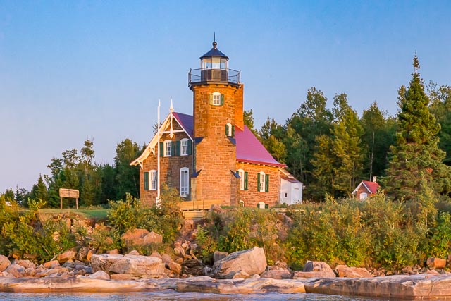
Point Cabrillo Lighthouse Point Cabrillo Light is a lighthouse in northern California, United States, between Point Arena and Cape Mendocino, just south of the community of Caspar. It has been a federal aid to navigation since 1909. It is part of the California state valium no prescription park system as Point Cabrillo Light Station State Historic Park. The Point Cabrillo Lighthouse complex is located about 1.5 miles north of Mendocino, California, and includes the lighthouse itself together with several outbuildings. Most of the original structures remain, but the barn is missing: in 1986 it was destroyed in a fire department exercise. The remaining lighthouse station is “one of the most complete light stations in the United States” History: Point Cabrillo, the sandstone headland on which the Point Cabrillo Light lies, was named in 1870 by the United States Geological Survey after the Portuguese explorer João Rodrigues Cabrilho, although Cabrillo’s voyage of exploration on behalf of Spain along the California coast did not reach as far north as the point. Because Spain controlled early California, the Spanish derivation of his name is the one used today. The opium-trading brig Frolic wrecked on a reef north of Point Cabrillo in 1850; the investigation of the wreck by agents of Henry Meiggs led to the discovery of the coast redwood forests of the Mendocino area and the beginning of the timber trade that would drive the local economy for decades. In 1873, Point Cabrillo was surveyed as a potential site for a lighthouse; however, no lighthouse was built at that time. By 1904, several shipwrecks later, the U.S. Lighthouse Service recommended that a lighthouse be placed at the point. The bill to fund its construction, Senate Bill 6648, passed in June 1906, and the government bought 30 acres of land on Point Cabrillo from rancher David Gordon for $3,195. The lighthouse was constructed by the Lindgren Company beginning in 1908, and began operation in 1909. Its first light keeper was Wilhelm Baumgartner, who held the position until 1923. In 1935, an air diaphone supertyfone sound signal was installed. The United States Coast Guard took over the Lighthouse Service in 1939. The lighthouse building sustained major damage in 1960 after a storm caused waves that crested above the light and flooded the building with mud, but the lens remained undamaged. Later during the Cold War, the station was used to simulate a Soviet radar base in training exercises. The Coast Guard manned the station until 1973, when the lens was covered and a modern rotating beacon was mounted on a metal stand on the roof west of the lantern room. In 1988 the California Coastal Conservancy began buying the land surrounding the light station, and in 1991 the station was added to the National Register of Historic Places. However, the California State Park System declined to take over the land at that time because of state budget shortfalls; instead, the station was managed for nine years by a non-profit organization, the North Coast Interpretive Association. Beginning in 1996, the NCIA organized a major restoration of the station to the state it would have been in the 1930s, after it was electrified, including a return to active duty of the main lens of the light. In 1999, the original third-order Fresnel lens was reinstalled after being upgraded to meet more modern standards. Before it could be used the light had to be as reliable as a Directional Code Beacon, which is commonly used at airports. The restored lighthouse was opened to the public in August 2001, and appeared in the Warner Bros. 2001 drama film The Majestic. In 2002, California State Parks purchased the light station for four million dollars. The NCIA, which then became the Point Cabrillo Light Keeper Association, continued to run the station for the state park system. The station won the Governor’s Historic Preservation Award in 2007, and the Preservation Design Award of the California Preservation Foundation in the same year. A hiking trail, part of the California Coastal Trail, was established in 2011 and connects the light station to Caspar Headlands State Beach one mile to the north, passing Frolic Cove along the way. The Light Station includes: The Lighthouse, which is an active duty Aid to Navigation, containing the original Chance Brothers classic 3rd order Fresnel lens three restored Lightkeeper homes; the first house is a period museum of a lightkeeper’s house in the 1930s; the other two houses are comfortable vacation rental homes the restored Blacksmith & Carpentry Shop, which houses the Marine Science Exhibit with its 240 gallon saltwater aquarium three restored storage buildings behind the residences; two of these have been converted to lovely vacation rental cottages, the other is a public restroom   What to Photograph The historic lighthouse and keepers quarters, which are one of the most intact light stations in the country. There are hiking trails throughout the Point which wind through coastal prairie and coastal bluff habitats. Where it is: Located on the Mendocino Coast, between Mendocino village and Fort Bragg, about halfway between Russian Gulch State Park and Caspar Beach, on Point Cabrillo Drive. Parking: The Light Station is approximately one half mile walk from the entry gate on Point Cabrillo Drive. Please park vehicles in the paved parking area at the gate. The parking area is open from sunrise to sunset daily. Handicapped access parking is available at the Light Station in front of the residences. Maps: Interactive Google Map Use the map  + – controls to zoom in and out, click and drag the to move the map, use the Map drop-down to change to “Map”, “Satellite”, “Hybrid”, or “Terrain” views.  Drag the little man icon from the upper left corner to a map location for street level view.   GPS: 39°20’55.948″ N 123°49’35.688″ W Hours: Hours of Operation State Historic Park: sunrise to sunset The main floor of the Lighthouse, the 1st Assistant Lightkeeper’s House and the Marine Science Exhibit are open to the public from 11am to 4pm year-round. The State Historic Park is open from sunrise to sunset daily.   Cost: There is not cost to visit the Point Cabrillo Light Station California State Historical Park, donations are welcome. Drone Policy: Due to the fragile and sensitive cultural and wildlife resources present at Point Cabrillo Light Station State Historic Park, the flying of private drones is prohibited throughout the Park.   Location Contact Information: office phone: 707.937.6123 giftshop: send email to giftshop@pointcabrillo.org general questions: send email to info@pointcabrillo.org web site issues: send email to pclk.webmaster@jhfrey.com URL: http://pointcabrillo.org Our mailing address: PCLK PO Box 641 Mendocino CA 95460 To send mail, see above. Mail is not delivered to the physical address. Physical address: Point Cabrillo Light Station 45300 Lighthouse Rd. Mendocino CA 95460 Point Cabrillo Lighthouse Photo Gallery Click Here for full page gallery   More Photographic Destinations in California: Interactive Google Map Use the map  + – controls to zoom in and out, use the Map drop-down to change to “Map”, “Satellite”, “Hybrid”, or “Terrain” views.  Drag the little man icon from the upper left corner to a map location for street level view. Click on a pushpin for more information about the Photographic Destination, then click on the title to go to the location page. Click Here for Photographic Destinations by State   All the information in this post was believed to be accurate at the time it was published.  Please be sure to double check with the location before relying on this information as everything changes over time, especially hours, prices, and whether the location is still open.   Great Places for Great Photos   Let me help you to find a great location for your next photography adventure.  I will list many lesser-known destinations, as well as the famous "Icon Locations" for photography.  I will provide photos (Lots of Photos), location information, consisting of what there is to photograph as well as other information about the destination.  I will give costs, maps, directions, contact information, and other essential information for a successful photo trip.  I will only post for locations that I have personally photographed to ensure a quality guide to great locations for photography. If you know of great places that are not posted, please send me the details, I may just decide that is a place I need to go!     Greg Disch is a freelance photographer located in Arkansas. Greg specializes in nature, scenic, wildlife, and other outdoor subjects in Arkansas and other areas of the country.  Most of the images on this site are available for sale as prints, personal use, or rights managed stock photos. Greg offers both classroom instruction and in the field hands on photographic workshops. Classroom sessions are normally held in Fort Smith Arkansas, but arrangements can be made to bring a class to your group. All classes and workshops have small class sizes designed to provide an optimum student to instructor ratio, where you can get the personal attention, you need.  Most classes and workshops are limited to a maximum of six participants and will be held with a minimum of only two. If you are looking for a wonderful opportunity to get personal individual instruction, I do private workshops and classes at a location of your choice, whether doing a location photo shoot, coming to your home or business, traveling across the country on a road trip, or at my classroom.  This is a fantastic way to learn digital workflow and be sure that your computer equipment is properly configured for optimum performance. [...]Read more...
Point Arena Lighthouse Point Arena Light is a lighthouse two miles north of Point Arena, California. The lighthouse features a small museum and giftshop. Guided tours of the light station as well as self-guided tours of the grounds are available daily. The lighthouse at this site was constructed in 1870. The brick-and-mortar tower included ornate iron balcony supports and a large keeper residence with enough space to house several families. In April 1906, a devastating earthquake struck the light station. The keeper’s residence and lighthouse were damaged so severely they had to be demolished. The United States Lighthouse Service contracted with a San Francisco based company to build a new lighthouse on the site, and specified that it had to be able to withstand any future earthquakes. The company chosen normally built factory smokestacks, which accounts for the final design for the new Point Arena Lighthouse, featuring steel reinforcement rods encased in concrete. This was the first lighthouse built this way. The new lighthouse began operation in 1908, nearly 18 months after the quake. It stands 115 feet tall, and featured a 1st Order Fresnel Lens, over six feet in diameter and weighing more than six tons. The lens was made up of 666 hand-ground glass prisms all focused toward three sets of double bullseyes. It was these bullseyes that gave the Point Arena Lighthouse its unique “light signature” of two flashes every six seconds. The optics, which held an appraised value of over $3.5 million, was set in solid brass framework, and was built in France. In 1984, a nonprofit organization called the Point Arena Lighthouse Keepers acquired the light station as part of a 25-year land lease from the Coast Guard and the Department of Transportation. In November 2000, the nonprofit group became the official owners of the property due to their diligent historic preservation and educational efforts. Daily visitation, gift store sales, memberships and the rental of the historic Keeper’s homes on the property as vacation houses, all provide income to the group, for ongoing preservation, facility upgrades, and educational endeavors.   What to Photograph The lighthouse, the fog house and 23 acres of grounds surrounded on 3 sides by the Pacific Ocean. Where it is: To get there, follow Highway 1 north from the town of Point Arena and turn west onto Lighthouse Road at the sign for Lighthouse Pointe Resort. Follow this road to the end and follow signs for parking. Maps: Interactive Google Map Use the map  + – controls to zoom in and out, click and drag the to move the map, use the Map drop-down to change to “Map”, “Satellite”, “Hybrid”, or “Terrain” views.  Drag the little man icon from the upper left corner to a map location for street level view.   GPS: 38°57’16.499″ N 123°44’26.615″ W Hours: Point Arena Lighthouse is open every day of the year except Thanksgiving Day and Christmas Day.   Hours of operation: 10 a.m. to 4:30 p.m. Memorial Day weekend through Labor Day 10 a.m. to 3:30 p.m. from the day after Labor Day to Memorial Day weekend PLEASE NOTE:  The last Tower Tour is at 3:15 p.m. (4:15 p.m. Memorial Day weekend through Labor Day).  The grounds, Museum and Gift Store are open until 3:30 p.m. (4:30 p.m. Memorial Day weekend through Labor Day). The Lighthouse will close early on Christmas Eve. Hours on December 24 will be from 10 a.m. to 1 p.m., with the last Tower Tour at 12:45 p.m. Cost: Museum admission, no Tower Tour: $5 per person (12 years and up), $1 for children ages 5 – 11, under 5 free Museum & Tower Tour: $8 per person (12 years and up), $1 for children ages 5 – 11, under 5 free Museum & Tower Tour per vehicle discount rate (5 to 8 people per vehicle): $35 per vehicle Active Military & Veterans Admission including Tower tour: $6.50 per person Location Contact Information: Point Arena Lighthouse Keepers, Inc.  P.O. Box 11 45500 Lighthouse Road Point Arena, CA 95468 PH: 877-725-4448, ext. 1 or 707-882-2809, ext. 1 email: info.palight@gmail.com     Point Arena Lighthouse Photo Gallery Click Here for full page gallery   More Photographic Destinations in California: Interactive Google Map Use the map  + – controls to zoom in and out, use the Map drop-down to change to “Map”, “Satellite”, “Hybrid”, or “Terrain” views.  Drag the little man icon from the upper left corner to a map location for street level view. Click on a pushpin for more information about the Photographic Destination, then click on the title to go to the location page. Click Here for Photographic Destinations by State    All the information in this post was believed to be accurate at the time it was published.  Please be sure to double check with the location before relying on this information as everything changes over time, especially hours, prices, and whether the location is still open.   Great Places for Great Photos   Let me help you to find a great location for your next photography adventure.  I will list many lesser-known destinations, as well as the famous "Icon Locations" for photography.  I will provide photos (Lots of Photos), location information, consisting of what there is to photograph as well as other information about the destination.  I will give costs, maps, directions, contact information, and other essential information for a successful photo trip.  I will only post for locations that I have personally photographed to ensure a quality guide to great locations for photography. If you know of great places that are not posted, please send me the details, I may just decide that is a place I need to go!     Greg Disch is a freelance photographer located in Arkansas. Greg specializes in nature, scenic, wildlife, and other outdoor subjects in Arkansas and other areas of the country.  Most of the images on this site are available for sale as prints, personal use, or rights managed stock photos. Greg offers both classroom instruction and in the field hands on photographic workshops. Classroom sessions are normally held in Fort Smith Arkansas, but arrangements can be made to bring a class to your group. All classes and workshops have small class sizes designed to provide an optimum student to instructor ratio, where you can get the personal attention, you need.  Most classes and workshops are limited to a maximum of six participants and will be held with a minimum of only two. If you are looking for a wonderful opportunity to get personal individual instruction, I do private workshops and classes at a location of your choice, whether doing a location photo shoot, coming to your home or business, traveling across the country on a road trip, or at my classroom.  This is a fantastic way to learn digital workflow and be sure that your computer equipment is properly configured for optimum performance. [...]Read more...
Pensacola Lighthouse The Pensacola Light remains an active aid to navigation. As of 2009, the lighthouse opened on a limited basis for public tours, and since early 2011 it has been open 7 days a week. Maintenance and tour operations are currently conducted by the Pensacola Lighthouse Association. The 1869 keeper’s quarters, adjacent to the lighthouse tower, houses a museum and gift shop also administered by the Pensacola Lighthouse Association. In 1858 a new tower was built on the north side of the bay entrance, and was lit on January 1, 1859. The new, and current, tower is 150 feet (46 m) tall, and also sits on a 40-foot (12 m) bluff located on the Pensacola Naval Air Station, placing the light 190 feet (58 m) above sea level. At the start of the Civil War, Pensacola was controlled by Confederate forces, while Fort Pickens across the bay remained in Union hands. Confederate authorities removed the lens from the lighthouse, and most of the lighthouse supplies were requisitioned for the war effort. In November 1861 an artillery duel between the two forces damaged the lighthouse tower. Confederate forces later evacuated Pensacola, and were replaced by Union forces. In 1863 the Pensacola Light was relit using a fourth-order Fresnel lens. A new first-order lens was placed in the tower in 1869. The tower was all white during the Civil War. Later, the upper two-thirds of the tower was painted black. Electricity was introduced to the lighthouse in 1939, eliminating the need to rewind the light rotation clockworks every 4½ hours. The light was automated in 1965. The lighthouse tower and associated buildings were placed on the National Register of Historic Places in 1974. What to Photograph The Pensacola Lighthouse and grounds along with great views of Pensacola Naval Air Station and Pensacola Bay from the 150 tall lighthouse tower. The Lighthouse is located right across the street from the National Naval Aviation Museum, the world’s largest Naval Aviation museum and one of the most-visited museums in the state of Florida. Security Gate Procedures The Pensacola Lighthouse and Museum sits on Naval Air Station Pensacola, which is an active military base. All visitors must enter through a security checkpoint (see below for additional gate details). At high traffic times, lines may form at the checkpoints which can delay entrance. Please take the potential delay into account if you have reservations for a tour or other scheduled event. When approaching the security checkpoints, please be prepared to present the guard with proper identification for yourself as well as any other passengers who are 18 or older (a valid driver’s license will work). Visitors without military ID will not be permitted to bring pets onto NAS. PLEASE NOTE: visitors from Illinois, Missouri, New Mexico, Minnesota, or Washington may require additional identification to enter through the security gate of NAS Pensacola.  From the U.S. Department of Defense: “Defense Department installations will no longer accept driver’s licenses from Illinois, Missouri and New Mexico as proof of identity for access control purposes, according to DoD officials. Non-enhanced licenses from Minnesota or Washington also are no longer accepted. Those attempting to gain physical access to DoD installations must show an alternate form of identification, such as a passport.” Other acceptable alterate forms of identification include: – Social Security Card – Voter’s Registration – State or Federal Work ID – Concealed Weapons ID All civilian visitors to NAS Pensacola during daily operating hours must use the West Gate entrance, located approximately one mile south of  the intersection of Blue Angel Parkway and Sorrento Rd. This gate closes to visitors at 4:30pm, so be sure to be on the base by that time in order to see the lighthouse.  Map to West Gate (PDF) Please be sure to check out the NAS Driving Rules & Regulations, especially if you will be driving a motorcycle onto the base. Driving Directions From Perdido Key, FL and Orange Beach, Gulf Shores, AL: From 292, cross Perdido Key Bridge and take the first right onto Gulf Beach Hwy. Then take a right onto Blue Angel Parkway and drive through the west gate of NAS Pensacola. Take Radford Boulevard. The Pensacola Lighthouse will be on the right. From I-10 East or West: Take Exit 7 (Pine Forest Road, 297). Head south about 1.5 miles to Blue Angel Parkway. Drive about 11 miles to west gate of NAS Pensacola. Keep straight on Radford Boulevard. Pensacola Lighthouse will be on the right. From Gulf Breeze, Pensacola Beach, Ft. Walton and Destin: From Highway 98 to Pensacola Bay Bridge, veer left onto Bayfront Parkway, which turns into Main Street. Take a left onto Barrancas Avenue. Continue on Gulf Beach Hwy and turn left onto Blue Angel Parkway and drive through the west gate of NAS Pensacola. Take Radford Boulevard. The Pensacola Lighthouse will be on the right. Maps: Interactive Google Map Use the map  + – controls to zoom in and out, click and drag the to move the map, use the Map drop-down to change to “Map”, “Satellite”, “Hybrid”, or “Terrain” views.  Drag the little man icon from the upper left corner to a map location for street level view. GPS: 30°20’45.185″ N 87°18’30.384″ W Cost: Daily Admission Adults $7.00 Children 12 and under $4.00 Seniors 65+ $4.00 Military $4.00 Hours: Hours of Operation 9:00am–5:00pm Daily Last climber admitted to the tower at 4:45pm Facilities: There are restrooms and a gift shop on site. Location Contact Information: Pensacola Lighthouse & Museum 2081 Radford Blvd. Pensacola, Fl 32508 Phone: (850) 393-1561 Email: info@PensacolaLighthouse.org Pensacola Lighthouse Photo Gallery Click Here for full page gallery More Photographic Destinations in Florida: Interactive Google Map Use the map  + – controls to zoom in and out, use the Map drop-down to change to “Map”, “Satellite”, “Hybrid”, or “Terrain” views.  Drag the little man icon from the upper left corner to a map location for street level view. Click on a pushpin for more information about the Photographic Destination, then click on the title to go to the location page. Click Here for Photographic Destinations by State    [...]Read more...
  Nubble Lighthouse Nubble Light, also known as Cape Neddick Light Station. The park that overlooks this picturesque lighthouse is called Sohier Park. The lighthouse itself is not accessible to the public but can be photographed and enjoyed from Sohier Park. The Cape Neddick Light is a lighthouse in Cape Neddick, York, Maine, it is commonly known as “Nubble Light” or simply “the Nubble”. In 1874 Congress appropriated $15,000 to build a light station at the “Nubble” and in 1879 construction began. Cape Neddick Light Station was dedicated by the U.S. Lighthouse Service and put into use in 1879. It is still in use today. Plans had been in the works to build a lighthouse on the site since 1837.  The tower is lined with brick and sheathed with cast iron. It stands 41 feet tall but the light is 88 feet above sea level because of the additional height of the steep rocky islet on which it sits. Unusually, the stanchions of the walkway railing around the lantern room are decorated with 4-inch brass replicas of the lighthouse itself. Nubble Light is a famous American icon and a classic example of a lighthouse. The Voyager spacecraft, which carries photographs of Earth’s most prominent man-made structures and natural features, should it fall into the hands of intelligent extraterrestrials, includes a photo of Nubble Light with images of the Great Wall of China and the Taj Mahal. Cape Neddick Light is one of the last eight lights in Maine to still have its Fresnel lens. It was added to the National Register of Historic Places as Cape Neddick Light Station on April 16, 1985   Where it is: The Cape Neddick Light stands on Nubble Island about 100 yards off Cape Neddick Point. Cape Neddick Point is at the north end of Long Sands Beach in the village of York Beach. The lighthouse is inaccessible to the general public, but the nearby mainland is occupied by Sohier Park which offers a telescope with which to view the lighthouse and a gift shop with a “Nubble” theme. Maps: Interactive Google Map Use the map  + – controls to zoom in and out, click and drag the to move the map, use the Map drop-down to change to “Map”, “Satellite”, “Hybrid”, or “Terrain” views.  Drag the little man icon from the upper left corner to a map location for street level view.   GPS: 43°9’55.728″ N 70°35’34.896″ W Cost: There is no cost to visit the park.   Hours: Sohier Park is always open. Nubble Light Gift Shop is open seven days per week from 9:00am – 7:00pm from the first of May thru late October. Facilities: Seasonal restroom facilities and water fountain. Location Contact Information: Nubble Lighthouse Contact Form Nubble Lighthouse Photo Gallery Click Here for full page gallery   More Photographic Destinations in Maine Interactive Google Map Use the map  + – controls to zoom in and out, use the Map drop-down to change to “Map”, “Satellite”, “Hybrid”, or “Terrain” views.  Drag the little man icon from the upper left corner to a map location for street level view. Click on a pushpin for more information about the Photographic Destination, then click on the title to go to the location page. Click Here for Photographic Destinations by State    All the information in this post was believed to be accurate at the time it was published.  Please be sure to double check with the location before relying on this information as everything changes over time, especially hours, prices, and whether the location is still open.   Great Places for Great Photos   Let me help you to find a great location for your next photography adventure.  I will list many lesser-known destinations, as well as the famous "Icon Locations" for photography.  I will provide photos (Lots of Photos), location information, consisting of what there is to photograph as well as other information about the destination.  I will give costs, maps, directions, contact information, and other essential information for a successful photo trip.  I will only post for locations that I have personally photographed to ensure a quality guide to great locations for photography. If you know of great places that are not posted, please send me the details, I may just decide that is a place I need to go!     Greg Disch is a freelance photographer located in Arkansas. Greg specializes in nature, scenic, wildlife, and other outdoor subjects in Arkansas and other areas of the country.  Most of the images on this site are available for sale as prints, personal use, or rights managed stock photos. Greg offers both classroom instruction and in the field hands on photographic workshops. Classroom sessions are normally held in Fort Smith Arkansas, but arrangements can be made to bring a class to your group. All classes and workshops have small class sizes designed to provide an optimum student to instructor ratio, where you can get the personal attention, you need.  Most classes and workshops are limited to a maximum of six participants and will be held with a minimum of only two. If you are looking for a wonderful opportunity to get personal individual instruction, I do private workshops and classes at a location of your choice, whether doing a location photo shoot, coming to your home or business, traveling across the country on a road trip, or at my classroom.  This is a fantastic way to learn digital workflow and be sure that your computer equipment is properly configured for optimum performance. [...]Read more...
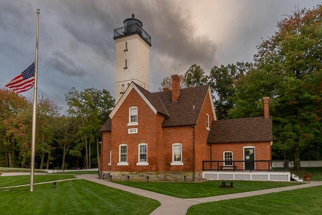
Michigan City Breakwater lighthouse   The Michigan City Breakwater lighthouse is located in the harbor of Michigan City, Indiana. The lighthouse is also known as Michigan City East Pierhead Lighthouse Built in 1904, the lighthouse has become the most popular symbol of Michigan City, and is the only public operating lighthouse in Indiana. The elevated walkway, known as the “catwalk”, was used by lighthouse keepers for 29 years to access the light tower. In 1933, this light on the east pier was electrified, and in 1939, the U.S. Coast Guard took over the service. The catwalk, no longer in use, was threatened with demolition. Local citizens rallied and succeeded in saving this landmark structure. The pier is a favorite spot for fishing and watching sunsets, and is frequently painted and photographed by local artists. This is the successor to the Old Michigan City Light, when the lantern, lens and light was moved to the new light at the end of the newly extended pier. This is one of very few lights on the Great Lakes which still has the iron walkway atop the pier. There has been a lighthouse in Michigan City for 170 years. However, “most people in Indiana don’t realize there is a lighthouse in the state.” In May 2007, this aid to navigation was deemed excess by the Coast Guard. It was offered at no cost to eligible entities, including federal, state and local agencies, non-profit corporations, educational agencies, or community development organizations under the terms of the National Historic Lighthouse Preservation Act. “According to Mayor Chuck Oberlie, Michigan City filed a letter of interest for the lighthouse and will seek ownership.” It is one of a dozen past or present lighthouses in Indiana. The lighthouse tower  and the steel catwalk are not open to the public. The old 1858 lighthouse, near the entrance to the park, is open as a museum every day except Mondays from 1 to 4 p.m. Where it is: Lighthouse is located in Michigan City Indiana, in Washington Park on the shores of Lake Michigan. Directions: From Interstate 94, take Highway 35 into Michigan City. Where Highway 35 intersects Highway 12, turn left on Highway 12 then right on Pine Street. Pine Street will become Franklin Street after two blocks, which will lead you over a bridge to Lakeshore Drive. Turn right onto Lakeshore Drive and take the first left. Follow this road west to the marina, from where you can walk the pier to the light. Located at the end of the breakwater forming the harbor in Michigan City.  You can walk on the concrete pier all the way to the lighthouse. Maps: Interactive Google Map Use the map  + – controls to zoom in and out, click and drag the to move the map, use the Map drop-down to change to “Map”, “Satellite”, “Hybrid”, or “Terrain” views.  Drag the little man icon from the upper left corner to a map location for street level view.   GPS: 41°43’42.762″ N 86°54’38.952″ W Cost: there is no cost to visit the pier and lighthouse.  During the summer there is a parking fee. Hours: WASHINGTON PARK is open daily from 5 am to 10 pm. Facilities: Washington Park is a majestic, 99 acre park located along the shores of Lake Michigan. Walk out to the pier or enjoy a picnic in one of our many shelters. Plan to have a wedding in the historic band stand, walk through our historic gardens or along the sand dunes, visit the Washington Park Zoo or spend the day at the beach. Location Contact Information: Michigan City Parks & Recreation Department 100 East Michigan Boulevard, Suite 2 Michigan City, Indiana 46360 Telephone: 219-873-1506 Michigan City Breakwater lighthouse Photo Gallery Click Here for full page gallery   More Photographic Destinations in Indiana Interactive Google Map Use the map  + – controls to zoom in and out, use the Map drop-down to change to “Map”, “Satellite”, “Hybrid”, or “Terrain” views.  Drag the little man icon from the upper left corner to a map location for street level view. Click on a pushpin for more information about the Photographic Destination, then click on the title to go to the location page. Click Here for Photographic Destinations by State    All the information in this post was believed to be accurate at the time it was published.  Please be sure to double check with the location before relying on this information as everything changes over time, especially hours, prices, and whether the location is still open.   Great Places for Great Photos   Let me help you to find a great location for your next photography adventure.  I will list many lesser-known destinations, as well as the famous "Icon Locations" for photography.  I will provide photos (Lots of Photos), location information, consisting of what there is to photograph as well as other information about the destination.  I will give costs, maps, directions, contact information, and other essential information for a successful photo trip.  I will only post for locations that I have personally photographed to ensure a quality guide to great locations for photography. If you know of great places that are not posted, please send me the details, I may just decide that is a place I need to go!     Greg Disch is a freelance photographer located in Arkansas. Greg specializes in nature, scenic, wildlife, and other outdoor subjects in Arkansas and other areas of the country.  Most of the images on this site are available for sale as prints, personal use, or rights managed stock photos. Greg offers both classroom instruction and in the field hands on photographic workshops. Classroom sessions are normally held in Fort Smith Arkansas, but arrangements can be made to bring a class to your group. All classes and workshops have small class sizes designed to provide an optimum student to instructor ratio, where you can get the personal attention, you need.  Most classes and workshops are limited to a maximum of six participants and will be held with a minimum of only two. If you are looking for a wonderful opportunity to get personal individual instruction, I do private workshops and classes at a location of your choice, whether doing a location photo shoot, coming to your home or business, traveling across the country on a road trip, or at my classroom.  This is a fantastic way to learn digital workflow and be sure that your computer equipment is properly configured for optimum performance. [...]Read more...
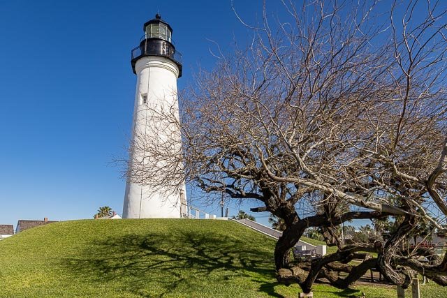
Marquette Harbor Lighthouse The first lighthouse was built in the city in 1853. The present lighthouse was constructed in 1866 and a second story added in 1909. The lighthouse is the oldest significant structure in the city and more importantly, the lighthouse is one of the most historic navigation beacons on Lake Superior and critical to the development of the Great Lakes iron ore trade. Until the opening of the major Minnesota mines in the 1890s, Marquette was the premier shipping port for iron ore on the Great Lakes and this Marquette beacon was vital for the safe navigation of ships entering Marquette. This light still shines through for today’s sailors. In 2002, a 30-year lease was signed by the Marquette Maritime Museum, which is responsible for maintenance and control of the facility. As part of their operations, they also make the lighthouse available for scheduled tours. The lighthouse is open and tours are conducted from 10:00 a.m. until 4:00 p.m. from mid-May through late October. The Marquette Maritime Museum offers guided lighthouse tours of the Marquette Harbor Lighthouse. This is the only way to view this picturesque light. Tours run daily mid-May through mid-October, 11:30 a.m., 1:00 p.m., and 2:30 p.m. Group tours can also be arranged by calling the Museum. The tour consists of a walk through the Coast Guard grounds where visitors will get a brief history of the Life Saving Station and Coast Guard in Marquette, MI before reaching Lighthouse Point. Once there, visitors are treated to the history of the lighthouse and get to explore the grounds and the living quarters. The tour ends with a majestic walk down the front catwalk. This is the only place to get a photograph of the front of the lighthouse and also see Marquette’s historic shoreline. What to Photograph: The historic lighthouse, the Marquette Maritime Museum, and the town of Marquette with the old lower harbor ore dock. Best Time for Photographers: The only way to access the lighthouse grounds is on a tour, which are run mid-May through mid-October, 11:30 a.m., 1:00 p.m., and 2:30 p.m. Where it is: The Marquette Harbor Light is located on Lake Superior in Marquette, Michigan, a part of the Upper Peninsula. Address: 300 N Lakeshore Blvd, Marquette, MI 49855 Maps: Interactive Google Map Use the map  + – controls to zoom in and out, click and drag the to move the map, use the Map drop-down to change to “Map”, “Satellite”, “Hybrid”, or “Terrain” views.  Drag the little man icon from the upper left corner to a map location for street level view. Cost: Adults: $7 (Museum or Lighthouse) – $12 (both Lighthouse and Museum) Children 12 & under: $3 (Museum or Light) – $5 (both) Hours: Open Tuesday thru Sunday (closed Mondays) from May 16 to mid – October 11am – 4pm Facilities: The lighthouse is located in the town of Marquette with a population of 21,000, which has all facilities available. Links: Marquette Maritime Museum Location Contact Information: Mailing Address Marquette Maritime Museum P.O. Box 1096 Marquette, Michigan 49855 906-226-2006 Marquette Harbor Lighthouse Photo Gallery Click Here for full page gallery More Photographic Destinations in Michigan: Interactive Google Map Use the map  + – controls to zoom in and out, use the Map drop-down to change to “Map”, “Satellite”, “Hybrid”, or “Terrain” views.  Drag the little man icon from the upper left corner to a map location for street level view. Click on a pushpin for more information about the Photographic Destination, then click on the title to go to the location page. Click Here for Photographic Destinations by State    All the information in this post was believed to be accurate at the time it was published.  Please be sure to double check with the location before relying on this information as everything changes over time, especially hours, prices, and whether the location is still open.   Great Places for Great Photos   Let me help you to find a great location for your next photography adventure.  I will list many lesser-known destinations, as well as the famous "Icon Locations" for photography.  I will provide photos (Lots of Photos), location information, consisting of what there is to photograph as well as other information about the destination.  I will give costs, maps, directions, contact information, and other essential information for a successful photo trip.  I will only post for locations that I have personally photographed to ensure a quality guide to great locations for photography. If you know of great places that are not posted, please send me the details, I may just decide that is a place I need to go!     Greg Disch is a freelance photographer located in Arkansas. Greg specializes in nature, scenic, wildlife, and other outdoor subjects in Arkansas and other areas of the country.  Most of the images on this site are available for sale as prints, personal use, or rights managed stock photos. Greg offers both classroom instruction and in the field hands on photographic workshops. Classroom sessions are normally held in Fort Smith Arkansas, but arrangements can be made to bring a class to your group. All classes and workshops have small class sizes designed to provide an optimum student to instructor ratio, where you can get the personal attention, you need.  Most classes and workshops are limited to a maximum of six participants and will be held with a minimum of only two. If you are looking for a wonderful opportunity to get personal individual instruction, I do private workshops and classes at a location of your choice, whether doing a location photo shoot, coming to your home or business, traveling across the country on a road trip, or at my classroom.  This is a fantastic way to learn digital workflow and be sure that your computer equipment is properly configured for optimum performance. [...]Read more...
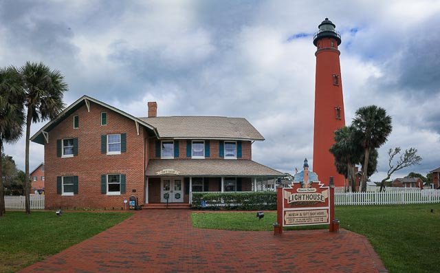
  Heceta Head Lighthouse   Head Lighthouse State Scenic Viewpoint is located in a cove at the mouth of Cape Creek. There are picnic tables sheltered from the wind and a great view of the ocean. A short trail leads to the historic Heceta Head lighthouse and assistant keeper’s house. The trail is 1/2 a mile long and climbs 150 feet in elevation to get to the lighthouse. Heceta Head trail is part of a 7-mile network. Trails of varying difficulty feature beach and wildlife viewing areas. Wildlife refuge islands feature a view of common murres, cormorants, gulls, and other bird nesting areas. Sea lions and whales can be seen from the beach and cliff-top lighthouse. On the west side of 1,000-foot-high Heceta Head, 205 feet above the ocean, the lighthouse is one of the most photographed on the coast. The light at top of 56-foot tower was illuminated in 1894; the automated beacon, seen 21 miles from land, is rated as the strongest light on the Oregon coast. The historic assistant lighthouse keeper’s house (Heceta House; built 1893) offers bed and breakfast rentals and facilities for group events.  The bed and breakfast is operated by a concessionaire of the U.S. Forest Service and can be reached at 1-866-547-3696 or http://hecetalighthouse.com/ Common murres, which lay their eggs on the bare rocks, can be easily seen by looking down, just over the railing near the lighthouse. Brown pelicans commonly fly by, as do bald eagles. Migrating gray whales can be seen as they travel to and from Alaska and Baja California. May is a great time to look right down on the migrating mothers and calves as they travel close to shore. There are natural caves, tidepools, and a sandy beach for building sandcastles. Park History Heceta Head is named for Bruno de Heceta, a Spanish navigator and explorer, who surveyed the Oregon coast in 1775. The lighthouse was constructed between 1892 and 1893 and was listed in the National Register of Historic Places in 1978. The head lightkeeper’s  house was demolished and the lumber purchased for $10 in 1940 following the move from kerosene to electricity to power the lighthouse. The salvaged wood was used to construct the Alpha-Bit Café in nearby Mapleton. The state of Oregon was granted a license to use the lighthouse and surrounding property by the Coast Guard in 1963, the same year that the lighthouse became fully automated. The assistant lightkeeper’s house, which still stands, is now a bed and breakfast operated by concessionaires of the U.S. Forest Service.  In 1998, Heceta Head Lighthouse State Scenic Viewpoint was officially deeded to OPRD by ODOT.  In 2001, the remaining Coast Guard property was transferred to OPRD. What to Photograph The historic lighthouse and the keepers order ambien online no prescription quarters which is a bed and breakfast managed by the forest service and the rugged Oregon Coast. There is an excellent view of the lighthouse from a pullout on Hwy 101 south of the Lighthouse, you will need a long lens to get a good shot of the Lighthouse. Where it is: Heceta Head Light is a lighthouse on the Oregon Coast 13 miles north of Florence, and 13 miles south of Yachats. It is located at Heceta Head Lighthouse State Scenic Viewpoint, a state park. Maps: Interactive Google Map Use the map  + – controls to zoom in and out, click and drag the to move the map, use the Map drop-down to change to “Map”, “Satellite”, “Hybrid”, or “Terrain” views.  Drag the little man icon from the upper left corner to a map location for street level view. Click here to download PDF map   GPS: 44°8’14.442″ N 124°7’41.956″ W   Hours:   Cost: Day-use parking permits are required year round at Heceta Head Lighthouse State Scenic Viewpoint. A daily ($5), 12-month or 24-month permit, an Oregon Coast Passport, or a valid state park camping receipt is required. Purchase daily permits from a machine at the park. The 12-month and 24-month permits are sold at most major state park offices. Location Contact Information: Oregon Parks and Recreation Department 725 Summer Street NE, Suite C Salem, OR 97301 Office: (503) 986-0707 Info: 800.551.6949 Park: 541-547-3416 Heceta Head Lighthouse Photo Gallery Click Here for full page gallery   More Photographic Destinations in Oregon: Interactive Google Map Use the map  + – controls to zoom in and out, use the Map drop-down to change to “Map”, “Satellite”, “Hybrid”, or “Terrain” views.  Drag the little man icon from the upper left corner to a map location for street level view. Click on a pushpin for more information about the Photographic Destination, then click on the title to go to the location page. Click Here for Photographic Destinations by State    All the information in this post was believed to be accurate at the time it was published.  Please be sure to double check with the location before relying on this information as everything changes over time, especially hours, prices, and whether the location is still open.   Great Places for Great Photos   Let me help you to find a great location for your next photography adventure.  I will list many lesser-known destinations, as well as the famous "Icon Locations" for photography.  I will provide photos (Lots of Photos), location information, consisting of what there is to photograph as well as other information about the destination.  I will give costs, maps, directions, contact information, and other essential information for a successful photo trip.  I will only post for locations that I have personally photographed to ensure a quality guide to great locations for photography. If you know of great places that are not posted, please send me the details, I may just decide that is a place I need to go!     Greg Disch is a freelance photographer located in Arkansas. Greg specializes in nature, scenic, wildlife, and other outdoor subjects in Arkansas and other areas of the country.  Most of the images on this site are available for sale as prints, personal use, or rights managed stock photos. Greg offers both classroom instruction and in the field hands on photographic workshops. Classroom sessions are normally held in Fort Smith Arkansas, but arrangements can be made to bring a class to your group. All classes and workshops have small class sizes designed to provide an optimum student to instructor ratio, where you can get the personal attention, you need.  Most classes and workshops are limited to a maximum of six participants and will be held with a minimum of only two. If you are looking for a wonderful opportunity to get personal individual instruction, I do private workshops and classes at a location of your choice, whether doing a location photo shoot, coming to your home or business, traveling across the country on a road trip, or at my classroom.  This is a fantastic way to learn digital workflow and be sure that your computer equipment is properly configured for optimum performance. [...]Read more...
Grays Harbor Lighthouse The Grays Harbor Lighthouse (Westport Light) is located on Point Chehalis on the southern side of the entrance to Grays Harbor, Westport, Washington. The 107-foot Grays Harbor Lighthouse is the tallest lighthouse in Washington and the third tallest on the West Coast. It marks the entrance to Grays Harbor, which is one of Washington’s few outer-coast harbors, and was first lit in 1898. Construction began in 1897, using plans drawn up by architect Carl Leick, at a site facing the Pacific Ocean about 400 feet from water’s edge. Massive amounts of accretion, due in large part to the jetty system at the entrance to Grays Harbor, have since built up, and the lighthouse now stands approximately 3,000 feet from high tide. The base of the lighthouse rests on a 12-foot-thick foundation of sandstone. The lighthouse walls, which are four feet thick at the base, are made of brick with a coating of cement on the exterior. Originally windows lit the interior of the tower, but to cut down on maintenance they were cemented over when electricity was added to the station. One hundred thirty-five metal stairs bolted to the wall lead to the lantern room. The light’s initial signature was a five-second white flash, darkness, then a five-second red flash. After electricity reached the lighthouse, the signature became white flashes followed by 15 seconds of darkness, then red flashes followed by 15 seconds of darkness. In August 1992, the original third order Fresnel lens was turned off. A smaller light (FA-251), manufactured in New Zealand, was mounted to the balcony. The new light operates on a 35 watt bulb and can be seen 19 miles with the white sector, 17 on the red sector. The original lens still occupies the lantern room. In late 1960s, the Coast Guard automated the light. In 1977, the lighthouse achieved listing on the National Register of Historic Places. In 2004, under the National Historic Lighthouse Preservation Act of 2000, ownership was transferred to the Westport-South Beach Historical Society, which conducts regular tours. The light station is adjacent to Westport Light State Park. What to Photograph The historic Lighthouse is really the only thing to photograph at the site, but the area has much to offer.     Where it is: Address 1020 Ocean Avenue Westport, Washington 360-268-0078 Maps: Interactive Google Map Use the map  + – controls to zoom in and out, click and drag the to move the map, use the Map drop-down to change to “Map”, “Satellite”, “Hybrid”, or “Terrain” views.  Drag the little man icon from the upper left corner to a map location for street level view.   GPS: 46°53’15.31″ N 124°6’59.992″ W Cost: Admission The grounds and outside the lighthouse are free, the fee is to climb the tower. All Climbers: $5 Active & Retired Coast Guard Free with Military ID Must be at least 5 years old and 40″ tall to climb Hours: SUMMER (June through August) Open Daily 11 AM to 5 PM ​ AUTUMN (September and October) Open Thursday through Monday 12 PM to 4 PM Closed Tuesday and Wednesday ​ WINTER November: By appointment only  December and January: CLOSED ​ SPRING (February through May 31st) Open Thursday through Monday 12 to 4 PM Closed Tuesday and Wednesday ​ Hours may vary. Please call 360.268.0078 Location Contact Information: WESTPORT SOUTH BEACH HISTORICAL SOCIETY 360.268.0078 1020 Ocean Avenue Westport, Washington 360-268-0078 Grays Harbor Lighthouse Photo Gallery Click Here for full page gallery   More Photographic Destinations in Washington: Interactive Google Map Use the map  + – controls to zoom in and out, use the Map drop-down to change to “Map”, “Satellite”, “Hybrid”, or “Terrain” views.  Drag the little man icon from the upper left corner to a map location for street level view. Click on a pushpin for more information about the Photographic Destination, then click on the title to go to the location page. Click Here for Photographic Destinations by State    All the information in this post was believed to be accurate at the time it was published.  Please be sure to double check with the location before relying on this information as everything changes over time, especially hours, prices, and whether the location is still open.   Great Places for Great Photos   Let me help you to find a great location for your next photography adventure.  I will list many lesser-known destinations, as well as the famous "Icon Locations" for photography.  I will provide photos (Lots of Photos), location information, consisting of what there is to photograph as well as other information about the destination.  I will give costs, maps, directions, contact information, and other essential information for a successful photo trip.  I will only post for locations that I have personally photographed to ensure a quality guide to great locations for photography. If you know of great places that are not posted, please send me the details, I may just decide that is a place I need to go!     Greg Disch is a freelance photographer located in Arkansas. Greg specializes in nature, scenic, wildlife, and other outdoor subjects in Arkansas and other areas of the country.  Most of the images on this site are available for sale as prints, personal use, or rights managed stock photos. Greg offers both classroom instruction and in the field hands on photographic workshops. Classroom sessions are normally held in Fort Smith Arkansas, but arrangements can be made to bring a class to your group. All classes and workshops have small class sizes designed to provide an optimum student to instructor ratio, where you can get the personal attention, you need.  Most classes and workshops are limited to a maximum of six participants and will be held with a minimum of only two. If you are looking for a wonderful opportunity to get personal individual instruction, I do private workshops and classes at a location of your choice, whether doing a location photo shoot, coming to your home or business, traveling across the country on a road trip, or at my classroom.  This is a fantastic way to learn digital workflow and be sure that your computer equipment is properly configured for optimum performance. [...]Read more...
Eagle Harbor Lighthouse Eagle Harbor Light is an operational lighthouse at Eagle Harbor, in Keweenaw County in the state of Michigan. It sits on the rocky entrance to Eagle Harbor and is one of several light stations that guide mariners on Lake Superior across the northern edge of the Keweenaw Peninsula. The original lighthouse, built in 1851, was replaced in 1871 by the present red brick structure, which is a Michigan State Historic Site and listed on the National Register of Historic Places. The octagonal brick light tower is ten feet in diameter, with walls 12 inches thick and it supports a 10-sided cast iron lantern. The Lighthouse was manned by a head keeper and two assistant keepers. In 1999 the Congress of the United States transferred ownership of the Eagle Harbor Light Station to the Keweenaw County Historical Society. The Coast Guard continues to operate the light at the top of the tower. The Keweenaw County Historical Society operates the lighthouse as a museum, and also operates other museums at the site, including the Maritime Museum in the old fog signal building, the Commercial Fishing Museum, the Keweenaw History Museum and an exhibit on the 1926 shipwreck of the City of Bangor.   Where it is: The Eagle Harbor Lighthouse Complex is located on Lighthouse Drive, not far from the swimming beach along M26 in Eagle Harbor Michigan on the Keweenaw Peninsula.   Maps: Interactive Google Map Use the map  + – controls to zoom in and out, click and drag the to move the map, use the Map drop-down to change to “Map”, “Satellite”, “Hybrid”, or “Terrain” views.  Drag the little man icon from the upper left corner to a map location for street level view. GPS:  N 47 27.582 W 88 09.558, Decimal Degrees: 47.459705, -88.159300 Cost: Admission $8.00. Children and KCHS members free. Hours: The Eagle Harbor Lighthouse and museum complex is open from mid-June to early October. June – Noon to 5 PM July – 10 AM to 5 PM Mon-Sat; Noon to 5 PM Sun August – 10 AM to 5 PM Mon-Sat; Noon to 5 PM Sun September – Noon to 5 PM October – Noon to 5 PM Facilities: Unknown the lighthouse was closed when I visited. Location Contact Information: Keweenaw County Historical Society 670 Lighthouse Road Eagle Harbor Mohawk, MI 49950   EMAIL Eagle Harbor Lighthouse Photo Gallery Click Here for full page gallery   More Photographic Destinations in Michigan Interactive Google Map Use the map  + – controls to zoom in and out, use the Map drop-down to change to “Map”, “Satellite”, “Hybrid”, or “Terrain” views.  Drag the little man icon from the upper left corner to a map location for street level view. Click on a pushpin for more information about the Photographic Destination, then click on the title to go to the location page. Click Here for Photographic Destinations by State    All the information in this post was believed to be accurate at the time it was published.  Please be sure to double check with the location before relying on this information as everything changes over time, especially hours, prices, and whether the location is still open.   Great Places for Great Photos   Let me help you to find a great location for your next photography adventure.  I will list many lesser-known destinations, as well as the famous "Icon Locations" for photography.  I will provide photos (Lots of Photos), location information, consisting of what there is to photograph as well as other information about the destination.  I will give costs, maps, directions, contact information, and other essential information for a successful photo trip.  I will only post for locations that I have personally photographed to ensure a quality guide to great locations for photography. If you know of great places that are not posted, please send me the details, I may just decide that is a place I need to go!     Greg Disch is a freelance photographer located in Arkansas. Greg specializes in nature, scenic, wildlife, and other outdoor subjects in Arkansas and other areas of the country.  Most of the images on this site are available for sale as prints, personal use, or rights managed stock photos. Greg offers both classroom instruction and in the field hands on photographic workshops. Classroom sessions are normally held in Fort Smith Arkansas, but arrangements can be made to bring a class to your group. All classes and workshops have small class sizes designed to provide an optimum student to instructor ratio, where you can get the personal attention, you need.  Most classes and workshops are limited to a maximum of six participants and will be held with a minimum of only two. If you are looking for a wonderful opportunity to get personal individual instruction, I do private workshops and classes at a location of your choice, whether doing a location photo shoot, coming to your home or business, traveling across the country on a road trip, or at my classroom.  This is a fantastic way to learn digital workflow and be sure that your computer equipment is properly configured for optimum performance. [...]Read more...
Dunkirk Lighthouse The Dunkirk Lighthouse, also known as the Point Gratiot Light, is an active lighthouse located at Point Gratiot on Lake Erie in New York state. The lighthouse was established in 1826 and the current tower was first lit in 1875. The lighthouse was automated in 1960 and is still operational. The foundation is made out of dressed stone and the lighthouse is made out of rubblestone encased in brick. The tower is square-shaped with the upper two thirds in white and the lower third left natural and the lantern housing in red. The original lens is a third order Fresnel lens installed in 1857 in the original 1826 light and is still in operation. Its being still in use makes it a rarity. Only 70 such lenses are operational in the United States, 16 being on the Great Lakes of which two are in New York. At the entrance to the park property is the South Buffalo North Side Light, formerly located in Buffalo Harbor. It was added to the National Register of Historic Places as Point Gratiot Lighthouse Complex in 1979. The Dunkirk Lighthouse is open seasonally from May through October. The hours are 10:00am to 2:00pm in the spring and fall, and 10:00am to 4:00pm in the summer. Guided tours include a climb to the top of the lighthouse, a tour of the keeper’s house, Veteran museums and gift shop. All four rooms of the second floor of the original keeper’s house are part of the veteran’s museum. There is one room devoted to each of the branches of the armed forces, with an additional building housing artifacts from the Coast Guard. Additionally, the hallway contains an exhibit on the Vietnam War. Almost all artifacts contained in the museum are donated by local residents or by the United States Coast Guard, due to their association with the lighthouse. The grounds contain many maritime items which can be of interest or clutter your images. Where it is: Located Off of Route 5, to Point Drive North, Dunkirk, New York From Interstate 90 south of Dunkirk, take Exit 59 and proceed to Highway 60 then go north on Highway 60 for 2.1 miles to Highway 5. Turn left onto Highway 5 and drive 1.1 miles to Point Drive. Turn right onto Point Drive and follow it 0.6 miles to the lighthouse which will be on your right. Maps: Interactive Google Map Use the map  + – controls to zoom in and out, click and drag the to move the map, use the Map drop-down to change to “Map”, “Satellite”, “Hybrid”, or “Terrain” views.  Drag the little man icon from the upper left corner to a map location for street level view. Cost: Lighthouse Grounds – There is no fee to walk the grounds to take pictures of the lighthouse . Tours – Includes: A climb of the Lighthouse’s spiral stairs to the upper observation level, a walk through the restored 1800 lighthouse keepers home, experience the Museums – see and discover the many Lake Erie nautical displays and US Veterans displays. Then top it off with a tour of the lighthouse grounds. You will be escorted by a lighthouse staff member. . Adults   $10 ea. Seniors, Students & Veterans  $8 ea. Children 4 yrs to 10 yrs $3 ea Family  Includes 2 adults and up to 3 children from 4 yrs to 10 yrs.-  $25   Hours:   Hours May – June  Daily 10 AM  to 2 PM Last Tour at 1 PM .. July – August    Daily 10AM to 4PM   Last Tour at 3:00 PM . September – October Daily 10AM  to 2 PM Last Tour at 1 PM Facilities: There are restrooms and a gift shop at the lighthouse. Location Contact Information: Phone / Office 716-366-5050  . Mailing Address: Dunkirk Lighthouse & Veterans Park Museum   PO Box 69 – 1 Lighthouse Point Drive Dunkirk, NY 14048 . Information: dunkirklighthouse@gmail.com . Office Manager: Barbara A. Lawson    LST551@juno.com Events Coordinator Dave Briska  dave53@netsync.net 716 679 0647   Dunkirk Lighthouse Photo Gallery Click Here for full page gallery     More Photographic Destinations in New York Interactive Google Map Use the map  + – controls to zoom in and out, use the Map drop-down to change to “Map”, “Satellite”, “Hybrid”, or “Terrain” views.  Drag the little man icon from the upper left corner to a map location for street level view. Click on a pushpin for more information about the Photographic Destination, then click on the title to go to the location page. Click Here for Photographic Destinations by State    All the information in this post was believed to be accurate at the time it was published.  Please be sure to double check with the location before relying on this information as everything changes over time, especially hours, prices, and whether the location is still open.   Great Places for Great Photos   Let me help you to find a great location for your next photography adventure.  I will list many lesser-known destinations, as well as the famous "Icon Locations" for photography.  I will provide photos (Lots of Photos), location information, consisting of what there is to photograph as well as other information about the destination.  I will give costs, maps, directions, contact information, and other essential information for a successful photo trip.  I will only post for locations that I have personally photographed to ensure a quality guide to great locations for photography. If you know of great places that are not posted, please send me the details, I may just decide that is a place I need to go!     Greg Disch is a freelance photographer located in Arkansas. Greg specializes in nature, scenic, wildlife, and other outdoor subjects in Arkansas and other areas of the country.  Most of the images on this site are available for sale as prints, personal use, or rights managed stock photos. Greg offers both classroom instruction and in the field hands on photographic workshops. Classroom sessions are normally held in Fort Smith Arkansas, but arrangements can be made to bring a class to your group. All classes and workshops have small class sizes designed to provide an optimum student to instructor ratio, where you can get the personal attention, you need.  Most classes and workshops are limited to a maximum of six participants and will be held with a minimum of only two. If you are looking for a wonderful opportunity to get personal individual instruction, I do private workshops and classes at a location of your choice, whether doing a location photo shoot, coming to your home or business, traveling across the country on a road trip, or at my classroom.  This is a fantastic way to learn digital workflow and be sure that your computer equipment is properly configured for optimum performance. [...]Read more...
  Crooked River Lighthouse The Crooked River Light, also known as the Carrabelle Light, was built in 1895 to replace the Dog Island Light on Dog Island, which had been destroyed in 1875 by a hurricane. The location on the mainland allowed the light to serve as the rear range light for the channel to the west of Dog Island, used by ships in the lumber trade. The Crooked River Lighthouse, built in 1895, replaced three lighthouses on Dog Island that over the years were destroyed by storms. The lightstation grounds originally included a house for both the Keeper and the Assistant Keeper, and several outbuildings. At first the lighthouse was painted solid dark red except for the black lantern room. Later (at the end of 1901) the lower half was painted white to offset it from the surrounding pine forest. This is the same daymark seen on the lighthouse today – the lower half white, the upper half red and a black lantern room. After being electrified in 1933, the lighthouse was automated and unmanned in 1952. In 1964 the two houses and all outbuildings were sold and removed from the site. The original 4th Order lens was removed by the Coast Guard in 1976, due to mercury leakage in the float container. The lens was replaced by a modern optic and this beacon remained in operation until the lighthouse was decommissioned in 1995. In 1999 the Carrabelle Lighthouse Association was formed to restore, preserve, and open the lighthouse to the public. This goal was achieved between 2007-2009. An acrylic replica of the original glass Fresnel lens was installed and the lighthouse serves as an aid to navigation once again. This iron skeleton structure is topped with a circular parapet which provides great viewing for those adventurous enough to climb its 128 inside steps which are open to the public. The historic 103-foot lighthouse is the tallest on the Forgotten Coast. Surrounding the lighthouse is Crooked River Lighthouse Park, a publicly owned historic and natural resource conservation site with outdoor recreation area. It is open daily from dawn to dusk. Where it is: From Carrabelle Beach, travel west on Highway 89 for just over a mile, where you see a short dirt road to your right, which leads to Crooked River Lighthouse. 1975 HWY 98 W, CARRABELLE, FL (JUST 1/2 MILE WEST OF CARRABELLE PUBLIC BEACH PARK) Maps: Interactive Google Map Use the map  + – controls to zoom in and out, click and drag the to move the map, use the Map drop-down to change to “Map”, “Satellite”, “Hybrid”, or “Terrain” views.  Drag the little man icon from the upper left corner to a map location for street level view. GPS: 29°49’37.218″ N 84°42’2.79″ W Cost: Admission to the Museum and Park Grounds is Free. The Lighthouse Tower is open for climbs, weather permitting, with a cost of $5.00 for adults (age 17+), $3.00 for youth (6-16 yrs), and free for children (6 & under). All climbers must be 44 inches tall. Hours: Hours are Wednesday thru Friday from 11:00 a.m. till 5:00 p.m., Saturday from 9:00 a.m. to 5:00 p.m. and Sunday from 1:00 p.m. to 5:00 p.m. The Museum and Tower will be closed Christmas Day. Facilities: The CRLH Gift Shop is full of wonderful nautical-themed gifts including art, jewelry, home decor, apparel, toys, and souvenirs for both children and adults. Location Contact Information: 1975 HWY 98 W, CARRABELLE, FL CARRABELLELIGHTHOUSE@GMAIL.COM (850) 697-2732   Crooked River Lighthouse Photo Gallery Click Here for full page gallery   More Photographic Destinations in Florida Interactive Google Map Use the map  + – controls to zoom in and out, use the Map drop-down to change to “Map”, “Satellite”, “Hybrid”, or “Terrain” views.  Drag the little man icon from the upper left corner to a map location for street level view. Click on a pushpin for more information about the Photographic Destination, then click on the title to go to the location page. Click Here for Photographic Destinations by State    All the information in this post was believed to be accurate at the time it was published.  Please be sure to double check with the location before relying on this information as everything changes over time, especially hours, prices, and whether the location is still open.   Great Places for Great Photos   Let me help you to find a great location for your next photography adventure.  I will list many lesser-known destinations, as well as the famous "Icon Locations" for photography.  I will provide photos (Lots of Photos), location information, consisting of what there is to photograph as well as other information about the destination.  I will give costs, maps, directions, contact information, and other essential information for a successful photo trip.  I will only post for locations that I have personally photographed to ensure a quality guide to great locations for photography. If you know of great places that are not posted, please send me the details, I may just decide that is a place I need to go!     Greg Disch is a freelance photographer located in Arkansas. Greg specializes in nature, scenic, wildlife, and other outdoor subjects in Arkansas and other areas of the country.  Most of the images on this site are available for sale as prints, personal use, or rights managed stock photos. Greg offers both classroom instruction and in the field hands on photographic workshops. Classroom sessions are normally held in Fort Smith Arkansas, but arrangements can be made to bring a class to your group. All classes and workshops have small class sizes designed to provide an optimum student to instructor ratio, where you can get the personal attention, you need.  Most classes and workshops are limited to a maximum of six participants and will be held with a minimum of only two. If you are looking for a wonderful opportunity to get personal individual instruction, I do private workshops and classes at a location of your choice, whether doing a location photo shoot, coming to your home or business, traveling across the country on a road trip, or at my classroom.  This is a fantastic way to learn digital workflow and be sure that your computer equipment is properly configured for optimum performance. [...]Read more...
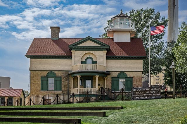
Coquille River Lighthouse Coquille River Light (formerly known as Bandon Light) is a lighthouse located near Bandon, Oregon, United States. It is currently maintained by the Oregon Parks and Recreation Department as a part of Bullards Beach State Park. Originally named Bandon Light, Coquille River Light was commissioned in 1895. First lit on February 29, 1896, the light guided mariners past the dangerous shifting sandbars into the Coquille River and harbor at Bandon. The light contained a fourth-order Fresnel lens and connected to the nearby keepers house by a wooden walkway. In September 1936, a large wildfire swept through the surrounding area, and destroyed most of Bandon. The town soon became bankrupt as a result of the decline in shipping. Coquille Light was shut down in 1939 and replaced by an automated light on the south jetty. The light was originally built with a Daboll trumpet for its foghorn, which was used as the light’s fog signal for several years. However, at certain times due to specific weather conditions, the sound of the trumpet would fail at sea, and in 1910 the trumpet was replaced by a more reliable fog siren. While mariners liked the new signal, many Bandon residents did not. The siren would eventually be removed along with the Fresnel lens after the light’s decommissioning. Over the next 37 years, the condition of the light deteriorated due to neglect and vandalism, until 1976, when its first major restoration began. However, by this time, the keepers quarters and other outbuildings had deteriorated past the point of repair, and were eventually removed. In 1991, a new solar powered light was installed in the tower. What to Photograph The historic lighthouse sits at the mouth of the Coquille River and can be photographed in the Bullards Beach State Park and also from across the river from Bandon. From the state park there are 4.5 miles of beach to explore. Where it is: Bullards Beach State Park From Highway 101 just over two miles north of Bandon, the lighthouse is located in Bullards Beach State Park in Bandon.  Enter the park just north of the Coquille River. Follow Park Road to the end where it will fork. Follow the right fork towards the ocean. Bullards Beach is a large, family-oriented park located two miles north of Bandon. The historic Coquille River Lighthouse is located at the end of Bullards Beach Road. It’s staffed from mid-May through the September with volunteers who interpret the history of the area. Maps: Interactive Google Map Use the map  + – controls to zoom in and out, click and drag the to move the map, use the Map drop-down to change to “Map”, “Satellite”, “Hybrid”, or “Terrain” views.  Drag the little man icon from the upper left corner to a map location for street level view.     GPS: 43°7’26.549″ N 124°25’27.138″ W Hours: Hours are 11 a.m. to 5 p.m. daily from mid-May through September. While visitors are no longer able to access the tower due to safety concerns, the fog/ signal room remains open.   Cost: Bullards Beach does not charge a day use fee. Location Contact Information:     Call  541-347-2209 for information.   Coquille River Lighthouse Photo Gallery Click Here for full page gallery   More Photographic Destinations in Oregon: Interactive Google Map Use the map  + – controls to zoom in and out, use the Map drop-down to change to “Map”, “Satellite”, “Hybrid”, or “Terrain” views.  Drag the little man icon from the upper left corner to a map location for street level view. Click on a pushpin for more information about the Photographic Destination, then click on the title to go to the location page. Click Here for Photographic Destinations by State    All the information in this post was believed to be accurate at the time it was published.  Please be sure to double check with the location before relying on this information as everything changes over time, especially hours, prices, and whether the location is still open.   Great Places for Great Photos   Let me help you to find a great location for your next photography adventure.  I will list many lesser-known destinations, as well as the famous "Icon Locations" for photography.  I will provide photos (Lots of Photos), location information, consisting of what there is to photograph as well as other information about the destination.  I will give costs, maps, directions, contact information, and other essential information for a successful photo trip.  I will only post for locations that I have personally photographed to ensure a quality guide to great locations for photography. If you know of great places that are not posted, please send me the details, I may just decide that is a place I need to go!     Greg Disch is a freelance photographer located in Arkansas. Greg specializes in nature, scenic, wildlife, and other outdoor subjects in Arkansas and other areas of the country.  Most of the images on this site are available for sale as prints, personal use, or rights managed stock photos. Greg offers both classroom instruction and in the field hands on photographic workshops. Classroom sessions are normally held in Fort Smith Arkansas, but arrangements can be made to bring a class to your group. All classes and workshops have small class sizes designed to provide an optimum student to instructor ratio, where you can get the personal attention, you need.  Most classes and workshops are limited to a maximum of six participants and will be held with a minimum of only two. If you are looking for a wonderful opportunity to get personal individual instruction, I do private workshops and classes at a location of your choice, whether doing a location photo shoot, coming to your home or business, traveling across the country on a road trip, or at my classroom.  This is a fantastic way to learn digital workflow and be sure that your computer equipment is properly configured for optimum performance. [...]Read more...
Cockspur Island Lighthouse The Cockspur Island Light is the smallest lighthouse in Georgia. It ceased operation as an active beacon in 1909. It has been relit since 2007 for historical rather than navigational purposes. The lighthouse is built on an oyster and mussel bed. This lighthouse is unique in that the base is shaped like the prow of a ship to reduce the impact of the waves on the structure. The lighthouse is not currently open to the public. However, visitors to the area frequently access the water near the beacon by kayak, often taking a commercial tour. The National Park Service cut a trail from Fort Pulaski National Monument to the lighthouse through the brush in 2005 to allow visitors a closer vantage point. The trail begins on the northeast side of the fort and is about 0.8 mile long. At low tide, hikers can get within approximately 200 yards of the lighthouse. This lighthouse was initially built as a daymarker without lights to indicate the entrance to the South Channel of the Savannah River. Construction lasted from March 1837 to November 1839. By 1848 it was retrofitted with lights and reflectors. It housed a fixed white light from five lamps with 14 inch reflectors that shone 9 miles at a height of 25 feet above sea level. It was damaged by a hurricane in 1854. The larger replacement that was built in 1855 on the same foundation. The light was extinguished for a time during the American Civil War during the battle that brought the defeat of Fort Pulaski. The lighthouse suffered little or no damage, even though it was in direct line of fire. It was relit in 1866. On June 1, 1909, the light was finally extinguished, because the south channel was infrequently used, compared to the deeper and wider North Channel of the Savannah River. The United States Coast Guard relinquished control of this lighthouse to the National Park Service on August 14, 1958. Along with the entire National Monument, the lighthouse and the island is listed on the National Register of Historic Places. Starting in 1995 and lasting until 2000, the upper portions of the lighthouse were restored, although the foundations still require protection from wave action and tidal erosion. On March 18, 2007 at 7:30 p.m. the lighthouse was relit in a ceremony hosted by the National Park Service and the U.S. Coast Guard. Where it is: The lighthouse is situated on an islet off Cockspur Island at the south channel of the Savannah River near Lazaretto Creek, northwest of Tybee Island in Chatham County, Georgia. It is part of Fort Pulaski National Monument. Fort Pulaski, on Cockspur Island at the mouth of the Savannah River, is 15 miles east of Savannah, Ga., and may be reached from the city by way of U.S. 80 (Tybee Road). Due to ongoing preservation efforts, the lighthouse and lighthouse island are closed to the public. However, an overlook trail offers visitors the best chance to get a closer look at the lighthouse today.  The lighthouse can also be photographed from across the river. Maps: Interactive Google Map Use the map  + – controls to zoom in and out, click and drag the to move the map, use the Map drop-down to change to “Map”, “Satellite”, “Hybrid”, or “Terrain” views.  Drag the little man icon from the upper left corner to a map location for street level view. GPS: 32.022747611973216, -80.87991174983692 Cost: Per Person: $10 valid for 7 consecutive days. Youth 15 and under are admitted free of charge. Fort Pulaski Annual Pass: ($35 valid for one year from month of purchase) The federal interagency annual pass, the America the Beautiful – The National Parks and Federal Recreation Lands Pass Series are accepted. Hours: Fort Pulaski National Monument is open year round from 9:00 a.m. to 5:00 pm, except for New Years, Thanksgiving, and Christmas Days. Last entry into the park is at 4:30 pm. Historic Fort Pulaski is open 9:00 a.m. to 4:30 pm and the Visitor Center is open from 9:00 am to 5:00 pm. Facilities: There are restrooms and park store in the visitor center. Location Contact Information: By Phone: Visitor Information (912) 786-5787 Administration (912) 786-8182 By Fax: Administration (912) 786-6023 By Mail: Visitor Services Fort Pulaski National Monument 101 Fort Pulaski Road Savannah, GA 31410 Park Headquarters Fort Pulaski National Monument 41 Cockspur Island Road Savannah, GA 31410 By E-mail: You can e-mail  for any additional questions about the park.   Cockspur Island Lighthouse Photo Gallery Click Here for full page gallery   More Photographic Destinations in Georgia Interactive Google Map Use the map  + – controls to zoom in and out, use the Map drop-down to change to “Map”, “Satellite”, “Hybrid”, or “Terrain” views.  Drag the little man icon from the upper left corner to a map location for street level view. Click on a pushpin for more information about the Photographic Destination, then click on the title to go to the location page. Click Here for Photographic Destinations by State    All the information in this post was believed to be accurate at the time it was published.  Please be sure to double check with the location before relying on this information as everything changes over time, especially hours, prices, and whether the location is still open.   Great Places for Great Photos   Let me help you to find a great location for your next photography adventure.  I will list many lesser-known destinations, as well as the famous "Icon Locations" for photography.  I will provide photos (Lots of Photos), location information, consisting of what there is to photograph as well as other information about the destination.  I will give costs, maps, directions, contact information, and other essential information for a successful photo trip.  I will only post for locations that I have personally photographed to ensure a quality guide to great locations for photography. If you know of great places that are not posted, please send me the details, I may just decide that is a place I need to go!     Greg Disch is a freelance photographer located in Arkansas. Greg specializes in nature, scenic, wildlife, and other outdoor subjects in Arkansas and other areas of the country.  Most of the images on this site are available for sale as prints, personal use, or rights managed stock photos. Greg offers both classroom instruction and in the field hands on photographic workshops. Classroom sessions are normally held in Fort Smith Arkansas, but arrangements can be made to bring a class to your group. All classes and workshops have small class sizes designed to provide an optimum student to instructor ratio, where you can get the personal attention, you need.  Most classes and workshops are limited to a maximum of six participants and will be held with a minimum of only two. If you are looking for a wonderful opportunity to get personal individual instruction, I do private workshops and classes at a location of your choice, whether doing a location photo shoot, coming to your home or business, traveling across the country on a road trip, or at my classroom.  This is a fantastic way to learn digital workflow and be sure that your computer equipment is properly configured for optimum performance. [...]Read more...
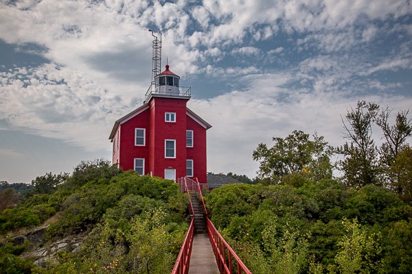
  Cape San Blas Lighthouse The Cape San Blas Lighthouse was built more than 130 years ago when Congress appropriated $8,000 to erect the original structure. It was designed to guide vessels around the shoals running out from the Cape using the sole beacon that could be seen for up to 10 miles offshore. Rich with history, including an attack by Union Troops in 1862, the structure has survived a series of blows from storms, winds and high surf throughout the years. Cape San Blas is a dangerous shoal that extends over five miles into the Gulf, east of the port of Panama City and west of the port of Apalachicola. In 1847 the first lighthouse was constructed there. After a storm toppled it into the sea in 1851, Congress authorized a second one which was completed in 1856, just as the great storm of 1856 arrived in the area and toppled it into the sea. The Lighthouse Board then built a third brick tower in 1859, but that was burned at the start of the Civil War. After the war, the lighthouse was lighted in 1865 and a new keeper’s home added in 1870. This tower was toppled by encroaching waters in 1882. In 1885 a movable 96′ iron skeleton tower was erected 900′ from the Gulf. By 1894, the water was again washing away the foundation and in 1918 the tower was again moved 1,850′ from the water. Mother Nature continued her own onslaught and Tropical Storm Isaac reclaimed the remaining shoreline forcing the lighthouse to close temporarily in 2012. In honor of its historic and iconic presence, the City of Port St. Joe successfully moved the lighthouse to its protective shores on St. Joseph Bay to preserve and maintain the beloved structure. On July 15, 2014, hundreds of people watched as the Lighthouse, its two Keepers’ Quarters and Oil House made its journey into Port St. Joe. The convoy, which was over 900 feet long and two lanes wide, was moved from the Gulf shores of Cape San Blas to its new location. The choreographed moving process took an entire day and required multiple power lines and a traffic light to be moved to accommodate the convoy on their safe journey. Locals and visitors alike were applauding with relief and pride as it came to its final stop in George Core Park. Hundreds gathered once again on July 24 to observe the Lighthouse as it was erected onto its new platform. On the weekend of September 12, 2014, surrounded by the sights and sounds of the 18th Annual Florida Scallop & Music Festival, 249 climbers came out to be the first to take in the new breathtaking viewpoint of St. Joseph Bay from the top of the historic Lighthouse.   Where it is: The lighthouse is located in George Core Park located at 200 Miss Zola’s Dr. in Port St. Joe. Take Highway 98 to Port St. Joe and then turn toward the bay on Captain Fred’s Place, the extension of Fourth Street. You will find George Gore Park and the lighthouse at the end of the road. The lighthouse and gift shop should be open year-round, Thursday through Saturday. To confirm hours, call (850) 229-1151. Maps: Interactive Google Map Use the map  + – controls to zoom in and out, click and drag the to move the map, use the Map drop-down to change to “Map”, “Satellite”, “Hybrid”, or “Terrain” views.  Drag the little man icon from the upper left corner to a map location for street level view. GPS: 29°48’47.352″ N 85°18’23.658″ W Cost: The cost to climb is $5.00 for adults and $3.00 for children under 13 years of age. Children climbers must be at least 44 inches tall. Flip flops or other open back shoes cannot be worn to climb the tower.   Hours: Wednesday through Saturday, 11:00 pm EST to 5:00 pm EST All times Eastern. Hours vary, please call 850-229-1151 or 850-229-8261 to confirm. Facilities: The Lighthouse Gift Shop is currently housed in the Keepers’ Quarters, located adjacent to the Welcome Center and the historic Maddox Park overlooking St. Joseph Bay. The Gift Shop houses souvenirs that honor the Cape San Blas Lighthouse, visitors can also see antiquities from the Keepers’ Quarters as well as register to climb the Lighthouse! Location Contact Information: Cape San Blas Lighthouse George Core Park 200 Miss Zola’s Dr., Port Saint Joe, FL, United States, 32456 St. Joseph Historical Society, Inc. P. O. Box 231 Port St. Joe, FL 32457 (850) 229-1151 historicalsocietypsj@yahoo.com Cape San Blas Lighthouse Photo Gallery Click Here for full page gallery   More Photographic Destinations in Florida Interactive Google Map Use the map  + – controls to zoom in and out, use the Map drop-down to change to “Map”, “Satellite”, “Hybrid”, or “Terrain” views.  Drag the little man icon from the upper left corner to a map location for street level view. Click on a pushpin for more information about the Photographic Destination, then click on the title to go to the location page. Click Here for Photographic Destinations by State    All the information in this post was believed to be accurate at the time it was published.  Please be sure to double check with the location before relying on this information as everything changes over time, especially hours, prices, and whether the location is still open.   Great Places for Great Photos   Let me help you to find a great location for your next photography adventure.  I will list many lesser-known destinations, as well as the famous "Icon Locations" for photography.  I will provide photos (Lots of Photos), location information, consisting of what there is to photograph as well as other information about the destination.  I will give costs, maps, directions, contact information, and other essential information for a successful photo trip.  I will only post for locations that I have personally photographed to ensure a quality guide to great locations for photography. If you know of great places that are not posted, please send me the details, I may just decide that is a place I need to go!     Greg Disch is a freelance photographer located in Arkansas. Greg specializes in nature, scenic, wildlife, and other outdoor subjects in Arkansas and other areas of the country.  Most of the images on this site are available for sale as prints, personal use, or rights managed stock photos. Greg offers both classroom instruction and in the field hands on photographic workshops. Classroom sessions are normally held in Fort Smith Arkansas, but arrangements can be made to bring a class to your group. All classes and workshops have small class sizes designed to provide an optimum student to instructor ratio, where you can get the personal attention, you need.  Most classes and workshops are limited to a maximum of six participants and will be held with a minimum of only two. If you are looking for a wonderful opportunity to get personal individual instruction, I do private workshops and classes at a location of your choice, whether doing a location photo shoot, coming to your home or business, traveling across the country on a road trip, or at my classroom.  This is a fantastic way to learn digital workflow and be sure that your computer equipment is properly configured for optimum performance. [...]Read more...
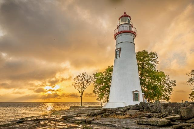
Cape Meares Lighthouse The Shortest Lighthouse in Oregon   Captain John Meares was the first to sail into Tillamook Bay, naming it Quick Sand Bay because of the mud at low tide. Captain Robert Gray was the first American on the scene and he called it Murderers Harbor because one of his crew was killed by natives there. The lighthouse was built in 1889 and commissioned on January 1, 1890. The tower stands 38 feet high and is the shortest lighthouse in Oregon. It is constructed of bricks (made right on site at a cost of $2,900) with iron plates covering it. The original addition that now houses the interpretive shop was a work room built in 1895 – the current interpretive shop replaced the original work room in 1978. The light was a five wick oil lamp with a reflector to increase the light. It was turned by a 200 pound lead weight that was wound by a system similar to a grandfather clock. It turned 2 ½ hours on one winding at a pace of 4 minutes per full revolution. The lens and iron housing weighed two tons complete. The two oil storage buildings held 3,240 gallons of oil in five gallon cans and were located east of the lighthouse. The walls were made 15 inches thick to protect the area from the danger of fire in the buildings. The original lens is a first order Fresnel (pronounced “Fraynel”) lens made in Paris, France. It was shipped around Cape Horn, up the west coast to Cape Meares and then hauled 217 feet up the cliff by a wooden crane that was built from local timbers native to the area. It is an eight-sided lens with 4 primary lenses and 4 bull’s-eye lenses with red panels covering the bull’s-eye lenses. It produced about 30 seconds of fixed white light from the primary lens followed by a red flash of 5 seconds from the bull’s-eye lens once every minute. This was the signature of Cape Meares Lighthouse. The primary lens produced 18,000 candlepower and the bull’s-eye lens produced 160,000 candlepower. The light could be seen 21 nautical miles at sea. The oil lamp was replaced in 1910 with an oil vapor light similar to the Coleman lanterns of today. This was replaced in 1934 with electricity produced by generators and eventually by central power. The light today is automated and produces 57,000 candle power. It is located in a building adjacent to the historic structure. The keepers houses were located where the parking lot and kiosk are now situated. The houses cost $26,000 to build. The lighthouse was decommissioned in 1963, stood vacant for a number of years and was heavily vandalized. What to Photograph The historic lighthouse and fantastic views of the rugged Oregon Coast. The Three Arch Rocks Wildlife Refuge can be seen in the distance from the shore. Where it is: Hwy 131 – As you are driving south on Hwy 101, turn right onto Hwy 131, previously Third St. Travel through the town of Netarts and continue on to Oceanside. Keep to the right as you near Oceanside and continue on Cape Meares Loop for 2 miles to the Lighthouse. Watch for signage along the way!   Maps: Interactive Google Map Use the map  + – controls to zoom in and out, click and drag the to move the map, use the Map drop-down to change to “Map”, “Satellite”, “Hybrid”, or “Terrain” views.  Drag the little man icon from the upper left corner to a map location for street level view.   GPS: 45°29’11.098″ N 123°58’42.168″ W Hours: Cape Meares State Scenic Viewpoint & National Wildlife Refuge is open 365 days a year. 7 a.m. to dusk. Cape Meares Lighthouse is open daily May thru September. The Lighthouse Gift Shop Hours: MONDAY…. closed TUESDAY…..closed WEDNESDAY…..closed THURSDAY…..11:00-4:00 closed FRIDAY…..11:00-4:00 closed SATURDAY…..11:00-4:00 closed SUNDAY…..11:00-4:00 closed Cost: Admittance to Cape Meares Lighthouse is free. Location Contact Information: Contact Cape Lookout State Park PHONE (503) 842-3182 for further information. or visit OPRD Cape Meares State scenic Viewpoint website at OPRD.org.  Oregon Parks and Recreation Department 725 Summer St. N.E. Suite C Salem, OR 97301 (503) 986-0707 Cape Meares Lighthouse Photo Gallery Click Here for full page gallery   More Photographic Destinations in Oregon: Interactive Google Map Use the map  + – controls to zoom in and out, use the Map drop-down to change to “Map”, “Satellite”, “Hybrid”, or “Terrain” views.  Drag the little man icon from the upper left corner to a map location for street level view. Click on a pushpin for more information about the Photographic Destination, then click on the title to go to the location page. Click Here for Photographic Destinations by State    All the information in this post was believed to be accurate at the time it was published.  Please be sure to double check with the location before relying on this information as everything changes over time, especially hours, prices, and whether the location is still open.   Great Places for Great Photos   Let me help you to find a great location for your next photography adventure.  I will list many lesser-known destinations, as well as the famous "Icon Locations" for photography.  I will provide photos (Lots of Photos), location information, consisting of what there is to photograph as well as other information about the destination.  I will give costs, maps, directions, contact information, and other essential information for a successful photo trip.  I will only post for locations that I have personally photographed to ensure a quality guide to great locations for photography. If you know of great places that are not posted, please send me the details, I may just decide that is a place I need to go!     Greg Disch is a freelance photographer located in Arkansas. Greg specializes in nature, scenic, wildlife, and other outdoor subjects in Arkansas and other areas of the country.  Most of the images on this site are available for sale as prints, personal use, or rights managed stock photos. Greg offers both classroom instruction and in the field hands on photographic workshops. Classroom sessions are normally held in Fort Smith Arkansas, but arrangements can be made to bring a class to your group. All classes and workshops have small class sizes designed to provide an optimum student to instructor ratio, where you can get the personal attention, you need.  Most classes and workshops are limited to a maximum of six participants and will be held with a minimum of only two. If you are looking for a wonderful opportunity to get personal individual instruction, I do private workshops and classes at a location of your choice, whether doing a location photo shoot, coming to your home or business, traveling across the country on a road trip, or at my classroom.  This is a fantastic way to learn digital workflow and be sure that your computer equipment is properly configured for optimum performance. [...]Read more...