Great Places for Great Photos

Let me help you to find a great location for your next photography adventure. I will list many lesser known destinations, as well as the famous “Icon Locations” for photography. I will provide photos (Lots of Photos), location information, consisting of what there is to photograph as well as other information about the destination. I will give costs, maps, directions, contact information, and other essential information for a successful photo trip. I will only post for locations that I have personally photographed to insure a quality guide to great locations for photography.

Water Mills Photographic Destinations

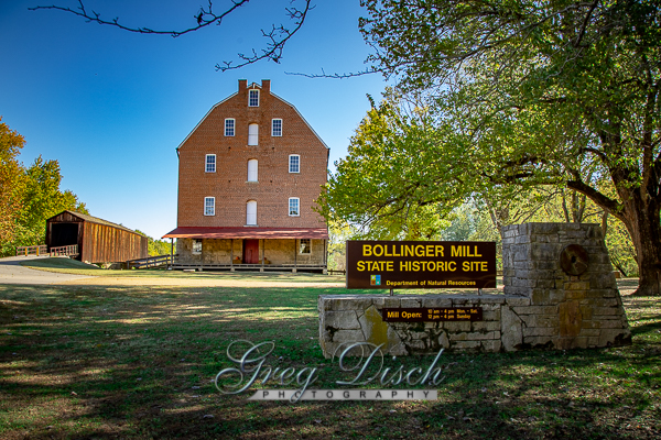
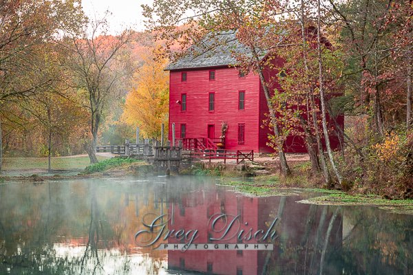
A watermill or water mill is a mill that uses hydropower. It is a structure that uses a water wheel or water turbine to drive a mechanical process such as milling (grinding), rolling, or hammering. Such processes are needed in the production of many material goods, including flour, lumber, paper, textiles, and many metal products. These watermills may comprise gristmills, sawmills, paper mills, textile mills, hammermills, trip hammering mills, rolling mills, wire drawing mills.

One major way to classify watermills is by wheel orientation (vertical or horizontal), one powered by a vertical waterwheel through a gear mechanism, and the other equipped with a horizontal waterwheel without such a mechanism. The former type can be further divided, depending on where the water hits the wheel paddles, into undershot, overshot, breastshot and pitchback (backshot or reverse shot) waterwheel mills.


Interactive Google Map

Use the map  + – controls to zoom in and out, use the Map drop-down to change to “Map”, “Satellite”, “Hybrid”, or “Terrain” views.  Drag the little man icon from the upper left corner to a map location for street level view. Click on a pushpin for more information about the Photographic Destination, then click on the title to go to the location page.
Water Mills

Water Mill Destinations
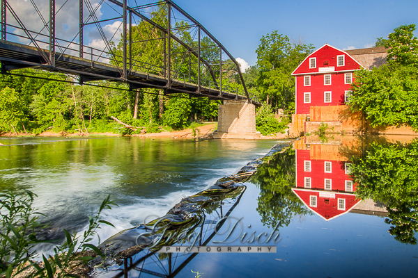
War Eagle Mill War Eagle Mill is a working gristmill in Benton County, Arkansas. A mill has been located on the site as early as 1832, but was destroyed three times, and last rebuilt in 1973. The mill currently the only operating mill in Arkansas and operates as an undershot gristmill, and houses a store and the Bean Palace restaurant. The mill is home to the War Eagle mill Crafts Fair in May and October. Historic War Eagle Bridge The historic War Eagle Bridge next to the mill is a one lane steel bridge built in 1907 and is listed on the National Register of Historic Places.  The bridge was restored, preserving the historic integrity in 2010. What to Photograph: The main things to photograph are the mill and the bridge, however their are other old buildings and the War Eagle Creek. Best Time for Photographers: The mill and bridge can be photographed at most any time of the day, however late afternoon and early evening will put the sun at your back when shooting the mill from across the river.  The worst time to try and photograph the mill is during either the spring or fall craft show, however the craft show can be a good photo subject by itself. Getting There: From Springdale –take Hwy 412 E to Hwy 303 N. Eight miles to the mill. Alternatley, take I-540 N to Exit 85. Turn right from ramp on Hwy 71 S. Turn left on Hwy 62B/Second Street. Turn right to Hwy 12 E and follow 6.8 miles. Turn right on War Eagle Road. It is 1.5 miles to the mill. From Fayetteville – take Hwy 45 N to Hwy 303 N to Hwy 412 E to Hwy 303 N. It is 8 miles to the mill. From Bella Vista – take I-540 S to Exit 86 turn left from ramp on Hwy 102 E. Turn right on Hwy 62B/Second Street. Turn left on Hwy 12 E. Follow Hwy 12 E. Go 6.8 miles to War Eagle Road 98. It is 1.5 miles to the mill. From Points South of Rogers – take I-540 N to Exit 85. Turn right from ramp on Hwy 71 S. Turn left on Hwy 62B/Second Street. Turn right to Hwy 12 E and follow for 6.8 miles. Turn right on War Eagle Road. It is 1.5 miles to the mill. From Huntsville – take Hwy 412 W to Hwy 303 N. It is 8 miles to the mill. From Eureka Springs – take Hwy 23 S. Turn right on Hwy 12 W and travel about 14 miles. Turn left on War Eagle Road 98 and follow 1.5 miles to the mill. From Branson – take Hwy 65 South to Hwy 412/62 W stay on Hwy 412 W from Alpena to Hwy 303 N. It is 8 miles to the mill. Maps: Interactive Google Map Use the map  + – controls to zoom in and out, click and drag the to move the map, use the Map drop-down to change to “Map”, “Satellite”, “Hybrid”, or “Terrain” views.  Drag the little man icon from the upper left corner to a map location for street level view. Cost: There are no fees for this area. Facilities: There are no lodging or camping facilities at the mill, however there are restrooms and the Bean Palace Restaurant. The mill, gift shop and restaurant are open every day in March through January 1 from 8:30 am to 5:00 pm. The mill will be open January 1 for a new year’s celebration. Closed for the rest of January and only Friday, Saturday and Sunday in February. Please note that the Mill has 3 floors but no elevator. If you have any questions about the mill, gift shop or restaurant, please call  toll-free at 866-492-7324. Location Contact Information: War Eagle Mill 11045 War Eagle Road | Rogers, Arkansas | 72756-7544 Local: 479-789-5343 Toll Free: 1-866-492-7324 Fax: 479-789-5100 http://www.wareaglemill.com/ Nearest City or Town: Roges Arkansas   War Eagle Mill Photo Gallery Click Here for full page gallery More Photographic Destinations in Arkansas: Interactive Google Map Use the map  + – controls to zoom in and out, use the Map drop-down to change to “Map”, “Satellite”, “Hybrid”, or “Terrain” views.  Drag the little man icon from the upper left corner to a map location for street level view. Click on a pushpin for more information about the Photographic Destination, then click on the title to go to the location page. Click Here for Photographic Destinations by State    All the information in this post was believed to be accurate at the time it was published.  Please be sure to double check with the location before relying on this information as everything changes over time, especially hours, prices, and whether the location is still open.   Great Places for Great Photos   Let me help you to find a great location for your next photography adventure.  I will list many lesser-known destinations, as well as the famous "Icon Locations" for photography.  I will provide photos (Lots of Photos), location information, consisting of what there is to photograph as well as other information about the destination.  I will give costs, maps, directions, contact information, and other essential information for a successful photo trip.  I will only post for locations that I have personally photographed to ensure a quality guide to great locations for photography. If you know of great places that are not posted, please send me the details, I may just decide that is a place I need to go!     Greg Disch is a freelance photographer located in Arkansas. Greg specializes in nature, scenic, wildlife, and other outdoor subjects in Arkansas and other areas of the country.  Most of the images on this site are available for sale as prints, personal use, or rights managed stock photos. Greg offers both classroom instruction and in the field hands on photographic workshops. Classroom sessions are normally held in Fort Smith Arkansas, but arrangements can be made to bring a class to your group. All classes and workshops have small class sizes designed to provide an optimum student to instructor ratio, where you can get the personal attention, you need.  Most classes and workshops are limited to a maximum of six participants and will be held with a minimum of only two. If you are looking for a wonderful opportunity to get personal individual instruction, I do private workshops and classes at a location of your choice, whether doing a location photo shoot, coming to your home or business, traveling across the country on a road trip, or at my classroom.  This is a fantastic way to learn digital workflow and be sure that your computer equipment is properly configured for optimum performance. [...]Read more...
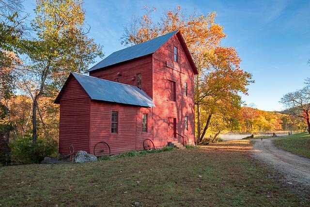
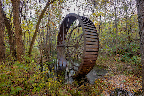
  Turner’s Mill Wheel Turners Mill is an extinct town in eastern Oregon County, in the state of Missouri. The mill was adjacent to Turners Spring on the north bank of the Eleven Point River. The community has the name of Jesse L. Clay Turner, the proprietor of a local mill. A variant name was “Surprise”. A post office called Surprise was established in 1895, and remained in operation until 1925. Turner Spring is a lovely place for family fun. Turner Spring (1.5-million-gallon average daily flow), flows from a high rocky bluff and use to power a 25 ft metal mill. The Mill is in the Spring branch. There is no camping on the North side of the River. The North River Access is strictly for viewing and exploring. What remains of Turner Mill is the huge overshot wheel, drive shafts and  a stone burr, used fro grinding corn and wheat.  Operated as early as the 1850’s by G.W. Decker, the original mill utilized a wooden overshot wheel.  Jesse L. (Clay) Turner bought the mill in 1891.  After partially rebuilding the wheel, he refurbished the four story mill building with a system of belts, pulleys and drive shafts, which operated a planer, drill press, various types of saws and the equipment for grinding wheat or corn.  The Post Office was housed in one end of the mill. The possession of enough power to operate the mill and the maintenance of the wheel were ongoing concerns.  Turner abandoned the wooden wheel in favor of a turbine, which furnished power until 1915.  The turbine was then replaced by a 25 foot steel overshot wheel hauled to the site in sections by oxen.  Logs were brought to the mill by floating them down the Eleven Point River.  Teams of Oxen hauled the logs out of the river.  At that time roads were almost non-existent or very poor. What to Photograph The only thing remaining of Turner’s Mill is the 25′ Metal wheel that is still standing in the spring near where the mill was located many years ago.     Where it is: The remains of the mill wheel are located at the Turner’s Mill Access point on the Eleven Point River in the Mark Twain National Forest 15 miles south of Winona, Missouri.  Turner Mill North is located on the left side Eleven Point National Scenic River at mile 22.3. This access is 4.9 miles downriver of Greer Crossing. Located on the edge of the Irish Wilderness area near Alton, Missouri, Directions: Turner Mill North Picnic Area is accessed by hilly, gravel Forest roads 3152 and 3190. The turnoff to Turner Mill is 15 miles south of Winona or 11 miles north of Alton on Hwy 19. From Hwy 19, turn onto FR 3152 for 6 miles then on FR 3190 for 3 miles. when you reach the canoe access and picnic area there is a trail behind the vault toilets that follows the Turner Spring to the wheel. Maps: Interactive Google Map Use the map  + – controls to zoom in and out, click and drag the to move the map, use the Map drop-down to change to “Map”, “Satellite”, “Hybrid”, or “Terrain” views.  Drag the little man icon from the upper left corner to a map location for street level view.   GPS: 36°45’59.746″ N 91°16’5.05″ W Cost: There is no cost to Turner Mill. Hours: There are no hours the site is open 24 hours a day.   Facilities: There are vault toilets but no pother facilities at the mill site. The nearest town is Alton, MO. Location Contact Information: Mark Twain National Forest 401 Fairgrounds Road Rolla, MO 65401 (573) 364-4621 Eleven Point District Office: (573) 996-2153 Contact Us Turner’s Mill Photo Gallery Click Here for full page gallery   More Photographic Destinations in Missouri: Interactive Google Map Use the map  + – controls to zoom in and out, use the Map drop-down to change to “Map”, “Satellite”, “Hybrid”, or “Terrain” views.  Drag the little man icon from the upper left corner to a map location for street level view. Click on a pushpin for more information about the Photographic Destination, then click on the title to go to the location page. Click Here for Photographic Destinations by State    All the information in this post was believed to be accurate at the time it was published.  Please be sure to double check with the location before relying on this information as everything changes over time, especially hours, prices, and whether the location is still open.   Great Places for Great Photos   Let me help you to find a great location for your next photography adventure.  I will list many lesser-known destinations, as well as the famous "Icon Locations" for photography.  I will provide photos (Lots of Photos), location information, consisting of what there is to photograph as well as other information about the destination.  I will give costs, maps, directions, contact information, and other essential information for a successful photo trip.  I will only post for locations that I have personally photographed to ensure a quality guide to great locations for photography. If you know of great places that are not posted, please send me the details, I may just decide that is a place I need to go!     Greg Disch is a freelance photographer located in Arkansas. Greg specializes in nature, scenic, wildlife, and other outdoor subjects in Arkansas and other areas of the country.  Most of the images on this site are available for sale as prints, personal use, or rights managed stock photos. Greg offers both classroom instruction and in the field hands on photographic workshops. Classroom sessions are normally held in Fort Smith Arkansas, but arrangements can be made to bring a class to your group. All classes and workshops have small class sizes designed to provide an optimum student to instructor ratio, where you can get the personal attention, you need.  Most classes and workshops are limited to a maximum of six participants and will be held with a minimum of only two. If you are looking for a wonderful opportunity to get personal individual instruction, I do private workshops and classes at a location of your choice, whether doing a location photo shoot, coming to your home or business, traveling across the country on a road trip, or at my classroom.  This is a fantastic way to learn digital workflow and be sure that your computer equipment is properly configured for optimum performance. [...]Read more...
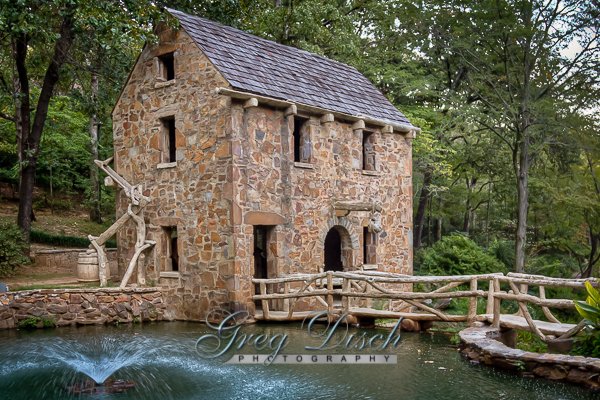
Topaz Mill Topaz Mill, located on the North Fork River, is a privately owned historic site. Tourist are welcomed to visit the site and tours are gladly given! The farm and mill was purchased in 1957, by the O’Neal family… Clarence and Adith O’Neal, and their son Joe and his wife Billie O’Neal. It is a popular destination point for those interested the old mills. Topaz stands out because all of the original equipment remains. It is as if they shut the doors at the end of the work day! Tours of the old mill are gladly given by Joe Bob O’Neal when he is available. There are no regular hours that the mill is open for tours. One can drop by or call ahead to insure that someone is available to give a tour. The old Topaz Store remains to be enjoyed by tourist. It is a step back in time! Many of our local senior citizens recall shopping in the old store and treats of “penny candies”. You may drop into Topaz anytime or schedule a visit and tour. 417-948-0154 Once the small but thriving community of Topaz, MO. existed at the crossing of the North Fork River at Topaz Springs. Still standing there is the historic Topaz Mill and the old General Store which is now part of the privately owned farm of the O’Neal Family. They have shared the history of the community with curious tourists for years. The mill amazingly has all of the original equipment, which is unusual for buildings of this age. The mill is partially operational and powered by the waters that flow from Topaz Spring. What to Photograph The historic Topaz Mill, the original mill equipment inside and the Topaz General Store.   Where it is: Directions to Topaz Mill from Cabool, MO: South from Cabool on Hwy 181 to Hwy 76. Turn Rt and go about 1/2 mile and turn left on “E”. You go about 4 miles and the pavement ends just past Mt.Ararat Church. Continue on the dirt road about 1.5 mil and you will come to Topaz Mill! Maps: Interactive Google Map Use the map  + – controls to zoom in and out, click and drag the to move the map, use the Map drop-down to change to “Map”, “Satellite”, “Hybrid”, or “Terrain” views.  Drag the little man icon from the upper left corner to a map location for street level view.   GPS: 36°56’44.158″ N 92°12’11.67″ W Cost: There is no cost to visit Topaz Mill, however donations are greatly appreciated and help to preserve the mill. Hours: You may drop into Topaz anytime or schedule a visit and tour. 417-948-0154 Facilities: There are no public facilities at the mill.  The nearest towns are Cabool and Willow Springs Location Contact Information: Rt 63 Box 728 Cabool, Missouri m.me/194425447587837 Call (417) 948-0154 friendsoftopazmill@gmail.com Topaz Mill Photo Gallery Click Here for full page gallery   More Photographic Destinations in Missouri: Interactive Google Map Use the map  + – controls to zoom in and out, use the Map drop-down to change to “Map”, “Satellite”, “Hybrid”, or “Terrain” views.  Drag the little man icon from the upper left corner to a map location for street level view. Click on a pushpin for more information about the Photographic Destination, then click on the title to go to the location page. Click Here for Photographic Destinations by State    All the information in this post was believed to be accurate at the time it was published.  Please be sure to double check with the location before relying on this information as everything changes over time, especially hours, prices, and whether the location is still open.   Great Places for Great Photos   Let me help you to find a great location for your next photography adventure.  I will list many lesser-known destinations, as well as the famous "Icon Locations" for photography.  I will provide photos (Lots of Photos), location information, consisting of what there is to photograph as well as other information about the destination.  I will give costs, maps, directions, contact information, and other essential information for a successful photo trip.  I will only post for locations that I have personally photographed to ensure a quality guide to great locations for photography. If you know of great places that are not posted, please send me the details, I may just decide that is a place I need to go!     Greg Disch is a freelance photographer located in Arkansas. Greg specializes in nature, scenic, wildlife, and other outdoor subjects in Arkansas and other areas of the country.  Most of the images on this site are available for sale as prints, personal use, or rights managed stock photos. Greg offers both classroom instruction and in the field hands on photographic workshops. Classroom sessions are normally held in Fort Smith Arkansas, but arrangements can be made to bring a class to your group. All classes and workshops have small class sizes designed to provide an optimum student to instructor ratio, where you can get the personal attention, you need.  Most classes and workshops are limited to a maximum of six participants and will be held with a minimum of only two. If you are looking for a wonderful opportunity to get personal individual instruction, I do private workshops and classes at a location of your choice, whether doing a location photo shoot, coming to your home or business, traveling across the country on a road trip, or at my classroom.  This is a fantastic way to learn digital workflow and be sure that your computer equipment is properly configured for optimum performance. [...]Read more...
The Old Mill The Old Mill was never a real working mill, but instead the creation of Senor Dionicio Rodriguez who sculpted the entire project from cement.  The project was built as part of the development of the Lakewood residential community in North Little Rock and was completed in 1933.  The Old Mill was placed on the National Record of Historic Places in 1986.  The Old Mill is well known from the opening scenes of the 1939 film Gone With the Wind. What to Photograph: The entire park is very photographic and draws many photographers from around the world.  The main attraction of course of the mill itself, but the surrounding gardens are also great photo subjects themselves.  There are many intricate details in the paths and bridges as well that make interesting photos. Best Time for Photographers: Early morning and evening of course are some of the best time for photography, but due to the popularity of the park weekdays are the best time to photograph without crowds of people.  The park is very popular with professional shooting portraits and for weddings. Where it is: The Old Mill  is located in the T.R. Pugh Memorial Park, at the corner of Fairway Avenue and Lakeshore Drive in North Little Rock. Maps: Interactive Google Map Use the map  + – controls to zoom in and out, click and drag the to move the map, use the Map drop-down to change to “Map”, “Satellite”, “Hybrid”, or “Terrain” views.  Drag the little man icon from the upper left corner to a map location for street level view. Cost: Admission if free to the park which is open from sunrise to sunset, and is now owned by the city of North Little Rock. Facilities:  There are public restrooms located in the park. Links:  Information about the Old Mill Location Contact Information: Address: The Old Mill at T.R. Pugh Memorial Park 3800 Lakeshore Drive North Little Rock, AR 72119 Phone: 501-758-1424 Toll-Free: 800-643-4690 Fax: 501-758-5752 Website: www.northlittlerock.org E-mail: visitnlr@northlittlerock.org GPS: N34.7916357 W92.2504150 Nearest City or Town:  North Little Rock Arkansas   Weather: Click for weather forecast The Old Mill Photo Gallery Click Here for full page gallery More Photographic Destinations in Arkansas: Interactive Google Map Use the map  + – controls to zoom in and out, use the Map drop-down to change to “Map”, “Satellite”, “Hybrid”, or “Terrain” views.  Drag the little man icon from the upper left corner to a map location for street level view. Click on a pushpin for more information about the Photographic Destination, then click on the title to go to the location page. Click Here for Photographic Destinations by State   All the information in this post was believed to be accurate at the time it was published.  Please be sure to double check with the location before relying on this information as everything changes over time, especially hours, prices, and whether the location is still open.   Great Places for Great Photos   Let me help you to find a great location for your next photography adventure.  I will list many lesser-known destinations, as well as the famous "Icon Locations" for photography.  I will provide photos (Lots of Photos), location information, consisting of what there is to photograph as well as other information about the destination.  I will give costs, maps, directions, contact information, and other essential information for a successful photo trip.  I will only post for locations that I have personally photographed to ensure a quality guide to great locations for photography. If you know of great places that are not posted, please send me the details, I may just decide that is a place I need to go!     Greg Disch is a freelance photographer located in Arkansas. Greg specializes in nature, scenic, wildlife, and other outdoor subjects in Arkansas and other areas of the country.  Most of the images on this site are available for sale as prints, personal use, or rights managed stock photos. Greg offers both classroom instruction and in the field hands on photographic workshops. Classroom sessions are normally held in Fort Smith Arkansas, but arrangements can be made to bring a class to your group. All classes and workshops have small class sizes designed to provide an optimum student to instructor ratio, where you can get the personal attention, you need.  Most classes and workshops are limited to a maximum of six participants and will be held with a minimum of only two. If you are looking for a wonderful opportunity to get personal individual instruction, I do private workshops and classes at a location of your choice, whether doing a location photo shoot, coming to your home or business, traveling across the country on a road trip, or at my classroom.  This is a fantastic way to learn digital workflow and be sure that your computer equipment is properly configured for optimum performance. [...]Read more...
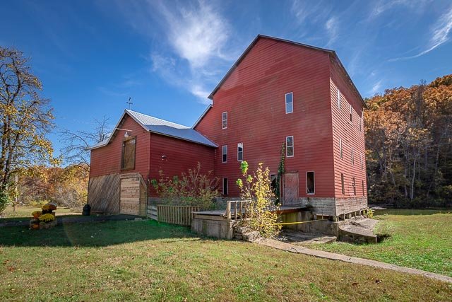
Star’s Mill The property that became Starr’s Mill was owned by Hananiah Gilcoat who built the first mill here before his death in 1825. This site, on Whitewater Creek, was less than a mile from the boundary between Creek Indian lands and the State of Georgia. Hilliard Starr, who owned the mill from 1866 until 1879, gave the site its current name. After the first two log structures burned, William T. Glower built the current building in 1907. This mill operated until 1959, using a water-powered turbine, instead of a wheel, to grind corn and operate a sawmill. The Starr’s Mill site also included a cotton gin and a dynamo that produced electricity for nearby Senoia. Star’s mill was the location for “Deep South Glass”  the glass shop in the movie Sweet Home Alabama.  The film crew did a lot of restoration and a new coat of paint and the front deck was built. The current mill, just over 100 years old, was the third mill constructed Starr’s Mill Interior – Senoia, Georgia on the mill foundation. Dating back to 1907, the present mill was rebuilt by William T. Glower when the previous mill was destroy by fire. More than a grist mill, the Georgia mill site went on to power a cotton gin and supply electrical power to the nearby town of Senoia. Still a popular place to fish and take photographs, this charming mill and day use park can be found about 25 miles south of Atlanta, nearby the communities of Starrs Mill and Senoia. The Fayette County Water System purchased the historic Starr’s Mill in February, 1991. The millpond will be used as an additional water source for the System. This purchase included the mill house, dam, and approximately 16 acres of land. It is located on Highway 85 south of Fayetteville and will continue to be used for fishing, family gatherings and picnics. What to Photograph The old mill, the dam and waterfall, and the mill pond. Where it is: 115 Waterfall Way Fayetteville, GA 30215 From Atlanta take I-75 South to Georgia 85 ( NOT Interstate 85) South, through Riverdale and then Fayetteville and the Mill is about 5 miles past the courthouse square on the right. It is plainly visible from the road so you can’t miss it. Maps: Interactive Google Map Use the map  + – controls to zoom in and out, click and drag the to move the map, use the Map drop-down to change to “Map”, “Satellite”, “Hybrid”, or “Terrain” views.  Drag the little man icon from the upper left corner to a map location for street level view. GPS: 33°19’42.888″ N 84°30’29.147″ W Cost: There is not cost to visit the site at Star’s Mill Hours: Facilities: There are walking trails and picnic tables in the mill park.   Location Contact Information: Fayette County Administration 140 Stonewall Avenue West Suite 100 Fayetteville, Georgia 30214 Star’s Mill Photo Gallery Click Here for full page gallery   More Photographic Destinations in Georgia: Interactive Google Map Use the map  + – controls to zoom in and out, use the Map drop-down to change to “Map”, “Satellite”, “Hybrid”, or “Terrain” views.  Drag the little man icon from the upper left corner to a map location for street level view. Click on a pushpin for more information about the Photographic Destination, then click on the title to go to the location page. Click Here for Photographic Destinations by State    All the information in this post was believed to be accurate at the time it was published.  Please be sure to double check with the location before relying on this information as everything changes over time, especially hours, prices, and whether the location is still open.   Great Places for Great Photos   Let me help you to find a great location for your next photography adventure.  I will list many lesser-known destinations, as well as the famous "Icon Locations" for photography.  I will provide photos (Lots of Photos), location information, consisting of what there is to photograph as well as other information about the destination.  I will give costs, maps, directions, contact information, and other essential information for a successful photo trip.  I will only post for locations that I have personally photographed to ensure a quality guide to great locations for photography. If you know of great places that are not posted, please send me the details, I may just decide that is a place I need to go!     Greg Disch is a freelance photographer located in Arkansas. Greg specializes in nature, scenic, wildlife, and other outdoor subjects in Arkansas and other areas of the country.  Most of the images on this site are available for sale as prints, personal use, or rights managed stock photos. Greg offers both classroom instruction and in the field hands on photographic workshops. Classroom sessions are normally held in Fort Smith Arkansas, but arrangements can be made to bring a class to your group. All classes and workshops have small class sizes designed to provide an optimum student to instructor ratio, where you can get the personal attention, you need.  Most classes and workshops are limited to a maximum of six participants and will be held with a minimum of only two. If you are looking for a wonderful opportunity to get personal individual instruction, I do private workshops and classes at a location of your choice, whether doing a location photo shoot, coming to your home or business, traveling across the country on a road trip, or at my classroom.  This is a fantastic way to learn digital workflow and be sure that your computer equipment is properly configured for optimum performance. [...]Read more...
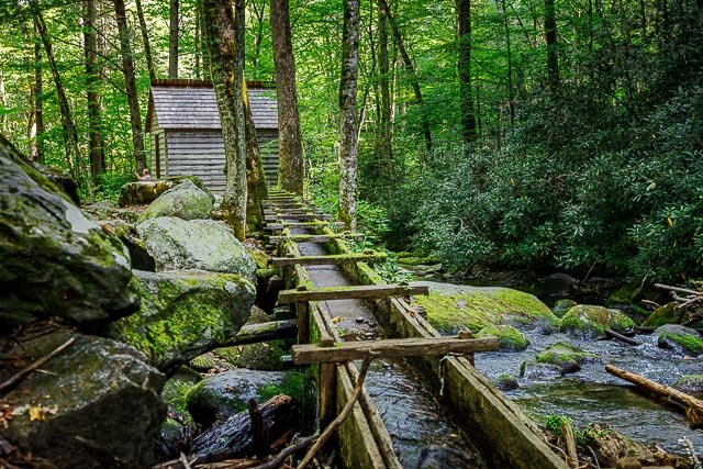
Rockbridge Mill From the Rockbridge Rainbow Trout & Game Ranch Late in the summer of 1841 a group of families left Marion County, Kentucky, in three ox and horse drawn wagons led by Captain Kim Amyx. Their destination would require some 500 miles and six months of challenging travel. They were searching the unknown for a new life in the virgin wilderness of the Ozarks, and would end their journey near present day Hodgson Mill. It is reported that members of this wagon train, along with other previous settlers, set about to establish a new community known as Rockbridge. The original town and mill site was located near the confluence of Spring Creek and Bryant Creek. It was the county seat of Ozark County, and encompassed what today is three separate counties: Douglas, Howell, and Ozark. After a few short years, the town and mill were destroyed by fire during a civil war battle. In 1868, B.V. Morris rebuilt the original mill on its present day location. The Mill’s reconstruction was followed by the reinstatement of the post office, a general store, Masonic Lodge, bank, church, school, blacksmith shop, and a large farm house, known today as the White House. The village of Rockbridge was a gathering place for people from the countryside. A trip to the mill was a great occasion, enabling people to visit old friends and neighbors, to get their meal and flour, to utilize the post office, to vote on Election Day, and to get news of the outside world. In 1946, the Amyx family moved to Rockbridge. Lile and Edith Amyx had a saw mill on the lower part of the stream, and also worked in Gainesville in the family business, the Amyx Auto Company. In 1954, the family began to develop the Rockbridge Rainbow Trout & Game Ranch. Edith became Postmaster of the Rockbridge Post Office, the oldest post office in the county. The days were long, and the nights short as they worked diligently to bring life back to the Rockbridge Village.  Once again, people from the towns and countryside came from miles around to visit friends and neighbors, enjoy a good meal, and vote on Election Day. This time they came to bring news from the outside world and enjoy world class trout fishing. In the 1895, Sidney and Edgie Amyx (Lile’s parents), were married at Rockbridge. The couple homesteaded the land directly above Rockbridge Spring. Ralph Amyx (Lile’s brother) was born on this site in 1907, now the site of Ralph’s Ridge Condos named in his honor.  Activity flourished during the latter years of the 19th century and continued until the 1920’s and 1930’s, but as gasoline power and better roads came along, the need for the mill and the blacksmith shop gradually declined. Eventually there was not a need for the general store. The world changed and Rockbridge was almost abandoned. Only the post office remained to mark the existence of this once bustling community. Years later Rockbridge still exists with all the stamina, character, and the way of life we so greatly admired about our forefathers. With a little luck and a lot of hard work, the little village in a valley of the Ozark hills will continue to create history and provide memories for all who visit. The mill is now home to the Rockbridge Grist Mill Club…This wonderful old pub set in the 1800’s grist mill serves scrumptious appetizers and premium beverages in a unique setting. What to Photograph The old mill which is now a pub, the dam and waterfall along with trout fishermen in the creek, and the few remaining buildings of the village of Rockbridge. Note:   At the time I visited and photographed the mill had sustained major damage from record flooding and was closed, but has since reopened. Where it is: Hidden away in a valley along the bluff-lined Spring Creek, Rockbridge, Missouri. Drive south on Hwy. 181 to N Hwy., then right on N. Just north of the Junction with Hwy. 95, follow the signs to Rockbridge. Maps: Interactive Google Map Use the map  + – controls to zoom in and out, click and drag the to move the map, use the Map drop-down to change to “Map”, “Satellite”, “Hybrid”, or “Terrain” views.  Drag the little man icon from the upper left corner to a map location for street level view.   GPS: 36°47’20.58″ N 92°24’32.604″ W   Cost: There is no cost to visit Rockbridge Mill. Hours: Access to the exterior of the Mill is open all the time. The Grist Mill Club is open from April – October, and is closed during the winter season.  Hours may vary, but generally the Mill is open in the afternoons and evenings through the week and early afternoon through the evening on the weekends. Resturant hours: Winter Hours: 8a-7p In-Season: 8a-8p   Facilities: This 2000+ acre resort in the heart of the Ozark Mountains is the perfect setting for a family vacation or corporate retreat! Take a picturesque step back in time. Eliminate the distractions and chaos of modern life and immerse yourself in the tranquil and relaxing atmosphere of ROCKBRIDGE Rainbow Trout & Game Ranch.  Lodging and a restaurant are at this location. Location Contact Information: 4297 CR 142 Rockbridge, MO 65741 Phone: (417) 679-3619 Fax: (417) 679-2470 info@rockbridgemo.com Rockbridge Mill Photo Gallery Click Here for full page gallery   More Photographic Destinations in Missouri: Interactive Google Map Use the map  + – controls to zoom in and out, use the Map drop-down to change to “Map”, “Satellite”, “Hybrid”, or “Terrain” views.  Drag the little man icon from the upper left corner to a map location for street level view. Click on a pushpin for more information about the Photographic Destination, then click on the title to go to the location page. Click Here for Photographic Destinations by State    All the information in this post was believed to be accurate at the time it was published.  Please be sure to double check with the location before relying on this information as everything changes over time, especially hours, prices, and whether the location is still open.   Great Places for Great Photos   Let me help you to find a great location for your next photography adventure.  I will list many lesser-known destinations, as well as the famous "Icon Locations" for photography.  I will provide photos (Lots of Photos), location information, consisting of what there is to photograph as well as other information about the destination.  I will give costs, maps, directions, contact information, and other essential information for a successful photo trip.  I will only post for locations that I have personally photographed to ensure a quality guide to great locations for photography. If you know of great places that are not posted, please send me the details, I may just decide that is a place I need to go!     Greg Disch is a freelance photographer located in Arkansas. Greg specializes in nature, scenic, wildlife, and other outdoor subjects in Arkansas and other areas of the country.  Most of the images on this site are available for sale as prints, personal use, or rights managed stock photos. Greg offers both classroom instruction and in the field hands on photographic workshops. Classroom sessions are normally held in Fort Smith Arkansas, but arrangements can be made to bring a class to your group. All classes and workshops have small class sizes designed to provide an optimum student to instructor ratio, where you can get the personal attention, you need.  Most classes and workshops are limited to a maximum of six participants and will be held with a minimum of only two. If you are looking for a wonderful opportunity to get personal individual instruction, I do private workshops and classes at a location of your choice, whether doing a location photo shoot, coming to your home or business, traveling across the country on a road trip, or at my classroom.  This is a fantastic way to learn digital workflow and be sure that your computer equipment is properly configured for optimum performance. [...]Read more...
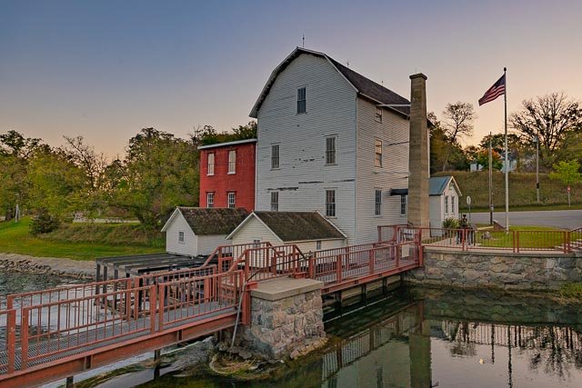
Alfred Reagan Mill Great Smoky Mountains National Park The Alfred Reagan grist mill was probably built around 1900. We must assume the builder was Alfred Reagan. The grist mill was a turbine or “tub” mill, the most common type found in the mountains. Water was channeled to strike a primitive horizontal wooden turbine wheel, which turned and provided direct drive power to the mill stones. The only unusual feature known about the mill is that it had a hand-powered, homemade bolting machine. Apparently some wheat was ground there, and the bolting machine was needed to remove the chaff and separate the ground wheat into different grades. Herb Clabo recalls that Reagan’s mill toll was one gallon to the bushel of corn. This was not the only mill on Roaring Fork, but according to Wesley Reagan, it was so well constructed that it would operate when other mills were shut down due to lack of water. Wesley credited this to a special type of small vaned turbine wheel constructed by his father. One of the other mills on Roaring Fork was owned by Alfred’s brother, Aaron, and was located a short distance downstream. Aside from grinding his own corn, Alfred was able to “pick up a few extra gallons of meal a week as toll.”   Where it is: The Alfred Reagan Tub Mill is located on the Roaring Fork Motor Trail in the Great Smoky Mountains National Park. To access Roaring Fork, turn off the main parkway in Gatlinburg, TN at traffic light #8 and follow Historic Nature Trail Road to the Cherokee Orchard entrance to the national park. Just beyond the Rainbow Falls trailhead you have the option of taking the one-way Roaring Fork Motor Nature Trail (closed in winter). Please note that buses, trailers, and motor homes are not permitted on the motor nature trail. This is a 5.5-mile-long, one-way, loop road. The mill is located just inches from the road. GPS: 35°42’7.698″ N 83°28’12.888″ W   Maps: Interactive Google Map Use the map  + – controls to zoom in and out, click and drag the to move the map, use the Map drop-down to change to “Map”, “Satellite”, “Hybrid”, or “Terrain” views.  Drag the little man icon from the upper left corner to a map location for street level view.   Hours: The Roaring Fort Motor Trail is open 24 hours a day from early April until November, the road is closed in winter. Cost: There is no cost to visit the mill or the Great Smoky Mountains National Park. Location Contact Information: By Mail Great Smoky Mountains National Park 107 Park Headquarters Road Gatlinburg, TN 37738 By Phone Recorded information: (865) 436-1200 Road Updates: (865) 436-1200 select 2, then 2 again Emergencies: 911 Email Us   Facilities: There are no facilities on the Roaring Fork Motor Trail.  Photo Gallery Click Here for full page gallery   More Photographic Destinations in Tennessee Interactive Google Map Use the map  + – controls to zoom in and out, use the Map drop-down to change to “Map”, “Satellite”, “Hybrid”, or “Terrain” views.  Drag the little man icon from the upper left corner to a map location for street level view. Click on a pushpin for more information about the Photographic Destination, then click on the title to go to the location page. Click Here for Photographic Destinations by State   All the information in this post was believed to be accurate at the time it was published.  Please be sure to double check with the location before relying on this information as everything changes over time, especially hours, prices, and whether the location is still open.   Great Places for Great Photos   Let me help you to find a great location for your next photography adventure.  I will list many lesser-known destinations, as well as the famous "Icon Locations" for photography.  I will provide photos (Lots of Photos), location information, consisting of what there is to photograph as well as other information about the destination.  I will give costs, maps, directions, contact information, and other essential information for a successful photo trip.  I will only post for locations that I have personally photographed to ensure a quality guide to great locations for photography. If you know of great places that are not posted, please send me the details, I may just decide that is a place I need to go!     Greg Disch is a freelance photographer located in Arkansas. Greg specializes in nature, scenic, wildlife, and other outdoor subjects in Arkansas and other areas of the country.  Most of the images on this site are available for sale as prints, personal use, or rights managed stock photos. Greg offers both classroom instruction and in the field hands on photographic workshops. Classroom sessions are normally held in Fort Smith Arkansas, but arrangements can be made to bring a class to your group. All classes and workshops have small class sizes designed to provide an optimum student to instructor ratio, where you can get the personal attention, you need.  Most classes and workshops are limited to a maximum of six participants and will be held with a minimum of only two. If you are looking for a wonderful opportunity to get personal individual instruction, I do private workshops and classes at a location of your choice, whether doing a location photo shoot, coming to your home or business, traveling across the country on a road trip, or at my classroom.  This is a fantastic way to learn digital workflow and be sure that your computer equipment is properly configured for optimum performance. [...]Read more...
Paydown Mill The Paydown Grist Mill sitting near the Gasconade River on Mill Creek not far from Vienna, is one of mills that has an interesting past with the Civil War. According to records. many goods were supplied thru the general store at Paydown to the U.S. Government for troops in some of the northern states. The mill was commonly known as Pay Down during the time period dates back to 1826. Though out history several mills have occupied the site until the 1930’s Paydown was entire community during the 1800’s. The current mill sits on a limestone foundation, operated using a turbine, has clapboard siding, & is over two stories high. In 1860, an employee tried to commit suicide there, but did not complete the task until sometime latter. The original owner was Charles Lane, who began building the first mill on site, but sold to Peter Walter in 1829 before it was completed. Other owners were Thomas Kinsey, Rubin Terrill, & Daniel Boone Wherry, a descendant of legendary Daniel Boone after 1866, the Bray family took over. In 1886 & 1872, another mill was erected. In 1890’s the present mill was completed by C. E. Givens about a mile down from the other mill. It operated for about 30 years. What to Photograph The old Paydown Mill building and the Paydown Manor across the road and some additional old barns and out buildings.   Where it is: Paydown is located on the east bank of the Gasconade River at the mouth of Spring Creek, ten miles northeast of Vienna on MO hwy 42.  There are no signs or markers, however it plainly visible from the highway.   Maps: Interactive Google Map Use the map  + – controls to zoom in and out, click and drag the to move the map, use the Map drop-down to change to “Map”, “Satellite”, “Hybrid”, or “Terrain” views.  Drag the little man icon from the upper left corner to a map location for street level view.     GPS: 38°13’44.207″ N 91°48’12.732″ W Cost: There is no fee for access to the Paydown Mill site, it is abandoned along the highway. Hours: There are no hours, this is an abandoned property along the side of the road. Facilities: There are no facilities. Location Contact Information: There is no contact information for this location. Paydowm Mill Photo Gallery Click Here for full page gallery   More Photographic Destinations in Missouri: Interactive Google Map Use the map  + – controls to zoom in and out, use the Map drop-down to change to “Map”, “Satellite”, “Hybrid”, or “Terrain” views.  Drag the little man icon from the upper left corner to a map location for street level view. Click on a pushpin for more information about the Photographic Destination, then click on the title to go to the location page. Click Here for Photographic Destinations by State    All the information in this post was believed to be accurate at the time it was published.  Please be sure to double check with the location before relying on this information as everything changes over time, especially hours, prices, and whether the location is still open.   Great Places for Great Photos   Let me help you to find a great location for your next photography adventure.  I will list many lesser-known destinations, as well as the famous "Icon Locations" for photography.  I will provide photos (Lots of Photos), location information, consisting of what there is to photograph as well as other information about the destination.  I will give costs, maps, directions, contact information, and other essential information for a successful photo trip.  I will only post for locations that I have personally photographed to ensure a quality guide to great locations for photography. If you know of great places that are not posted, please send me the details, I may just decide that is a place I need to go!     Greg Disch is a freelance photographer located in Arkansas. Greg specializes in nature, scenic, wildlife, and other outdoor subjects in Arkansas and other areas of the country.  Most of the images on this site are available for sale as prints, personal use, or rights managed stock photos. Greg offers both classroom instruction and in the field hands on photographic workshops. Classroom sessions are normally held in Fort Smith Arkansas, but arrangements can be made to bring a class to your group. All classes and workshops have small class sizes designed to provide an optimum student to instructor ratio, where you can get the personal attention, you need.  Most classes and workshops are limited to a maximum of six participants and will be held with a minimum of only two. If you are looking for a wonderful opportunity to get personal individual instruction, I do private workshops and classes at a location of your choice, whether doing a location photo shoot, coming to your home or business, traveling across the country on a road trip, or at my classroom.  This is a fantastic way to learn digital workflow and be sure that your computer equipment is properly configured for optimum performance. [...]Read more...
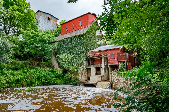
Old Oxford Mill The Old Oxford Mill in Oxford Kansas. Construction began in 1874 was completed in the fall of 1876. A new mill was built in the 1930 and the old mill closed in 1935 but still used to provide power for the new mill. Old Oxford Mill was completely restored in 1988-89 by the owners, Wallace Champeny and Hal Ross. After the mill was renovated in the 1980’s, it served as a restaurant and gift shop until 2006. For the last decade, Oxford High School has operated the restaurant for one meal a week on Sunday. The Old Oxford Mill is a rare reminder of a once ubiquitous Kansas building type. The survival and continuing use of the building is a testament to the fortitude and ingenuity of the citizens of the town of Oxford. In 1874, three years after the town’s founding, construction began on a gristmill in a heavily wooded valley to the north of town. Investor John M. Hewett and his partner D. N. Cook spearheaded the project, but its completion depended on the support of the townspeople. Local citizens were anxious to see the gristmill completed because it would benefit the entire community, particularly local farmers, thereby increasing Oxford’s overall economic viability. Volunteers hand-dug a half-mile-long diversion channel from the Arkansas River. A local landowner donated the stone used to line the millrace and to construct the mill building. Construction was completed in the fall of 1876 and the mill was soon operating day and night. The original portion of the Oxford Mill is a four-story, uncoursed rubble stone structure, supported on the interior by hand-hewn timber columns and beams. The wood-shingled gable roof is topped by a small building, known as a “Texas,” sitting astride the ridge of the roof. A one-story gabled element is connected to the east of the main building; it sits above the sluice and houses the milling equipment. Another shed is attached to the north of the main building. The appendages are clad with horizontal wood siding. At the Old Oxford Mill, burrstone wheels were used to grind both wheat and corn, but by the 1880s roller-reduction mills had begun to replace the burrstone type. The roller-reduction mills utilized cast-iron rollers more effective in processing the hard red winter wheat, which had become the grain of choice for most Kansan wheat farmers. With the introduction of this type of wheat, the amount harvested in Kansas grew from 2.5 million bushels in the 1870s to 8 million bushels in 1890 and 172 million bushels in 1914. By the mid-1880s, flour milling had become the largest industry in the state. The increasing demand for milling capability resulted in a growth in the number and size of mills. The milling business also relied on changing power supplies, from water to steam and finally to electrical power. The newer, large-scale mills were most often located along rail lines, adjacent to large grain storage facilities, and in larger communities. Struggling to survive, the Oxford Mill tried keep its equipment up-to-date. In 1923 the old grinding machinery was replaced with roller-reduction machinery. In 1935 a new mill was built upstream, and the old mill was again re-engineered with turbines that could supply power to the new mill. The two Oxford mills managed to survive based on its convenient location and the loyalty of the surrounding farmers. But by 1977 the mills were no longer profitable and ceased operation. By the 1980s, with the Old Oxford Mill falling into disrepair, owners Wallace Champeny and Hal Ross, substantially rebuilt the structure under the direction of architect F. Gene Ernst. The original grinding stones were replaced, and corn and wheat were once again milled, albeit on a reduced schedule. The mill ceased operation for good in 1997, and began a new life as a restaurant. Never wildly successful, the restaurant was taken over in 2008 by the Old Oxford Mill Center for Entrepreneurship, which is a joint venture between Cowley College and the local public school district. Students assist in operating the restaurant, which is open for Sunday lunch and for private parties. Although in a different manner, the Old Oxford Mill remains an asset to its community.     Where it is: Midway between Winfield and Wellington, Ks. off US160 in Oxford. Turn north off US166, go 6-7 blocks, and turn right on Buss St. at the water tower. Cross Michigan St. along the high school practice fields to Water St. Turn left on Old Mill Road and go 0.5 miles to 170 Old Mill Rd. The mill is down below the new mill. GPS: 37°17’16.447″ N 97°9’40.0289″ W Maps: Interactive Google Map Use the map  + – controls to zoom in and out, click and drag the to move the map, use the Map drop-down to change to “Map”, “Satellite”, “Hybrid”, or “Terrain” views.  Drag the little man icon from the upper left corner to a map location for street level view.     Hours: The mill’s grounds are open to the public throughout the week. The restaurant is only open from 11am to 2 pm on Sundays. Call to verify whether or not they are open (620) 455-3456.   Cost: There is no cost to visit the mill grounds, the meal runs $12 to $14 per person. Location Contact Information: The restaurant is located at 170 N. Old Mill Rd., Oxford, and they can be reached by phone at 620-455-3456. Old Oxford Mill Photo Gallery Click Here for full page gallery   More Photographic Destinations in Kansas Interactive Google Map Use the map  + – controls to zoom in and out, use the Map drop-down to change to “Map”, “Satellite”, “Hybrid”, or “Terrain” views.  Drag the little man icon from the upper left corner to a map location for street level view. Click on a pushpin for more information about the Photographic Destination, then click on the title to go to the location page. Click Here for Photographic Destinations by State    All the information in this post was believed to be accurate at the time it was published.  Please be sure to double check with the location before relying on this information as everything changes over time, especially hours, prices, and whether the location is still open.   Great Places for Great Photos   Let me help you to find a great location for your next photography adventure.  I will list many lesser-known destinations, as well as the famous "Icon Locations" for photography.  I will provide photos (Lots of Photos), location information, consisting of what there is to photograph as well as other information about the destination.  I will give costs, maps, directions, contact information, and other essential information for a successful photo trip.  I will only post for locations that I have personally photographed to ensure a quality guide to great locations for photography. If you know of great places that are not posted, please send me the details, I may just decide that is a place I need to go!     Greg Disch is a freelance photographer located in Arkansas. Greg specializes in nature, scenic, wildlife, and other outdoor subjects in Arkansas and other areas of the country.  Most of the images on this site are available for sale as prints, personal use, or rights managed stock photos. Greg offers both classroom instruction and in the field hands on photographic workshops. Classroom sessions are normally held in Fort Smith Arkansas, but arrangements can be made to bring a class to your group. All classes and workshops have small class sizes designed to provide an optimum student to instructor ratio, where you can get the personal attention, you need.  Most classes and workshops are limited to a maximum of six participants and will be held with a minimum of only two. If you are looking for a wonderful opportunity to get personal individual instruction, I do private workshops and classes at a location of your choice, whether doing a location photo shoot, coming to your home or business, traveling across the country on a road trip, or at my classroom.  This is a fantastic way to learn digital workflow and be sure that your computer equipment is properly configured for optimum performance. [...]Read more...
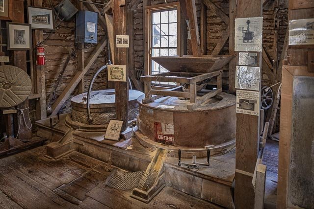
Montauk Mill The grist mill was built in 1896 replacing an earlier mill built in 1870. It was rehabilitated in 1935 by Company 1770 of the Civilian Conservation Corps. It is a 2​1⁄2-story frame building with a multi-gable roof and stone foundation. It features a central tower-like extension above the second story roof. The Montauk mill is available for tours. The mill ceased operations in 1927.  The steel rollers were removed in 1942 for the war effort. The area around the mill became a state park in 1926 and quickly became one of Missouri’s most popular vacation spots known for fishing, camping, and canoeing. Montauk Mill stands today as a testament to the once-thriving community of Montauk. The mill was the last of four mills built to make use of the ideal waters of Montauk Spring. Much of the original machinery used to grind the grain is still intact. The Montauk Mill was posted to the National Register of Historic Places on June 27, 1985. Montauk State Park The valley surrounding the springs that form Current River attracted settlers in the early 1800s. Early residents came to the area from New York and named their first post office after Montauk in Suffolk County, Long Island. Because of its proximity to the springs and its abundant supply of water power, the village of Montauk proved to be an excellent spot for milling. Four mills were constructed to serve the community. The last one, a gristmill built in 1896, still stands today and retains much of its original a man stis on the bank of the river fishingmachinery. It is open seasonally for tours. The next big step in the park’s history was in 1926 when it became a Missouri state park. Members of the Civilian Conservation Corps built many of the amenities and structures in the park in the 1930s. Many of these structures still stand today, a testament to the craftsmanship of this era. Montauk State Park is best known for being one of the three “trout parks” in the Missouri state park system. Anglers wanting to try their luck for rainbow trout flock to the clear, spring waters and go away happy with their catch. The Current River is also known as one of the finest canoeing rivers in the Midwest. Canoe access is located just outside the park’s southeast border, making Montauk State Park the perfect place to stay during a river adventure. What to Photograph The old Montauk Mill,  the Montauk Fish Hatchery, and the Montauk State Park. Where it is: Maps: Interactive Google Map Use the map  + – controls to zoom in and out, click and drag the to move the map, use the Map drop-down to change to “Map”, “Satellite”, “Hybrid”, or “Terrain” views.  Drag the little man icon from the upper left corner to a map location for street level view. Click here for larger map GPS: +37.45074, -91.68340 37°27’03” N, 91°41’00” W  Cost: There is no cost to enter the park. Hours: PARK HOURS Park Grounds: 24 hours a day Quiet Hours: 10 p.m. to 6 a.m. Late arrivals for lodging and camping should remain quiet during check in after 10 p.m. PARK OFFICE HOURS Summer Hours (On-Season)  March 1 through Oct. 31 – 8 a.m. to 4:30 p.m., Monday through Sunday Winter Hours (Off-Season)  Nov. 1 through Feb. 28 – 8 a.m. to 4:30 p.m., Monday through Friday (with the exception of state holidays) Facilities: The park’s store offers everything from last-minute items to the souvenirs of the long-anticipated vacation at Montauk State Park. Located in the Dorman L. Steelman Lodge, the store offers all essentials for a successful fishing trip –fishing supplies, including hand-tied flies made by local craftsmen, tackle, waders, fishing licenses and tags. For campers, the store offers snacks and groceries such as marshmallows, milk and bread, and camping supplies such as charcoal and cast-iron cookware. For those that want to remember their trip to the park, the store sells a variety of souvenirs and apparel such as sweatshirts and t-shirts. The lodge is a smoke-free facility. Wireless Internet (Wi-Fi) connections are now available at no charge in the Dorman L. Steelman Lodge. Wi-Fi has been added to meet the requests of state park users to stay connected. This free service is popular with regular visitors as well as those coming to the park for meetings or conferences. Guests must provide their own computers. The cabins, motel, dining lodge, store and snack bar are operated by Montauk Resorts, LLC, a Forever Resorts property. John Johnston, general manager, and his friendly team are ready to make your visit to Montauk State Park an enjoyable experience. For more information about the concession facilities, please visit their website or call 573-548-2434. Location Contact Information: ADDRESS 345 County Road 6670 Salem, MO 65560-9025 PHONE NUMBERS Park Office: (573) 548-2201 Lodging: (573) 548-2434 Store/Dining: (573) 548-2434 Nature Center: (573) 548-2225 Montauk Mill Photo Gallery Click Here for full page gallery More Photographic Destinations in Missouri: Interactive Google Map Use the map  + – controls to zoom in and out, use the Map drop-down to change to “Map”, “Satellite”, “Hybrid”, or “Terrain” views.  Drag the little man icon from the upper left corner to a map location for street level view. Click on a pushpin for more information about the Photographic Destination, then click on the title to go to the location page. Click Here for Photographic Destinations by State    All the information in this post was believed to be accurate at the time it was published.  Please be sure to double check with the location before relying on this information as everything changes over time, especially hours, prices, and whether the location is still open.   Great Places for Great Photos   Let me help you to find a great location for your next photography adventure.  I will list many lesser-known destinations, as well as the famous "Icon Locations" for photography.  I will provide photos (Lots of Photos), location information, consisting of what there is to photograph as well as other information about the destination.  I will give costs, maps, directions, contact information, and other essential information for a successful photo trip.  I will only post for locations that I have personally photographed to ensure a quality guide to great locations for photography. If you know of great places that are not posted, please send me the details, I may just decide that is a place I need to go!     Greg Disch is a freelance photographer located in Arkansas. Greg specializes in nature, scenic, wildlife, and other outdoor subjects in Arkansas and other areas of the country.  Most of the images on this site are available for sale as prints, personal use, or rights managed stock photos. Greg offers both classroom instruction and in the field hands on photographic workshops. Classroom sessions are normally held in Fort Smith Arkansas, but arrangements can be made to bring a class to your group. All classes and workshops have small class sizes designed to provide an optimum student to instructor ratio, where you can get the personal attention, you need.  Most classes and workshops are limited to a maximum of six participants and will be held with a minimum of only two. If you are looking for a wonderful opportunity to get personal individual instruction, I do private workshops and classes at a location of your choice, whether doing a location photo shoot, coming to your home or business, traveling across the country on a road trip, or at my classroom.  This is a fantastic way to learn digital workflow and be sure that your computer equipment is properly configured for optimum performance. [...]Read more...
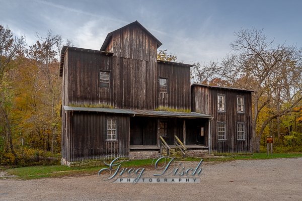
Mingus Mill Great Smoky Mountains National Park Mingus Mill provides a rare opportunity for Park visitors to get a glimpse what life was like when the North American continent was being settled. The mill is staffed by knowledgeable caretakers from April through October (and also weekends in November) who are happy to share information about the mill and perform demonstrations. Cookbooks, lye soap, wheat flour, corn meal, and informative brochures can be purchased during opening hours. During the winter months, the interior of the mill is closed to the public, however visitors are welcome to meander along the paths and structures outside the mill. Mingus Mill was built in 1886 by the millwright Sion Thomas Early of Sevier County, Tennessee. Early did the work for John Mingus, a son of John Jacob Mingus. Early completed the mill in three months for a cost of $600. The mill operated at wholesale and retail levels until the National Park Service purchased the property in 1934. The mill was restored in 1937, closed during World War II, and reopened in 1968. Water diverted from Mingus Creek via a sluice (canal) and a wooden flume turns two turbines which provide power to the mill. An iron shaft connects the turbines to grindstones on the first floor and a wheat cleaner and bolting chest on the second floor (the latter two via a series of pulleys). Wheat or corn is first transported by bucket belt to the wheat cleaner, which is essentially a fan which clears the grain of dirt and excess material, and then drops it back to the first floor. The cleaned grain is then fed into the grindstones, which break it down into flour (or cornmeal). The flour is then transported back to the second floor and fed into the bolting chest, which uses bolts of progressively coarser cloth to separate the flour into different grades. While the mill’s turbine is not as photogenic as the overshot wheels that power mills such as the Cable Mill at Cades Cove, it was more efficient and required less water power to operate. The turbine generated approximately 11 horsepower (8.2 kW) turning at 400 rpm. Aden Carver, who arrived in Oconaluftee in the mid-19th century, helped Early build the mill in 1886. When the mill was restored in 1937, Carver, then in his 90s, aided in its restoration.   Where it is: The mill is located just off of Highway 441 (Newfound Gap Road).  Mingus Mill is just short walk down a trail from the parking lot. Directions:  From Cherokee, NC and the Oconaluftee visitor’s center, take 441 into the Great Smoky Mountains National Park.  The mill is just a few miles past the visitor center on the left.  You’ll see signs. From Gatlinburg, TN take 441 into the Great Smoky Mountains National Park.  Pass Sugarlands Visitor Center and travel about 30 miles through the park, until you see the signs for Mingus Mill on your right.  If you reach the Oconaluftee Visitor center, you went too far.   GPS: 35°31’11.058″ N 83°18’35.994″ W Maps: Interactive Google Map Use the map  + – controls to zoom in and out, click and drag the to move the map, use the Map drop-down to change to “Map”, “Satellite”, “Hybrid”, or “Terrain” views.  Drag the little man icon from the upper left corner to a map location for street level view.   Hours: Operating hours: 9:00 AM – 5:00 PM daily from mid-March through mid-November. The grounds and the outside of the mill is accessible at all times. Cost: There is no cost to visit Mingus Mill or to enter Great Smoky Mountain National Park. Location Contact Information: By Mail Great Smoky Mountains National Park 107 Park Headquarters Road Gatlinburg, TN 37738 By Phone Recorded information: (865) 436-1200 Road Updates: (865) 436-1200 select 2, then 2 again Emergencies: 911 Email Us   Facilities: There is a large parking area and restrooms.  Photo Gallery Click Here for full page gallery   More Photographic Destinations in North Carolina Interactive Google Map Use the map  + – controls to zoom in and out, use the Map drop-down to change to “Map”, “Satellite”, “Hybrid”, or “Terrain” views.  Drag the little man icon from the upper left corner to a map location for street level view. Click on a pushpin for more information about the Photographic Destination, then click on the title to go to the location page. Click Here for Photographic Destinations by State    All the information in this post was believed to be accurate at the time it was published.  Please be sure to double check with the location before relying on this information as everything changes over time, especially hours, prices, and whether the location is still open.   Great Places for Great Photos   Let me help you to find a great location for your next photography adventure.  I will list many lesser-known destinations, as well as the famous "Icon Locations" for photography.  I will provide photos (Lots of Photos), location information, consisting of what there is to photograph as well as other information about the destination.  I will give costs, maps, directions, contact information, and other essential information for a successful photo trip.  I will only post for locations that I have personally photographed to ensure a quality guide to great locations for photography. If you know of great places that are not posted, please send me the details, I may just decide that is a place I need to go!     Greg Disch is a freelance photographer located in Arkansas. Greg specializes in nature, scenic, wildlife, and other outdoor subjects in Arkansas and other areas of the country.  Most of the images on this site are available for sale as prints, personal use, or rights managed stock photos. Greg offers both classroom instruction and in the field hands on photographic workshops. Classroom sessions are normally held in Fort Smith Arkansas, but arrangements can be made to bring a class to your group. All classes and workshops have small class sizes designed to provide an optimum student to instructor ratio, where you can get the personal attention, you need.  Most classes and workshops are limited to a maximum of six participants and will be held with a minimum of only two. If you are looking for a wonderful opportunity to get personal individual instruction, I do private workshops and classes at a location of your choice, whether doing a location photo shoot, coming to your home or business, traveling across the country on a road trip, or at my classroom.  This is a fantastic way to learn digital workflow and be sure that your computer equipment is properly configured for optimum performance. [...]Read more...
  Kymulga Mill and Covered Bridge Kymulga Mill is a working gristmill built in 1864 by German contractor G.E. Morris for Confederate Army Major George H. Forney, who was later promoted to lieutenant colonel. Forney died at the Battle of the Wilderness in Virginia before construction was completed, but his wife allowed Morris to finish it. Union Army soldiers burned most of the gristmills throughout the area during the Civil War, but Kymulga Mill was missed. The mill was sold four times before being purchased by the Childersburg Heritage Committee from latest owner Edward Donahoo in 1988, though it remained in active service through many of those years. Three water powered turbines ran the four-story mill, including lights, grain elevator and millstones used for grinding grain. Two of its five sets are French buhrs, thought to be the hardest rock in the world. Kymulga Mill continues to operate to this day, though under electricity, still making corn meal with its huge millstones. The building is now a tourist attraction open for guided tours. It also serves as a gift shop and park office.   The Kymulga Covered Bridge is a wood & metal combination style covered bridge that spans Talladega Creek, located just east of Kymulga Mill within Kymulga Park. Built in 1861, the 105-foot bridge is a Howe truss construction over a single span. The Kymulga Covered Bridge is one of two 19th-century covered bridges extant in Alabama still remaining at its original location; the Waldo Covered Bridge, also located in Talladega County, is the other. The bridge once provided access to the Old Georgia Road or the McIntosh Road, a Native American trade route which was used by settlers and frontiersmen who ventured the area. Eventually, farms and communities spawned along the former trail. The United States government purchased land adjacent to Kymulga Mill in 1941 for the Alabama Ordnance Works, a military installation. Settlements within the tract had to be relocated. Today, the Kymulga Covered Bridge leads park visitors to a series of nature trails north of Talladega Creek. People may still find remnants of the Old Georgia Road, as well as other traces of the past. Where it is: Located on Grist Mill Road four miles northeast of Childersburg, Alabama. 7346 Grist Mill Road Childersburg, AL 35044 Get Directions (256) 378-7436 Maps: Interactive Google Map Use the map  + – controls to zoom in and out, click and drag the to move the map, use the Map drop-down to change to “Map”, “Satellite”, “Hybrid”, or “Terrain” views.  Drag the little man icon from the upper left corner to a map location for street level view. GPS: Mill 33°20’2.1931″ N 86°17’59.102″ W Covered Bridge 33°20’3.738″ N 86°17’57.972″ W Cost: ENTRY FEE $3.00 Daily – per person – Children 5 and under free $20.00 Yearly – Individual membership / $30.00 Yearly – Family Membership Hours: Normal operating hours – Wednesday to Sunday, 9AM to 5PM.   Facilities: There are restrooms and camping facilities are available at the park as well as a pavilion rental. The part of the park near the bridge offers a venue for musical instruction and performances. Festivals, featuring folk music and dance, pioneer arts and crafts, storytelling and reenactments of local historical events could be held. Location Contact Information: 7346 Grist Mill Road Childersburg, AL 35044 Get Directions (256) 378-7436   Kymulga Mill & Covered Bridge Photo Gallery Click Here for full page gallery   More Photographic Destinations in Alabama Interactive Google Map Use the map  + – controls to zoom in and out, use the Map drop-down to change to “Map”, “Satellite”, “Hybrid”, or “Terrain” views.  Drag the little man icon from the upper left corner to a map location for street level view. Click on a pushpin for more information about the Photographic Destination, then click on the title to go to the location page. Click Here for Photographic Destinations by State    All the information in this post was believed to be accurate at the time it was published.  Please be sure to double check with the location before relying on this information as everything changes over time, especially hours, prices, and whether the location is still open.   Great Places for Great Photos   Let me help you to find a great location for your next photography adventure.  I will list many lesser-known destinations, as well as the famous "Icon Locations" for photography.  I will provide photos (Lots of Photos), location information, consisting of what there is to photograph as well as other information about the destination.  I will give costs, maps, directions, contact information, and other essential information for a successful photo trip.  I will only post for locations that I have personally photographed to ensure a quality guide to great locations for photography. If you know of great places that are not posted, please send me the details, I may just decide that is a place I need to go!     Greg Disch is a freelance photographer located in Arkansas. Greg specializes in nature, scenic, wildlife, and other outdoor subjects in Arkansas and other areas of the country.  Most of the images on this site are available for sale as prints, personal use, or rights managed stock photos. Greg offers both classroom instruction and in the field hands on photographic workshops. Classroom sessions are normally held in Fort Smith Arkansas, but arrangements can be made to bring a class to your group. All classes and workshops have small class sizes designed to provide an optimum student to instructor ratio, where you can get the personal attention, you need.  Most classes and workshops are limited to a maximum of six participants and will be held with a minimum of only two. If you are looking for a wonderful opportunity to get personal individual instruction, I do private workshops and classes at a location of your choice, whether doing a location photo shoot, coming to your home or business, traveling across the country on a road trip, or at my classroom.  This is a fantastic way to learn digital workflow and be sure that your computer equipment is properly configured for optimum performance. [...]Read more...
Klepzig Mill Walter Klepzig Mill and Farm is a historic farm and sawmill and national historic district located in the Ozark National Scenic Riverways near Eminence Missouri. The district encompasses three contributing buildings, three contributing sites, and one contributing structure associated with an early-20th century Ozark farm and mill. It developed between about 1912 and 1936 and includes the mill (c. 1912) and its related hydraulic system (c. 1912-1935); a spring house and smokehouse (c. 1920-1925); foundations of a 1923 farmhouse and barn (c. 1920-1925); and two post-1934 chicken coops and a ruin of a post-1934 machine shed. It was listed on the National Register of Historic Places in 1990 Along Rocky Creek is a small turbine mill built by Walter Klepzig in 1928 –hence its name, Klepzig Mill. Walter, son of a Prussian German immigrant, was a progressive thinker. He was the first in the neighborhood to introduce both barbed and woven fence wire and a refined breed of milk cow. He sawed logs into boards for his house and out-buildings, and routinely saved “good boards” for use in building coffins for his neighbors. He frequently ground corn free for neighbors “on starvation,” i.e. those who could ill afford to leave him the customary toll of grain. Klepzig Mill is a type of building referred to in the vernacular as a “sawmill house.” It was a building type that tended to replace log construction after the arrival of sawmills in a locale. A sawmill house could be erected quickly and by only one or two people. Instead of stud-wall framing, vertical planks were nailed to a hand-hewn sill at the bottom and a sawn two-by-four plate at the top. The resulting wall panels, fabricated flat on the ground, were then raised into place. Battens might then be added to cover the seams. Foundations were often piers of uncut and unmortared native stone. Klepzig Mill is not much to look at with its various accouterments and modifications– cement spillway, scrap metal hinge from the hood of a Model “A” Ford truck, old corrugated iron roof. Still, it is in a spectacular setting, surrounded by the rhyolite rock of the “shut in” canyon made by Rocky Creek. It is a lasting testament to the hardships of every day life in the Ozarks in a time not so long ago. What to Photograph The mill and outbuildings and Rocky Creek with some fantastic rock formations. Where it is: Klepzig Mill is located within the Ozark National Scenic Riverways which is the first national park area to protect a river system. The Current and Jacks Fork Rivers are two of the finest floating rivers you’ll find anywhere. Spring-fed, cold and clear they are a delight to canoe, swim, boat or fish. Besides these two famous rivers, the park is home to hundreds of freshwater springs, caves, trails and historic sites To reach Klepzig Mill take Highway H (east of Eminence and Winona) to Highway NN. You’ll pass the sign for Rocky Falls, this is a pleasant stop also. Turn left on County Road #522. This dirt road can be very muddy and is narrow, not recommended for large motorhomes or trailers. Klepzig Mill is less than a mile on the right. There is no sign or defined parking area, and it’s easy to miss in summer vegetation, so watch carefully. It is also possible to hike to Klepzig Mill from Rocky Falls along the Ozark Trail, or park at the end of the pavement on NN and walk up the dirt road. Maps: Interactive Google Map Use the map  + – controls to zoom in and out, click and drag the to move the map, use the Map drop-down to change to “Map”, “Satellite”, “Hybrid”, or “Terrain” views.  Drag the little man icon from the upper left corner to a map location for street level view. GPS: 37°7’35.73″ N 91°11’52.926″ W   Cost: There is no entrance fee at Ozark National Scenic Riverways. Hours: There are no hours, the location is accessible 24 hours a day. Facilities: There are no facilities at this location.   Location Contact Information: Mailing Address: Ozark National Scenic Riverways 404 Watercress Drive P.O. Box 490  Van Buren, MO 63965 Phone: (573) 323-4236 Fax 573-323-4140 Klepzig Mill Photo Gallery Click Here for full page gallery   More Photographic Destinations in Missouri: Interactive Google Map Use the map  + – controls to zoom in and out, use the Map drop-down to change to “Map”, “Satellite”, “Hybrid”, or “Terrain” views.  Drag the little man icon from the upper left corner to a map location for street level view. Click on a pushpin for more information about the Photographic Destination, then click on the title to go to the location page. Click Here for Photographic Destinations by State    All the information in this post was believed to be accurate at the time it was published.  Please be sure to double check with the location before relying on this information as everything changes over time, especially hours, prices, and whether the location is still open.   Great Places for Great Photos   Let me help you to find a great location for your next photography adventure.  I will list many lesser-known destinations, as well as the famous "Icon Locations" for photography.  I will provide photos (Lots of Photos), location information, consisting of what there is to photograph as well as other information about the destination.  I will give costs, maps, directions, contact information, and other essential information for a successful photo trip.  I will only post for locations that I have personally photographed to ensure a quality guide to great locations for photography. If you know of great places that are not posted, please send me the details, I may just decide that is a place I need to go!     Greg Disch is a freelance photographer located in Arkansas. Greg specializes in nature, scenic, wildlife, and other outdoor subjects in Arkansas and other areas of the country.  Most of the images on this site are available for sale as prints, personal use, or rights managed stock photos. Greg offers both classroom instruction and in the field hands on photographic workshops. Classroom sessions are normally held in Fort Smith Arkansas, but arrangements can be made to bring a class to your group. All classes and workshops have small class sizes designed to provide an optimum student to instructor ratio, where you can get the personal attention, you need.  Most classes and workshops are limited to a maximum of six participants and will be held with a minimum of only two. If you are looking for a wonderful opportunity to get personal individual instruction, I do private workshops and classes at a location of your choice, whether doing a location photo shoot, coming to your home or business, traveling across the country on a road trip, or at my classroom.  This is a fantastic way to learn digital workflow and be sure that your computer equipment is properly configured for optimum performance. [...]Read more...
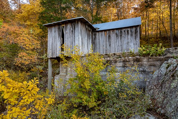
Jolly Mill Jolly Mill was built on Capps Creek at Jollification, Berwick Township, Newton County, Missouri, United States in 1848 by Thomas Isbell and his son John to serve as a whiskey distillery. Jolly Mill was named for the local Jolly family. The mill also served as a grist mill, and continued to operate in that capacity until 1975. The three-floor structure still retains the original hand-hewn and pegged framing timbers and limestone slab foundations. A village named Jollification quickly developed around the distillery/mill to serve as a rest stop and resupply point for wagon trains and stagecoaches. Because of new taxes on whiskey that owner George Isbell refused to pay, the distillery was closed in the 1870s. Isbell turned his attention to the milling of flour. The mill was purchased in 1983 by The Friends of Jolly Mill and listed on the National Register of Historic Places. In recent years, under the care of The Friends of Jolly Mill, the mill has undergone somewhat of a renaissance. Mill restoration was completed in 1998 when the repaired water-powered machinery began grist milling demonstrations. The mill and surrounding land have been restored and converted into a park, with many period buildings moved in from other locations in an attempt to replicate the look and feel of the town of Jollification. Milling demonstrations are still put on at 1 p.m. on the first Saturday of the month from May to October. Where it is: Jolly Mill Park is located southwest of Pierce City Missouri.  The park can be accessed from U.S. Highway 60 to the south on Wallaby Road, which is about 71/2 miles west of Monett. GPS: 36°53’49.05″ N 94°4’18.288″ W Maps: Interactive Google Map Use the map  + – controls to zoom in and out, click and drag the to move the map, use the Map drop-down to change to “Map”, “Satellite”, “Hybrid”, or “Terrain” views.  Drag the little man icon from the upper left corner to a map location for street level view.   Hours: Jolly Mill is open dawn to dusk, seven days a week. Cost: Entrance fee to the park is $5 per car.   Location Contact Information: 11262 Jolly Mill Lane Pierce City, MO 65723 417-476-5421   Facilities: The area is a family friendly park with playground equipment, picnic areas, and modern restrooms. No pets are allowed in the park.  Photo Gallery Click Here for full page gallery   More Photographic Destinations in Missouri Interactive Google Map Use the map  + – controls to zoom in and out, use the Map drop-down to change to “Map”, “Satellite”, “Hybrid”, or “Terrain” views.  Drag the little man icon from the upper left corner to a map location for street level view. Click on a pushpin for more information about the Photographic Destination, then click on the title to go to the location page. Click Here for Photographic Destinations by State    All the information in this post was believed to be accurate at the time it was published.  Please be sure to double check with the location before relying on this information as everything changes over time, especially hours, prices, and whether the location is still open.   Great Places for Great Photos   Let me help you to find a great location for your next photography adventure.  I will list many lesser-known destinations, as well as the famous "Icon Locations" for photography.  I will provide photos (Lots of Photos), location information, consisting of what there is to photograph as well as other information about the destination.  I will give costs, maps, directions, contact information, and other essential information for a successful photo trip.  I will only post for locations that I have personally photographed to ensure a quality guide to great locations for photography. If you know of great places that are not posted, please send me the details, I may just decide that is a place I need to go!     Greg Disch is a freelance photographer located in Arkansas. Greg specializes in nature, scenic, wildlife, and other outdoor subjects in Arkansas and other areas of the country.  Most of the images on this site are available for sale as prints, personal use, or rights managed stock photos. Greg offers both classroom instruction and in the field hands on photographic workshops. Classroom sessions are normally held in Fort Smith Arkansas, but arrangements can be made to bring a class to your group. All classes and workshops have small class sizes designed to provide an optimum student to instructor ratio, where you can get the personal attention, you need.  Most classes and workshops are limited to a maximum of six participants and will be held with a minimum of only two. If you are looking for a wonderful opportunity to get personal individual instruction, I do private workshops and classes at a location of your choice, whether doing a location photo shoot, coming to your home or business, traveling across the country on a road trip, or at my classroom.  This is a fantastic way to learn digital workflow and be sure that your computer equipment is properly configured for optimum performance. [...]Read more...
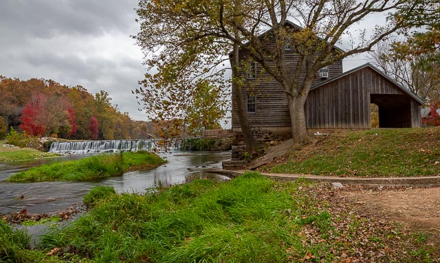
Hodgson Mill Hodgson-Aid Mill, also known as Hodgson Water Mill and Aid-Hodgson Mill, is a historic grist mill located on Bryant Creek near Sycamore, Ozark County, Missouri. It was constructed around 1897, and is a 3 1/2-story, timber frame mill building covered with red-painted weatherboards. Associated with the mill are the man-made mill pond and the limestone barrel vault constructed at the base of the cliff where Hodgson Spring discharges. The mill has not been in operation since 1976. It is privately owned and was listed on the National Register of Historic Places in 2002. History The area around Hodgson-Aid Mill had been settled prior to the Civil War; Ozark County, Missouri was organized in 1841, and until 1857, included parts of Howell and Douglas County. The Hodgson-Aid Water Mill is at least the second mill to be located on the Hodgson Mill Spring. In the early 1860s, William Holeman settled on Bryant Creek and constructed a water mill on or near the site of the Hodgson-Aid Mill. This mill was closed during the Civil War. It is unclear whether Holeman reopened this original mill, or whether he had to construct a new mill after the war. It is reported that Holeman’s mill was powered by a vertical wood turbine. Holeman operated the mill until his death in 1879. In 1884, Alva Hodgson and his mother, Mary Elizabeth Hodgson, purchased the mill from Manuel and Elizabeth Smith, the parents of Alva’s future wife, Mary Elizabeth Smith Hodgson, for $500.00. Alva Hodgson continued to operate Holeman’s existing mill, but made plans to construct a state-of-the-art mill capable of producing new white or “patent” flour, a higher quality flour than had previously been produced, made possible by the invention of the “middlings purifier” around 1870. Hodgson used this new milling machinery, including roller mills, and also installed two vertical steel water turbines, known as “Leffel turbines” or now as Francis Turbines. The mill building also housed a general store and the Sycamore post office, sawmill, and cotton gin. Like other rural gristmills, the mill was likely an economic hub of the community. Farmers visited the mill to have their grain (corn and wheat) to be ground into flour and meal, and were able to buy and sell their crops, as well as other goods and services. The store “not only sold necessities – groceries, hardware, and dry goods – it also bought every valuable commodity produced in the area.” Construction of the new mill was completed around 1897; a notice that appeared in the local newspaper on November 25, 1897 noted that “Mr. Hodgson is making a good grade of flour on his new roller mill.” Records show that at this time, Alva Hodgson’s brother, George, bought 1/3 interest in the mill. In 1901, Alva Hodgson sold his brother the remaining 2/3 interest, and George Hodgson became sole proprietor. Alva Hodgson went on to build nearby Dawt Mill, completed in 1909, as well as a cotton gin in Harrison Arkansas. He returned to Hodgson Mill to work with his brother and improve the mill; he installed a dynamo to generate electricity to light the mill, and imported and installed two millstones, or buhrstones from the French Pyrenees for stone-grinding flour. Despite failing vision, Alva helped run the mill until his death in 1921. George Hodgson then continued to operate the mill until his death in 1927. Ownership of the mill passed to Fred O. Foster from 1927-1934. In 1934, the mill was purchased by businessman Charles Theodore Aid. The mill stayed in the ownership of the Aid family until 1998 and so became known locally as the Hodgson-Aid Mill, or Aid-Hodgson Mill. The mill was leased and operated intermittently from 1934-1949. In 1949 Fred Leach, an experienced miller, assumed the lease and both operated the mill and began marketing products through wholesalers, mostly whole grain flour and corn meal. He also provided picnic tables, campsites, and operated a gift shop for visitors to the mill. Leach increased production of meal and flour to as much as 2,000 pounds a day. From 1963 to 1969, the Harold Stott family took over operation of the mill. They expanded the line of products to include “white and yellow cornmeal, whole wheat cereal, and bran, whole wheat, unbleached, rye and pancake flours.” In 1969, Ken and Teena Harrington, avid antiquers visiting the area, stumbled on the property. They took over the lease, and initially began selling antiques and operating canoe rentals for the nearby Bryant River They also offered flour and products in their store, and as demand grew; they incorporated the company as Hodgson Mill Inc, and sold products to wholesalers and grocers. When Ken took up the lease in 1969, the mill was grinding only a couple of hundred pounds of flour a day. By 1973, sales had grown 500 percent, and the old mill was straining under the maximum of 1 million pounds of wheat and corn a year. The Harringtons installed two more buhrstones to keep up with demand, and also acquired a site in the nearby Gainesville Missouri industrial park to construct a modern production facility. Production of Hodgson Mill Inc. products moved to the Gainesville location in 1976. No large-scale production has taken place at the Hodgson-Aid Mill since, and the mill has been intermittently operated primarily as a tourist attraction. At some point ca. 1970’s a concrete block building was built near the mill building. The Hodgson-Aid Mill suffered some flood damage in 1982, when water rose into the main milling room. Between 1985 and 1993, Herbert Smith (great-nephew of Alva Hodgson) and his wife leased the mill and provided tours, a store, resort cabins and campground. The mill was sold to Hank and Jean Macler, who raised money in the community to fund restoration efforts. They stabilized the foundation, used Amish craftspeople to repair flood damage, installed facilities to bottle spring water and registered the Hodgson-Aid Mill in the National Register of Historic Places. In 2011, the mill was sold to John and Gwen Deakle, experienced preservationists.   What to Photograph The historic mill and property with a mill pond and small waterfall. Where it is: From Mo 160 0.5 miles east of Gainesville take Mo 181 north for about 15 miles give or take, to the mill on the left side of Mo 181 about 4 mlies past Zanoni. Maps: Interactive Google Map Use the map  + – controls to zoom in and out, click and drag the to move the map, use the Map drop-down to change to “Map”, “Satellite”, “Hybrid”, or “Terrain” views.  Drag the little man icon from the upper left corner to a map location for street level view.   GPS: 36°42’34.228″ N 92°15’59.712″ W Cost: There is no cost to visit this location Hours: There are no hours for the location. Facilities: There are no public facilities at the mill.  The nearest town is Dora Mo. Location Contact Information: Hwy 181 Ozark County, Dora, Missouri 65637 Phone (417) 261-2556 Hodgson Mill Photo Gallery Click Here for full page gallery   More Photographic Destinations in Missouri: Interactive Google Map Use the map  + – controls to zoom in and out, use the Map drop-down to change to “Map”, “Satellite”, “Hybrid”, or “Terrain” views.  Drag the little man icon from the upper left corner to a map location for street level view. Click on a pushpin for more information about the Photographic Destination, then click on the title to go to the location page. Click Here for Photographic Destinations by State    All the information in this post was believed to be accurate at the time it was published.  Please be sure to double check with the location before relying on this information as everything changes over time, especially hours, prices, and whether the location is still open.   Great Places for Great Photos   Let me help you to find a great location for your next photography adventure.  I will list many lesser-known destinations, as well as the famous "Icon Locations" for photography.  I will provide photos (Lots of Photos), location information, consisting of what there is to photograph as well as other information about the destination.  I will give costs, maps, directions, contact information, and other essential information for a successful photo trip.  I will only post for locations that I have personally photographed to ensure a quality guide to great locations for photography. If you know of great places that are not posted, please send me the details, I may just decide that is a place I need to go!     Greg Disch is a freelance photographer located in Arkansas. Greg specializes in nature, scenic, wildlife, and other outdoor subjects in Arkansas and other areas of the country.  Most of the images on this site are available for sale as prints, personal use, or rights managed stock photos. Greg offers both classroom instruction and in the field hands on photographic workshops. Classroom sessions are normally held in Fort Smith Arkansas, but arrangements can be made to bring a class to your group. All classes and workshops have small class sizes designed to provide an optimum student to instructor ratio, where you can get the personal attention, you need.  Most classes and workshops are limited to a maximum of six participants and will be held with a minimum of only two. If you are looking for a wonderful opportunity to get personal individual instruction, I do private workshops and classes at a location of your choice, whether doing a location photo shoot, coming to your home or business, traveling across the country on a road trip, or at my classroom.  This is a fantastic way to learn digital workflow and be sure that your computer equipment is properly configured for optimum performance. [...]Read more...
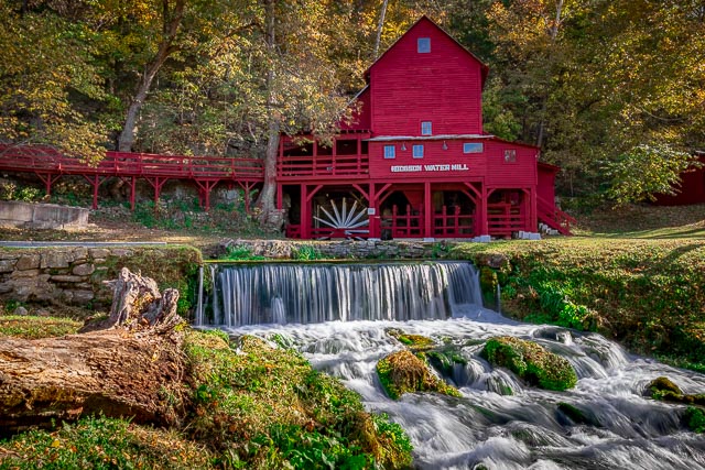
Falling Spring Mill The spring, known as Falling Spring because it pours out of the rock as a small waterfall, provided power for two mills. The second mill, which still stands, was built between 1927 and 1929, Falling Spring Mill, was used to grind corn for feed, saw out shingles, saw firewood, and generate electricity on the site. This mill had a metal wheel, the original structure had a wooden wheel.  The mill was first constructed of timer, then later enclosed with sawboard siding.  The mill’s present overshot wheel came from Johnson Spring, located approximately three miles down Hurricane Creek from Falling Spring. Also located on the site is a log cabin over 100 years old.  This cabin is the first of four houses built near this site. Constructed with half-dovetail notches at the corners, this helps to shed water away from the cabin, and may be one reason why it still stands today. The Thomas Brown Cabin is located at the Falling Springs Mill in the Mark Twain National Forest in Missouri. Thomas and Jane Brown homesteaded the Falling Spring Area in 1851. They settled in a land which looked very similar to their homeland, Tennessee. The area around Falling Spring provided for their basic needs – water for livestock and personal use, and trees from which to build a cabin. What to Photograph The spring and surrounding pond with the waterfall, the 100 year old Falling Springs Mill, and the log cabin. Where it is: From Winona: From US Hwy 60, travel South on MO Hwy 19 approx. 9.6 miles. Turn Left/East onto FR#3170. This buy clonazepam with no prescription road immediately splits; follow FR#3164 to your Left. Keep right at an intersection at approx 2 miles, then Falling Spring will be on your right at approx. 2.3. From Alton: Travel North on MO Hwy 19 approx. 16.3 miles. Turn Right/East onto FR#3170. This road immediately splits; follow FR#3164 to your Left. Keep right at an intersection at approx 2 miles, then Falling Spring will be on your right at approx. 2.3. Maps: Interactive Google Map Use the map  + – controls to zoom in and out, click and drag the to move the map, use the Map drop-down to change to “Map”, “Satellite”, “Hybrid”, or “Terrain” views.  Drag the little man icon from the upper left corner to a map location for street level view. GPS: 36°52’3.485″ N 91°17’41.448″ W Cost: There are no fees to enter the park. Hours: The Falling Springs Picnic area is open at all times Facilities: There are picnic tables and pit toilets, there is no running water. Location Contact Information: Eleven Point Ranger District District Ranger: Matt Dillon Address: # 4 Confederate Ridge Road Doniphan, MO 63935 Phone: (573) 996-2153 FAX: (573) 996-7745 Office Hours: M-F: 8:00am – 4:30pm Falling Springs Mill Photo Gallery Click Here for full page gallery More Photographic Destinations in Missouri: Interactive Google Map Use the map  + – controls to zoom in and out, use the Map drop-down to change to “Map”, “Satellite”, “Hybrid”, or “Terrain” views.  Drag the little man icon from the upper left corner to a map location for street level view. Click on a pushpin for more information about the Photographic Destination, then click on the title to go to the location page. Click Here for Photographic Destinations by State    All the information in this post was believed to be accurate at the time it was published.  Please be sure to double check with the location before relying on this information as everything changes over time, especially hours, prices, and whether the location is still open.   Great Places for Great Photos   Let me help you to find a great location for your next photography adventure.  I will list many lesser-known destinations, as well as the famous "Icon Locations" for photography.  I will provide photos (Lots of Photos), location information, consisting of what there is to photograph as well as other information about the destination.  I will give costs, maps, directions, contact information, and other essential information for a successful photo trip.  I will only post for locations that I have personally photographed to ensure a quality guide to great locations for photography. If you know of great places that are not posted, please send me the details, I may just decide that is a place I need to go!     Greg Disch is a freelance photographer located in Arkansas. Greg specializes in nature, scenic, wildlife, and other outdoor subjects in Arkansas and other areas of the country.  Most of the images on this site are available for sale as prints, personal use, or rights managed stock photos. Greg offers both classroom instruction and in the field hands on photographic workshops. Classroom sessions are normally held in Fort Smith Arkansas, but arrangements can be made to bring a class to your group. All classes and workshops have small class sizes designed to provide an optimum student to instructor ratio, where you can get the personal attention, you need.  Most classes and workshops are limited to a maximum of six participants and will be held with a minimum of only two. If you are looking for a wonderful opportunity to get personal individual instruction, I do private workshops and classes at a location of your choice, whether doing a location photo shoot, coming to your home or business, traveling across the country on a road trip, or at my classroom.  This is a fantastic way to learn digital workflow and be sure that your computer equipment is properly configured for optimum performance. [...]Read more...
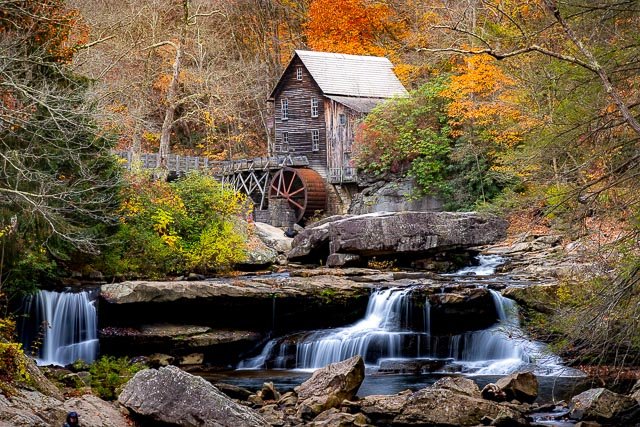
Drinkwater & Schriver Mill Cedar Point, Kansas The mill, which is also called the Cedar Point Mill, is owned by Drinkwater & Schriver Mill Inc., a Kansas non-profit corporation dedicated to saving the mill and maintaining it as an historic site, celebrating this exceptional 1875 Chase County, Kansas grist mill. In 1857 a Pennsylvanian named O.H. Drinkwater settled in the Cottonwood Valley of Chase County, KS. One of the first settlers of this area, he built a cabin along a small stream in the far western part of the county and called it “Cedar.” A few years later, in 1862, a post office was established here. Mr. Drinkwater became postmaster and named the town Cedar Point. In 1867, Mr. Drinkwater and J.P. Crawford began a milling partnership and built a wooden frame mill used for sawing lumber. P.P. Schriver replaced Mr. Crawford in the partnership and they began milling flour. In 1870, the mill began operating under the name of Drinkwater and Schriver. A year later, construction of a stone structure was begun and the three-story mill was completed in 1875. By 1883, the mill was proclaimed “the largest and finest in Chase County or in this part of the State.” Mr. Schriver’s son, Paul, operated the mill from 1903-1917 and added the frame part on the south side of the mill. The mill changed hands several times throughout the next years, and finally in 1941 was changed from a flour mill to a feed mill. After time spent standing vacant, Dr. Bruce McMullen from Wichita purchased the mill. In January 2000, Cedar Point Mill, Inc. was established by Dr. McMullen, Dan Clothier and Barry Linnens. This group plans to explore the potential restoration of the Drinkwater and Schriver Flour Mill and to maintain it as a community asset. The mill is one of few remaining limestone mills in Kansas and holds great importance in the historic culture of the community, state and region. The mill was listed on the National Register of Historic Places in 2006. What to Photograph: At this time visitors are welcome to photograph the exterior of the mill.  The mill is too dangerous for visitors to go inside the mill until work is completed. Where it is: The mill is located just ¾ mile south of US 50 Highway, eight miles east of Florence, seventeen miles west of Strong City and approximately thirty miles west of Emporia. Maps: Interactive Google Map Use the map  + – controls to zoom in and out, click and drag the to move the map, use the Map drop-down to change to “Map”, “Satellite”, “Hybrid”, or “Terrain” views.  Drag the little man icon from the upper left corner to a map location for street level view. Cost: There are no fees to visit the mill. Donations are being accepted to restore the mill. Facilities: There are no facilities at the mill. Links: Cedar Point Mill Location Contact Information: Drinkwater &Schriver Mill Inc. First & Main Cedar Point, KS 66843 816-808-1610 info@cedarpointmill.com Drinkwater & Schriver Mill Photo Gallery Click Here for full page gallery More Photographic Destinations in Kansas: Interactive Google Map Use the map  + – controls to zoom in and out, use the Map drop-down to change to “Map”, “Satellite”, “Hybrid”, or “Terrain” views.  Drag the little man icon from the upper left corner to a map location for street level view. Click on a pushpin for more information about the Photographic Destination, then click on the title to go to the location page. Click Here for Photographic Destinations by State    All the information in this post was believed to be accurate at the time it was published.  Please be sure to double check with the location before relying on this information as everything changes over time, especially hours, prices, and whether the location is still open.   Great Places for Great Photos   Let me help you to find a great location for your next photography adventure.  I will list many lesser-known destinations, as well as the famous "Icon Locations" for photography.  I will provide photos (Lots of Photos), location information, consisting of what there is to photograph as well as other information about the destination.  I will give costs, maps, directions, contact information, and other essential information for a successful photo trip.  I will only post for locations that I have personally photographed to ensure a quality guide to great locations for photography. If you know of great places that are not posted, please send me the details, I may just decide that is a place I need to go!     Greg Disch is a freelance photographer located in Arkansas. Greg specializes in nature, scenic, wildlife, and other outdoor subjects in Arkansas and other areas of the country.  Most of the images on this site are available for sale as prints, personal use, or rights managed stock photos. Greg offers both classroom instruction and in the field hands on photographic workshops. Classroom sessions are normally held in Fort Smith Arkansas, but arrangements can be made to bring a class to your group. All classes and workshops have small class sizes designed to provide an optimum student to instructor ratio, where you can get the personal attention, you need.  Most classes and workshops are limited to a maximum of six participants and will be held with a minimum of only two. If you are looking for a wonderful opportunity to get personal individual instruction, I do private workshops and classes at a location of your choice, whether doing a location photo shoot, coming to your home or business, traveling across the country on a road trip, or at my classroom.  This is a fantastic way to learn digital workflow and be sure that your computer equipment is properly configured for optimum performance. [...]Read more...
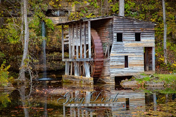
Dillard Mill Dillard Mill is one of Missouri’s best-preserved examples of a water-powered gristmill. Sitting along the clear-flowing Ozark stream, Huzzah Creek, the red mill is nestled among trees and near water cascading over a rock dam, creating a picturesque setting. Dillard Mill is the second mill structure at this site. Wisdom’s Mill, the first mill built here, was constructed in the 1850s. A rock wall along the Huzzah Creek was blasted open allowing the increased water flow to the mill needed for its operation. As a result, Huzzah Creek changed its channel. Joseph Dillard Cottrell and his brother, James, later owned Wisdom’s Mill from 1881 to 1889 – years that brought many changes to the area. During the Cottrells’ ownership of the mill, the small community grew with the establishment of a post office in 1887. It was also during this time that the community was named Dillard after Joseph Dillard Cottrell. Today, the restored mill contains most of its original machinery. Two of the three steel roller mills, however, were donated for scrap metal during World War II. Visitors can see the remaining machinery come to life during a tour of the mill. With the turn of a wheel, the mill begins to operate as it did years ago, grinding grain into flour. The sound of the water gushing over the dam outside the mill is replaced with the sounds of the belts and rollers turning. Tours of the mill are given year-round, although days and times vary by season. In 1974, the L-A-D Foundation of St. Louis, a non-profit organization, bought the property. In 1975, the foundation leased the mill and surrounding property to the Missouri Department of Natural Resources to operate as a state historic site. Also on the property is a building that once housed a general store owned by Adam Wilhite. Dillard Mill What to Photograph The historic mill, the mill pond, the dam and waterfall as well as the Adam Wilhite General Store. Where it is: One mile south of Dillard off Highway 49 in Crawford County, just outside of Davisville.   Maps: Interactive Google Map Use the map  + – controls to zoom in and out, click and drag the to move the map, use the Map drop-down to change to “Map”, “Satellite”, “Hybrid”, or “Terrain” views.  Drag the little man icon from the upper left corner to a map location for street level view. Click here for large Map GPS: 37°43’3.185″ N 91°12’23.646″ W   Cost: There is no fee for access to the Dillard Mill State Historic Site. Hours: PARK HOURS HISTORIC SITE GROUNDS: May through October 8 a.m. – 8 p.m. daily November through April 8 a.m. – 5 p.m. daily Closed Thanksgiving, Christmas and New Year’s days DILLARD MILL HOURS Tours: May through October 10 a.m., 11 a.m., 12:30 p.m., 1:30 p.m. and 2:30 p.m. daily November through April 10 a.m., 11 a.m., 12:30 p.m., 1:30 p.m. and 2:30 p.m. on Wednesday through Sunday Tours on Monday and Tuesday by prior appointment only HISTORIC SITE OFFICE HOURS Historic Site Office Hours May through October 10 a.m. – 4 p.m. daily November through April 10 a.m. – 4 p.m. Wednesday through Sunday; closed Monday and Tuesday Facilities: The historic site has picnic areas, restrooms and hiking trails. Five picnic tables with pedestal grills are located at the parking lot area, where there is also a covered, accessible shelter. There is a playground located in the picnic area. Location Contact Information: ADDRESS 142 Dillard Mill Road Davisville, MO 65456-4014 PHONE NUMBER Park Office: (573) 244-3120 Dillard Mill Photo Gallery Click Here for full page gallery   More Photographic Destinations in Missouri: Interactive Google Map Use the map  + – controls to zoom in and out, use the Map drop-down to change to “Map”, “Satellite”, “Hybrid”, or “Terrain” views.  Drag the little man icon from the upper left corner to a map location for street level view. Click on a pushpin for more information about the Photographic Destination, then click on the title to go to the location page. Click Here for Photographic Destinations by State    All the information in this post was believed to be accurate at the time it was published.  Please be sure to double check with the location before relying on this information as everything changes over time, especially hours, prices, and whether the location is still open.   Great Places for Great Photos   Let me help you to find a great location for your next photography adventure.  I will list many lesser-known destinations, as well as the famous "Icon Locations" for photography.  I will provide photos (Lots of Photos), location information, consisting of what there is to photograph as well as other information about the destination.  I will give costs, maps, directions, contact information, and other essential information for a successful photo trip.  I will only post for locations that I have personally photographed to ensure a quality guide to great locations for photography. If you know of great places that are not posted, please send me the details, I may just decide that is a place I need to go!     Greg Disch is a freelance photographer located in Arkansas. Greg specializes in nature, scenic, wildlife, and other outdoor subjects in Arkansas and other areas of the country.  Most of the images on this site are available for sale as prints, personal use, or rights managed stock photos. Greg offers both classroom instruction and in the field hands on photographic workshops. Classroom sessions are normally held in Fort Smith Arkansas, but arrangements can be made to bring a class to your group. All classes and workshops have small class sizes designed to provide an optimum student to instructor ratio, where you can get the personal attention, you need.  Most classes and workshops are limited to a maximum of six participants and will be held with a minimum of only two. If you are looking for a wonderful opportunity to get personal individual instruction, I do private workshops and classes at a location of your choice, whether doing a location photo shoot, coming to your home or business, traveling across the country on a road trip, or at my classroom.  This is a fantastic way to learn digital workflow and be sure that your computer equipment is properly configured for optimum performance. [...]Read more...
Dells Mill Water-Powered grist mills ground the wheat that dominated Wisconsin’s Civil War-era economy. Built in 1864, the mill was one of the server serving area farmers. After wheat production moved westward, owners adapted the building to mill flour and grind feed. A trip to the Dells mill could be an all-day family affair. Farmers often fished the millpond to pass the time. The millpond also provided a source for the winter ice harvest. A store, hotel, and school grew up nearby to serve the growing community Creating a mill pond required the building of a dam to flood upstream land. The Wisconsin Territorial Legislature enacted legislation enabling dam construction in 1840. Built along the dells of Bridge Creek, the base of the mill was carved into the sandstone bedrock. massive hand-hewn timbers secured with wooden pegs make up the structure of the Mill. Water turbines powered the milling process. A concrete dam replaced the original log structure in 1919. Dells Mill, which is listed on the National Register of Historic Places, operated continuously until 1968 Gustave Clark, the mill’s proprietor passed away on Sunday, August 24, 2014. The Mill’s future in unknown.  See it soon What to Photograph: The mill and grounds are open for photography, the best shot of the mill is from the bridge. The Dells School is a half mile from the mill. Best Time for Photographers: The area is accessible day or night and most anytime can make good photos.  As with many subjects outdoors early morning or late evening with the sun low in the sky can give the beautiful golden hour warmth to your images. Where it is: From Augusta drive north on Hwy 27 about three miles. Turn left at the sign onto County Rd V. Follow road past school house, around a few turns, to the mill, on the left. Maps: Interactive Google Map Use the map  + – controls to zoom in and out, click and drag the to move the map, use the Map drop-down to change to “Map”, “Satellite”, “Hybrid”, or “Terrain” views.  Drag the little man icon from the upper left corner to a map location for street level view. Cost: There are no fees to photograph the mill, the museum is closed at this time and it’s future is uncertain. Hours: The grounds are open year round. Facilities: There are currently no facilities at the mill, the town of Augusta is 5 miles south.   Links: Dells Mill Website Augusta Wisconsin Location Contact Information: Augusta Wisconsin Dells Mill  Dells Mill Museum Historic Properties E18855 County Road V Augusta, WI 54722 715-286-2714   Dells Mill Photo Gallery Click Here for full page gallery   More Photographic Destinations in Wisconsin: Interactive Google Map Use the map  + – controls to zoom in and out, use the Map drop-down to change to “Map”, “Satellite”, “Hybrid”, or “Terrain” views.  Drag the little man icon from the upper left corner to a map location for street level view. Click on a pushpin for more information about the Photographic Destination, then click on the title to go to the location page. Click Here for Photographic Destinations by State    All the information in this post was believed to be accurate at the time it was published.  Please be sure to double check with the location before relying on this information as everything changes over time, especially hours, prices, and whether the location is still open.   Great Places for Great Photos   Let me help you to find a great location for your next photography adventure.  I will list many lesser-known destinations, as well as the famous "Icon Locations" for photography.  I will provide photos (Lots of Photos), location information, consisting of what there is to photograph as well as other information about the destination.  I will give costs, maps, directions, contact information, and other essential information for a successful photo trip.  I will only post for locations that I have personally photographed to ensure a quality guide to great locations for photography. If you know of great places that are not posted, please send me the details, I may just decide that is a place I need to go!     Greg Disch is a freelance photographer located in Arkansas. Greg specializes in nature, scenic, wildlife, and other outdoor subjects in Arkansas and other areas of the country.  Most of the images on this site are available for sale as prints, personal use, or rights managed stock photos. Greg offers both classroom instruction and in the field hands on photographic workshops. Classroom sessions are normally held in Fort Smith Arkansas, but arrangements can be made to bring a class to your group. All classes and workshops have small class sizes designed to provide an optimum student to instructor ratio, where you can get the personal attention, you need.  Most classes and workshops are limited to a maximum of six participants and will be held with a minimum of only two. If you are looking for a wonderful opportunity to get personal individual instruction, I do private workshops and classes at a location of your choice, whether doing a location photo shoot, coming to your home or business, traveling across the country on a road trip, or at my classroom.  This is a fantastic way to learn digital workflow and be sure that your computer equipment is properly configured for optimum performance. [...]Read more...
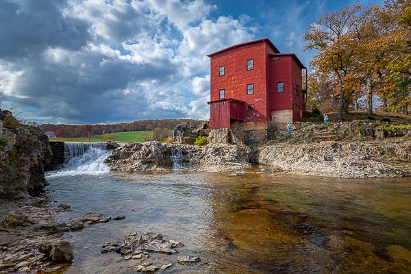
Crystal Mill The Crystal Mill, or the Old Mill is an 1892 wooden powerhouse located on an outcrop above the Crystal River in Crystal, Colorado, United States. It is accessible from Marble, Colorado via 4×4. Although called a Watermill, it is more correctly denoted as a compressor station, which used a water turbine to drive an air compressor. Originally built with a horizontal wheel. The compressed air was then used to power other machinery or tools. In the 21st century, the mill is usually called the Crystal Mill or the Old Crystal Mill. Many decades ago, when the mill was still in use, it was called the Sheep Mountain Power House at the Lost Horse Millsite, or simply the Lost Horse Mill. Sometimes it is erroneously called the Dead Horse Mill. The mill was constructed in 1893 by George C. Eaton and B.S. Phillips, promoters of the Sheep Mountain Tunnel and Mining Company.  It was built as a power plant for the Sheep Mountain Tunnel. Originally it had a horizontal waterwheel which generated compressed air for miners in the nearby silver mines.  It fell into disuse in 1917 when the Sheep Mountain Mine closed. The mill was placed on the National Register of Historic Places on July 5, 1985. History: THE CRYSTAL MILL This Structure located at Crystal City is considered by some to be the most photographed site in Colorado. It was constructed in 1893 by George C. Eaton and B.S. Phillips, promoters of the Sheep Mountain Tunnel and Mining Company, as a power plant for the Sheep Mountain Tunnel. It was originally known as the Sheep Mountain Tunnel Mill and the name was commonly shortened to “Crystal Mill,” though later writers sometimes called it by other names. It contained a horizontal wooden water wheel, turned by two one-inch water jets, at the base of the penstock shaft at river level, and this powered a large air compressor. Power was transmitted via a steel driveshaft up to the gear house on the front Of the building, then to the compressor by a wide leather belt. The air was carried to the mine entrance by a 3-inch iron pipe, across the river and up to the base of Sheep Mountain. compressed air powered the air drills and provided ventilation for the tunnel which in 1893 extended over 1500 feet into the mountain. The mill building has a privy in the overhanging corner which emptied directly into the river. The back end of the building contained a sleeping room for the attendant. In December 1893 the mill began operation, in spite of the 1893 silver panic, and continued sporadically until sometime in the 1920’s. River water powered the water wheel and a wooden dam above the falls raised the water level to the top of the penstock shaft. High water runoff the next spring after construction washed out the dam. It was rebuilt, and when it again washed out, water was obtained by building a long wooden flume which tapped the river far upstream on the east end of Crystal. Remnants of this flume can still be seen on the south side of the river. As the mine began to produce rich silver ore a stamp mill was built to the west of the mill to crush and concentrate the ore for shipping. It contained three large timbers tipped with iron which were raised and dropped to crush the ore, and powered via a 12-inch wide leather belt from the power house. Evidence of crushed ore can be seen across the river but little other remains of the stamp mill exist. This Structure never contained a saw mill and the powerhouse never had an electric generator. The Crystal Mill is privately owned and not open for public inspection. A new wood shingle roof, just like the original, was installed in 1976 with help from a Bicentennial Grant of $2500, and public donations. In 1984 several volunteers, with the advice of an engineer. installed supporting cables inside the building to raise and secure the gear house, which was pulling away from the building and in danger of falling into the river. Located in the Rock Creek Mining District this old power house is a picturesque remnant Of the intense prospecting and mineral extraction activities which accompanied and supported early settlement of this area. OSCAR MCCOLLUM, HISTORIAN FRONTIER HISTORICAL SOCIETY 1996   What to Photograph Crystal Mill Beaver Lake and Lizard Lake On the way to Crystal Mill you will pass by two beautiful mountain lakes.   The town of Marble The natural beauty of Marble inspires everyone, but especially those who are artistically or historically inclined and those who seek to refresh their soul. Marble is home to artists, artisans and galleries. The biggest art event of the year is of course the world renowned Marble Sculpting Symposium, which takes place every summer. Aside from the arts, there is also a fascinating wealth of history, which is evident all throughout town. If you are a history buff, Marble is for you. Refresh yourself and get inspired! Where it is: The Crystal Mill is located 6 miles east of Marble, just before the ghost town of Crystal. It is reachable only in the summer and fall months by a rough, one-lane, 4-wheel-drive road. If you are not interested in driving, or your vehicle does not have generous ground clearance, the trip to Crystal and The Mill can be reached by foot, mountain bike, or guided jeep tour. The Mill can also be accessed by horseback, but on a busy summer or fall day, riders will encounter many vehicles and the route is very rocky.     Maps: Interactive Google Map Use the map  + – controls to zoom in and out, click and drag the to move the map, use the Map drop-down to change to “Map”, “Satellite”, “Hybrid”, or “Terrain” views.  Drag the little man icon from the upper left corner to a map location for street level view.     GPS: 39°3’33.179″ N 107°6’16.859″ W   Cost: There is no cost to travel the road to Crystal Mill or to photograph from the road, to access the site from the river (private property) they were charging $10 per person. Hours: There are no hours for this location.   Facilities: There is a gift shop in the city of Crystal which is just above the mill The nearest town is Marble which has a general store and a BBQ restaurant (which is very busy), no gas. Location Contact Information:   Crystal Mill Photo Gallery Click Here for full page gallery   More Photographic Destinations in Colorado: Interactive Google Map Use the map  + – controls to zoom in and out, use the Map drop-down to change to “Map”, “Satellite”, “Hybrid”, or “Terrain” views.  Drag the little man icon from the upper left corner to a map location for street level view. Click on a pushpin for more information about the Photographic Destination, then click on the title to go to the location page. Click Here for Photographic Destinations by State   All the information in this post was believed to be accurate at the time it was published.  Please be sure to double check with the location before relying on this information as everything changes over time, especially hours, prices, and whether the location is still open.   Great Places for Great Photos   Let me help you to find a great location for your next photography adventure.  I will list many lesser-known destinations, as well as the famous "Icon Locations" for photography.  I will provide photos (Lots of Photos), location information, consisting of what there is to photograph as well as other information about the destination.  I will give costs, maps, directions, contact information, and other essential information for a successful photo trip.  I will only post for locations that I have personally photographed to ensure a quality guide to great locations for photography. If you know of great places that are not posted, please send me the details, I may just decide that is a place I need to go!     Greg Disch is a freelance photographer located in Arkansas. Greg specializes in nature, scenic, wildlife, and other outdoor subjects in Arkansas and other areas of the country.  Most of the images on this site are available for sale as prints, personal use, or rights managed stock photos. Greg offers both classroom instruction and in the field hands on photographic workshops. Classroom sessions are normally held in Fort Smith Arkansas, but arrangements can be made to bring a class to your group. All classes and workshops have small class sizes designed to provide an optimum student to instructor ratio, where you can get the personal attention, you need.  Most classes and workshops are limited to a maximum of six participants and will be held with a minimum of only two. If you are looking for a wonderful opportunity to get personal individual instruction, I do private workshops and classes at a location of your choice, whether doing a location photo shoot, coming to your home or business, traveling across the country on a road trip, or at my classroom.  This is a fantastic way to learn digital workflow and be sure that your computer equipment is properly configured for optimum performance. [...]Read more...
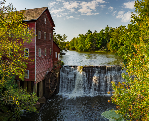
Cable Mill Great Smoky Mountains National Park The Cable Mill was one of the most successful — and enduring — grist mills in Cades Cove, built in 1867 by its namesake, John Cable. The mill, which processed logs, wheat and corn and was originally operated by millwright Daniel Ledbetter, continued to function in some fashion until the 1920s, and was actually still — informally — in use when the Park was formed. Renovations about the middle of the last century and the replacement of the mill wheel  has ensured the mill continues to operate much as it did almost 150 years ago. The John Cable Mill served as a valuable social outlet as well as a commodity source.    Cove residents would gather once a week, usually Saturday, and have their grain or corn processed into meal and flour for a fee of 8 percent of whatever was ground. This was not just a place to get your corn ground; other than church, this was the social outlet, they’d talk about the same things we do today — each other, crops, who was sick, who was getting married. Where it is: The mill is located on the Cades Cove Loop in the Great Smokey Mountain Nat. Park. Take Old State Hwy 73/E. Lamar Alexander Pkwy east-southeast of Townsend, Tn. for about 3.5 miles. Turn right on Laurel Creek Road and go 11-12 miles to Cades Creek Loop. Follow the one-way loop road to the mill at the far side of the loop, near Forge Creek Road junction. Follow signs. Because of slow moving traffic it may take over an hour to drive six miles from the start of Cades Cove Loop Road to Cades Cove Visitor Center/Cable Mill Area. Plan accordingly.   GPS: 35°35’6.546″ N 83°50’39.378″ W Maps: Interactive Google Map Use the map  + – controls to zoom in and out, click and drag the to move the map, use the Map drop-down to change to “Map”, “Satellite”, “Hybrid”, or “Terrain” views.  Drag the little man icon from the upper left corner to a map location for street level view.     Hours: Great Smoky Mountains National Park is open 24 hours a day, 365 days a year. However some secondary roads, campgrounds, and other visitor facilities close in winter. Open daily March 11 through October, and on weekends (Friday-Sunday) in November Hours: 9:00-5:00 Cost: There is no cost to visit Cable Mill or to enter Great Smoky Mountain National Park. Location Contact Information: By Mail Great Smoky Mountains National Park 107 Park Headquarters Road Gatlinburg, TN 37738 By Phone Recorded information: (865) 436-1200 Road Updates: (865) 436-1200 select 2, then 2 again Emergencies: 911 Email Us   Facilities: There is a large parking area and restrooms.  The Cades Cove Visitor center is also located near the mill.  Photo Gallery Click Here for full page gallery   More Photographic Destinations in Tennessee Interactive Google Map Use the map  + – controls to zoom in and out, use the Map drop-down to change to “Map”, “Satellite”, “Hybrid”, or “Terrain” views.  Drag the little man icon from the upper left corner to a map location for street level view. Click on a pushpin for more information about the Photographic Destination, then click on the title to go to the location page. Click Here for Photographic Destinations by State    All the information in this post was believed to be accurate at the time it was published.  Please be sure to double check with the location before relying on this information as everything changes over time, especially hours, prices, and whether the location is still open.   Great Places for Great Photos   Let me help you to find a great location for your next photography adventure.  I will list many lesser-known destinations, as well as the famous "Icon Locations" for photography.  I will provide photos (Lots of Photos), location information, consisting of what there is to photograph as well as other information about the destination.  I will give costs, maps, directions, contact information, and other essential information for a successful photo trip.  I will only post for locations that I have personally photographed to ensure a quality guide to great locations for photography. If you know of great places that are not posted, please send me the details, I may just decide that is a place I need to go!     Greg Disch is a freelance photographer located in Arkansas. Greg specializes in nature, scenic, wildlife, and other outdoor subjects in Arkansas and other areas of the country.  Most of the images on this site are available for sale as prints, personal use, or rights managed stock photos. Greg offers both classroom instruction and in the field hands on photographic workshops. Classroom sessions are normally held in Fort Smith Arkansas, but arrangements can be made to bring a class to your group. All classes and workshops have small class sizes designed to provide an optimum student to instructor ratio, where you can get the personal attention, you need.  Most classes and workshops are limited to a maximum of six participants and will be held with a minimum of only two. If you are looking for a wonderful opportunity to get personal individual instruction, I do private workshops and classes at a location of your choice, whether doing a location photo shoot, coming to your home or business, traveling across the country on a road trip, or at my classroom.  This is a fantastic way to learn digital workflow and be sure that your computer equipment is properly configured for optimum performance. [...]Read more...
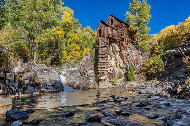
Boxley Mill Villines Mill, also known as Boxley Mill or Whiteley Mill, was originally built circa 1840 by Abner Casey in the Buffalo River valley, in what is now Buffalo National River. After becoming known as Whiteley Mill, the mill was at the center of a Civil War skirmish known as the Battle of Whiteley’s Mill. The mill was rebuilt in 1870 and replaced with a larger mill, becoming known as Villines Mill after the new owner. After three generations of Villines, the mill closed in the 1960s. The mill is included in the Big Buffalo Valley Historic District. The National Park Service now owns the mill and normally opens it to the public on weekends in October. History: The first mill was built about 1840 by Abner Casey at its present site below the Boxley Spring. After a period of operation, it was purchased by Samuel WHITELY and became known as the Whiteley Mill. The Civil War broke out, and while records reveal no major battles in Newton County, there were a number of bloody skirmishes, including one at Whiteley’s mill on April 10, 1864. In his book, The History of Newton County, Walter LACKEY, relates the following “James Larking VILLINES was two years old when the battle of Whiteley’s Mill was fought. As a young boy he later saw much of the battle ground. The Whiteley Mill then stood on the same ground that the present old water mill stands, and where Mr. VILLINES was the miller for many years. He says that the rebel army was camped opposite the present Duty store (Boxley) and that the Union Army attacked the enemy with both mounted and un-mounted troops, being assisted by cannons located on the flinty ridge. John CECIL, the well-known, well-loved sheriff of Newton County was the leading rebel Captain in this battle.” The war ended and by 1870, many new families had established homesteads in the Upper Buffalo River Valley and the need for a larger grist mill became evident. A man by the name of MILLER was employed to build a large, two-story frame building and Robert VILLINES became the miller. The mill had a large under-shot wheel with plenty of water from the Boxley millpond spring supplying sufficient power for grinding corn and processing flour. Over the years, Cager BOEN and James Larkin VILLINES, the son of Robert VILLINES, were the millers, providing a much needed service for Boxley, Ponca and the surrounding countryside. Jasper resident Carl VILLINES recalls: “Old Jimmie VILLINES was running the mill when I was about 12 years old. I couldn’t lift the sack of corn up on the horse, so my father would load the corn and then I’d ride to the mill with it. We lived at Center Point, which was eight to ten miles away, and I had to cross the Big Buffalo five times to get to the mill. The round trip took about all day. Then Lester YOUNG put up a grist mill at Ponca which was a lot closer, so I’d go there instead.” Clyde VILILNES son of James Larking VILLINES and present owner of the Boxley Mill continued to do custom grinding until 1950 when the mill was closed down, ending more than 80 years of service and closing a chapter of Newton County history. What to Photograph There is a great deal to photograph here, the mill itself along with other nearby structures including an old house and some small cabins.  There is also an old springhouse across the road which during periods of heavy rain a waterfall runs right beside the structure. Where it is: The Boxley Grist Mill is located just off of Highway 43 approximately 1 mile north of the Highway 21/43 intersection.  It will be on the right side just past the Mill Pond and behind an old stone home and fishing cabins. 3-13-17-Updated-BUFF-Map (1) Maps: Interactive Google Map Use the map  + – controls to zoom in and out, click and drag the to move the map, use the Map drop-down to change to “Map”, “Satellite”, “Hybrid”, or “Terrain” views.  Drag the little man icon from the upper left corner to a map location for street level view. Click here for PDF version of map GPS: 35°59’25.544″ N 93°23’53.151″ W Cost: There are no fees for access to the Buffalo National River. Hours: The Gorgas Science Foundation, in partnership with the National Park Service, maintains and preserves the historic mill and nearby fishing cabins. The Boxley Grist Mill is open to the public only during ranger-guided tours.  There is a fence around the mill, but you can photograph from behind the fence at any time. Facilities: There are no facilities at this location. The closest restroom and drinking water is located a couple miles north of the mill at the Lost Valley Day Use Area. Location Contact Information: Mailing Address: By Mail Superintendent Buffalo National River 402 N. Walnut, Suite 136 Harrison, AR 72601 By Phone Tyler Bend Visitor Center Information (870) 439-2502 Headquarters (870) 365-2700 Headquarters (TDD) (870) 365-2789 Buffalo Point Ranger Station Information (870) 449-4311 Steel Creek InformationStation (870) 861-2570 Boxley Mill Photo Gallery Click Here for full page gallery   More Photographic Destinations in Arkansas: Interactive Google Map Use the map  + – controls to zoom in and out, use the Map drop-down to change to “Map”, “Satellite”, “Hybrid”, or “Terrain” views.  Drag the little man icon from the upper left corner to a map location for street level view. Click on a pushpin for more information about the Photographic Destination, then click on the title to go to the location page. Click Here for Photographic Destinations by State   All the information in this post was believed to be accurate at the time it was published.  Please be sure to double check with the location before relying on this information as everything changes over time, especially hours, prices, and whether the location is still open.   Great Places for Great Photos   Let me help you to find a great location for your next photography adventure.  I will list many lesser-known destinations, as well as the famous "Icon Locations" for photography.  I will provide photos (Lots of Photos), location information, consisting of what there is to photograph as well as other information about the destination.  I will give costs, maps, directions, contact information, and other essential information for a successful photo trip.  I will only post for locations that I have personally photographed to ensure a quality guide to great locations for photography. If you know of great places that are not posted, please send me the details, I may just decide that is a place I need to go!     Greg Disch is a freelance photographer located in Arkansas. Greg specializes in nature, scenic, wildlife, and other outdoor subjects in Arkansas and other areas of the country.  Most of the images on this site are available for sale as prints, personal use, or rights managed stock photos. Greg offers both classroom instruction and in the field hands on photographic workshops. Classroom sessions are normally held in Fort Smith Arkansas, but arrangements can be made to bring a class to your group. All classes and workshops have small class sizes designed to provide an optimum student to instructor ratio, where you can get the personal attention, you need.  Most classes and workshops are limited to a maximum of six participants and will be held with a minimum of only two. If you are looking for a wonderful opportunity to get personal individual instruction, I do private workshops and classes at a location of your choice, whether doing a location photo shoot, coming to your home or business, traveling across the country on a road trip, or at my classroom.  This is a fantastic way to learn digital workflow and be sure that your computer equipment is properly configured for optimum performance. [...]Read more...
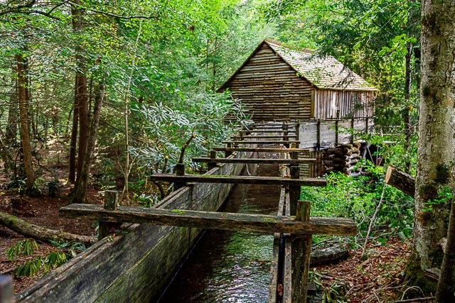
Bollinger Mill State Historic Site After receiving a Spanish land grant, George Frederick Bollinger led a group of families from North Carolina to this area and in 1800 began construction of a mill and dam on the Whitewater River. The mill quickly became successful and by the 1820s, a road linked Bollinger Mill with surrounding communities. Bollinger himself became well known, entered politics, and served as a senator in Missouri’s first general assembly. mill machinery inside the millThe mill and dam, originally constructed from logs, were rebuilt in stone in 1825 and this limestone foundation and dam are still visible today. When Bollinger died in 1842, his daughter, Sarah Daugherty, and her two sons continued to operate the popular mill. During the Civil War, Union forces burned the mill to prevent the passing of flour and meal into rebel hands. Only the stone foundation survived. After the war, the family sold the mill and 640 acres to Solomon R. Burford, who rebuilt the mill of brick upon the original stone foundation. The present-day, four-story stone and brick mill was completed in 1867 and Burford’s initials are still visible on the wall inside the front door. It was probably at this time that the method of powering the mill was changed from a water wheel to a more efficient, water-driven turbine. It was also at this time that the town of Burfordville came into existence. Construction of a covered bridge, begun before the war, was completed in 1868 and linked Burfordville to the main road. Made from nearby yellow poplar trees, the bridge was built by Joseph Lansmon, a well-known builder from Cape Girardeau. He used a Howe truss design, wherein diagonal wooden compression members are used with vertical iron rods in tension to form trusses. Historical records show that there was a toll house on the east end of the 140-foot-long bridge. several vintage old cars parked in front of the millFrom 1897 to 1953, the mill was owned by the Cape County Milling Co. After the milling company went out of business in 1953, the mill was sold to the Vandivort family, relatives of George F. Bollinger. The Vandivorts, interested in seeing the mill preserved, donated it to the Cape Girardeau County Historical Society in 1961, who in turn donated it to the state in 1967. That same year, the Missouri legislature authorized the state park system to maintain all four of Missouri’s remaining covered bridges.   Burfordville Covered Bridge is the oldest remaining covered bridge in Missouri. Joseph Lansmon began its construction in 1858, but it is unclear if the bridge was completed before or after the Civil War. The bridge was not mentioned in St. Louis newspaper accounts of the 1861 burning of Bollinger Mill, located next to the bridge. After the Civil War, the bridge became a vital link, especially to farmers driving wagonloads of grain destined for the mill. The bridge exhibits Howe-truss construction, named for William Howe, who patented the design in 1840. The essential feature of the design was its use of vertical iron rods to draw the diagonal wooden members tight against the top and bottom of the truss. The Howe-truss span was built mainly of yellow poplar. Burfordville Covered Bridge, which spans the Whitewater River, is 140 feet long and has a clearance 14 feet high and 12 feet wide. The road going through the bridge was part of the toll-road system between Burfordville, Jackson and Cape Girardeau. At that time, toll roads and bridges were commonly operated as private businesses. Tolls were charged until 1906 when local farmers, tired of waiting for the courts to abolish the tolls, broke down the gates and used the roads without paying. Although there were many advantages to the shelter provided by the roof and sides, the main purpose behind covering the bridges was to protect the intricate structural network of iron and timber trusses from the weather. The coverings also added strength, which reduced sagging and listing. Riders in uncovered buggies and carriages often used the bridges as shelters from wind, snow and rain. What to Photograph The historic mill, the dam on Whitewater River, and the Burfordville Covered Bridge. Where it is: Directions: From the intersection of US-61 and MO-34 (south of downtown) in Jackson take MO-34 west approximately 7 miles to County Road 360. Take a left and go south on County Road 360 approximately 2 mile to Bollinger Mill Road. Turn left on Bollinger Mill Road and proceed to the site. Maps: Interactive Google Map Use the map  + – controls to zoom in and out, click and drag the to move the map, use the Map drop-down to change to “Map”, “Satellite”, “Hybrid”, or “Terrain” views.  Drag the little man icon from the upper left corner to a map location for street level view.   GPS: 37°22’5.867″ N 89°48’10.865″ W Cost: There is no fee for access to the Bollinger Mill State Historic Site. Hours: PARK HOURS Historic Site Grounds: Sunrise to sunset, year-round (except New Year’s, Easter, Thanksgiving and Christmas days) BOLLINGER MILL HOURS Tours: Tours are given on demand. Summer Hours (On-Season) March 15 through Nov. 15 10 a.m. – 4 p.m., Monday through Saturday (last tour begins at 3:30 p.m.) Noon – 4 p.m., Sunday (last tour begins at 3:30 p.m.) Winter Hours (Off-Season) Nov. 16 through March 14 10 a.m. – 4 p.m. Monday and Thursday through Saturday (last tour begins at 3:30 p.m.) Noon – 4 p.m. Sunday (last tour begins at 3:30 p.m.) No tours are offered on Tuesday or Wednesday. The historic site is closed New Year’s, Easter, Thanksgiving and Christmas days. HISTORIC SITE OFFICE HOURS 8 a.m. to 4:30 p.m., Monday through Friday, year-round Facilities: Presently, there are two accessible picnic tables. Picnic sites are accessed over natural turf. The vault toilet is accessible via a concrete ramp and there is an accessible parking space. An accessible drinking fountain is along a concrete path near the parking space and vault toilet. Location Contact Information: Bollinger Mill State Historic Site 113 Bollinger Mill Road Burfordville, Missouri 573-243-4591   Bollinger Mill Photo Gallery Click Here for full page gallery   More Photographic Destinations in Missouri: Interactive Google Map Use the map  + – controls to zoom in and out, use the Map drop-down to change to “Map”, “Satellite”, “Hybrid”, or “Terrain” views.  Drag the little man icon from the upper left corner to a map location for street level view. Click on a pushpin for more information about the Photographic Destination, then click on the title to go to the location page. Click Here for Photographic Destinations by State    All the information in this post was believed to be accurate at the time it was published.  Please be sure to double check with the location before relying on this information as everything changes over time, especially hours, prices, and whether the location is still open.   Great Places for Great Photos   Let me help you to find a great location for your next photography adventure.  I will list many lesser-known destinations, as well as the famous "Icon Locations" for photography.  I will provide photos (Lots of Photos), location information, consisting of what there is to photograph as well as other information about the destination.  I will give costs, maps, directions, contact information, and other essential information for a successful photo trip.  I will only post for locations that I have personally photographed to ensure a quality guide to great locations for photography. If you know of great places that are not posted, please send me the details, I may just decide that is a place I need to go!     Greg Disch is a freelance photographer located in Arkansas. Greg specializes in nature, scenic, wildlife, and other outdoor subjects in Arkansas and other areas of the country.  Most of the images on this site are available for sale as prints, personal use, or rights managed stock photos. Greg offers both classroom instruction and in the field hands on photographic workshops. Classroom sessions are normally held in Fort Smith Arkansas, but arrangements can be made to bring a class to your group. All classes and workshops have small class sizes designed to provide an optimum student to instructor ratio, where you can get the personal attention, you need.  Most classes and workshops are limited to a maximum of six participants and will be held with a minimum of only two. If you are looking for a wonderful opportunity to get personal individual instruction, I do private workshops and classes at a location of your choice, whether doing a location photo shoot, coming to your home or business, traveling across the country on a road trip, or at my classroom.  This is a fantastic way to learn digital workflow and be sure that your computer equipment is properly configured for optimum performance. [...]Read more...
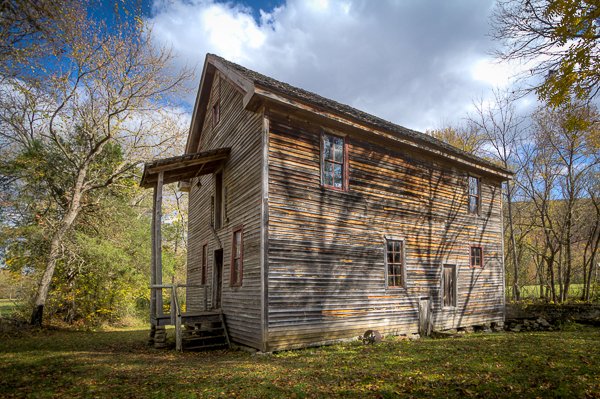
Alley Spring Mill The Alley Community… A Gathering Place Alley was home, farm, and school for people who lived here a century ago. Dances, baseball games, and roller skating were all part of Alley’s busier days. John Knotts purchased the 80 acre site in 1902 and diversified the enterprises to include a well-stocked store and blacksmith shop. A mill was vital to community life, where grain was ground to provide the daily bread. The present building was constructed during 1893-1894 by George Washington McCaskill as a merchant mill. It was larger than most mills in the Jacks Fork area and replaced an earlier mill on this same site that was built by 1868. Originally unpainted, it was first painted white with green trim, then later the famous red color associated with Alley Mill today. A TOUR OF THE MILL The Back Porch Located under the back porch is the turbine pit. In it sat a thirty five inch Leffel turbine. Belts from the turbine brought power into the basement. A control wheel on the porch allowed the miller to control how much water entered the turbine and thereby control its speed. This ability to control the speed was one of the innovations that made turbines preferable to the old water wheels. Basement This is where all power was transmitted to the machinery. Elevators and belts operated from a driveshaft running the length of the building. This section of the mill is not open for public visits. First Floor Whole grain (corn or wheat) entered the mill here. The grain was put into bins, then elevated to chutes that were connected to milling machines. These are the large iron and wood machines near the back of the room. Here the grain was ground, picked up in another elevator, taken back up and dropped down into the next machine. This process allowed the grain to be ground repeatedly to a fine flour suitable for baking. Bins for storage were also located on this floor, as well as the miller’s office. Second Floor Sifting was the main activity here. The large cube shaped machine was called a swing sifter. It shook the ground grain through a series of sieves to achieve a uniform consistency. The rectangular machines were an earlier way to do the same thing. In these machines, flour was filtered or sifted through silk. The Attic Belts that operated the second floor machines were located here. The attic is not restored and is not open for public visits. Alley Mill is an example of over 100 historic structures found within Ozark National Riverways. By protecting this landmark, we are preserving the heritage of all Americans. Please help by respecting all historic and archeological artifacts in the park. It is illegal to remove artifacts, including arrowheads, from Park Service or other Federal lands. It is also disrespectful to the memories of those who went before us. Please leave them for the next person to enjoy. Ozark National Scenic Riverways is the first national park area to protect a river system. The Current and Jacks Fork Rivers are two of the finest floating rivers you’ll find anywhere. Spring-fed, cold and clear they are a delight to canoe, swim, boat or fish. Besides these two famous rivers, the park is home to hundreds of freshwater springs, caves, trails and historic sites such as Alley Mill. What to Photograph The Alley Mill was built in 1894. Much of the original milling equipment is still in place. Exhibits explain the life and culture of the Ozarks. Storeys Creek One Room Schoolhouse Located within walking distance of Alley Mill, six miles west of Eminence, Missouri on State Route 106. Open on summer weekends. Grounds always open, but access into the school is limited. Where it is: Alley Mill is located six miles west of Eminence, Mo on State Route 106 Maps: Interactive Google Map Use the map  + – controls to zoom in and out, click and drag the to move the map, use the Map drop-down to change to “Map”, “Satellite”, “Hybrid”, or “Terrain” views.  Drag the little man icon from the upper left corner to a map location for street level view. GPS: Coordinates 37°9′15″N 91°26′31″W Cost: There are no fees to enter the park. Hours: The Ozark National Scenic Riverways is open year around, the grounds of the mill are open 24 hours a day.  Alley Mill and General Store are open daily from Memorial Day weekend through mid-October. Alley Spring Visitor Information Center is open from Memorial Day to Labor Day, 7 days a week from 8:00 a.m. to 4:30 p.m. Alley Spring campground is open daily year-round. Campers only from 10 p.m. to 6 a.m. Location Contact Information: Ozark National Scenic Riverways Mailing Address: P.O. Box 490 Van Buren, MO 63965 Physical Address 404 Watercress Drive Van Buren, MO 63965 Phone: (573) 323-4236 Links Ozark National Scenic Riverways Alley Springs Mill Photo Gallery Click Here for full page gallery More Photographic Destinations in Missouri: Interactive Google Map Use the map  + – controls to zoom in and out, use the Map drop-down to change to “Map”, “Satellite”, “Hybrid”, or “Terrain” views.  Drag the little man icon from the upper left corner to a map location for street level view. Click on a pushpin for more information about the Photographic Destination, then click on the title to go to the location page. Click Here for Photographic Destinations by State    All the information in this post was believed to be accurate at the time it was published.  Please be sure to double check with the location before relying on this information as everything changes over time, especially hours, prices, and whether the location is still open.   Great Places for Great Photos   Let me help you to find a great location for your next photography adventure.  I will list many lesser-known destinations, as well as the famous "Icon Locations" for photography.  I will provide photos (Lots of Photos), location information, consisting of what there is to photograph as well as other information about the destination.  I will give costs, maps, directions, contact information, and other essential information for a successful photo trip.  I will only post for locations that I have personally photographed to ensure a quality guide to great locations for photography. If you know of great places that are not posted, please send me the details, I may just decide that is a place I need to go!     Greg Disch is a freelance photographer located in Arkansas. Greg specializes in nature, scenic, wildlife, and other outdoor subjects in Arkansas and other areas of the country.  Most of the images on this site are available for sale as prints, personal use, or rights managed stock photos. Greg offers both classroom instruction and in the field hands on photographic workshops. Classroom sessions are normally held in Fort Smith Arkansas, but arrangements can be made to bring a class to your group. All classes and workshops have small class sizes designed to provide an optimum student to instructor ratio, where you can get the personal attention, you need.  Most classes and workshops are limited to a maximum of six participants and will be held with a minimum of only two. If you are looking for a wonderful opportunity to get personal individual instruction, I do private workshops and classes at a location of your choice, whether doing a location photo shoot, coming to your home or business, traveling across the country on a road trip, or at my classroom.  This is a fantastic way to learn digital workflow and be sure that your computer equipment is properly configured for optimum performance. [...]Read more...