Texas Photographic Destinations

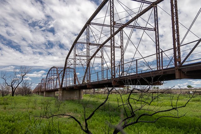
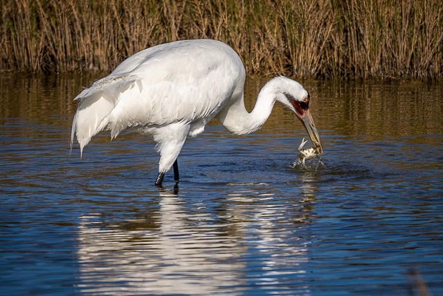
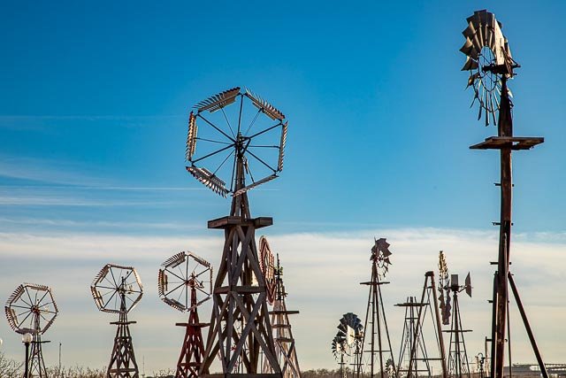
Canadian River Wagon Bridge Muleshoe Bend Bluebonnets Chapel On The Dunes Padre Island National Seashore Aransas National Wildlife Refuge Port Isabel Lighthouse Texola Ghost Town Glenrio Ghost Town Caddo Lake American Windmill Museum Judge Roy Bean Visitor Center Mariscal Mine Big Bend National Park Stonehenge II Terlingua Ghost Town Fort Davis National Historic Site Fort Leaton State Historic Site Wildseed Farms Fort Worth Stockyards Cross of our Lord Jesus Christ - Groom Texas San Antonio Missions National Historic Park Cadillac Ranch - Amarillo TX

Let me help you to find a great location in Texas for your next photography adventure.  I will list many lesser known destinations, as well as the famous “Icon Locations” for photography.  I will provide photos (Lots of Photos), location information,  consisting of what there is to photograph as well as other information about the destination.  I will give costs, maps, directions, contact information, and other essential information for a successful photo trip.  I will only post for locations that I have personally photographed to insure a quality guide to the best places for photography in Texas.

Interactive Google Map

Use the map  + – controls to zoom in and out, use the Map drop-down to change to “Map”, “Satellite”, “Hybrid”, or “Terrain” views.  Drag the little man icon from the upper left corner to a map location for street level view. Click on a pushpin for more information about the Photographic Destination, then click on the title to go to the location page.

Texas Photographic Destinations

Texas Destinations
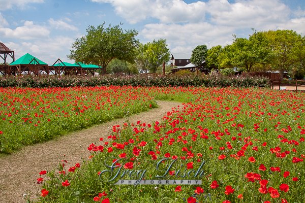
Wildseed Farms Wildseed Farms has been growing fields of wildflowers for the production of seed for over 35 years.  They are the nation’s largest working wildflower farm with over 200 acres in Fredericksburg Texas alone.  There is no charge for admission and they are open year around, 7 days a week, 9:30am – 5:00pm. The walking trails are open 9:30am – 4:30pm. They respectfully request pictures be taken from the trails next to the flowers and not in the flower beds. The larger fenced fields are  production fields. Through the ages, Mother Nature worked alone splashing the countryside with brilliant colors. In 1983, there were very few sources for wildflower seeds and the seeds that were available were prohibitively expensive. Today, Wildseed Farms in Fredericksburg, Texas lends a hand. John R. Thomas, Wildseed’s founder and president, knows the importance of beautiful wildflowers along our highways. The public’s love of wildflowers and demands from landscape contractors and the highway department motivated Thomas to turn his sideline turf seeding business into a full-time wildflower farm. The new company pioneered the practice of planting wildflowers in rows on large acreage and developed machinery to plant and harvest the tiny seeds. The farm has more than 1,000 cultivated acres in Texas and over 200 acres of wildflower fields at its Texas Hill Country headquarters outside of Fredericksburg. You will see fields of wildflowers blooming from March through October. More than 450,000 people a year stop by the Center. Come and view a real working wildflower farm and stay to shop at Blossoms Boutique, Lantana Nursery, and the Brewbonnet Biergarten Fun for the whole family! Visitors can enjoy a glass of wine, cold beer or other refreshments and explore the walking trails, watch the farm staff work and take photos. They can buy wildflower seeds and pick up one of the farm’s award-winning and extremely informative catalogs.   What to Photograph The Trial Gardens and display gardens are surrounded by a half mile of walking trails, which in turn are surrounded by acres of production crops. Wide and wheel chair accessible, the walking trails allow you to stroll at your leisure. Covered sitting areas are photo opportunities in their own right, surrounded by flowers, butterflies, and hummingbirds. Visit the Butterfly Gardens (seasonal) and see many different species of native butterflies nectaring on certain varieties of plants that provide a food source as well as plants that aid in there reproduction. Where it is: Wildseed Farms is located in the beautiful Texas Hill Country, just seven miles east of Fredericksburg, Texas. Maps: Interactive Google Map Use the map  + – controls to zoom in and out, click and drag the to move the map, use the Map drop-down to change to “Map”, “Satellite”, “Hybrid”, or “Terrain” views.  Drag the little man icon from the upper left corner to a map location for street level view. Cost: There is no charge for admission. Hours: Open year around, 7 days a week, 9:30am – 5:00pm.  Walking trails are open 9:30am – 4:30pm.   Facilities: There are restrooms, the Brewbonnet Biergarten offers our guests a place to relax and sit a spell. They offer cold beer, snacks, and ice cream. Location Contact Information: Wildseed Farms, Inc. 100 Legacy Drive Fredericksburg, TX 78624 Main: (800) 848 0078Retail Store:  (830) 990 1393   Wildseed Farms Photo Gallery Click Here for full page gallery   More Photographic Destinations in Texas: Interactive Google Map Use the map  + – controls to zoom in and out, use the Map drop-down to change to “Map”, “Satellite”, “Hybrid”, or “Terrain” views.  Drag the little man icon from the upper left corner to a map location for street level view. Click on a pushpin for more information about the Photographic Destination, then click on the title to go to the location page. Click Here for Photographic Destinations by State   All the information in this post was believed to be accurate at the time it was published.  Please be sure to double check with the location before relying on this information as everything changes over time, especially hours, prices, and whether the location is still open.   Great Places for Great Photos   Let me help you to find a great location for your next photography adventure.  I will list many lesser-known destinations, as well as the famous "Icon Locations" for photography.  I will provide photos (Lots of Photos), location information, consisting of what there is to photograph as well as other information about the destination.  I will give costs, maps, directions, contact information, and other essential information for a successful photo trip.  I will only post for locations that I have personally photographed to ensure a quality guide to great locations for photography. If you know of great places that are not posted, please send me the details, I may just decide that is a place I need to go!     Greg Disch is a freelance photographer located in Arkansas. Greg specializes in nature, scenic, wildlife, and other outdoor subjects in Arkansas and other areas of the country.  Most of the images on this site are available for sale as prints, personal use, or rights managed stock photos. Greg offers both classroom instruction and in the field hands on photographic workshops. Classroom sessions are normally held in Fort Smith Arkansas, but arrangements can be made to bring a class to your group. All classes and workshops have small class sizes designed to provide an optimum student to instructor ratio, where you can get the personal attention, you need.  Most classes and workshops are limited to a maximum of six participants and will be held with a minimum of only two. If you are looking for a wonderful opportunity to get personal individual instruction, I do private workshops and classes at a location of your choice, whether doing a location photo shoot, coming to your home or business, traveling across the country on a road trip, or at my classroom.  This is a fantastic way to learn digital workflow and be sure that your computer equipment is properly configured for optimum performance. [...]Read more...
  Texola Ghost Town Texola is a living Ghost Town meaning there are still people living there even though the town is mostly abandoned.  Texola sits on the border of Texas and Oklahoma on old Route 66.  There are many abandoned buildings including a 1930 Magnolia Gas Station and a one room jail. The History of Texola dates back to the early 1900s. Before being named Texola, the town site had been called Texokla and Texoma. Because of its location near the 100th Meridian, the town was surveyed eight different times, which meant that some early residents lived in both Texas and Oklahoma without ever moving. Texola was originally part of northern Greer County until Beckham County was formed after Oklahoma gained statehood in 1907. A post office was established in the community on December 12, 1901 with Reuben H. Grimes serving as the first postmaster. In 1902, the Choctaw, Oklahoma and Gulf Railroad (later owned by the Chicago, Rock Island and Pacific Railway) was built through the town. A weekly newspaper, the Texola Herald, began publishing in 1902 and continued to operate into the early 1920s. By 1909, Texola had two cotton gins as well as a corn and grist mill. The local economy was agriculturally based and several businesses opened in the community. The 1910 census recorded 361 people living in Texola. That same year, a small Territorial Jail was built. After a slight decline in population during the 1910s, Texola grew rapidly in the 1920s. The population peaked at 581 in the 1930 census. The arrival of Route 66  had a positive impact on the local economy. Cotton production increased during the decade, necessitating the need for two additional gins. As the town prospered, amenities such as a ten-acre park and an auditorium capable of seating 300 people were found in the community. The population began to decline in the 1940s and continued to do so throughout the remainder of the twentieth century. By 1980, Texola was a town of 106 residents. When the next census was conducted in 1990, Texola had lost nearly 58 percent of its population, leaving just 45 people in the town. That figure rose by two, to 47, in 2000. By 2010, the population had decreased to 36.     One Room Jail The Texola Territorial Jail was used from 1908 to 1910 and consists of nothing more than a one room block building with iron bars on the door and window. the walls continue several feet underground to keep the bad guys from digging out.   Where it is: Texola is located on Route 66 just south of Interstate 40 Oklahoma Exit 1. Get directions on Google Maps Maps: Interactive Google Map Use the map  + – controls to zoom in and out, click and drag the to move the map, use the Map drop-down to change to “Map”, “Satellite”, “Hybrid”, or “Terrain” views.  Drag the little man icon from the upper left corner to a map location for street level view. GPS: 35°13’9.312″ N 99°59’29.232″ W Cost: There is no cost to visit Texola. Hours: The location is accessible at all times. Facilities: There are no public facilities available. Location Contact Information: No contact information is available.     Texola Ghost Town Photo Gallery Click Here for full page gallery   More Photographic Destinations in Oklahoma Interactive Google Map Use the map  + – controls to zoom in and out, use the Map drop-down to change to “Map”, “Satellite”, “Hybrid”, or “Terrain” views.  Drag the little man icon from the upper left corner to a map location for street level view. Click on a pushpin for more information about the Photographic Destination, then click on the title to go to the location page. Click Here for Photographic Destinations by State    All the information in this post was believed to be accurate at the time it was published.  Please be sure to double check with the location before relying on this information as everything changes over time, especially hours, prices, and whether the location is still open.   Great Places for Great Photos   Let me help you to find a great location for your next photography adventure.  I will list many lesser-known destinations, as well as the famous "Icon Locations" for photography.  I will provide photos (Lots of Photos), location information, consisting of what there is to photograph as well as other information about the destination.  I will give costs, maps, directions, contact information, and other essential information for a successful photo trip.  I will only post for locations that I have personally photographed to ensure a quality guide to great locations for photography. If you know of great places that are not posted, please send me the details, I may just decide that is a place I need to go!     Greg Disch is a freelance photographer located in Arkansas. Greg specializes in nature, scenic, wildlife, and other outdoor subjects in Arkansas and other areas of the country.  Most of the images on this site are available for sale as prints, personal use, or rights managed stock photos. Greg offers both classroom instruction and in the field hands on photographic workshops. Classroom sessions are normally held in Fort Smith Arkansas, but arrangements can be made to bring a class to your group. All classes and workshops have small class sizes designed to provide an optimum student to instructor ratio, where you can get the personal attention, you need.  Most classes and workshops are limited to a maximum of six participants and will be held with a minimum of only two. If you are looking for a wonderful opportunity to get personal individual instruction, I do private workshops and classes at a location of your choice, whether doing a location photo shoot, coming to your home or business, traveling across the country on a road trip, or at my classroom.  This is a fantastic way to learn digital workflow and be sure that your computer equipment is properly configured for optimum performance. [...]Read more...
Terlingua Ghost Town Due to its proximity to Big Bend National Park, today Terlingua is mostly a tourist destination for park visitors. Rafting and canoeing on the Rio Grande, mountain biking, camping, hiking, and motorcycling are some of the outdoor activities favored by tourists.  Much of the Ghost Town has been re-inhabited and there are restaurants and lodging available. On the first Saturday of November, over 10,000 “chiliheads” convene in Terlingua for two annual chili cookoffs: the Chili Appreciation Society International and the Frank X. Tolbert/Wick Fowler World Chili Championship (established 1967). The Chisos Mining Company, was established in 1903 at Terlingua . Founded by Howard E. Perry, a Chicago industrialist, the Chisos reported the first recovery in 1903, and during the next three decades became one of the nation’s leading producers of quicksilver. Initially the company processed the cinnabar ore in primitive retorts, where the silver liquid metal is recovered through a simple baking process. As production increased, Perry turned to more industrialized methods . Exploration continued, and in 1914 the company discovered one of the richest veins of cinnabar ore in the Terlingua district. This discovery coincided with the outbreak of World War I, and with the increased military demands for the product, the company entered its most successful period. Several factors contributed to the success. First, the property contained some of the richest ore in the quicksilver district; second; Perry engaged men of outstanding caliber to supervise the onsite operations ; third, quicksilver prices peaked during World War I, the period of the mine’s maximum recovery; and fourth, an abundance of cheap Mexican labor. The community of Terlingua grew up around the mine. Up to  2,000 inhabitants had access to facilities of modern civilization: a company-owned commissary and hotel, several excellent dwellings (for Anglo employees), a school, a company doctor, telephone service, a dependable water supply, and three-times-a-week mail delivery. Prior to the use of mechanized vehicles in the early 1930s, the mule-drawn wagontrains that delivered the quicksilver to the railroad at Alpine and Marathon supplied the History According to the historian Kenneth Baxter Ragsdale, “Facts concerning the discovery of cinnabar in the Terlingua area are so shrouded in legend and fabrication that it is impossible to cite the date and location of the first quicksilver recovery.” The cinnabar was apparently known to Native Americans, who supposedly used its brilliant red color for pictographs. A man named Jack Dawson reportedly produced the first mercury from Terlingua in 1888, but the district got off to a slow start. The Terlingua finds did not begin to be publicized in newspapers and mining industry magazines until the mid-1890s. By 1900, four mining companies had recovered 1000 flasks in the district: Lindheim and Dewees, Marfa and Mariposa, the California, and the Excelsior. By 1903, they were joined by the Texas Almaden Mining Company, the Big Bend Cinnabar Mining Company, and the Colquitt-Tigner combine. George W. Wanless and Charles Allen began working the area of California Mountain around 1894 based on reports of Mexican miners from as early as 1850. Ore was found in 1896. Jack Dawson, J.A. Davies and Louis Lindheim soon followed. A Terlingua post office was established in 1899 at the California Mountain mining community. The origin of the name Terlingua may be a corruption of Tres Lenguas, in reference to an early mine or local feature. By 1903, 3000 people populated the area. The mining center and post office eventually moved to the area of the Chisos Mine and the original settlement took on the name of Mariposa. What to Photograph There are many old ruins mixed in with restored or new buildings throughout the town.  The Starlight Theater now a restaurant, St Agnes Catholic Church, and the Terlingua Cemetery are some great photo opportunities. Where it is: Terlingua is accessible from heading west on Highway 118 out of Big Bend National Park, or by traveling south on 118 from Alpine and turning west on Highway 170 also known as the River Road, rated as the #1 Scenic Drive in Texas. The road winds through high altitude with the iconic river, providing plenty of photo opportunities of the desert scenery and canyons passed along the way. Interactive Google Map Use the map  + – controls to zoom in and out, click and drag the to move the map, use the Map drop-down to change to “Map”, “Satellite”, “Hybrid”, or “Terrain” views.  Drag the little man icon from the upper left corner to a map location for street level view. GPS: 29°19’9.923″ N 103°36’24.965″ W   Cost: There is no cost to visit Terlingua Hours: There are no hours to visit the Ghost Town and it is an excellent location for night photography.   Facilities: Visitors will  find a trading company/gift shop, art galleries, unique lodging options, restaurants, and bars.   Terlingua Ghost Town Photo Gallery Click Here for full page gallery   More Photographic Destinations in Texas: Interactive Google Map Use the map  + – controls to zoom in and out, use the Map drop-down to change to “Map”, “Satellite”, “Hybrid”, or “Terrain” views.  Drag the little man icon from the upper left corner to a map location for street level view. Click on a pushpin for more information about the Photographic Destination, then click on the title to go to the location page. Click Here for Photographic Destinations by State    All the information in this post was believed to be accurate at the time it was published.  Please be sure to double check with the location before relying on this information as everything changes over time, especially hours, prices, and whether the location is still open.   Great Places for Great Photos   Let me help you to find a great location for your next photography adventure.  I will list many lesser-known destinations, as well as the famous "Icon Locations" for photography.  I will provide photos (Lots of Photos), location information, consisting of what there is to photograph as well as other information about the destination.  I will give costs, maps, directions, contact information, and other essential information for a successful photo trip.  I will only post for locations that I have personally photographed to ensure a quality guide to great locations for photography. If you know of great places that are not posted, please send me the details, I may just decide that is a place I need to go!     Greg Disch is a freelance photographer located in Arkansas. Greg specializes in nature, scenic, wildlife, and other outdoor subjects in Arkansas and other areas of the country.  Most of the images on this site are available for sale as prints, personal use, or rights managed stock photos. Greg offers both classroom instruction and in the field hands on photographic workshops. Classroom sessions are normally held in Fort Smith Arkansas, but arrangements can be made to bring a class to your group. All classes and workshops have small class sizes designed to provide an optimum student to instructor ratio, where you can get the personal attention, you need.  Most classes and workshops are limited to a maximum of six participants and will be held with a minimum of only two. If you are looking for a wonderful opportunity to get personal individual instruction, I do private workshops and classes at a location of your choice, whether doing a location photo shoot, coming to your home or business, traveling across the country on a road trip, or at my classroom.  This is a fantastic way to learn digital workflow and be sure that your computer equipment is properly configured for optimum performance. [...]Read more...
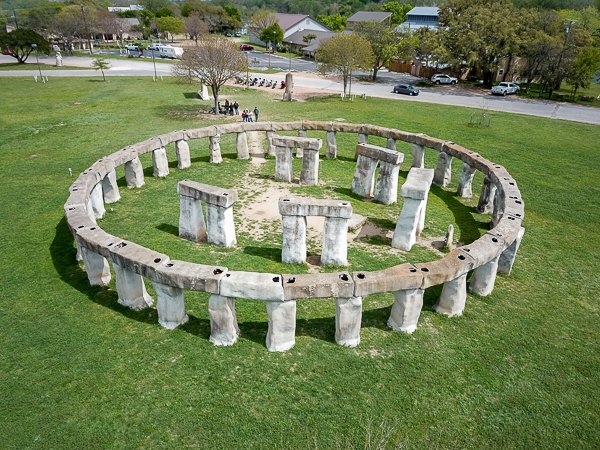
Stonehenge II Stonehenge II is an homage to the original Stonehenge monument and is located in the Texas Hill Country. Stonehenge II was conceived by Al Shepperd and built with the help of his friend and neighbor, Doug Hill. Originally located on FM 1340 west of Hunt, Texas, Stonehenge II now resides on the campus of the Hill Country Arts Foundation in Ingram, Texas. History of Stonehenge II In 1989, Kerr County native Doug Hill finished work on the back patio on his Hunt, Texas property and was left with one extra limestone slab. As a joke, he offered it to his good friend neighbor, Al Sheppard, who then accepted it and stood the slab upright the middle of his pasture. Sheppard and Hill liked the 100 k of the monolith and built an arch around it. The 13 — foot arch reminded them of Stonehenge in England Soon a vision formed and Sheppard contracted Hill to build their very own Stonehenge II. The original Stonehenge in Wiltshire, England was erected around 2500 B. C. and is believed ‘o have functional as an important site for religious or astrological ceremonies. Sheppard and Hill’s project took about 9 months to complete. Hill fabricated the stones from steel, metal lathe, and plaster and anchored each with cement. Stonehenge Il is 9000 as wide and 60% as tall as the original. Later, after visiting Easter Island off the coast of Chile, Sheppard was inspired to add two 13 — foot tall Moai head Statues to the collection. Al Sheppard passed away in 1994 and his property stayed within the family. In 2010, the Sheppard Family donated Stonehenge II and the Moai to the HCAF in memory of Al, a long-time supporter Of the organization. After funds were raised, the structures were moved to their current home on this campus in 2012. Where it is: Stonehenge II is located in Ingram Texas, 64 miles west of San Antonio, South off I-10, Exit 505 to FM 783, Harper Rd., Right on TX-27, to Hwy 39 to Left on Point Theatre Rd. in Lions Park. Interactive Google Map Use the map  + – controls to zoom in and out, click and drag the to move the map, use the Map drop-down to change to “Map”, “Satellite”, “Hybrid”, or “Terrain” views.  Drag the little man icon from the upper left corner to a map location for street level view.   GPS: 30°4’20.07″ N 99°14’55.722″ W Cost: There is no cost to visit Stonehenge II, however donations are accepted.   Hours: Daily from dawn until dusk. Facilities: There are all facilities in Ingram. Location Contact Information: Hill Country Arts Foundation Physical Address: 120 Point Theatre Road, Ingram, Texas 78025 Mailing Address: P.O Box 1169, Ingram, Texas 78025 Phone: (830) 367 5121 email: visualarts@hcaf.com Stonehenge II Photo Gallery Click Here for full page gallery   More Photographic Destinations in Texas: Interactive Google Map Use the map  + – controls to zoom in and out, use the Map drop-down to change to “Map”, “Satellite”, “Hybrid”, or “Terrain” views.  Drag the little man icon from the upper left corner to a map location for street level view. Click on a pushpin for more information about the Photographic Destination, then click on the title to go to the location page. Click Here for Photographic Destinations by State    All the information in this post was believed to be accurate at the time it was published.  Please be sure to double check with the location before relying on this information as everything changes over time, especially hours, prices, and whether the location is still open.   Great Places for Great Photos   Let me help you to find a great location for your next photography adventure.  I will list many lesser-known destinations, as well as the famous "Icon Locations" for photography.  I will provide photos (Lots of Photos), location information, consisting of what there is to photograph as well as other information about the destination.  I will give costs, maps, directions, contact information, and other essential information for a successful photo trip.  I will only post for locations that I have personally photographed to ensure a quality guide to great locations for photography. If you know of great places that are not posted, please send me the details, I may just decide that is a place I need to go!     Greg Disch is a freelance photographer located in Arkansas. Greg specializes in nature, scenic, wildlife, and other outdoor subjects in Arkansas and other areas of the country.  Most of the images on this site are available for sale as prints, personal use, or rights managed stock photos. Greg offers both classroom instruction and in the field hands on photographic workshops. Classroom sessions are normally held in Fort Smith Arkansas, but arrangements can be made to bring a class to your group. All classes and workshops have small class sizes designed to provide an optimum student to instructor ratio, where you can get the personal attention, you need.  Most classes and workshops are limited to a maximum of six participants and will be held with a minimum of only two. If you are looking for a wonderful opportunity to get personal individual instruction, I do private workshops and classes at a location of your choice, whether doing a location photo shoot, coming to your home or business, traveling across the country on a road trip, or at my classroom.  This is a fantastic way to learn digital workflow and be sure that your computer equipment is properly configured for optimum performance. [...]Read more...
San Antonio Missions National Historic Park Description: The Spanish Missions built along the San Antonio River, are now in metro San Antonio and are preserved as a National Historic Park.  There are 4 missions in the park each at a separate location, so to visit them all you have to travel to 4 different places in San Antonio.  The four sites are Mission Conception, Mission San José, Mission San Juan, and Mission Espada.  The 5th San Antonio Mission and the best known, the Alamo, is not a part of the park.  The missions are nearly 250 years old, continue to operate as active parishes of the Catholic church and all are open to the public. Through a cooperative agreement with the Archdiocese of San Antonio, the San Antonio Missions National Historical Park of the National Park Service administers and maintains these missions today. The missions were much more than just churches, the were each self contained communities, with ranching and farming for food production. Cost: There is no entrance fee for the Historic Park. Best Time to Visit: Spring through fall you will have green grass and flowers to add color to your images, the missions make excellent subjects for B&W photos, that can be made at any time.  The park hours are a great restriction on being able to shoot at the prime photography times of sunrise and sunset, but it is possible to photograph some of the missions after hours, others will have locked gates. Where it is: Mission Concepción 807 Mission Road San Antonio, Texas 78210 Mission San Juan 9101 Graf Road San Antonio, Texas 78214 Administrative Headquarters 2202 Roosevelt Avenue San Antonio, Texas 78210 Mission San José 6701 San José Drive San Antonio, Texas 78214 Mission Espada 10040 Espada Road San Antonio, Texas 78214 Directions: From downtown and the Alamo area:•Travel south on South St. Mary’s Street. Approximately one mile south of downtown, after passing beneath railroad tracks, South St. Mary’s becomes Roosevelt Ave. Continue on Roosevelt 4 miles, to a drive-in buy lorazepam online theater on your left, followed by a large stone structure: Mission San José. At the first stop light past the mission turn left onto New Napier Ave. Follow the signs into our parking lot or bus lanes, as appropriate. Map: Click here for National Park Service map Interactive Google Map Use the map  + – controls to zoom in and out, click and drag the to move the map, use the Map drop-down to change to “Map”, “Satellite”, “Hybrid”, or “Terrain” views.  Drag the little man icon from the upper left corner to a map location for street level view. Links: San Antonio Missions National Historic Park Hours of Operation: Open daily from 9:00 a.m. to 5:00 p.m. Closed Thanksgiving Day, December 25, and January 1. Tips for the Photographer Equipment: There is no special equipment needed, you can get great shots with just about any camera and lens combination. What to Photograph: The mission buildings, churches, and grounds.  Pay close attention to the detail and workmanship of the 250 year old structures. Photography Tips: Photographing during the midday outdoors can cause very high contrast and make it difficult to accurately capture the scene.  Photographing on an overcast or cloudy day will help to soften the light.  Using the technique of HDR or High Dynamic Range can also improve your photos.  All of the photos I have posted here used HDR. More Photographic Destinations in Texas: Interactive Google Map Use the map  + – controls to zoom in and out, use the Map drop-down to change to “Map”, “Satellite”, “Hybrid”, or “Terrain” views.  Drag the little man icon from the upper left corner to a map location for street level view. Click on a pushpin for more information about the Photographic Destination, then click on the title to go to the location page. Click Here for Photographic Destinations by State All the information in this post was believed to be accurate at the time it was published.  Please be sure to double check with the location before relying on this information as everything changes over time, especially hours, prices, and whether the location is still open.   Great Places for Great Photos   Let me help you to find a great location for your next photography adventure.  I will list many lesser-known destinations, as well as the famous "Icon Locations" for photography.  I will provide photos (Lots of Photos), location information, consisting of what there is to photograph as well as other information about the destination.  I will give costs, maps, directions, contact information, and other essential information for a successful photo trip.  I will only post for locations that I have personally photographed to ensure a quality guide to great locations for photography. If you know of great places that are not posted, please send me the details, I may just decide that is a place I need to go!     Greg Disch is a freelance photographer located in Arkansas. Greg specializes in nature, scenic, wildlife, and other outdoor subjects in Arkansas and other areas of the country.  Most of the images on this site are available for sale as prints, personal use, or rights managed stock photos. Greg offers both classroom instruction and in the field hands on photographic workshops. Classroom sessions are normally held in Fort Smith Arkansas, but arrangements can be made to bring a class to your group. All classes and workshops have small class sizes designed to provide an optimum student to instructor ratio, where you can get the personal attention, you need.  Most classes and workshops are limited to a maximum of six participants and will be held with a minimum of only two. If you are looking for a wonderful opportunity to get personal individual instruction, I do private workshops and classes at a location of your choice, whether doing a location photo shoot, coming to your home or business, traveling across the country on a road trip, or at my classroom.  This is a fantastic way to learn digital workflow and be sure that your computer equipment is properly configured for optimum performance. [...]Read more...
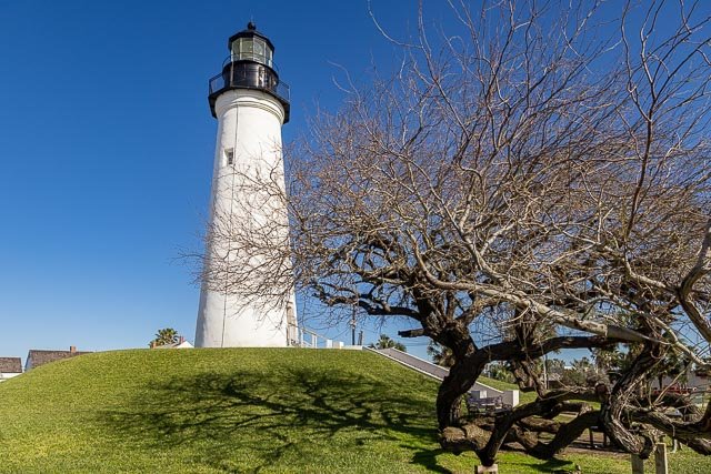
  Port Isabel Lighthouse The Point (Port) Isabel Lighthouse is a historic lighthouse located in Port Isabel, Texas, United States that was built in 1852 to guide ships through the Brazos Santiago Pass to Port Isabel. The lighthouse was added to the National Register of Historic Places on April 30, 1976. On September 28, 1850, the United States Congress authorized an appropriation of $15,000 for “a lighthouse and beacon light” at Brazos Santiago Pass. Work began in February 1852. When complete, the lighthouse was an 82-foot-high brick tower and had four lights. By 1854, it had 15 lamps and 21 reflectors. A third order fresnel lens was installed in 1857 and the fixed light was varied by flashes. The Texas State Park Board began restoring the lighthouse in 1951, and it was opened to the public in 1952. Today the lighthouse is operated as Port Isabel Lighthouse State Historic Site. In September 1996, a new visitors center was completed. Where it is: Take Highway 100 into Port Isabel. The lighthouse is located alongside Highway 100 just before the causeway leading to South Padre Island. Maps: Interactive Google Map Use the map  + – controls to zoom in and out, click and drag the to move the map, use the Map drop-down to change to “Map”, “Satellite”, “Hybrid”, or “Terrain” views.  Drag the little man icon from the upper left corner to a map location for street level view.   GPS: 26°4’39.8676″ N 97°12’26.7249″ W Cost: Ticket prices are $5.00 (adults); $4.00 (seniors 55+); $3.00 (children4 – 12 yrs.) Purchase tickets at the Keeper’s Cottage Visitor Center or at the Lighthouse. (956-943-2262) Children must be 4 years old and 38” tall to tour the lighthouse. A child may not be carried by an adult. Hours: The historic Port Isabel Lighthouse is open to the public, weather permitting. Tuesday – Thursday 10am-6pm and Friday – Monday 9am – 7pm. Last ticket sold 30 minutes before closing. The park at the Lighthouse is open to the public. The Keeper’s Cottage Visitors Center/Chamber of Commerce is open Monday – Friday, 9 a.m. to 5 p.m. Closed Thanksgiving, Christmas & New Year’s Day.   Facilities:  All facilities are available in the town of Port Isabell.   Location Contact Information: 421 East Queen Isabella Blvd Port Isabel, TX 78578 956-943-2262 Email: info@portisabel-texas.com Port Isabel Lighthouse Photo Gallery Click Here for full page gallery   More Photographic Destinations in Texas Interactive Google Map Use the map  + – controls to zoom in and out, use the Map drop-down to change to “Map”, “Satellite”, “Hybrid”, or “Terrain” views.  Drag the little man icon from the upper left corner to a map location for street level view. Click on a pushpin for more information about the Photographic Destination, then click on the title to go to the location page. Click Here for Photographic Destinations by State    All the information in this post was believed to be accurate at the time it was published.  Please be sure to double check with the location before relying on this information as everything changes over time, especially hours, prices, and whether the location is still open.   Great Places for Great Photos   Let me help you to find a great location for your next photography adventure.  I will list many lesser-known destinations, as well as the famous "Icon Locations" for photography.  I will provide photos (Lots of Photos), location information, consisting of what there is to photograph as well as other information about the destination.  I will give costs, maps, directions, contact information, and other essential information for a successful photo trip.  I will only post for locations that I have personally photographed to ensure a quality guide to great locations for photography. If you know of great places that are not posted, please send me the details, I may just decide that is a place I need to go!     Greg Disch is a freelance photographer located in Arkansas. Greg specializes in nature, scenic, wildlife, and other outdoor subjects in Arkansas and other areas of the country.  Most of the images on this site are available for sale as prints, personal use, or rights managed stock photos. Greg offers both classroom instruction and in the field hands on photographic workshops. Classroom sessions are normally held in Fort Smith Arkansas, but arrangements can be made to bring a class to your group. All classes and workshops have small class sizes designed to provide an optimum student to instructor ratio, where you can get the personal attention, you need.  Most classes and workshops are limited to a maximum of six participants and will be held with a minimum of only two. If you are looking for a wonderful opportunity to get personal individual instruction, I do private workshops and classes at a location of your choice, whether doing a location photo shoot, coming to your home or business, traveling across the country on a road trip, or at my classroom.  This is a fantastic way to learn digital workflow and be sure that your computer equipment is properly configured for optimum performance. [...]Read more...
   Padre Island National Seashore North Padre Island is the longest undeveloped barrier island in the world. Meaning father in Spanish, it was named after Father José Nicolás Ballí (c.1770-1829), who owned the island and served as a missionary priest and collector of finances for all the churches in the Rio Grande Valley. He also founded the first mission in present-day Cameron County. Most of the park is primitive, but camping is available, and most of the beach is only accessible to four-wheel-drive vehicles. All but four miles is open to vehicle traffic. The national seashore is 70 miles long with 65.5 miles of Gulf beach. Padre Island National Seashore hosts a variety of pristine beach, dune, and tidal flat environments, including the Laguna Madre on its west coast, a famous spot for windsurfing. A program to re-establish a nesting beach for Kemp’s ridley sea turtles on Padre Island was begun in 1978. In 1992, the first two turtles from the program returned to Padre Island beach to lay their eggs. The number of Kemp’s ridley sea turtle nests on Padre Island has increased ever since. Due to the location of Padre Island National Seashore on the Central Flyway, a major migratory route for birds, about 380 species of birds have been documented within the park, which represents approximately 45% of all bird species documented within North America. The park was designated as a “Globally Important Bird Area” by the American Bird Conservancy in 1998 for providing an “important habitat for globally significant numbers of Brown Pelicans, Redheads, Least Terns, Piping Plovers, Reddish Egrets and Peregrine Falcons. Where it is: The island is located along Texas’s southern coast of the Gulf of Mexico and is noted for its white sandy beaches. The National Seashore is located on North Padre Island, southeast of the city of Corpus Christi, Texas. Visitors to the area should head east through Corpus Christi on Highway 358. After crossing the JFK Causeway onto Padre Island, Highway 358 changes to Park Road 22. Continue about 10 miles south on Park Road 22 to reach the park entrance.  Park Road 22 – actually dead ends into the national park. The park entrance station is a booth that is located literally in the middle of the road. So once you get on Park Road 22, just keep going until you reach the end and the park entrance station. Padre Island National Seashore and South Padre Island are two different places located over 100 miles apart. Sometimes Padre Island National Seashore is confused with South Padre Island, but the two are very different destinations. Maps: Interactive Google Map Use the map  + – controls to zoom in and out, click and drag the to move the map, use the Map drop-down to change to “Map”, “Satellite”, “Hybrid”, or “Terrain” views.  Drag the little man icon from the upper left corner to a map location for street level view.   GPS: 27.490931614693423, -97.2800124687446 Cost: Entrance Fees: Padre Island Vehicle 7 Day Entrance Fee – $25.00 This fee provides entrance into the park for one private, standard passenger vehicle for up to 7 days. It covers all occupants of the vehicle. Padre Island Vehicle 1 Day Entrance Fee – $10.00 This fee provides entrance into the park for one private, standard passenger vehicle for one day (not overnight). It covers all occupants of the vehicle. Padre Island Bicycle/Pedestrian 7 Day Entrance Fee – $15.00 This fee provides entrance into the park for one pedestrian or one bicycle for up to 7 days. Bird Island Basin Use Fee – $5.00 This fee provides for use of the Bird Island Basin area within Padre Island National Seashore for one day. It covers all occupants of one private, standard passenger vehicle. Bird Island Basin provides access to the Laguna Madre and has a boat ramp, windsurfing and kayaking area, and camping area. Please note this fee is in addition to the park entrance fee. Padre Island Motorcycle 7 Day Entrance Fee – $20.00 This fee provides entrance into the park for one motorcycle for up to 7 days. Padre Island Bicycle/Pedestrian 1 Day Entrance Fee – $5.00 This fee provides entrance into the park for one person on foot or on bicycle for 1 day. Padre Island Motorcycle 1 Day Entrance Fee – $7.00 This fee provides entrance into the park for one motorcycle for 1 day. Federal Interagency Passes are accepted for free entry. Hours: The Padre Island National Seashore is open 24 per day 365 days a year. Facilities: Malaquite Pavilion is the primary location for goods and services in the park. The Pavilion includes the Visitor Center, restrooms, cold-water showers, two observation decks, and an auditorium. The restrooms and cold-water showers at the Pavilion are open 24 hours per day, 7 days per week except when being cleaned from 7:00 a.m. – 9:00 a.m. daily. No pets are allowed at Malaquite Pavilion facilities. However, pet-friendly restrooms and rinse-off showers are located at the northern end of the Pavilion parking area. Malaquite Visitor Center has an information desk, educational exhibits, a small bookstore and an ice machine. Visitors can watch orientation videos, get maps and brochures, check out binoculars and beach wheelchairs, and attend ranger programs. First aid is also available here. Please note that firewood and fishing licenses are not sold in the park. The park does not have a gas station and is about 12 miles from the nearest one, so fill up before you visit. The park does not have a post office or sell stamps, and cannot mail items for visitors. Only camping is available in the park. The nearest hotels and motels are about ten miles from the park. All campgrounds are open year-round. No reservations are accepted, as camping is first-come, first-served. Campers, including beach campers, must have a camping permit, which is available from the kiosks at the entrances of each campground. There are no RV hook-ups anywhere in the park, but an RV dump station and a water filling station are available for all campers staying in the park. Location Contact Information: E-mail: Park Information and/or Comments Volunteer Information Sea Turtle Volunteer Information   Mail: Padre Island National Seashore P.O. Box 181300 Corpus Christi, TX 78480-1300   Physical Address: Padre Island National Seashore 20420 Park Road 22 Corpus Christi, TX 78418  Padre Island National Seashore Photo Gallery Click Here for full page gallery   More Photographic Destinations in Texas Interactive Google Map Use the map  + – controls to zoom in and out, use the Map drop-down to change to “Map”, “Satellite”, “Hybrid”, or “Terrain” views.  Drag the little man icon from the upper left corner to a map location for street level view. Click on a pushpin for more information about the Photographic Destination, then click on the title to go to the location page. Click Here for Photographic Destinations by State    All the information in this post was believed to be accurate at the time it was published.  Please be sure to double check with the location before relying on this information as everything changes over time, especially hours, prices, and whether the location is still open.   Great Places for Great Photos   Let me help you to find a great location for your next photography adventure.  I will list many lesser-known destinations, as well as the famous "Icon Locations" for photography.  I will provide photos (Lots of Photos), location information, consisting of what there is to photograph as well as other information about the destination.  I will give costs, maps, directions, contact information, and other essential information for a successful photo trip.  I will only post for locations that I have personally photographed to ensure a quality guide to great locations for photography. If you know of great places that are not posted, please send me the details, I may just decide that is a place I need to go!     Greg Disch is a freelance photographer located in Arkansas. Greg specializes in nature, scenic, wildlife, and other outdoor subjects in Arkansas and other areas of the country.  Most of the images on this site are available for sale as prints, personal use, or rights managed stock photos. Greg offers both classroom instruction and in the field hands on photographic workshops. Classroom sessions are normally held in Fort Smith Arkansas, but arrangements can be made to bring a class to your group. All classes and workshops have small class sizes designed to provide an optimum student to instructor ratio, where you can get the personal attention, you need.  Most classes and workshops are limited to a maximum of six participants and will be held with a minimum of only two. If you are looking for a wonderful opportunity to get personal individual instruction, I do private workshops and classes at a location of your choice, whether doing a location photo shoot, coming to your home or business, traveling across the country on a road trip, or at my classroom.  This is a fantastic way to learn digital workflow and be sure that your computer equipment is properly configured for optimum performance. [...]Read more...
Muleshoe Bend Recreation Area Muleshoe Bend is a popular place for riding horses and bicycles on its trials, but what make it a great photographic destination are the Bluebonnets.  During the wildflower season, lake March and Early April, the area becomes a sea of blue.  A large area of the park was covered by lake Travis, which now has lower water levels and the Bluebonnets thrive there. Forty miles from downtown Austin and 20 miles southeast of Marble Falls, Muleshoe Bend Recreation Area lies on Lake Travis in both Travis and Burnet counties. Lake Travis is located on the Highland Lakes, which are designed to manage floodwaters along the lower Colorado River. These lakes also offer opportunity for boating, fishing, swimming and relaxing. Spicewood has a population of just under 8,000 and has enjoyed the same 10% annual growth rate as Burnet County for many years. This area is part of the Texas Hill Country region, which spreads across the geographic center of the state and features sloping hills, natural springs, bustling cities and charming small towns. Muleshoe Bend Recreation Area has earned a reputation for its impressive fields of bluebonnets during wildflower season and has been featured in both regional and national publications. Muleshoe Bend is owned and Managed by LCRA (Lower Colorado River Authority) and is off of Lake Travis. Where it is: 2820 County Road 414, Spicewood, TX 78669 From Texas 71 turn east (right if you are going north from Austin or Left if you are heading south coming from Marble Falls) on Co. Rd. 413/Greg Dr. which turns into Co. Rd. 404/Haynie Flat Rd. Turn left on Co. Rd. 414, this road will turn right and you will pass Hollingsworth Rd. and Exeter Rd. on the right. Stay on Co. Rd. 414 as it will go directly into Muleshoe Bend. Maps: Interactive Google Map Use the map  + – controls to zoom in and out, click and drag the to move the map, use the Map drop-down to change to “Map”, “Satellite”, “Hybrid”, or “Terrain” views.  Drag the little man icon from the upper left corner to a map location for street level view. Click on map for larger  PDF version Cost: Entrance Adults – $5 Children (12 and younger) – Free Disabled – $2 Seniors (65 and older) – $2 Horse and rider – $12 Free with LCRA Annual Parks Pass Lodging Two park entrance fees are included in your stay. Campsites: Standard – $27.50 Group – $38.50 Hours: Daily (sunrise to sunset) Facilities: 41 campsites Outdoor shower at park entrance Restroom (non-flushing) Restroom (flushing) at park entrance 24-hour ice and drinking water machine Location Contact Information: LCRA (Lower Colorado River Authority) 2820 County Road 414, Spicewood, TX 78669 Reserve your campsite: 855-392-7638 More park info: 512-473-3366 Muleshoe Bend Recreation Area Photo Gallery Click Here for full page galleryhttps://gregdisch.photoshelter.com/gallery/Muleshoe-Bend-Recreation-Area/G0000lLaOcgK_4Lc/C0000T2spPc2duRA   More Photographic Destinations in Texas Interactive Google Map Use the map  + – controls to zoom in and out, use the Map drop-down to change to “Map”, “Satellite”, “Hybrid”, or “Terrain” views.  Drag the little man icon from the upper left corner to a map location for street level view. Click on a pushpin for more information about the Photographic Destination, then click on the title to go to the location page. Click Here for Photographic Destinations by State    All the information in this post was believed to be accurate at the time it was published.  Please be sure to double check with the location before relying on this information as everything changes over time, especially hours, prices, and whether the location is still open.   Great Places for Great Photos   Let me help you to find a great location for your next photography adventure.  I will list many lesser-known destinations, as well as the famous "Icon Locations" for photography.  I will provide photos (Lots of Photos), location information, consisting of what there is to photograph as well as other information about the destination.  I will give costs, maps, directions, contact information, and other essential information for a successful photo trip.  I will only post for locations that I have personally photographed to ensure a quality guide to great locations for photography. If you know of great places that are not posted, please send me the details, I may just decide that is a place I need to go!     Greg Disch is a freelance photographer located in Arkansas. Greg specializes in nature, scenic, wildlife, and other outdoor subjects in Arkansas and other areas of the country.  Most of the images on this site are available for sale as prints, personal use, or rights managed stock photos. Greg offers both classroom instruction and in the field hands on photographic workshops. Classroom sessions are normally held in Fort Smith Arkansas, but arrangements can be made to bring a class to your group. All classes and workshops have small class sizes designed to provide an optimum student to instructor ratio, where you can get the personal attention, you need.  Most classes and workshops are limited to a maximum of six participants and will be held with a minimum of only two. If you are looking for a wonderful opportunity to get personal individual instruction, I do private workshops and classes at a location of your choice, whether doing a location photo shoot, coming to your home or business, traveling across the country on a road trip, or at my classroom.  This is a fantastic way to learn digital workflow and be sure that your computer equipment is properly configured for optimum performance. [...]Read more...
  Mariscal Mine Big Bend National Park The Mariscal Mine once bustled as the center of the Big Bend quicksilver mining economy. From 1900 to 1943, Mariscal Mine produced 1,400 seventy-six pound flasks of mercury – nearly one quarter of the total produced in the United States! Now deserted, the mine and surroundings once provided the people who lived here an income, a community, and a home. Farmer Martin Solis discovered the bright red mercury-bearing ore called cinnabar near his farm in 1900, and set the history of Mariscal Mine in motion. Shortly thereafter, local U.S. Customs agent and Boquillas, TX, store owner Ed Lindsay filed the first mining claim on Mariscal Mountain. The Lindsay Mine produced some ore between 1900 and 1905, but Lindsay encountered numerous difficulties. Transporting the cinnabar ore 30 miles by mule was costly and a lawsuit challenged his ownership of the property. Subsequently, Lindsay sold his interests to Isaac Sanger of Dallas in November 1905. Only four years later, Sanger’s Texas Almaden Mining company closed due to a worldwide economic depression. World War I created demand for mercury because it was required in the manufacture of blasting caps and bomb detonators. Subsequently, W. K. Ellis, a Midwestern inventor, purchased the mine in 1917. He built a four compartmnet ore bin that fed into three stationary retorts, or glazed tubes. The Ellis Mine produced 894 flasks of mercury, but when prices plummeted ast the end of the war, Ellis wisely sold the mine to William “Billy” Burcham. Sturctures from this early phase of cinnabar ore processing are visible at the lowest level of the mine complex. In the summer of 1919, Burcham and several New York financiers formed the Mariscal Mining Company. Naming the company after the mountain it rests upon, Burcham opened the mine and invested in modern equipment and refining methods to increase efficiency and production. The large Scott Furnace and elaborate concrete condenser system that stands above it are the remains of the Mariscal Mining Company. Unfortunately, the system proved to be not so modern or as efficient as hoped. The declining mercury market doomed the mine to failure, and it closed in 1923. At the beginning of World War II, Burcham reopened the Mariscal Mine under the name of the Vivianna Mining Company. He installed a 30-ton Gould rotary furnace. The high prices he anticipated for mercury did not materialize, and the mine closed for the final time in 1943, just a year before the establishment of Big Bend National Park. All items of value were sold at auction. Ironically, some of the mercury-soaked bricks from the Scott Furnace were processed, yielding a considerable quantity of mercury. Life at the Mine Between 1919 and 1923, Mariscal Mine employed 20-40 people. The miners were Mexican citizens who had walked into Texas to escape the Mexican Revolution. Only the manager, foreman, and brick-kiln specialist were American. Newly-arrived miners usually lived in brush shelters at the foot of Mariscal Mountain. As time permitted, they gathered rocks and built houses. Their wives planted and cared for small vegetable gardens near Fresno Creek. Most of the ruins you see today were one to three room houses, built between 1919 and 1923. During 1942-43, the Vivianna Mining Company built ten concrete and stucco homes for the miners. Ironically, they were probably never occupied as the mine never realized its potential. Water for the community was obtained from shallow, hand-dug wells along Fresno Creek, about a mile north of the mine. Mexican freighters also hauled large quantities of water to the mine from Glenn Spring, ten miles north. Working six days per week, experienced miners were paid up to $1.50 per 10-hour shift. Less-skilled laborers earned $1-$1.25. Most of the miners’ earnings returned to the mine owners via the company store, which provided supplies. Each employee also contributed $1 per paycheck to support the resident doctor in return for medical care. Mariscal Mine and its community depended upon the Mexican freighters for all their supplies, including firewood for the Scott Furncace. The freighters hauled extracted mercury from the Mine to the railhead at Marfa for $1 per flask. The work of digging cinnabar ore by pick and shovel from the depths of Mariscal Mine and then heating it to render mercury was both difficult and unhealthy. Many miners succumbed to mercury poisoning from handling the ore. Those who worked around the Scott Furnace often “salivated,” meaning they produced abnormal amounts of saliva. Most veteran furnace men had no teeth and developed chronic respiratory problems from mercury fumes. Where it is: Mariscal Mine is located on the northern end of Mariscal Mountain, deep in the interior of Big Bend National Park. Easiest access to the area is via the River Road east, which begins just five miles west of Rio Grande Village. High clearance or four-wheel drive vehicles are recommended for traveling this dirt road; check with a park ranger for current road conditions before setting out. Allow at least one-half day for this excursion. Maps: Interactive Google Map Use the map  + – controls to zoom in and out, click and drag the to move the map, use the Map drop-down to change to “Map”, “Satellite”, “Hybrid”, or “Terrain” views.  Drag the little man icon from the upper left corner to a map location for street level view. Map of Remaining Structures GPS: 29°5’41.086″ N 103°11’19.476″ W Cost: Entrance Passes All federal lands passes are issued and accepted at Big Bend National Park. Passes are non-transferable. Vehicle: $30 Admits one private, non-commercial vehicle (15 passenger capacity or less); valid for 7 days. Motorcycle: $25 Admits one non-commercial motorcycle; valid for 7 days. Individuals: $15 Admits one individual. Typically used for bicyclists and pedestrians; valid for 7 days. Big Bend Annual Pass: $55 (good for one year from purchase date) Covers entrance fees to Big Bend National Park. Pass is available at Big Bend National Park entrance stations or any Visitor Center. Pass is non-transferable. Hours: Park entrances are always open and you can arrive at any hour, but entrance fee stations and visitor centers may be closed after normal business hours.   Facilities: There are no facilities anywhere near the mine, the closest facilities are at Rio Grande Village. Location Contact Information: By Mail Big Bend National Park P.O. Box 129 Big Bend National Park, TX 79834 By Phone Panther Junction Park Headquarters/Visitor Information 432-477-2251 Weather Information Hotline 432-477-1183 By Fax Panther Junction Park Headquarters/Visitor Information 432-477-1160 or 432-477-1176 Email General Information Requests Information packets, trip planning, etc. Mariscal Mine Big Bend National Park Photo Gallery Click Here for full page gallery   More Photographic Destinations in Texas: Interactive Google Map Use the map  + – controls to zoom in and out, use the Map drop-down to change to “Map”, “Satellite”, “Hybrid”, or “Terrain” views.  Drag the little man icon from the upper left corner to a map location for street level view. Click on a pushpin for more information about the Photographic Destination, then click on the title to go to the location page. Click Here for Photographic Destinations by State    All the information in this post was believed to be accurate at the time it was published.  Please be sure to double check with the location before relying on this information as everything changes over time, especially hours, prices, and whether the location is still open.   Great Places for Great Photos   Let me help you to find a great location for your next photography adventure.  I will list many lesser-known destinations, as well as the famous "Icon Locations" for photography.  I will provide photos (Lots of Photos), location information, consisting of what there is to photograph as well as other information about the destination.  I will give costs, maps, directions, contact information, and other essential information for a successful photo trip.  I will only post for locations that I have personally photographed to ensure a quality guide to great locations for photography. If you know of great places that are not posted, please send me the details, I may just decide that is a place I need to go!     Greg Disch is a freelance photographer located in Arkansas. Greg specializes in nature, scenic, wildlife, and other outdoor subjects in Arkansas and other areas of the country.  Most of the images on this site are available for sale as prints, personal use, or rights managed stock photos. Greg offers both classroom instruction and in the field hands on photographic workshops. Classroom sessions are normally held in Fort Smith Arkansas, but arrangements can be made to bring a class to your group. All classes and workshops have small class sizes designed to provide an optimum student to instructor ratio, where you can get the personal attention, you need.  Most classes and workshops are limited to a maximum of six participants and will be held with a minimum of only two. If you are looking for a wonderful opportunity to get personal individual instruction, I do private workshops and classes at a location of your choice, whether doing a location photo shoot, coming to your home or business, traveling across the country on a road trip, or at my classroom.  This is a fantastic way to learn digital workflow and be sure that your computer equipment is properly configured for optimum performance. [...]Read more...
Judge Roy Bean Visitor Center Folklore legend Judge Roy Bean arrived in Texas during the Civil War, showing up in San Antonio after troubles booted him out of Chihuahua, Mexico, then California (both San Diego and San Gabriel), and finally Mesilla, New Mexico. Bean spent a number of years on South Flores Street in the Alamo City, earning the location the nickname “Beanville”, and avoiding both creditors and the law, and all the while annoying his business competitors. An escape across the Pecos River landed him at the heart of the railroad construction boom where tracks from the east were moving at a furious pace (courtesy of Chinese labor) to meet tracks arriving from the west. Ever the opportunist, Bean established his Jersey Lilly saloon, helping to stir an already roiling pot of lawlessness, before capturing the position of justice of the peace, permanently securing his place in Texas folklore. Today, the Jersey Lilly and the opera house Bean built in honor of his long-distance, unrequited (and one-sided) romance with English singer Lillian Langtry, combine to create the Judge Roy Bean Visitor Center, a Texas Department of Transportation rest stop for heritage and curious travels tackling the long stretch of Highway 90 between Del Rio and Sanderson.   Judge Roy Bean lived a life in which fiction became so intermingled with fact that he became a legend within his lifetime. Basis for his renown were the decisions which he reached in this building as the Law West of the Pecos. Court was held as frequently on the porch, spectators grouped about on horseback, as within the building. Nor was Bean above breaking off proceedings long enough to serve customers seeking services dispensed by the other businesses carried on in his courtroom-home. The Judge’s “law library” consisted of a single volume, an 1879 copy of the Revised Statutes of Texas. He seldom consulted it, however, calling instead on his own ideas about the brand of justice which should apply. This he effectively dispensed together with liberal quantities of bluff and bluster. Since Langtry had no jail, all offenses were deemed finable with Beam pocketing the fines. Drunken prisoners often were chained to mesquite trees in front of the building until they sobered up enough to stand trial. Bean reached a peak of notoreity when, on February 21, 1896, he staged the banned Fitzsimmons-Maher heavyweight title fight on a sand bar in the Rio Grande River, a stone’s throw from his front porch. By holding it on Mexican territory he outwitted Texas Rangers sent to stop the match — and turned a handsome profit for his shrewdness. This building was named the “Jersey Lilly” for the famous English actress Lillie Langtry whom Bean admired and for whom he claimed to have named the town. His lamp frequently burned into the night as he composed letters to her. But he never saw her since her only visit to Langtry occurred in 1904, less than a year after Bean died. What to Photograph Judge Roy Bean historical buildings and photo opportunities in Judge Roy Bean Opera House and Saloon available as well as a beautifully maintained desert garden and historic windmill. The historic Langtry church is right next door. Where it is: US 90 – Westbound at State Loop 25 (US 90 W. State Loop 25 at Torres Ave. Langtry, TX 78871)   Maps: Interactive Google Map Use the map  + – controls to zoom in and out, click and drag the to move the map, use the Map drop-down to change to “Map”, “Satellite”, “Hybrid”, or “Terrain” views.  Drag the little man icon from the upper left corner to a map location for street level view.   GPS: Latitude = 29.8139 Longitude = -101.5693 Cost: The visitor center and museum are free as well as the travel information provided. Hours: Hours of Operation: 8:00 a.m. – 5:00 p.m. CT seven days a week – 8:00 a.m. – 6:00 p.m. Memorial Day weekend through Labor Day Closed only on Easter Sunday, Thanksgiving Day, the day before Christmas, Christmas Day, and New Year’s Day Facilities: Air-conditioned lobby and restrooms Professional Travel Counselor Diaper Changing stations Video Theatre Drinking Water Walking Trail Handicap Access Weather Information Interpretive Displays Wireless Internet Access The center provides free maps and travel literature. The restrooms are only open during operating hours. Wireless Internet access is available. Certified professional counselors provide professional assistance with routings, current information on points of interest, events and road conditions in the state. Also provided are free maps and a variety of free statewide and local travel literature Location Contact Information: Hwy 90 West Loop 25 Langtry, Texas 78871 Phone: 432-291-3340 Judge Roy Bean Visitor Center Photo Gallery Click Here for full page gallery   More Photographic Destinations in Texas: Interactive Google Map Use the map  + – controls to zoom in and out, use the Map drop-down to change to “Map”, “Satellite”, “Hybrid”, or “Terrain” views.  Drag the little man icon from the upper left corner to a map location for street level view. Click on a pushpin for more information about the Photographic Destination, then click on the title to go to the location page. Click Here for Photographic Destinations by State    All the information in this post was believed to be accurate at the time it was published.  Please be sure to double check with the location before relying on this information as everything changes over time, especially hours, prices, and whether the location is still open.   Great Places for Great Photos   Let me help you to find a great location for your next photography adventure.  I will list many lesser-known destinations, as well as the famous "Icon Locations" for photography.  I will provide photos (Lots of Photos), location information, consisting of what there is to photograph as well as other information about the destination.  I will give costs, maps, directions, contact information, and other essential information for a successful photo trip.  I will only post for locations that I have personally photographed to ensure a quality guide to great locations for photography. If you know of great places that are not posted, please send me the details, I may just decide that is a place I need to go!     Greg Disch is a freelance photographer located in Arkansas. Greg specializes in nature, scenic, wildlife, and other outdoor subjects in Arkansas and other areas of the country.  Most of the images on this site are available for sale as prints, personal use, or rights managed stock photos. Greg offers both classroom instruction and in the field hands on photographic workshops. Classroom sessions are normally held in Fort Smith Arkansas, but arrangements can be made to bring a class to your group. All classes and workshops have small class sizes designed to provide an optimum student to instructor ratio, where you can get the personal attention, you need.  Most classes and workshops are limited to a maximum of six participants and will be held with a minimum of only two. If you are looking for a wonderful opportunity to get personal individual instruction, I do private workshops and classes at a location of your choice, whether doing a location photo shoot, coming to your home or business, traveling across the country on a road trip, or at my classroom.  This is a fantastic way to learn digital workflow and be sure that your computer equipment is properly configured for optimum performance. [...]Read more...
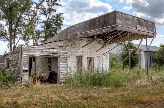
Glenrio Ghost Town During the 1940s and 1950s, Glenrio sat very much alone in the open scrub desert of the high plains straddling the Texas-New Mexico border. Amarillo was 73 miles to the east and Tucumcari 41 miles west. Travelers driving Route 66 across the desert could see a world of stars at night, with Glenrio providing some of the only light pollution around with its diners, bars, western-themed motels, a dance hall, and gas stations. Glenrio was a flash of neon in the desert, an overnight Mecca, and a spot of evening cool in the days before cars had air conditioning. Straddling the State line, Glenrio began as Rock Island Railroad stop. Although part of the town was located in Texas and the other part in New Mexico, the Federal Government considered Glenrio to be a Texas town during those days. Mail would be dropped off on the Texas side of the border and then the station master would carry the mailbag to the post office on the New Mexico side for delivery. Glenrio was not a railroad town for long. In 1913, the Ozark Trails Association organized and began marking and promoting hundreds of miles of highways connecting several States, including New Mexico and Texas. Ozark Trails pioneered the transition from horse-drawn buggies and wagons to automobiles along America’s roads. By 1917, the Glenrio Hotel began receiving guests traveling by automobile along the Ozark Trail. At that point, trail was a good description of the Ozark. The crooked, dirt track was dusty in the sun and muddy in the rain. It had square turns as it followed section lines. Yet motorists came. By 1919, green and white Ozark Trail markers stood along the route through Glenrio. The Ozark Trail was incorporated into the United States highway system as part of Route 66 in 1926. By that year, Glenrio had essentially turned its back on the railroad in favor of the highway. Businesses near the railroad either closed or moved to be closer to the highway. Several gas stations, a restaurant, and at least one motel were built on the northern right of way of Route 66 by the early 1930s. On the south side of the highway, a welcome station on the Texas side offered assistance–including water to cool overheated radiators–to motorists along the road. Local lore has it that the welcome station served as a film location for the 1940 movie, The Grapes of Wrath. This cannot be confirmed, but if location scouts didn’t choose Glenrio as a set, one has to wonder why. Even today, it’s not hard to imagine heavily loaded cars full of families leaving the Dust Bowl behind to seek a better life in California, their hopes pinned to Route 66. During the 1930s, Route 66 was transformed into a continuous two-lane paved highway across Texas. Several gas stations, a new restaurant, and a motel clustered along the north side of the road. A few buildings from Glenrio’s rail-town past were moved close to the new highway, but most were demolished or fell into ruin. There were no bars on the Texas side of the community, since Deaf Smith County was dry, and no service stations on the New Mexico side because of that state’s higher gasoline tax. During the 1940s, 50s, and 60s, travelers packed the highway and Glenrio thrived. Former resident John Paul Ferguson worked summers at Glenrio gas stations. He recalls constant traffic during the daytime, with cars lined up five or six in a row waiting to get gas. A new cluster of businesses were built during the 1950s. Two of them, a Texaco Gas Station and a nearby diner, are of particular interest today. Both were designed with Art Moderne influence. Look for the curved vertical panels on top of the drive-thru bay of the station and for curved concrete corner walls and a curved metal canopy on the diner. Both of these buildings are well preserved. Glenrio’s boom times ended in 1975 when Interstate 40 bypassed the town. It was listed in the National Register of Historic Places in 2007. Today, the Glenrio Historic District includes the old Route 66 roadbed and 17 abandoned buildings. Most of the buildings are utilitarian with concrete foundations, stucco walls, and flat roofs, but several of the buildings are distinctive. You can still identify the Little Juarez Diner, the State Line Bar, and the State Line Motel whose sign reads “Motel, Last in Texas” to travelers arriving from the east, and “Motel, First in Texas” to traffic motoring into town from the west. Only two Glenrio buildings are occupied–the Joseph Brownlee House and an office in the Texas Longhorn Motel. Other buildings have overgrown sites, missing windows, or debris surrounding them, the detritus of four decades when Glenrio welcomed tens of thousands, fed and entertained them, and sent the on their way toward Chicago or California. It’s well worth the detour to get off Interstate 40 and cruise Route 66 through Glenrio. Crossing the State border in one of the country’s best preserved mid-century ghost towns evokes some of the adventure motorists from decades ago felt when the traveled long stretches of two-lane blacktop through the American West. Portions of The Grapes of Wrath (1940) were filmed in Glenrio. An abandoned “Glenn Rio Motel” is depicted in the town of Radiator Springs in 2006’s animated film Cars, where the architectural design of Glenrio’s Little Juarez Café is used for a vacant, abandoned building, which eventually becomes the Racing Museum. The opening scene from the movie Daylight’s End (2018) was filmed in Glenrio. Where it is: Glenrio sits just a few yards to the south of Interstate 40 at Texas exit 0 on Business I-40, a road which turns into a local gravel road at the state line. This was the original Route 66 alignment between Glenrio and San Jon until 1952, and was paved for many years until Quay County removed the paving due to maintenance costs. Maps: Interactive Google Map Use the map  + – controls to zoom in and out, click and drag the to move the map, use the Map drop-down to change to “Map”, “Satellite”, “Hybrid”, or “Terrain” views.  Drag the little man icon from the upper left corner to a map location for street level view.   GPS: 35°10’43.266″ N 103°2’36.876″ W Cost: There is no cost to visit Glenrio. Hours: There are no hours, the location is accessable 24 hour per day. Facilities: There are no facilities in Glenrio, there is a visitor center and rest area on the New Mexico westbound lane of Interstate 40. Glenrio Ghost Town Photo Gallery Click Here for full page gallery   More Photographic Destinations in Texas: Interactive Google Map Use the map  + – controls to zoom in and out, use the Map drop-down to change to “Map”, “Satellite”, “Hybrid”, or “Terrain” views.  Drag the little man icon from the upper left corner to a map location for street level view. Click on a pushpin for more information about the Photographic Destination, then click on the title to go to the location page. Click Here for Photographic Destinations by State    All the information in this post was believed to be accurate at the time it was published.  Please be sure to double check with the location before relying on this information as everything changes over time, especially hours, prices, and whether the location is still open.   Great Places for Great Photos   Let me help you to find a great location for your next photography adventure.  I will list many lesser-known destinations, as well as the famous "Icon Locations" for photography.  I will provide photos (Lots of Photos), location information, consisting of what there is to photograph as well as other information about the destination.  I will give costs, maps, directions, contact information, and other essential information for a successful photo trip.  I will only post for locations that I have personally photographed to ensure a quality guide to great locations for photography. If you know of great places that are not posted, please send me the details, I may just decide that is a place I need to go!     Greg Disch is a freelance photographer located in Arkansas. Greg specializes in nature, scenic, wildlife, and other outdoor subjects in Arkansas and other areas of the country.  Most of the images on this site are available for sale as prints, personal use, or rights managed stock photos. Greg offers both classroom instruction and in the field hands on photographic workshops. Classroom sessions are normally held in Fort Smith Arkansas, but arrangements can be made to bring a class to your group. All classes and workshops have small class sizes designed to provide an optimum student to instructor ratio, where you can get the personal attention, you need.  Most classes and workshops are limited to a maximum of six participants and will be held with a minimum of only two. If you are looking for a wonderful opportunity to get personal individual instruction, I do private workshops and classes at a location of your choice, whether doing a location photo shoot, coming to your home or business, traveling across the country on a road trip, or at my classroom.  This is a fantastic way to learn digital workflow and be sure that your computer equipment is properly configured for optimum performance. [...]Read more...
Fort Worth Stockyards The Fort Worth Stockyards now celebrates Fort Worth’s long tradition as a part of the cattle industry and was listed on the National Register as a historical district in 1976. The listing included 46 contributing buildings and one other contributing structure. The Stockyards consist of mainly entertainment and shopping venues that capitalize on the “Cowtown” image of Fort Worth. Home to the famous boot making company M.L. Leddy’s which is located in the heart of the Stockyards and The Maverick Fine Western Wear and Saloon where customers “can ‘belly up’ to the bar, relax and have a cold beer while in the Stockyards; just like they did in the days of the big cattle drives”, as they shop around the store. The city of Fort Worth is often referred to as “Where the West Begins.” Many bars and nightclubs (including Billy Bob’s Texas) are located in the vicinity, and the area has a Western motif. There is also an opry and a rodeo. The Fort Worth Stockyards are the last standing stockyards in the United States. Some volunteers still run the cattle drives through the stockyards, a practice developed in the late 19th century by the frontiersman Charles “Buffalo” Jones, who herded buffalo calves through the streets of Garden City, Kansas. On April 1, 2011, the Fort Worth Stockyards Stables were remodeled and reopened. They are located next door to the Hyatt hotel in an original Historic Stockyards building that was built in 1912. These stables offer full care boarding, overnight boarding, hourly boarding, horse rentals on the open trails of the Trinity River and carriage rides. Boarders can ride their horses all around the Historic Stockyards. History Fort Worth Union Stockyards opened for business on January 19, 1890, covering 206 acres. On February 7, the Fort Worth Dressed Meat and Packing Company was founded. This facility was operated without profit until purchased by G. W. Simpson of Boston. In an effort to produce revenue, they reached out to the Swift and Armour companies to establish packing houses. By 1886, four stockyards had been built near the railroads. Boston capitalist Greenleif W. Simpson, with a half dozen Boston and Chicago associates, incorporated the Fort Worth Stock Yards Company on March 23, 1893, and purchased the Union Stock Yards and the Fort Worth Packing Company. The Stockyards experienced early success. By 1907, the Stockyards sold a million cattle per year. The stockyards was an organized place where cattle, sheep, and hogs could be bought, sold and slaughtered. Fort Worth remained an important part of the cattle industry until the 1950s. Business suffered due to livestock auctions held closer to where the livestock were originally produced. What to Photograph: The Cattle Drive The Fort Worth Herd is the world’s only twice daily cattle drive, held every day at 11:30 AM & 4:00 PM in the Fort Worth Stockyards. Drives are not held on Easter Sunday, Thanksgiving Day or Christmas Day. The Fort Worth Herd Trail Boss determines drive cancelations due to inclement weather and necessary onsite changes. The Fort Worth Herd steers can be viewed before and after cattle drives in their pens behind the Livestock Exchange Building on East Exchange Avenue. The Cowtown cattle pens, the Cowtown Coliseum, and the many historic buildings. Getting There: Driving Directions From DFW Airport Head south on International Parkway/TX-97 Spur Keep right to merge onto TX-183 W Veer left to exit onto Hwy 121 S Keep left to continue onto Interstate 820/Texas 121/Texas 183 Merge onto I-820 W Exit 17 toward N Riverside Drive Keep left at fork; merge onto I-35W south Exit 54A for 183/NE 28th St. Turn left onto Main St. Turn left onto E Exchange Ave. From Dallas Love Field Airport Turn right onto W Mockingbird Ln. Turn right onto John W. Carpenter Freeway Take the left ramp onto TX-183 W Keep left at the fork; follow signs for Fort Worth / DFW South Entry Use left two lanes to exit onto Hwy 121 S Keep left onto I-820/Texas 121/Texas 183 Exit 17 toward N Riverside Drive Keep left at fork; merge onto I-35W south Exit 54A onto 183/NE 28th St. Turn left onto Main St. Turn left onto E Exchange Ave. From Dallas Head west on I-30 Exit 15C onto US-287 N toward Denton/Downtown/I-35W N Keep left onto TX-280 Spur Continue onto 6th St. Turn right onto Commerce St. Commerce winds around and becomes Main St.; continue north on Main St. Turn right on E. Exchange Ave.   Cost: There are no fees for this area but parking will run $5 to $7 dollars for the day. Facilities This is a tourist attraction in downtown Fort Worth Texas, and as such has many restaurants, bars, and shopping facilities. Maps: Interactive Google Map Use the map  + – controls to zoom in and out, click and drag the to move the map, use the Map drop-down to change to “Map”, “Satellite”, “Hybrid”, or “Terrain” views.  Drag the little man icon from the upper left corner to a map location for street level view. Location Contact Information: Stockyards Visitor Center Monday through Friday, 8:30 a.m. to 6 p.m. Saturday, 9 a.m. to 6 p.m. Sunday, 11 a.m. to 5 p.m. 130 E. Exchange Ave. Fort Worth TX 76164 817-624-4741 Fort Worth Stockyards Photo Gallery Click Here for full page gallery More Photographic Destinations in Texas: Interactive Google Map Use the map  + – controls to zoom in and out, use the Map drop-down to change to “Map”, “Satellite”, “Hybrid”, or “Terrain” views.  Drag the little man icon from the upper left corner to a map location for street level view. Click on a pushpin for more information about the Photographic Destination, then click on the title to go to the location page. Click Here for Photographic Destinations by State   All the information in this post was believed to be accurate at the time it was published.  Please be sure to double check with the location before relying on this information as everything changes over time, especially hours, prices, and whether the location is still open.   Great Places for Great Photos   Let me help you to find a great location for your next photography adventure.  I will list many lesser-known destinations, as well as the famous "Icon Locations" for photography.  I will provide photos (Lots of Photos), location information, consisting of what there is to photograph as well as other information about the destination.  I will give costs, maps, directions, contact information, and other essential information for a successful photo trip.  I will only post for locations that I have personally photographed to ensure a quality guide to great locations for photography. If you know of great places that are not posted, please send me the details, I may just decide that is a place I need to go!     Greg Disch is a freelance photographer located in Arkansas. Greg specializes in nature, scenic, wildlife, and other outdoor subjects in Arkansas and other areas of the country.  Most of the images on this site are available for sale as prints, personal use, or rights managed stock photos. Greg offers both classroom instruction and in the field hands on photographic workshops. Classroom sessions are normally held in Fort Smith Arkansas, but arrangements can be made to bring a class to your group. All classes and workshops have small class sizes designed to provide an optimum student to instructor ratio, where you can get the personal attention, you need.  Most classes and workshops are limited to a maximum of six participants and will be held with a minimum of only two. If you are looking for a wonderful opportunity to get personal individual instruction, I do private workshops and classes at a location of your choice, whether doing a location photo shoot, coming to your home or business, traveling across the country on a road trip, or at my classroom.  This is a fantastic way to learn digital workflow and be sure that your computer equipment is properly configured for optimum performance. [...]Read more...
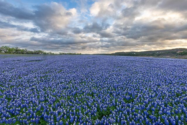
Fort Leaton State Historic Site Fort Leaton is believed to have been built as an adobe residence in the 1830s by Juan Bustillos. In 1848, it was acquired by Benjamin Leaton, who lived in the structure and also used it as his trading post and fortress. Benjamin Leaton was a trader, freight hauler along the Chihuahua Trail, and a bounty hunter paid by various local governments in Mexico for each scalp taken from an indigenous person. He also traded munitions to the Apache and Comanche for any stolen cattle they brought him. When Presidio County was established in 1850, Fort Leaton was its first seat of government. Leaton died in 1851, and his widow married Edward Hall who continued operating the freight business from the fort. Hall became financially indebted to Leaton’s scalp hunting partner John Burgess. Hall defaulted on his debt to Burgess in 1864, and was murdered. Burgess took over the fort, and was in turn murdered by Leaton’s son in 1875. The Burgess family remained in the fort until they abandoned it in 1926. The fort was purchased by Marfa State Bank and a private citizen in the 1930s and donated to Presidio County. An attempt at restoration was begun, but adequate financing never materialized. The site was then purchased by a private citizen and donated to the state of Texas. In 1968, the site was designated Fort Leaton State Historic Site. It opened to the public in 1978. Because of its desolate location and the constant threat of Indian attack, Fort Leaton offered much-needed frontier defense. The private bastion was the only fortification on the American side of the Rio Grande between Eagle Pass and El Paso before and during the building of Fort Davis (Jeff Davis County), and the United States Army made Fort Leaton its unofficial headquarters. Even after the completion of Fort Davis, eighty miles to the north, the army used the private fort as an outpost for military patrols. Military maps of the 1850s listed Fort Leaton along with official army posts. Fort Leaton was added to the National Register of Historic Places listings in Presidio County, Texas on June 18, 1973. The park is day use only and offers picnicking areas, guided tours, plus exhibits on the history from 15th century, natural history, and archaeological history of the area. The site serves for historical study activities. What to Photograph The restored Fort Leaton with many of the furnishings of the time.  Situated in the Chihuahuan Desert, plants range from arid-adapted cacti to water-loving cottonwoods. Where it is: The park is located four miles southeast of Presidio on the River Road to the Big Bend (FM 170), one of the most scenic highway routes in the southeast. Maps: Interactive Google Map Use the map  + – controls to zoom in and out, click and drag the to move the map, use the Map drop-down to change to “Map”, “Satellite”, “Hybrid”, or “Terrain” views.  Drag the little man icon from the upper left corner to a map location for street level view. GPS: Latitude: 29.542511 Longitude: -104.326348 Links: Interpretive Guide to Fort Leaton State Historic Site (PDF) Fort Leaton State Historic Site Self-Guided Walking Tour (PDF) Cost: Entrance Fees 13 years and older: $5 Daily Child 12 Years and Under : Free Hours: Hours 8 a.m. to 4:30 p.m. Busy Season September through April Facilities: There is a picnic area and public restrooms. The Texas State Park Store gift shop is located on the grounds. The Barton Warnock Environmental Education Center serves as the visitor center for both Ft. Leaton State Historic Site and Big Bend Ranch State Park. Wireless Internet Access (Wi-Fi) is available in some areas of this site. Location Contact Information: Location: FM 170 E. Presidio, TX 79845 Mailing: P.O. Box 2349 Presidio, TX 79845 (432) 229-3613 Fort Leaton Photo Gallery Click Here for full page gallery   More Photographic Destinations in Texas: Interactive Google Map Use the map  + – controls to zoom in and out, use the Map drop-down to change to “Map”, “Satellite”, “Hybrid”, or “Terrain” views.  Drag the little man icon from the upper left corner to a map location for street level view. Click on a pushpin for more information about the Photographic Destination, then click on the title to go to the location page. Click Here for Photographic Destinations by State    All the information in this post was believed to be accurate at the time it was published.  Please be sure to double check with the location before relying on this information as everything changes over time, especially hours, prices, and whether the location is still open.   Great Places for Great Photos   Let me help you to find a great location for your next photography adventure.  I will list many lesser-known destinations, as well as the famous "Icon Locations" for photography.  I will provide photos (Lots of Photos), location information, consisting of what there is to photograph as well as other information about the destination.  I will give costs, maps, directions, contact information, and other essential information for a successful photo trip.  I will only post for locations that I have personally photographed to ensure a quality guide to great locations for photography. If you know of great places that are not posted, please send me the details, I may just decide that is a place I need to go!     Greg Disch is a freelance photographer located in Arkansas. Greg specializes in nature, scenic, wildlife, and other outdoor subjects in Arkansas and other areas of the country.  Most of the images on this site are available for sale as prints, personal use, or rights managed stock photos. Greg offers both classroom instruction and in the field hands on photographic workshops. Classroom sessions are normally held in Fort Smith Arkansas, but arrangements can be made to bring a class to your group. All classes and workshops have small class sizes designed to provide an optimum student to instructor ratio, where you can get the personal attention, you need.  Most classes and workshops are limited to a maximum of six participants and will be held with a minimum of only two. If you are looking for a wonderful opportunity to get personal individual instruction, I do private workshops and classes at a location of your choice, whether doing a location photo shoot, coming to your home or business, traveling across the country on a road trip, or at my classroom.  This is a fantastic way to learn digital workflow and be sure that your computer equipment is properly configured for optimum performance. [...]Read more...
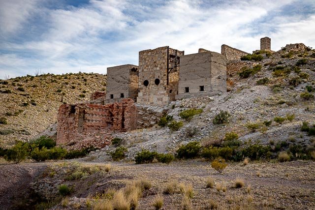
Fort Davis National Historic Site Established in October 1854 along the Limpia Creek at Painted Comanche Camp by Bvt. Maj. Gen. Persifor Frazer Smith, Fort Davis was named after Secretary of War Jefferson Davis. “Hoping to protect the garrison from winter northers, Smith tucked the fort into a canyon flanked on three sides by sheer rock walls.” Commanding the post was 8th Infantry Regiment commander Lt. Col. Washington Seawell. Other forts in the frontier fort system were Forts Griffin, Concho, Belknap, Chadbourne, Stockton, Richardson, Bliss, McKavett, Clark, McIntosh, Inge, and Phantom Hill in Texas, and Fort Sill in Oklahoma. “Sub posts or intermediate stations” also were used, including Bothwick’s Station on Salt Creek between Fort Richardson and Fort Belknap, Camp Wichita near Buffalo Springs between Fort Richardson and Red River Station, and Mountain Pass between Fort Concho and Fort Griffin. From 1854 to 1891, Fort Davis was strategically located to protect emigrants, mail coaches, and freight wagons on the trans-Pecos portion of the San Antonio-El Paso Road and the Chihuahua Trail, and to control activities on the southern stem of the Great Comanche War Trail and Mescalero Apache war trails. The fort was evacuated in April 1861 under orders from General David E. Twiggs at the start of the Civil War. During John R. Baylor’s invasion of New Mexico, only 20 Confederate States Army troops manned the fort. On the night of 4 August 1861, Mescalero Apaches raided a nearby cattle pen, and during the pursuit on 11 August, Lt. Reuben E. Mays and all but one of his 13-man patrol were killed in an ambush. This defeat convinced Baylor to staff the fort with three officers and 70 enlisted men. The Confederates evacuated the fort and all other posts west of Fort Clark in August 1862. Fort Davis is important in understanding the presence of African Americans in the West and in the frontier military because the 24th and 25th U.S. Infantry regiments and the 9th and 10th U.S. Cavalry regiments, all-black regiments (known as the buffalo soldiers), which were established after the Civil War, were stationed at the post. Lt. Col. Wesley Merritt led Troops C, F, H, and I of the 9th Cavalry in reoccupying the fort on 29 June 1867. They rebuilt the fort, using limestone and adobe, outside the canyon walls. What to Photograph Today, 24 restored historic buildings and over 100 ruins and foundations are part of Fort Davis National Historic Site. Five of the historic buildings have been refurbished to the 1880s, making it easy for visitors to envision themselves being at the fort at the height of its development. Where it is: From El Paso: Take I-10 east to Van Horn. At Van Horn take Highway 90 east. Just south of Valentine take Highway 505 and then 166 east. Turn left on Highway 17 and follow it to Fort Davis or continue south on Highway 90 to Marfa and then turn left on Highway 17 to Fort Davis. Alternate Route: From Van Horn take I-10 east to Kent and then turn south on 118 to Fort Davis. (About 4 hours) map From Midland/Odessa: Take I-20 west to Pecos. From Pecos take Highway 17 south through Balmorhea to Fort Davis. (About 2.5 hours) map From San Antonio: Take I-10 west to Balmorhea. Then take Highway 17 south to Fort Davis. (About 7 hours) map From Del Rio: Take Highway 90 west to Alpine. From Alpine take Highway 118 north to Fort Davis. (About 3.5 hours) map Maps: Interactive Google Map Use the map  + – controls to zoom in and out, click and drag the to move the map, use the Map drop-down to change to “Map”, “Satellite”, “Hybrid”, or “Terrain” views.  Drag the little man icon from the upper left corner to a map location for street level view. GPS: 30°35’56.094″ N 103°53’11.297″ W Cost: Entrance Fees Park Entrance fee is $10.00 per person for visitors 16 years and older. Children 15 and under are free. Group Visit Fees There are 3 options: $10.00 per person – 7 Days $20.00 per vehicle – 7 Days $15.00 per motorcycle – 7 Days Specific passes for free entrance to the park are honored and are also available at the Visitor Center. These include Senior (Golden Age), Access (Golden Access), Interagency Annual, Interagency Military and Fourth Grade passes. Hours: Open:8:00 a.m. to 5:00 p.m. Central Time Holiday Closures:Thanksgiving Day, Christmas Day, New Year’s Day, and Martin Luther King Jr. Holiday. Facilities: The park has no food or lodging. Please visit the Fort Davis Chamber of Commerce for area info. There are restrooms and a visitor center with a bookstore on site.  The site is located within the city of Fort Davis. Location Contact Information: Mailing Address: Fort Davis National Historic Site P.O. Box 1379 Fort Davis, Texas 79734 Phone Visitor Information (432) 426-3224 ext. 220 Fax (432) 426-3122   Fort Davis National Historic Site Photo Gallery Click Here for full page gallery   More Photographic Destinations in Texas: Interactive Google Map Use the map  + – controls to zoom in and out, use the Map drop-down to change to “Map”, “Satellite”, “Hybrid”, or “Terrain” views.  Drag the little man icon from the upper left corner to a map location for street level view. Click on a pushpin for more information about the Photographic Destination, then click on the title to go to the location page. Click Here for Photographic Destinations by State    All the information in this post was believed to be accurate at the time it was published.  Please be sure to double check with the location before relying on this information as everything changes over time, especially hours, prices, and whether the location is still open.   Great Places for Great Photos   Let me help you to find a great location for your next photography adventure.  I will list many lesser-known destinations, as well as the famous "Icon Locations" for photography.  I will provide photos (Lots of Photos), location information, consisting of what there is to photograph as well as other information about the destination.  I will give costs, maps, directions, contact information, and other essential information for a successful photo trip.  I will only post for locations that I have personally photographed to ensure a quality guide to great locations for photography. If you know of great places that are not posted, please send me the details, I may just decide that is a place I need to go!     Greg Disch is a freelance photographer located in Arkansas. Greg specializes in nature, scenic, wildlife, and other outdoor subjects in Arkansas and other areas of the country.  Most of the images on this site are available for sale as prints, personal use, or rights managed stock photos. Greg offers both classroom instruction and in the field hands on photographic workshops. Classroom sessions are normally held in Fort Smith Arkansas, but arrangements can be made to bring a class to your group. All classes and workshops have small class sizes designed to provide an optimum student to instructor ratio, where you can get the personal attention, you need.  Most classes and workshops are limited to a maximum of six participants and will be held with a minimum of only two. If you are looking for a wonderful opportunity to get personal individual instruction, I do private workshops and classes at a location of your choice, whether doing a location photo shoot, coming to your home or business, traveling across the country on a road trip, or at my classroom.  This is a fantastic way to learn digital workflow and be sure that your computer equipment is properly configured for optimum performance. [...]Read more...
Cross of our Lord Jesus Christ Description: Groom Texas is the site of the the largest free standing cross in the western hemisphere, located along interstate 40 in Groom Texas.  The cross was erected in 1995, and is 19 stories, or 190 feet tall.  The giant cross can be seen from as far as 25 miles away and seen by millions of motorists every year.  Around the base of the cross are life size sculptors depiction the 12 stations of the cross. Cost: This Cross is given for everyone and is open 24/7. There is no charge to visit or spend the night. Best Time to Visit: Anytime would be good, but sunrise or sunset will give the best photos.  Gift Shop Summer hours — 8:30 a.m. to 8:30 p.m. — Winter hours — 9:00 a.m. to 5:30 p.m. Where it is: The cross is located 40 miles east of Amarillo Texas on Interstate highway 40, and is visible from the road. Directions: Exit off I40 at  exit 112 Ranch Rd. 295 to county Rd. 2, or simply exit and drive to the cross, you can’t miss it. Map: Interactive Google Map Use the map  + – controls to zoom in and out, click and drag the to move the map, use the Map drop-down to change to “Map”, “Satellite”, “Hybrid”, or “Terrain” views.  Drag the little man icon from the upper left corner to a map location for street level view. Links: Cross of our Lord Jesus Christ Ministries Tips for the Photographer Equipment: You can photograph with any camera, and there is plenty of room to back off as far as needed to capture the entire cross, however a wide angle lens would make it easier. What to Photograph: The 19 story high cross is the primary subject, but there are many other sculptures to photograph including the twelve life size stations of the cross and the last supper. Photography Tips: When photographing architectural subjects such as the cross it is important to try and keep the vertical lines straight, watch closely in your view finder that the cross is not appearing to fall over sideways.Unless you are photographing on an overcast day, or in the golden hour, you will be dealing with harsh contrasting light.  Photographing the dark sculptures against a light sky you will need to over expose to maintain the detail and try to shoot with the sun at your back to avoid a silhouette effect. Cross of our Lord Jesus Christ Photo Gallery Click Here for full page gallery More Photographic Destinations in Texas: Interactive Google Map Use the map  + – controls to zoom in and out, use the Map drop-down to change to “Map”, “Satellite”, “Hybrid”, or “Terrain” views.  Drag the little man icon from the upper left corner to a map location for street level view. Click on a pushpin for more information about the Photographic Destination, then click on the title to go to the location page. Click Here for Photographic Destinations by State All the information in this post was believed to be accurate at the time it was published.  Please be sure to double check with the location before relying on this information as everything changes over time, especially hours, prices, and whether the location is still open.   Great Places for Great Photos   Let me help you to find a great location for your next photography adventure.  I will list many lesser-known destinations, as well as the famous "Icon Locations" for photography.  I will provide photos (Lots of Photos), location information, consisting of what there is to photograph as well as other information about the destination.  I will give costs, maps, directions, contact information, and other essential information for a successful photo trip.  I will only post for locations that I have personally photographed to ensure a quality guide to great locations for photography. If you know of great places that are not posted, please send me the details, I may just decide that is a place I need to go!     Greg Disch is a freelance photographer located in Arkansas. Greg specializes in nature, scenic, wildlife, and other outdoor subjects in Arkansas and other areas of the country.  Most of the images on this site are available for sale as prints, personal use, or rights managed stock photos. Greg offers both classroom instruction and in the field hands on photographic workshops. Classroom sessions are normally held in Fort Smith Arkansas, but arrangements can be made to bring a class to your group. All classes and workshops have small class sizes designed to provide an optimum student to instructor ratio, where you can get the personal attention, you need.  Most classes and workshops are limited to a maximum of six participants and will be held with a minimum of only two. If you are looking for a wonderful opportunity to get personal individual instruction, I do private workshops and classes at a location of your choice, whether doing a location photo shoot, coming to your home or business, traveling across the country on a road trip, or at my classroom.  This is a fantastic way to learn digital workflow and be sure that your computer equipment is properly configured for optimum performance. [...]Read more...
  Chapel On The Dunes High on a sand dune overlooking the Gulf of Mexico in Port Aransas, there is a little white Chapel, the oldest functional consecrated church on the Island. Built on one of the highest points in Port Aransas and overlooking the ocean, the outside of the chapel is striking. Known locally as the Chapel on the Dunes, it was built between 1937 and 1938 by Aline B. Carter who was called the “White Angel” because of her flowing, white organdy dresses and loving service to the community. Aline commissioned her friend and noted San Antonian artisan Ethel Wilson Harris, of Mission San Jose Pottery and Arts and Crafts Division of the Works Progress Administration, to construct the chapel. The altar and tile work were based on drawings designed by Aline. While attending Wellesley College, Aline received musical instruction for the harp at the Boston Conservatory as well as artistic training at the Eric Pape School of Art in Boston. Aline referred to her chapel as the Chapel of Eternal Light due her love of the morning light from the gulf and the sunset light from the bay shining through the small windows. The picturesque historic Chapel on the Dunes captivates artists and photographers alike. The family encourages and welcomes creative enthusiasts to paint, draw, or photograph the little chapel. Please feel free to share your inspirations with them (email 2MB or larger files to main@chapelonthedunes.com). They ask all those visiting to please be mindful of other guests, visitors, weddings and tours. Additionally, they ask all to preserve the natural dune landscape and not walk on the dune grass and sea oats. The Port Aransas Museum offers free guided chapel tours every first and third Saturday of each month starting at 9:15 a.m.  Additional times may also be available on request.  Please make reservations with the Museum at (361) 749-3800 one day ahead (before 4:00 p.m.).   If you feel inclined to give a donation, we suggest donating to the Port Aransas Museum. Where it is: The Chapel on the Dunes is located on Mustang Island in  Port Aransas Texas in a residential area at 203 South 11th Street . While built on private property, the Chapel is situated on top of a beautiful sand dune behind the main house on the property. 203 11th St. Port Aransas, TX 78373 Maps: Interactive Google Map Use the map  + – controls to zoom in and out, click and drag the to move the map, use the Map drop-down to change to “Map”, “Satellite”, “Hybrid”, or “Terrain” views.  Drag the little man icon from the upper left corner to a map location for street level view.   GPS: 27°49’42.336″ N 97°3’33.906″ W Cost: The family wishes everyone to enjoy the little chapel and never have an obligation to pay for a tour. If you feel inclined to give a donation, we suggest donating to the Port Aransas Museum. Hours: The property is accessible at all times, the chapel is only open for tours or private events. Facilities: There are no public facilities on the property.   Location Contact Information: Weddings For all questions regarding Chapel rentals (weddings, ceremonies, etc.) please email us at: Marsha Starkey (361) 749-3591 reservations@starkeyproperties.com Museum Tours For all questions about Chapel Tours please contact: Port Aransas Museum Cliff Strain, Director Community Center Complex 101 E Brundrett at N Alister P.O. Box 677 Port Aransas, Texas 78373 361-749-3800 director@portaransasmuseum.org Miscellaneous For general questions about the history, property and website errors please contact: (Note: this email is not associated with tours or bookings.  Please contact the museum for tours.) Main@chapelonthedunes.com  Chapel On The Dunes Photo Gallery Click Here for full page gallery   More Photographic Destinations in Texas Interactive Google Map Use the map  + – controls to zoom in and out, use the Map drop-down to change to “Map”, “Satellite”, “Hybrid”, or “Terrain” views.  Drag the little man icon from the upper left corner to a map location for street level view. Click on a pushpin for more information about the Photographic Destination, then click on the title to go to the location page. Click Here for Photographic Destinations by State    All the information in this post was believed to be accurate at the time it was published.  Please be sure to double check with the location before relying on this information as everything changes over time, especially hours, prices, and whether the location is still open.   Great Places for Great Photos   Let me help you to find a great location for your next photography adventure.  I will list many lesser-known destinations, as well as the famous "Icon Locations" for photography.  I will provide photos (Lots of Photos), location information, consisting of what there is to photograph as well as other information about the destination.  I will give costs, maps, directions, contact information, and other essential information for a successful photo trip.  I will only post for locations that I have personally photographed to ensure a quality guide to great locations for photography. If you know of great places that are not posted, please send me the details, I may just decide that is a place I need to go!     Greg Disch is a freelance photographer located in Arkansas. Greg specializes in nature, scenic, wildlife, and other outdoor subjects in Arkansas and other areas of the country.  Most of the images on this site are available for sale as prints, personal use, or rights managed stock photos. Greg offers both classroom instruction and in the field hands on photographic workshops. Classroom sessions are normally held in Fort Smith Arkansas, but arrangements can be made to bring a class to your group. All classes and workshops have small class sizes designed to provide an optimum student to instructor ratio, where you can get the personal attention, you need.  Most classes and workshops are limited to a maximum of six participants and will be held with a minimum of only two. If you are looking for a wonderful opportunity to get personal individual instruction, I do private workshops and classes at a location of your choice, whether doing a location photo shoot, coming to your home or business, traveling across the country on a road trip, or at my classroom.  This is a fantastic way to learn digital workflow and be sure that your computer equipment is properly configured for optimum performance. [...]Read more...
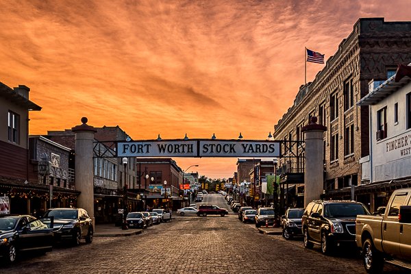
Canadian River Wagon Bridge In 1915, Hemphill County contracted to erect a bridge to span the Canadian River. Construction of the Canadian River Wagon Bridge was completed in July, 1916. The bridge was comprised of seventeen 153.5 ft. pin-connected Parker through-truss spans; the dimensions being 16 ft. in width and 2,635 ft. in total length. After its completion it was said to be the largest steel structure west of the Mississippi. In 1923, it fell victim to the raging waters of the Canadian River which cut a new channel around the north end of the bridge necessitating the extension on the north end of four identical spans and an approach span. The bridge’s 3,255 ft. length now made it the longest pin-connected bridge in Texas. In recent years a committee of interested citizens raised funds, along with matching grants, to renovate the bridge, laying wooden planked flooring, decking, and installing side-guard railings to create a walking bridge. After five years of hard work, the Canadian River Wagon Bridge was reopened on July 1, 2000. It was restored as part of a new scenic hiking and biking trail over the Canadian River Valley and wetlands habitat. This bridge is the longest known simple span pin connected highway truss bridge in the entire country. After being abandoned without a deck for many decades, the bridge was redecked for pedestrian use. Considering the length of the bridge, this is a very impressive preservation success story! The history of the bridge is somewhat confusing. The Historic American Engineering Record states the following: This 3,255′-0″-long structure is the longest pin-connected bridge in Texas, and was the state’s longest metal truss bridge prior to the completion of the Rainbow Bridge connecting Orange and Port Arthur in 1938. Two previous bridges at this site built in 1888 and 1889 were washed away by floods, and after some delays, voters finally approved a 1915 initiative to build a more permanent crossing of the river. The structure completed in 1916 included seventeen 155′-0″ long and 27′-0″ high pin-connected Parker through trusses for a 2,635′-0″ total length. The 16′-0″ roadway rested atop concrete piers with steel footings driven 65′-0″ into the riverbed. When high water widened the river in 1923, the county paid the Austin Bridge Company of Dallas to provide four additional Parker through trusses with the same dimensions and the same substructure. This increased the bridge’s length by 620′-0″. By the 1950s, the 16′-0″ roadway had become too narrow to safely carry passing traffic. In 1953, a new $1 million concrete and steel structure, built with state highway funds by the Austin Bridge Company of Dallas, bypassed the original bridge. Where it is: The Canadian River Wagon Bridge is in Canadian, Texas, in Hemphill County. It can be reached from U.S. 60, 0.1 miles south of U.S. 83. Maps: Interactive Google Map Use the map  + – controls to zoom in and out, click and drag the to move the map, use the Map drop-down to change to “Map”, “Satellite”, “Hybrid”, or “Terrain” views.  Drag the little man icon from the upper left corner to a map location for street level view. Cost: There is no cost visit or walk on the Historic Canadian River Wagon Bridge. GPS: 35°56’04.6″N 100°22’19.8″W Hours: Bridge is always open. Facilities: There are no facilities at the bridge.  There is one picnic table and a parking area. Location Contact Information: Canadian River Wagon Bridge Hwy 60 north of Canadian Canadian, TX 79014 (806) 323-6234   Canadian River Wagon Bridge Photo Gallery Click Here for full page gallery     More Photographic Destinations in Texas Interactive Google Map Use the map  + – controls to zoom in and out, use the Map drop-down to change to “Map”, “Satellite”, “Hybrid”, or “Terrain” views.  Drag the little man icon from the upper left corner to a map location for street level view. Click on a pushpin for more information about the Photographic Destination, then click on the title to go to the location page. Click Here for Photographic Destinations by State    All the information in this post was believed to be accurate at the time it was published.  Please be sure to double check with the location before relying on this information as everything changes over time, especially hours, prices, and whether the location is still open.   Great Places for Great Photos   Let me help you to find a great location for your next photography adventure.  I will list many lesser-known destinations, as well as the famous "Icon Locations" for photography.  I will provide photos (Lots of Photos), location information, consisting of what there is to photograph as well as other information about the destination.  I will give costs, maps, directions, contact information, and other essential information for a successful photo trip.  I will only post for locations that I have personally photographed to ensure a quality guide to great locations for photography. If you know of great places that are not posted, please send me the details, I may just decide that is a place I need to go!     Greg Disch is a freelance photographer located in Arkansas. Greg specializes in nature, scenic, wildlife, and other outdoor subjects in Arkansas and other areas of the country.  Most of the images on this site are available for sale as prints, personal use, or rights managed stock photos. Greg offers both classroom instruction and in the field hands on photographic workshops. Classroom sessions are normally held in Fort Smith Arkansas, but arrangements can be made to bring a class to your group. All classes and workshops have small class sizes designed to provide an optimum student to instructor ratio, where you can get the personal attention, you need.  Most classes and workshops are limited to a maximum of six participants and will be held with a minimum of only two. If you are looking for a wonderful opportunity to get personal individual instruction, I do private workshops and classes at a location of your choice, whether doing a location photo shoot, coming to your home or business, traveling across the country on a road trip, or at my classroom.  This is a fantastic way to learn digital workflow and be sure that your computer equipment is properly configured for optimum performance. [...]Read more...
Cadillac Ranch Cadillac Ranch is a public art installation and sculpture in Amarillo, Texas, U.S. It was created in 1974 by Chip Lord, Hudson Marquez and Doug Michels, who were a part of the art group Ant Farm, and it consists of what were (when originally installed during 1974) either older running used or junk Cadillac automobiles, representing a number of evolutions of the car line (most notably the birth and death of the defining feature of early Cadillacs; the tail fin) from 1949 to 1963, half-buried nose-first in the ground, at an angle corresponding to that of the Great Pyramid of Giza in Egypt. It was originally located in a wheat field, but in 1997 the installation was quietly moved by a local contractor two  to the west, to a cow pasture along Interstate 40, in order to place it further from the limits of the growing city. Cadillac Ranch is visible from the highway, and though it is located on private land, visiting it (by driving along a frontage road and entering the pasture by walking through an unlocked gate) is tacitly encouraged. In addition, writing graffiti on or otherwise spray-painting the vehicles is also encouraged, and the vehicles, which have long since lost their original colors, are wildly decorated. The cars are periodically repainted various colors (once white for the filming of a television commercial, another time pink in honor of Stanley’s wife Wendy’s birthday , and yet another time all 10 cars were painted flat black to mark the passing of Ant Farm artist Doug Michels or simply to provide a fresh canvas for future visitors. The cars were briefly “restored” to their original colors by the motel chain Hampton Inn in a public relation sponsored series of Route 66 landmark restoration projects. The new paint jobs and even the plaque commemorating the project lasted less than 24 hours without fresh graffiti. Cost: There is no fee for visiting Cadillac Ranch Best Time to Visit: The area is open 24 hours a day seven days a week, but there are no lights so plan to visit during daylight hours or furnishing your own lighting. Where it is: In a cow pasture outside of Amarillo TX Directions: Along eastbound I-40 between exits 60 and 62. Exit buy generic viagra in the usa onto the frontage road, a remnant of historic Route 66, then enter the pasture through an unlocked gate. Map: Links: Official Cadillac Ranch Website Amarillo Convention & Visitor Council Tips for the Photographer Equipment: You do not need any special equipment for this location, anything from a point and shoot up will give good results. What to Photograph: Cadillac Ranch is famous for the 10 Cadillacs buried in the ground in a cow pasture in in the Texas panhandle, don’t expect anything more than that.  The cars have been painted so many time the spray paint has built up to be over an inch thick in places, with changing colors and patterns.  You could photograph this site every week and it would look different. Photography Tips: Trying to shoot all 10 Cadillacs at one time will not give a real interesting shot.  Move in close and shoot the detail and color of the cars for some really interesting and abstract photos. Cadillac Ranch Photo Gallery Click Here for full page gallery More Photographic Destinations in Texas: Interactive Google Map Use the map  + – controls to zoom in and out, use the Map drop-down to change to “Map”, “Satellite”, “Hybrid”, or “Terrain” views.  Drag the little man icon from the upper left corner to a map location for street level view. Click on a pushpin for more information about the Photographic Destination, then click on the title to go to the location page. Click Here for Photographic Destinations by State All the information in this post was believed to be accurate at the time it was published.  Please be sure to double check with the location before relying on this information as everything changes over time, especially hours, prices, and whether the location is still open.   Great Places for Great Photos   Let me help you to find a great location for your next photography adventure.  I will list many lesser-known destinations, as well as the famous "Icon Locations" for photography.  I will provide photos (Lots of Photos), location information, consisting of what there is to photograph as well as other information about the destination.  I will give costs, maps, directions, contact information, and other essential information for a successful photo trip.  I will only post for locations that I have personally photographed to ensure a quality guide to great locations for photography. If you know of great places that are not posted, please send me the details, I may just decide that is a place I need to go!     Greg Disch is a freelance photographer located in Arkansas. Greg specializes in nature, scenic, wildlife, and other outdoor subjects in Arkansas and other areas of the country.  Most of the images on this site are available for sale as prints, personal use, or rights managed stock photos. Greg offers both classroom instruction and in the field hands on photographic workshops. Classroom sessions are normally held in Fort Smith Arkansas, but arrangements can be made to bring a class to your group. All classes and workshops have small class sizes designed to provide an optimum student to instructor ratio, where you can get the personal attention, you need.  Most classes and workshops are limited to a maximum of six participants and will be held with a minimum of only two. If you are looking for a wonderful opportunity to get personal individual instruction, I do private workshops and classes at a location of your choice, whether doing a location photo shoot, coming to your home or business, traveling across the country on a road trip, or at my classroom.  This is a fantastic way to learn digital workflow and be sure that your computer equipment is properly configured for optimum performance. [...]Read more...
Caddo Lake Caddo Lake is a truly unique photography destination. Bald cypress trees draped with Span­ish moss tower over the maze of bayous, sloughs and ponds of Caddo Lake. Caddo Lake (French: Lac Caddo) is a 25,400-acre lake and bayou (wetland) on the border between Texas and Louisiana. The lake is named after the Southeastern culture of Native Americans called Caddoans or Caddo, who lived in the area until their expulsion in the 19th century. It is an internationally protected wetland and includes one of the largest flooded cypress forests in the United States. According to Caddo legend, the lake was formed by the 1811–12 New Madrid earthquakes. There may be some truth to the legend, as Reelfoot Lake in Tennessee was formed by that earthquake. Most geologists feel the lake was formed, either gradually or catastrophically, by the “Great Raft”, a 100-mile log jam on the Red River in Louisiana, possibly by flooding the existing low-lying basin. Caddo Lake has been utilized by Native Americans for thousands of years, but substantial commercial development would only begin with invention of the steamboat and US annexation of Louisiana and Texas by treaty  in the 19th century. The cities of Port Caddo, Swanson’s Landing, and Jefferson in Texas, and Mooringsport in Louisiana, had thriving riverboat ports on the lake. Gradually as the log jams were removed in the lake and on the Red River by Captain Henry Miller Shreve and then by the Army Corps of Engineers, the lake changed shape and eventually fell over 10 feet, destroying the East Texas ports and their riverboat industry. Industry once again came to Caddo Lake with the discovery of oil beneath it. The world’s first over water oil platform was completed in Caddo Lake in 1911. The Ferry Lake No. 1 was erected by Gulf Refining Company. The well bottomed at 2,185 feet and produced 450 barrels per day. Wildlife inhabiting Caddo Lake includes owls, snakes, frogs, waterfowl, bobcats, river otters, beavers, eagles, and alligators. The lake is currently “under siege” by a fast-spreading, Velcro-like aquatic fern, Salvinia molesta, also known as Giant Salvinia.  Accidentally introduced to the lake by boaters, the noxious weed doubles in size every two to four days, rapidly killing off life below the surface. Efforts at removing the weed have included biological means via beetles that normally eat the weed but cannot survive the Texas cold and now include herbicide. Photography Information: In order to fully experience the haunting beauty of Caddo Lake you need to travel the lake by boat.  I would definitely recommend a guided sunrise boat tour for photography, if you don’t know the lake you could easily get lost. Where it is: Caddo Lake is located between Marshall, Texas and Shreveport, Louisiana in Uncertain, Texas.  The Texas side of the lake is the major swamp area while the Louisiana side is more open water. Directions to Shady Glade Resort From Shreveport, LA Take I-20 west bound 21.5 miles and take FM-134/Caddo Lake exit. Turn right onto FM-134 heading north and go 10 miles. In Leigh community, FM-134 makes a left turn. Turn left and follow FM-134  5.0 miles to Karnack. In Karnack, turn right on Old FM-134, which is 2 blocks north of the Post Office. Go .2 miles and turn right on FM-2198. Follow FM-2198 for 4.4 miles and turn left on Cypress Drive. Go 1/2 mile to Shady Glade Resort.   From Dallas, TX Take I-20 East and go approximately 120 miles to US-59/Marshall, TX exit. Turn left on US-59 and go 4.3 miles to Texas Hwy 43. Turn right on TX-43 and go 13.5 miles to FM-2198. Turn right on FM-2198 and go 4.8 miles to Cypress Drive. Turn left on Cypress Drive and go 1/2 mile to Shady Glade Resort.   From Houston, TX Take US-59 North 220 miles to Marshall, TX. Turn right on Texas Hwy 43 and go 13.5 miles to FM-2198. Turn right on FM-2198 and 4.8 miles to Cypress Drive. Turn left on Cypress Drive and go 1/2 mile to Shady Glade Resort. From Oklahoma City, OK Take I-40 East 86.3 miles and merge onto Indian Nation Turnpike south. Go 88.5 miles to Antlers, OK. Stay on the Indian Nation Turnpike south for 16 miles. Indian Nation Turnpike will become US-271 south. Take US-271 south towards Hugo/Paris and go 22.8 miles. Take the US-82E/TX-286 Loop E/US-271S ramp. Merge onto US-271 south and go 52.3 miles to Mt. Pleasant, TX. Stay straight and exit onto TX-49. Go 48.8 miles to Jefferson, TX. At the intersection with US-59, continue strait and US-49 becomes Polk St. Follow Polk St for approximately 1/2 mile and bear right thru downtown Jefferson. Continue for approximately 1-1/4 miles and turn left on FM-134. Go 11.5 miles to the intersection with Hwy 43. Continue thru the intersection and the road becomes FM-2198. Go 4.4 miles and turn left on Cypress. Go 1/2 mile to Shady Glade Resort.   From Little Rock, AR Take I-30 west and go 141.3 miles. Take the US-59 south exit and go 20.6 miles. Take TX-43 south and go 30.6 miles. Turn left on FM-2198 and go 4.8 miles. Turn left on Cypress Drive. Go 1/2 mile to Shady Glade Resort.     Maps: Interactive Google Map Use the map  + – controls to zoom in and out, click and drag the to move the map, use the Map drop-down to change to “Map”, “Satellite”, “Hybrid”, or “Terrain” views.  Drag the little man icon from the upper left corner to a map location for street level view. GPS: Shade Glade Resort Café and Marina.  32°42’45.906″ N 94°7’12.528″ W Cost: There is no cost to boat on Caddo Lake. Caddo Lake State Park Adult: $4 Daily Child 12 Years and Under: Free Hours: The lake is always open. Facilities: There are several restaurants and marinas in Uncertain Texas. Location Contact Information: Caddo Lake State Park 245 Park Road 2 Karnack, TX 75661 (903) 679-3351 Caddo Lake Photo Gallery Click Here for full page gallery   More Photographic Destinations in Texas: Interactive Google Map Use the map  + – controls to zoom in and out, use the Map drop-down to change to “Map”, “Satellite”, “Hybrid”, or “Terrain” views.  Drag the little man icon from the upper left corner to a map location for street level view. Click on a pushpin for more information about the Photographic Destination, then click on the title to go to the location page. Click Here for Photographic Destinations by State    All the information in this post was believed to be accurate at the time it was published.  Please be sure to double check with the location before relying on this information as everything changes over time, especially hours, prices, and whether the location is still open.   Great Places for Great Photos   Let me help you to find a great location for your next photography adventure.  I will list many lesser-known destinations, as well as the famous "Icon Locations" for photography.  I will provide photos (Lots of Photos), location information, consisting of what there is to photograph as well as other information about the destination.  I will give costs, maps, directions, contact information, and other essential information for a successful photo trip.  I will only post for locations that I have personally photographed to ensure a quality guide to great locations for photography. If you know of great places that are not posted, please send me the details, I may just decide that is a place I need to go!     Greg Disch is a freelance photographer located in Arkansas. Greg specializes in nature, scenic, wildlife, and other outdoor subjects in Arkansas and other areas of the country.  Most of the images on this site are available for sale as prints, personal use, or rights managed stock photos. Greg offers both classroom instruction and in the field hands on photographic workshops. Classroom sessions are normally held in Fort Smith Arkansas, but arrangements can be made to bring a class to your group. All classes and workshops have small class sizes designed to provide an optimum student to instructor ratio, where you can get the personal attention, you need.  Most classes and workshops are limited to a maximum of six participants and will be held with a minimum of only two. If you are looking for a wonderful opportunity to get personal individual instruction, I do private workshops and classes at a location of your choice, whether doing a location photo shoot, coming to your home or business, traveling across the country on a road trip, or at my classroom.  This is a fantastic way to learn digital workflow and be sure that your computer equipment is properly configured for optimum performance. [...]Read more...
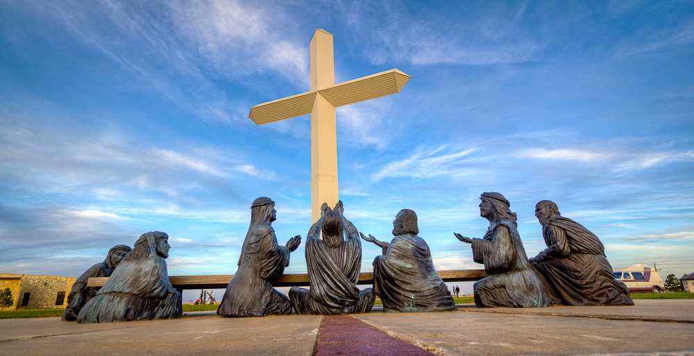
  Aransas National Wildlife Refuge It is the principal wintering ground for the rare whooping crane and also attracts almost 400 species of other waterfowl and other birds, who vary with the seasons—especially geese, ducks, pelicans, herons, egrets, gulls, sundial cranes, roseate spoonbills, ibises, quail, osprey, a variety of migrating songbirds, and various shorebirds. Deer, javelinas (peccaries), armadillos, alligators, and turkeys are also abundant. Bird-watching is the primary recreational activity. Although much of the refuge is closed to visitors, available facilities include an observation tower, an automobile touring road, a wildlife education center, and some hiking trails. The refuge was established in 1937 by presidential executive order to save the whooping cranes, then faced with extinction. The refuge’s resources are still largely devoted to this purpose, and Aransas has helped boost the species’ population. Headquarters are in Austwell. Whooping Crane Named for its whooping sound, the whooping crane is the tallest North American bird. It is an endangered crane species. Along with the sandhill crane, it is one of only two crane species native to North America. The whooping crane’s lifespan is estimated to be 22 to 24 years in the wild. After being pushed to the brink of extinction by unregulated hunting and loss of habitat to just 21 wild and two captive whooping cranes by 1941, conservation efforts have led to a limited recovery. The total number of cranes in the surviving migratory population, plus three reintroduced flocks and in captivity, now exceeds 800 birds. The best time of year to see Whooping Cranes is from December to February, though they typically begin arriving by mid-October and leave mid-April. Watch for them feeding in the refuge’s marshes during daylight hours. Visitors can also enjoy seeing the birds from boat tours offered by private operators. Photography Recommendation If you are wanting to photography the Whooping Cranes and other shorebirds I recommend taking a commercial tour by boat into the refuge.  While there is the chance to see them anywhere in the area the tour operators know where the birds are and stand a good chance of getting you close enough for good photos.   Where it is:  Aransas National Wildlife Refuge is located on Blackjack Peninsula, eight miles southeast of Austwell and midway between Rockport and Port Lavaca, on the Gulf Coast. The refuge comprises 54,829 acres of scattered blackjack oak woodlands, fresh and saltwater marshes, ponds, and coastal grasslands on the mainland, as well as 56,668 acres on Matagorda Island. Directions From the South: Follow Highway 35N to the FM 774 exit. Turn right on FM 774 and go approximately 6 miles, winding through the farm fields. Turn right again on FM 2040. Drive another 6 miles to the Refuge gate. Go to the Visitor Contact Station to register. From the North: Travel south on Hwy 35 to Tivoli. Continue past Tivoli approximately 1 mile to the FM 239 exit (on your left). Follow FM 239 to Austwell. Upon entering Austwell, FM 239 turns into FM 774 at the curve. Continue on FM 774. Follow 774 and take a right at the stop sign. At the end of the street, take a right again. As you exit Austwell, drive ½ mile to the FM 2040 intersection. Turn left on FM 2040 and drive 6 miles to the Refuge gate. Go to the Visitor Contact Station to register. Maps: Interactive Google Map Use the map  + – controls to zoom in and out, click and drag the to move the map, use the Map drop-down to change to “Map”, “Satellite”, “Hybrid”, or “Terrain” views.  Drag the little man icon from the upper left corner to a map location for street level view.   GPS: 28.313449,-96.804022 Cost: General Entrance Fees 18 years and under, entrance is free $3 – one adult in a vehicle $5 – two or more adults in a vehicle $25 – commercial vehicle (van or bus) with up to 20 people $50 – commercial vehicle with 21 or more people Entrance is free to the Aransas Refuge with the following federal park passports: Aransas Annual Pass Federal Duck Stamp Federal Duck Stamp Annual Pass for Active Military Senior Pass Access Pass “Every Kid in a Park” 4th Grade Annual Pass Hours: Auto tour and trails are open daily from half an hour before sunrise to half an hour after sunset. Visitor Center: October 15-April 14: 9 am – 4 pm daily April 15-October 14: 9 am – 4 pm Wednesday – Sunday (Closed Monday-Tuesday) Closed for all Federal Holidays Facilities: Public restrooms are available at the visitor parking lot, picnic area, and observation tower. There are no food or drinks available at the refuge. Information on Nearby Lodging and Businesses Rockport Chamber of Commerce Port Lavaca Chamber of Commerce   Location Contact Information: Visitor Contact Station (general questions/planning your visit): 361/349-1181 Refuge Office (administrative questions): 361/349-1138 Mailing Address: U.S. Fish and Wildlife Service Aransas National Wildlife Refuge P.O. Box 100 Austwell, TX 77950 Shipping Address for UPS / FedEx: U.S. Fish and Wildlife Service Aransas National Wildlife Refuge 1 Wildlife Circle Austwell, TX 77950 Aransas National Wildlife Refuge Photo Gallery Click Here for full page gallery   More Photographic Destinations in Texas Interactive Google Map Use the map  + – controls to zoom in and out, use the Map drop-down to change to “Map”, “Satellite”, “Hybrid”, or “Terrain” views.  Drag the little man icon from the upper left corner to a map location for street level view. Click on a pushpin for more information about the Photographic Destination, then click on the title to go to the location page. Click Here for Photographic Destinations by State    All the information in this post was believed to be accurate at the time it was published.  Please be sure to double check with the location before relying on this information as everything changes over time, especially hours, prices, and whether the location is still open.   Great Places for Great Photos   Let me help you to find a great location for your next photography adventure.  I will list many lesser-known destinations, as well as the famous "Icon Locations" for photography.  I will provide photos (Lots of Photos), location information, consisting of what there is to photograph as well as other information about the destination.  I will give costs, maps, directions, contact information, and other essential information for a successful photo trip.  I will only post for locations that I have personally photographed to ensure a quality guide to great locations for photography. If you know of great places that are not posted, please send me the details, I may just decide that is a place I need to go!     Greg Disch is a freelance photographer located in Arkansas. Greg specializes in nature, scenic, wildlife, and other outdoor subjects in Arkansas and other areas of the country.  Most of the images on this site are available for sale as prints, personal use, or rights managed stock photos. Greg offers both classroom instruction and in the field hands on photographic workshops. Classroom sessions are normally held in Fort Smith Arkansas, but arrangements can be made to bring a class to your group. All classes and workshops have small class sizes designed to provide an optimum student to instructor ratio, where you can get the personal attention, you need.  Most classes and workshops are limited to a maximum of six participants and will be held with a minimum of only two. If you are looking for a wonderful opportunity to get personal individual instruction, I do private workshops and classes at a location of your choice, whether doing a location photo shoot, coming to your home or business, traveling across the country on a road trip, or at my classroom.  This is a fantastic way to learn digital workflow and be sure that your computer equipment is properly configured for optimum performance. [...]Read more...
  American Windmill Museum The American Windmill Museum is a museum of wind power in Lubbock, Texas. Located on 28 acres of city park land east of downtown Lubbock, the museum has more than 160 American style windmills on exhibition. Windmills as large as 25 feet in diameter could be displayed indoors and by 2001, the windmill museum had the largest public collection of restored windmills in the world. The American Windmill Museum is internationally recognized as the place to visit for observing windmills and wind chargers, photographing groups of windmills and serving as the educational facility where the windmill’s heritage can be seen and heard. On the 28 acre park grounds sits over 70 historic windmills. Some of these mills actually pump water from a well and others are set up to recirculate water from a tank, while others are simply showing their historic beauty. Almost 4000 feet of “G” scale train track run around the building with a helix that allows the trains to run up above your head and around the building. Thomas and his Family are here along with a Circus Train, a Military Train and several others. What to Photograph For me photographing the windmills on the grounds was the best part with over 70 complete windmills to photograph.  The windmills are set far enough apart that you can isolate individual windmills with a clear sky background.  There are also hundreds of windmills inside the buildings along with 4000 feet of model railroad and a large collection of grinding mill stones.   Where it is: The American Windmill Museum is located in Lubbock Texas. Directions: I-27 exit 3. Drive east on 19th St./US 62 for three-quarters of a mile. You’ll see a giant wind turbine on the left, outside the museum. Turn left onto Canyon Lake Drive. Maps: Interactive Google Map Use the map  + – controls to zoom in and out, click and drag the to move the map, use the Map drop-down to change to “Map”, “Satellite”, “Hybrid”, or “Terrain” views.  Drag the little man icon from the upper left corner to a map location for street level view.   GPS: 33°34’48.413″ N 101°49’24.912″ W Hours: SUNDAY-MONDAY Closed TUESDAY – SATURDAY 10am – 5pm June, July, and August it is open on Sundays from 2 PM to 5 PM.   Cost: Admission is  $7.50 for adults, $5.00 for children 5 to 12 years old, under 5 free, $6.00 for seniors 60+ and veterans,  $20.00 for a family of 4 (2 adults & 2 children). Active Duty Military and their household family are admitted free with Military I.D. Facilities: The Windsmith Gift Shop features a wide variety of wind related souvenirs as well as train related items. From spinners to glassware and model windmills to model trains, you are sure to find something to take home to remind you of your visit to the museum. Classroom and event space are available for rent. Location Contact Information: 806.747.8734 1701 Canyon Lake Dr. Lubbock Tx 79043 Visit Website   American Windmill Museum Photo Gallery Click Here for full page gallery   More Photographic Destinations in Texas: Interactive Google Map Use the map  + – controls to zoom in and out, use the Map drop-down to change to “Map”, “Satellite”, “Hybrid”, or “Terrain” views.  Drag the little man icon from the upper left corner to a map location for street level view. Click on a pushpin for more information about the Photographic Destination, then click on the title to go to the location page. Click Here for Photographic Destinations by State   [...]Read more...