Great Places for Great Photos
Let me help you to find a great location for your next photography adventure. I will list many lesser known destinations, as well as the famous “Icon Locations” for photography. I will provide photos (Lots of Photos), location information, consisting of what there is to photograph as well as other information about the destination. I will give costs, maps, directions, contact information, and other essential information for a successful photo trip. I will only post for locations that I have personally photographed to insure a quality guide to great locations for photography.
National Park System Photographic Destinations
On August 25, 1916, President Woodrow Wilson signed the “Organic Act” creating the National Park Service, a federal bureau in the Department of the Interior responsible for maintaining national parks and monuments that were then managed by the department. The National Park System has since expanded to 422 units (often referred to as parks), more than 150 related areas, and numerous programs that assist in conserving the nation’s natural and cultural heritage for the benefit of current and future generations.
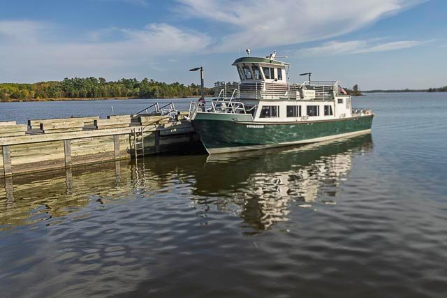
- Voyagers National Park
- Pipestone National Monument
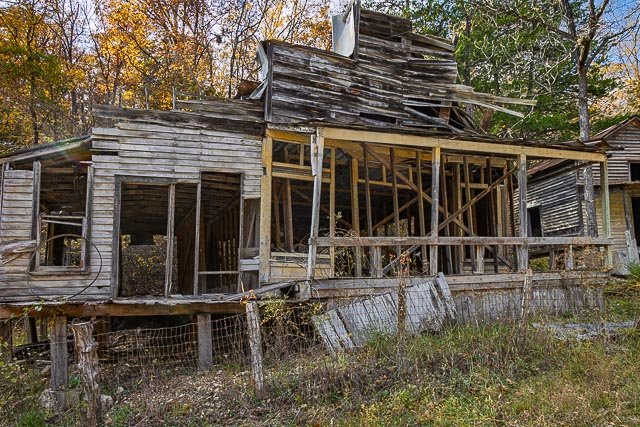
- Rush Ghost Town
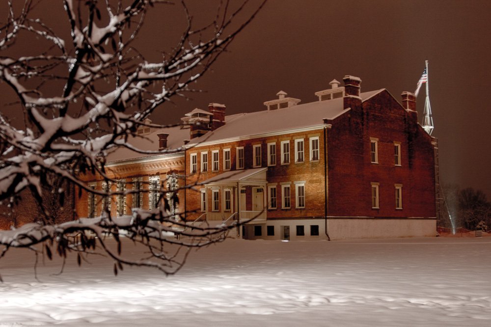
- Fort McHenry National Monument
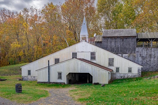
- Hopewell Furnace National Historic Site
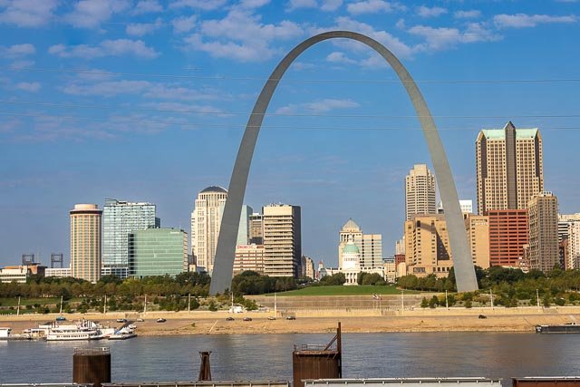
- Gateway Arch National Park
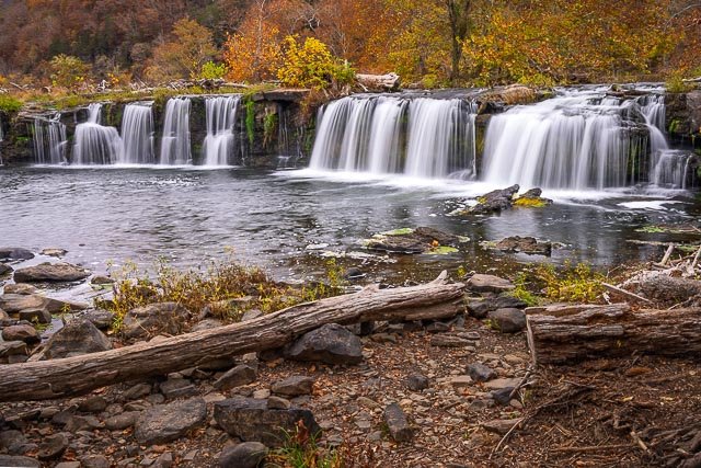
- Sandstone Falls – New River Gorge National Park
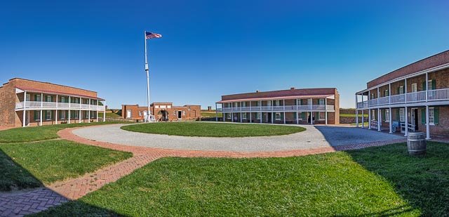
- Bent’s Old Fort National Historic Site
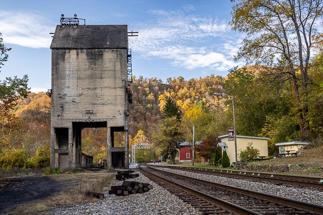
- Thurmond Historic District
- Knox Covered Bridge
- Organ Pipe Cactus – Bates Well Ranch
- Padre Island National Seashore
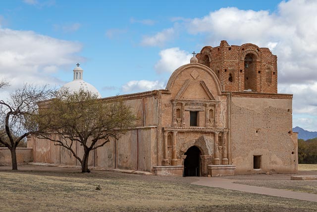
- Tumacacori National Historical Park
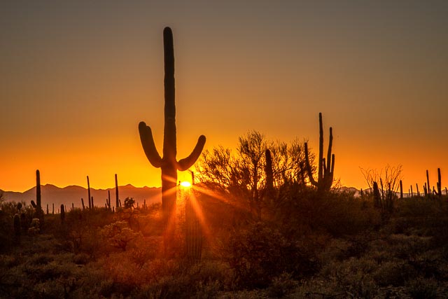
- Saguaro National Park
- Pea Ridge National Military Park
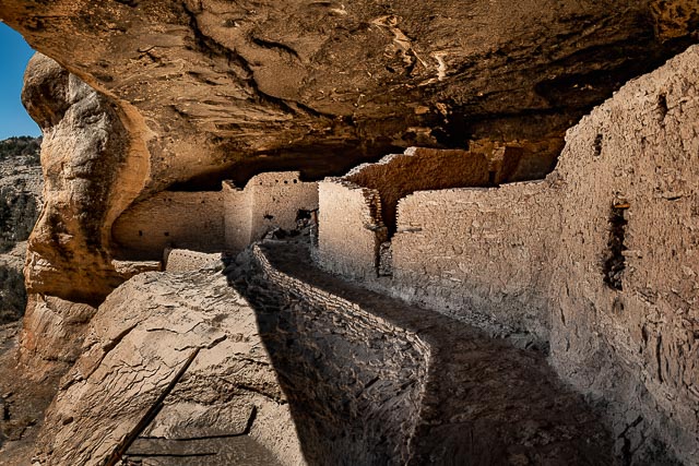
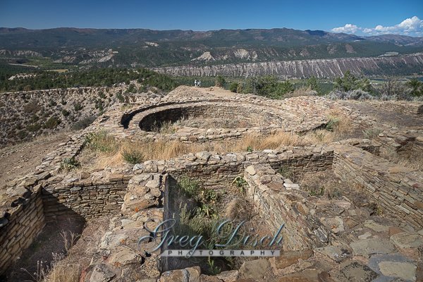
- Gila Cliff Dwellings National Monument
- Carlsbad Caverns National Park
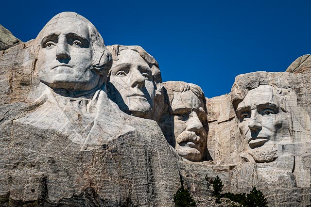
- Mount Rushmore National Memorial
- Sand Island Lighthouse
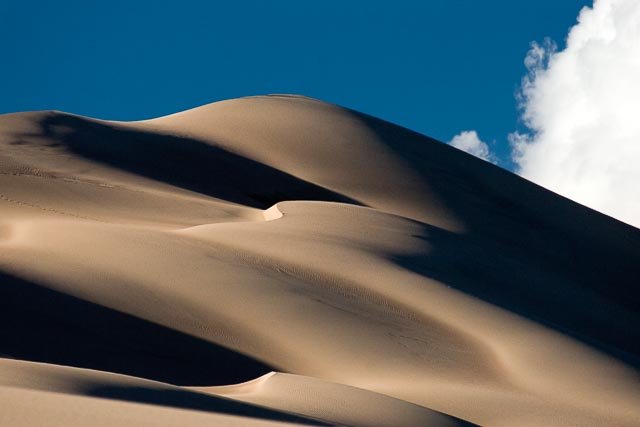
- Great Sand Dunes National Park
- Valle Grande – Valles Caldera National Preserve
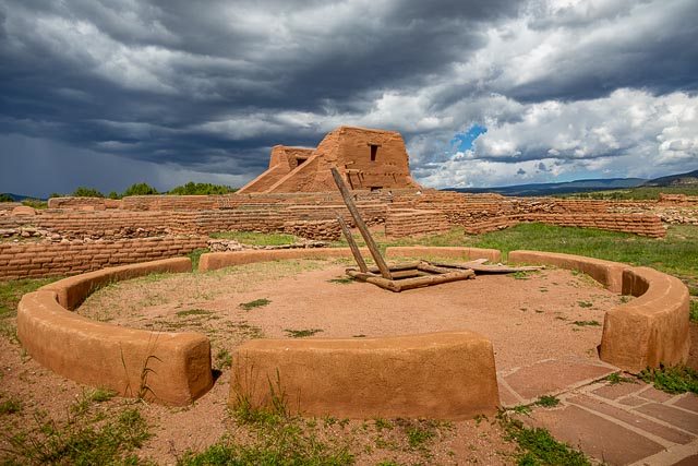
- Pecos National Historical Park
- Bowman Lake Glacier National Park
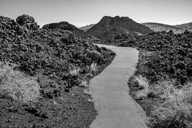
- Craters of the Moon National Monument
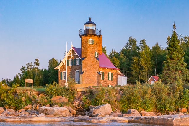
- Raspberry Island Lighthouse
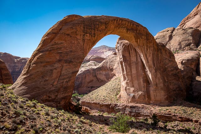
- Rainbow Bridge National Monument
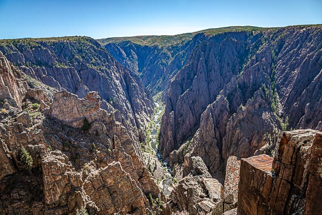
- Black Canyon of the Gunnison National Park
- Horseshoe Bend
- Fort Donelson National Battlefield
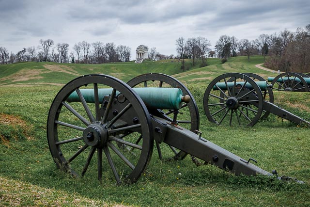
- Vicksburg National Military Park
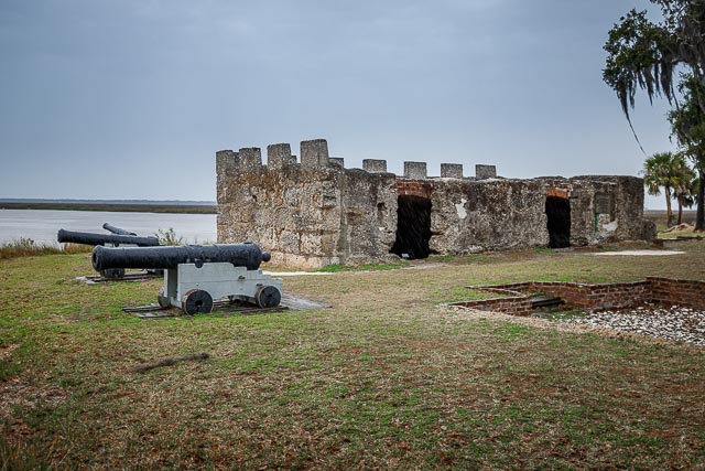
- Fort Frederica
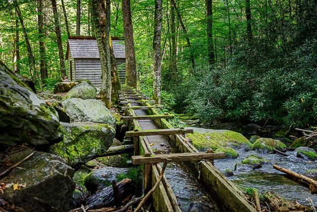
- Reagan Mill Great Smoky Mountains National Park
- Clingmans Dome Great Smoky Mountain National Park
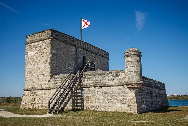
- Fort Matanzas National Monument
- Cable Mill Great Smoky Mountains National Park
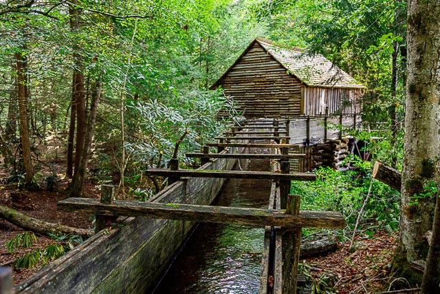
- Mingus Mill Great Smoky Mountain National Park
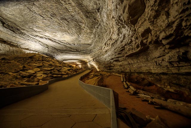
- Mammoth Cave
- Castillo de San Marcos National Monument
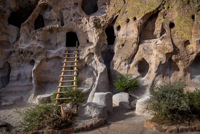
- Bandelier National Monument
- Cumberland Island National Seashore
- Fort Larned National Historic Site
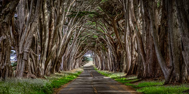
- Cypress Tree Tunnel Point Reyes National Seashore
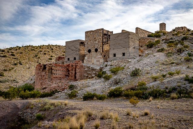
- Mariscal Mine Big Bend National Park
- Fort Davis National Historic Site
- Canyon de Chelly National Monument
- Fort Scott National Historic Site
- Chimney Rock National Monument
- Fort Pickens Gulf Islands National Seashore
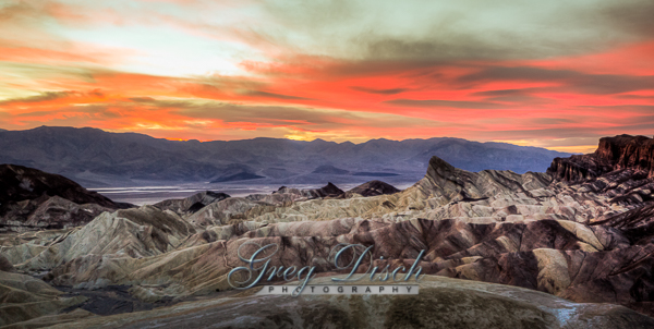
- Zabriskie Point – Death Valley
- Tallgrass Prairie Preserve
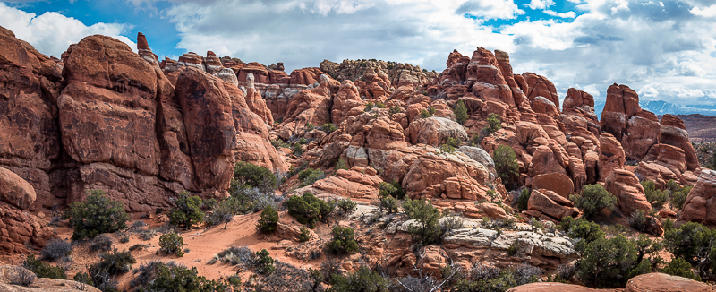
- Fiery Furnace Arches National Park
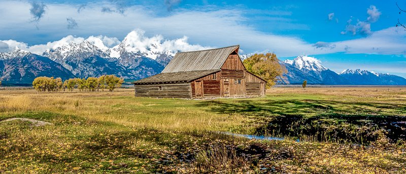
- Mormon Row Historic District – Grand Teton National Park
- Hoh Rain Forest – Olympic National Park
- Apostle Islands National Lakeshore
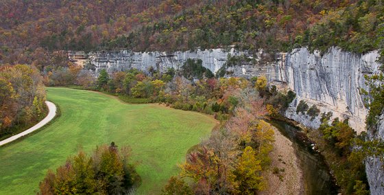
- Steel Creek – Buffalo National River Arkansas
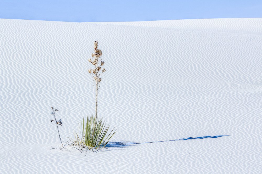
- White Sands National Park – New Mexico
- Fort Smith National Historic Site
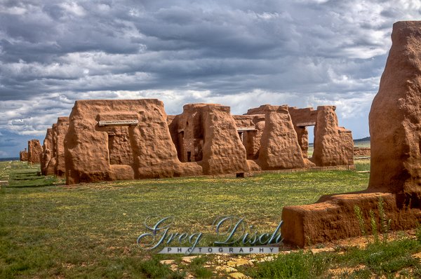
- Fort Union National Monument – New Mexico
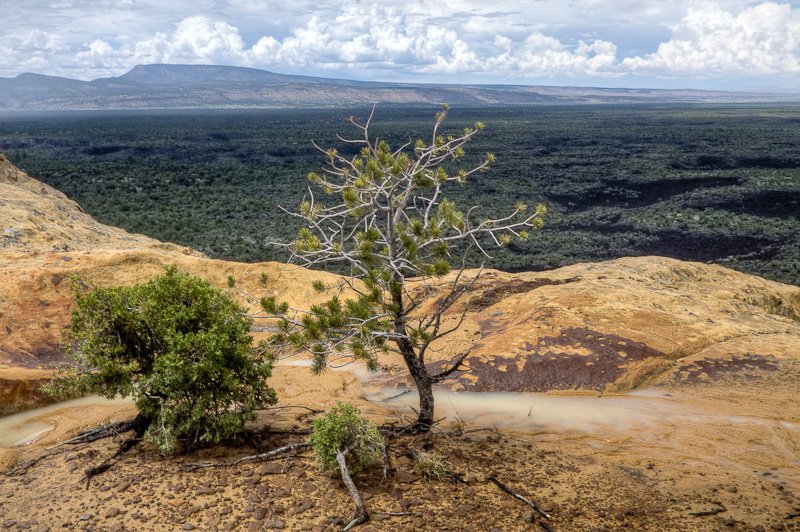
- El Malpais National Monument – Sandstone Bluffs
- San Antonio Missions National Historic Park
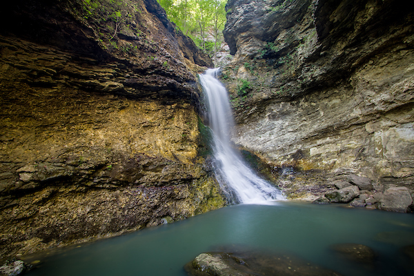
- Lost Valley – Eden Falls – Buffalo National River
Interactive Google Map
Use the map + – controls to zoom in and out, use the Map drop-down to change to “Map”, “Satellite”, “Hybrid”, or “Terrain” views. Drag the little man icon from the upper left corner to a map location for street level view. Click on a pushpin for more information about the Photographic Destination, then click on the title to go to the location page.